- Laguna Hills, California
-
City of Laguna Hills — City — 
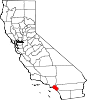
SealLocation of Laguna Hills within Orange County, California.
Coordinates: 33°35′59″N 117°41′58″W / 33.59972°N 117.69944°WCoordinates: 33°35′59″N 117°41′58″W / 33.59972°N 117.69944°W Country  United States
State  California
County Orange Government – Mayor L. Allan Songstad, Jr. Area[1] – Total 6.695 sq mi (17.340 km2) – Land 6.670 sq mi (17.276 km2) – Water 0.025 sq mi (0.064 km2) 0.37% Elevation 371 ft (113 m) Population (2010) – Total 30,344 – Density 4,532.3/sq mi (1,749.9/km2) Time zone PST (UTC-8) – Summer (DST) PDT (UTC-7) ZIP codes 92637, 92653, 92654, 92656 Area code(s) 949 FIPS code 06-39220 GNIS feature ID 1667917 Website http://www.ci.laguna-hills.ca.us/ Laguna Hills is a city located in southern Orange County, California, United States. Its name refers to its proximity to Laguna Canyon and the much older Laguna Beach. Other newer cities nearby—Laguna Niguel and Laguna Woods—are similarly named.
Contents
Geography
According to the United States Census Bureau, the city has a total area of 6.7 square miles (17 km2). 6.7 square miles (17 km2) of it is land and 0.025 square miles (0.065 km2) of it (0.37%) is water.
History
Laguna Hills is built on one of the major land grants developed during the rancho era. Following Mexico's independence from Spain in 1821, those who had served in the government or who had friends in authority, were given vast lands for cattle grazing. Rancho Lomas de Santiago, Rancho San Joaquin, and Rancho Niguel covered much of the western portion of the Saddleback Valley. Don Juan Avila was granted the 13,000 Rancho Niguel on which Laguna Hills is located.
In 1894, Lewis Moulton purchased Rancho Niguel from Don Juan Avila and increased the original grant to 22,000 acres (89 km2). Moulton and his partner, Jean Piedra Daguerre, used the ranch to raise sheep and cattle. The Moulton Ranch was eventually subdivided in the early 1960s, and part of the division became today's Laguna Hills.
Incorporation efforts began in 1987 and on March 5, 1991, 86% of the residents voted in favor of forming the City of Laguna Hills. On December 20, 1991, Laguna Hills officially became a City. Subsequent annexations have included the North Laguna Hills (1996) and the "Westside Annexation" (2000) areas. The latter included 149 acres (0.60 km2) of residential land, including the Aliso Viejo Community Association's Sheep Hills Park.[2]
Demographics
2010
The 2010 United States Census[3] reported that Laguna Hills had a population of 30,344. The population density was 4,532.4 per square mile (1,750.0/km²). The racial makeup of Laguna Hills was 22,045 (72.7%) White, 420 (1.4%) African American, 101 (0.3%) Native American, 3,829 (12.6%) Asian, 58 (0.2%) Pacific Islander, 2,470 (8.1%) from other races, and 1,421 (4.7%) from two or more races. Hispanic or Latino of any race were 6,242 persons (20.6%).
The Census reported that 29,975 people (98.8% of the population) lived in households, 233 (0.8%) lived in non-institutionalized group quarters, and 136 (0.4%) were institutionalized.
There were 10,469 households, of which 3,637 (34.7%) had children under the age of 18 living in them, 6,278 (60.0%) were opposite-sex married couples living together, 983 (9.4%) had a female householder with no husband present, 472 (4.5%) had a male householder with no wife present. There were 445 (4.3%) unmarried opposite-sex partnerships, and 101 (1.0%) same-sex married couples or partnerships. 2,041 households (19.5%) were made up of individuals and 822 (7.9%) had someone living alone who was 65 years of age or older. The average household size was 2.86. There were 7,733 families (73.9% of all households); the average family size was 3.25.
6,762 people (22.3%) were under the age of 18; 2,617 people (8.6%) aged 18 to 24; 7,638 people (25.2%) aged 25 to 44; 9,437 people (31.1%) aged 45 to 64; and 3,890 people (12.8%) who were 65 years of age or older. The median age was 40.8 years. For every 100 females there were 95.5 males. For every 100 females age 18 and over, there were 93.6 males.
There were 11,046 housing units at an average density of 1,649.9 per square mile (637.0/km²), of which 7,820 (74.7%) were owner-occupied, and 2,649 (25.3%) were occupied by renters. The homeowner vacancy rate was 1.4%; the rental vacancy rate was 11.2%. 22,307 people (73.5% of the population) lived in owner-occupied housing units and 7,668 people (25.3%) lived in rental housing units.
2000
At the 2000 census[4], there were 31,178 people, 10,895 households and 7,942 families residing in the city. The population density was 4,911.1 per square mile (1,895.7/km²). There were 11,303 housing units at an average density of 1,780.4 per square mile (687.3/km²). The racial makeup of the city was 76.83% White, 1.38% African American, 0.44% Native American, 10.20% Asian, 0.15% Pacific Islander, 7.19% from other races, and 3.81% from two or more races. Hispanic or Latino of any race were 16.40% of the population.
There were 10,895 households of which 37.5% of had children under the age of 18 living with them, 61.0% were married couples living together, 8.5% had a female householder with no husband present, and 27.1% were non-families. 21.6% of all households were made up of individuals and 10.0% had someone living alone who was 65 years of age or older. The average household size was 2.82 and the average family size was 3.29.
26.2% of the population were under the age of 18, 7.3% from 18 to 24, 28.8% from 25 to 44, 25.4% from 45 to 64, and 12.1% who were 65 years of age or older. The median age was 38 years. For every 100 females there were 92.6 males. For every 100 females age 18 and over, there were 89.0 males.
According to a 2007 estimate, the median household income was $89,781 and the median family income was $102,191.[5] Males had a median income of $59,144 versus $38,761 for females. The per capita income for the city was $36,133. About 3.6% of families and 5.0% of the population were below the poverty line, including 5.3% of those under age 18 and 5.1% of those age 65 or over.
Politics
In the state legislature Laguna Hills is located in the 33rd Senate District, represented by Republican Mimi Walters, and in the 73rd Assembly District, represented by Republican Diane Harkey. Federally, Laguna Hills is located in California's 48th congressional district, which has a Cook PVI of R +8[6] and is represented by Republican John Campbell.
The new Laguna Hills Civic Center and City Hall located off El Toro Road in the northernmost section of the city, near the Laguna Hills Mall and the Nellie Gail Ranch neighborhood.
Emergency services
Fire protection in Laguna Hills is provided by the Orange County Fire Authority with ambulance service by Doctor's Ambulance. Law enforcement is provided by the Orange County Sheriff's Department. There is also the Saddleback Memorial Medical Center, a hospital that is equipped with a full emergency room.
Education
Laguna Hills is served by the Saddleback Valley Unified School District. Laguna Hills students attend a variety of high performing elementary schools, and for middle school attend either La Paz Intermediate School or Los Alisos Intermediate School in neighboring Mission Viejo. The city has its own high school, Laguna Hills High School, the smallest school in the district and one of the smallest in south Orange County with under 1,700 students.
Residents of Laguna Hills, California
- Chad Carvin (1974), American freestyle swimmer
- Russ Conway, actor
- Mike Hopkins (unknown), Syracuse Orange men's basketball assistant coach and former player
- Kaitlin Sandeno (1983), Olympic medalist swimmer
- Michael Novales (1985), former US figure skating competitor, currently skating for Philippine Skating Union
- Whitney Houston, actress and Grammy awarded singer
- Jenna Haze (1982), American pornographic actress
- Carson Palmer (1998), NFL quarterback and Heisman Trophy winner for the University of Southern California
- Fieldy (current resident), bass guitarist for the band Korn, recording artist
- Steve Gibson, computer programmer and co-host of Security Now
- George Sixta, cartoonist of the syndicated Rivets (1953–1985)
- Zacky Vengeance (current resident), rhythm guitarist for the band Avenged Sevenfold
See also
References
- ^ U.S. Census
- ^ http://www.ci.laguna-hills.ca.us/about/default.aspM
- ^ All data are derived from the United States Census Bureau reports from the 2010 United States Census, and are accessible on-line here. The data on unmarried partnerships and same-sex married couples are from the Census report DEC_10_SF1_PCT15. All other housing and population data are from Census report DEC_10_DP_DPDP1. Both reports are viewable online or downloadable in a zip file containing a comma-delimited data file. The area data, from which densities are calculated, are available on-line here. Percentage totals may not add to 100% due to rounding. The Census Bureau defines families as a household containing one or more people related to the householder by birth, opposite-sex marriage, or adoption. People living in group quarters are tabulated by the Census Bureau as neither owners nor renters. For further details, see the text files accompanying the data files containing the Census reports mentioned above.
- ^ "American FactFinder". United States Census Bureau. http://factfinder.census.gov. Retrieved 2008-01-31.
- ^ "Laguna Hills, California Census Fact Sheet". U.S. Census Bureau. http://factfinder.census.gov/servlet/ACSSAFFFacts?_event=Search&geo_id=16000US0639178&_geoContext=01000US%7C04000US06%7C16000US0639178&_street=&_county=laguna+hills&_cityTown=laguna+hills&_state=04000US06&_zip=&_lang=en&_sse=on&ActiveGeoDiv=geoSelect&_useEV=&pctxt=fph&pgsl=160&_submenuId=factsheet_1&ds_name=ACS_2007_3YR_SAFF&_ci_nbr=null&qr_name=null®=null%3Anull&_keyword=&_industry=. Retrieved 6 November 2011.
- ^ "Will Gerrymandered Districts Stem the Wave of Voter Unrest?". Campaign Legal Center Blog. http://www.clcblog.org/blog_item-85.html. Retrieved 2008-02-10.
External links
- City of Laguna Hills official website
- Congressman John Campbell
- State Senator Mimi Walters
- State Assemblywoman Diane Harkey
Municipalities and communities of Orange County, California Cities Aliso Viejo | Anaheim | Brea | Buena Park | Costa Mesa | Cypress | Dana Point | Fountain Valley | Fullerton | Garden Grove | Huntington Beach | Irvine | La Habra | La Palma | Laguna Beach | Laguna Hills | Laguna Niguel | Laguna Woods | Lake Forest | Los Alamitos | Mission Viejo | Newport Beach | Orange | Placentia | Rancho Santa Margarita | San Clemente | San Juan Capistrano | Santa Ana | Seal Beach | Stanton | Tustin | Villa Park | Westminster | Yorba Linda
CDPs Unincorporated
communitiesAnaheim Island | Modjeska Canyon | Orange Park Acres | Santa Ana Heights | Santiago Canyon | Silverado | Trabuco Canyon
Categories:- Cities in Orange County, California
- Populated places established in 1991
- Incorporated cities and towns in California


Wikimedia Foundation. 2010.