- Rancho Santa Margarita, California
-
Not to be confused with Santa Margarita, California, a city in San Luis Obispo County.
City of Rancho Santa Margarita — City — Plaza El Paso and Civic Plaza in Rancho Santa Margarita

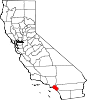
SealLocation of Rancho Santa Margarita within Orange County, California.
Coordinates: 33°38′29″N 117°35′40″W / 33.64139°N 117.59444°WCoordinates: 33°38′29″N 117°35′40″W / 33.64139°N 117.59444°W Country  United States
State  California
County Orange Incorporated January 1, 2000 Government – Mayor L. Anthony Beall[1] Area[2] – Total 12.992 sq mi (33.651 km2) – Land 12.957 sq mi (33.560 km2) – Water 0.035 sq mi (0.091 km2) 0.27% Elevation 551-1,000 ft (290 m) Population (2010) – Total 47,853 – Density 3,683.1/sq mi (1,422/km2) Time zone PST (UTC-8) – Summer (DST) PDT (UTC-7) ZIP code 92688, 92679 Area code(s) 949 FIPS code 06-59587 GNIS feature ID 1867054 Website http://www.cityofrsm.org/ Rancho Santa Margarita is a city in Orange County, California. One of Orange County's youngest cities, Rancho Santa Margarita is a master planned community set upon rolling hills. Most neighborhoods in Rancho Santa Margarita are within various homeowners associations. The population was 47,853 at the 2010 census, up from 47,214 at the 2000 census.
Although it is named for Rancho Santa Margarita y Las Flores, which was in San Diego County, the city limits fall within the borders of Rancho Mission Viejo.
Contents
History
The city seal has the brands of Rancho Mission Viejo and Rancho Santa Margarita and Las Flores on the border, with artwork containing Santiago Peak in the background. The tower in the foreground symbolizes the Rancho Santa Margarita Lake Tower.
Hughes Aircraft Company's Microelectronic Systems Division and Connecting Devices Division moved to Rancho Santa Margarita in May 1988 from Irvine. In August 1992 the Hughes plant closed its facilities and moved the division to Carlsbad, California due to budget constraints in the aerospace industry.
La Cañada Flintridge had the longest city name in California with 18 letters until January 1, 2000, when the title was ceded to Rancho Santa Margarita (20 letters) upon the latter's incorporation.
Geography
Rancho Santa Margarita is located at 33°38′29″N 117°35′40″W / 33.64139°N 117.59444°W (33.641518, -117.594524).[3]
According to the United States Census Bureau, the city has a total area of 13.0 square miles (34 km2). 13.0 square miles (34 km2) of it is land and 0.04 square miles (0.10 km2) of it (0.27%) is water.
Rancho Santa Margarita is bordered by the city of Mission Viejo on the west, the census-designated Coto de Caza and Las Flores on the south, Trabuco Canyon on the north, and the Cleveland National Forest on the east.
Major homeowner's associations and communities
 The Rancho Santa Margarita City Hall and Community Center building
SAMLARC
The Rancho Santa Margarita Landscape and Recreation Corporation, or SAMLARC, is often referred to as the master association in Rancho Santa Margarita because other smaller sub associations fall within its membership and it encompasses the original footprint of the master planned community of Rancho Santa Margarita. SAMLARC comprises roughly 13,000 units and maintains most streetscapes, medians, parks and trails within the community. In total, SAMLARC runs and maintains 13 parks, 4 pools, a lagoon, a lake, and numerous trails within the community. One of SAMLARC's most popular parks, Central Park located next to City Hall, contains a large amphitheater where a number of community events are held each year. Central Park is also home to an arena soccer rink that was converted from a roller hockey rink. SAMLARC also maintains a popular skate and dog park that are located within SAMLARC's Canada Vista Park.[4]
Dove Canyon
Dove Canyon is a private residential community located in eastern Rancho Santa Margarita. It is a small enclave of approximately 1,200 homes and 5,000 residents. Included within the guard-gated entry is a Jack Nicklaus signature golf club, pool, tennis courts, a small child's park, a wide field, a shopping center, and a reservoir. The majority of its residents are upper middle class residents of Orange County, and all of the homes in Dove Canyon are single-family residences. It is located in the Southeasternmost foothills of Orange County. Major roads include Dove Canyon/Bell Canyon and Sycamore Canyon. A horse trail starts at the waterfalls outside of the community and continues until the end of Sycamore Canyon. From there, hikers, horse riders, bikers, etc. can continue into Dove Canyon's neighbor community, Coto de Caza
Robinson Ranch
Robinson Ranch is a mid-sized residential community located northeastern Rancho Santa Margarita south of Trabuco Canyon. It is one of the older communities in Rancho Santa Margarita. It has several condominium areas closer to Plano Trabuco Road and a large park. Major Roads include Robinson Ranch and Shadow Rock. Like Dove Canyon and Rancho Cielo it is assigned with a Trabuco Canyon zip code even though the areas were annexed into Rancho Santa Margarita when the city incorporated in 2000.
Rancho Cielo
Rancho Cielo is a smaller residential community located in eastern Rancho Santa Margarita. It includes gated entry with security guard. It is near the intersection of Plano Trabuco Road and Dove Canyon Drive. All of the homes are all single family residences and the majority of its residents are upper-middle class. Major Roads include Rancho Cielo and Camino Del Cielo.
Climate
Rancho Santa Margarita, like most of coastal Southern California, generally has a Mediterranean climate. The name derives from its similarity to the climate of areas along the Mediterranean Sea. Summers are warm to hot, and winters are cool, rarely falling below freezing. Precipitation in Rancho Santa Margarita occurs predominantly during the winter months. The average January temperature in Rancho Santa Margarita is 56 °F (13 °C), while the average August temperature is 73 °F (23 °C).
Economy
Top employers
According to the City's 2010 Comprehensive Annual Financial Report,[5] the top employers in the city are:
# Employer # of employees 1 Applied Medical 1,174 2 Cox Communications 1,200 3 O'Connell Landscape Maintenance 980 4 Saddleback Valley Unified School District 606 5 Lucas & Mercier Construction 553 6 Control Components Inc. 370 7 Target 247 8 Car Sound Exhaust System 207 9 Capistrano Unified School District 210 10 Santa Margarita Catholic High School 200 11 Professional Association of Diving Instructors 200 12 Kohl's 118 Demographics
Historical populations Census Pop. %± 1990 11,390 — 2000 47,214 314.5% 2010 47,853 1.4% source:[6][7]  Antonio Parkway in Rancho Santa Margarita
 Avenida De Las Banderas in Rancho Santa Margarita
2010
The 2010 United States Census[8] reported that Rancho Santa Margarita had a population of 47,853. The population density was 3,683.1 people per square mile (1,422.0/km²). The racial makeup of Rancho Santa Margarita was 37,421 (78.2%) White, 887 (1.9%) African American, 182 (0.4%) Native American, 4,350 (9.1%) Asian, 102 (0.2%) Pacific Islander, 2,674 (5.6%) from other races, and 2,237 (4.7%) from two or more races. Hispanic or Latino of any race were 8,902 persons (18.6%).
The Census reported that 47,851 people (100% of the population) lived in households, 2 (0%) lived in non-institutionalized group quarters, and 0 (0%) were institutionalized.
There were 16,665 households, out of which 7,699 (46.2%) had children under the age of 18 living in them, 10,144 (60.9%) were opposite-sex married couples living together, 1,703 (10.2%) had a female householder with no husband present, 700 (4.2%) had a male householder with no wife present. There were 747 (4.5%) unmarried opposite-sex partnerships, and 103 (0.6%) same-sex married couples or partnerships. 3,199 households (19.2%) were made up of individuals and 761 (4.6%) had someone living alone who was 65 years of age or older. The average household size was 2.87. There were 12,547 families (75.3% of all households); the average family size was 3.33.
The population was spread out with 13,879 people (29.0%) under the age of 18, 3,793 people (7.9%) aged 18 to 24, 13,706 people (28.6%) aged 25 to 44, 13,764 people (28.8%) aged 45 to 64, and 2,711 people (5.7%) who were 65 years of age or older. The median age was 36.0 years. For every 100 females there were 95.6 males. For every 100 females age 18 and over, there were 92.1 males.
There were 17,260 housing units at an average density of 1,328.4 per square mile (512.9/km²), of which 11,906 (71.4%) were owner-occupied, and 4,759 (28.6%) were occupied by renters. The homeowner vacancy rate was 1.2%; the rental vacancy rate was 5.6%. 35,737 people (74.7% of the population) lived in owner-occupied housing units and 12,114 people (25.3%) lived in rental housing units.
2000
As of the census[9] of 2000, there were 47,214 people, 16,253 households, and 12,417 families residing within the city. The population density was 3,847.6 inhabitants per square mile (1,485.7/km²). There were 16,515 housing units at an average density of 1,345.9 per square mile (519.7/km²). The racial makeup of the city was 81.59% White, 1.75% African American, 0.42% Native American, 7.40% Asian, 0.21% Pacific Islander, 4.49% from other races, and 4.15% from two or more races. Hispanic of any race were 13.00% of the population.
There were 16,253 households out of which 51.4% had children under the age of 18 living with them, 64.7% were married couples living together, 8.5% had a female householder with no husband present, and 23.6% were non-families. 17.7% of all households were made up of individuals and 2.4% had someone living alone who was 65 years of age or older. The average household size was 2.90 and the average family size was 3.35.
In the city the population was spread out with 33.6% under the age of 18, 5.7% from 18 to 24, 41.4% from 25 to 44, 15.9% from 45 to 64, and 3.4% who were 65 years of age or older. The median age was 32 years. For every 100 females there were 96.8 males. For every 100 females age 18 and over, there were 92.9 males.
According to a 2007 estimate, the median income for a household in the city was $95,061, and the median income for a family was $110,799.[10] Males had a median income of $61,314 versus $40,799 for females. The per capita income for the city was $31,531. About 1.5% of families and 2.9% of the population were below the poverty line, including 3.1% of those under age 18 and 4.2% of those age 65 or over. Most of the neighborhoods in RSM are maintained by larger homeowner's associations including Melinda Heights, town center, Dove Canyon, Rancho Cielo, Robinson Ranch, and Trabuco Highlands. Dove Canyon, Trabuco Highlands, Robinson Ranch, and Rancho Cielo were all established before Rancho Santa Margarita was an incorporated community. East of Plano Tabuco Road is designated with a Trabuco Canyon (92679) zip code even though the area falls within the City of Rancho Santa Margarita boundary.[11]
Politics
In the state legislature Rancho Santa Margarita is located in the 33rd Senate District, represented by Republican Mimi Waters, and in the 71st Assembly District, represented by Republican Jeff Miller. Federally, Rancho Santa Margarita is located in California's 42nd congressional district, which has a Cook PVI of R +10[12] and is represented by Republican Gary Miller.
Education
The city is served by Saddleback Valley Unified School District and the Capistrano Unified School District.
- Students in SVUSD boundaries attend Trabuco Hills High School or Mission Viejo High School, both outside of Rancho Santa Margarita in the city of Mission Viejo. Students in CUSD boundaries attend Tesoro High School located in the Las Flores neighborhood.
- RSM Intermediate School (SVUSD) and Las Flores Middle School (CUSD) serve the city.
- Public Elementary schools include Cielo Vista, Trabuco Mesa, Robinson Ranch, Arroyo Vista, Melinda Heights, and Tijeras Creek.
- Private Elementary and Middle Schools include St. John's Episcopal, Serra Catholic, and Mission Hills Christian School.
- Santa Margarita Catholic High School is a private Roman Catholic high school associated with the Catholic Diocese of Orange, and headed by Principal Ray Dunne. SMCHS is located in Rancho Santa Margarita.
Popular culture
Television
The television series The Real Housewives of Orange County, although based in Coto De Caza, is mainly filmed in Rancho Santa Margarita where many of the housewives do business, shopping, commuting, and dining.[13]
The city's name often creates confusion: people in the Las Flores, Dove Canyon, Rancho Cielo, or Robinson Ranch neighborhoods, for example, can receive mail addressed to them at Rancho Santa Margarita, Dove Canyon, Coto de Caza, Robinson Ranch or Trabuco Canyon.
Notable natives and residents
- R.J. Adams, Film/TV Acting coach, Radio Personality, Producer
- Jonathon Blum Nashville Predators NHL
- Rod Carew California Angels MLB
- Martin Dugard, author
- Jim Everett, Retired NFL Quarterback Los Angeles Rams
- Joy Fawcett, Olympic gold medalist[14]
- Bobby Grich California Angels MLB
- General William Lyon Founder of William Lyon Homes Company
- Carson Palmer Oakland Raiders Quarterback NFL, 2002 Heisman winner, 2007 Pro Bowl MVP; attended Santa Margarita Catholic High School
- Mark Sanchez Quarterback of the New York Jets
- Teemu Selänne Anaheim Ducks NHL
- Orly Taitz, lawyer and leader of the anti-Obama "birther" movement
- Members of the band Velvet Revolver
See also
References
- ^ http://www.cityofrsm.org/gov/council/default.asp
- ^ U.S. Census
- ^ "US Gazetteer files: 2010, 2000, and 1990". United States Census Bureau. 2011-02-12. http://www.census.gov/geo/www/gazetteer/gazette.html. Retrieved 2011-04-23.
- ^ Official SAMLARC Website
- ^ City of Rancho Santa Margarita CAFR
- ^ "CENSUS OF POPULATION AND HOUSING (1790-2000)". U.S. Census Bureau. http://www.census.gov/prod/www/abs/decennial/index.html. Retrieved 2010-07-17.
- ^ 1990 census figure was taken prior to incorporation as Rancho Santa Margarita CDP.
- ^ All data are derived from the United States Census Bureau reports from the 2010 United States Census, and are accessible on-line here. The data on unmarried partnerships and same-sex married couples are from the Census report DEC_10_SF1_PCT15. All other housing and population data are from Census report DEC_10_DP_DPDP1. Both reports are viewable online or downloadable in a zip file containing a comma-delimited data file. The area data, from which densities are calculated, are available on-line here. Percentage totals may not add to 100% due to rounding. The Census Bureau defines families as a household containing one or more people related to the householder by birth, opposite-sex marriage, or adoption. People living in group quarters are tabulated by the Census Bureau as neither owners nor renters. For further details, see the text files accompanying the data files containing the Census reports mentioned above.
- ^ "American FactFinder". United States Census Bureau. http://factfinder.census.gov. Retrieved 2008-01-31.
- ^ Fact Finder
- ^ City Zoning Map
- ^ "Will Gerrymandered Districts Stem the Wave of Voter Unrest?". Campaign Legal Center Blog. http://www.clcblog.org/blog_item-85.html. Retrieved 2008-02-10.
- ^ BRAVOtv.com: The Real Housewives of Orange County: Season 3 : Home
- ^ Perkes, Courtney (2008-07-23). "Ex-Olympian battles rheumatoid arthritis". The Orange County Register: pp. Life, etc. 2
External links
Municipalities and communities of Orange County, California Cities Aliso Viejo | Anaheim | Brea | Buena Park | Costa Mesa | Cypress | Dana Point | Fountain Valley | Fullerton | Garden Grove | Huntington Beach | Irvine | La Habra | La Palma | Laguna Beach | Laguna Hills | Laguna Niguel | Laguna Woods | Lake Forest | Los Alamitos | Mission Viejo | Newport Beach | Orange | Placentia | Rancho Santa Margarita | San Clemente | San Juan Capistrano | Santa Ana | Seal Beach | Stanton | Tustin | Villa Park | Westminster | Yorba Linda
CDPs Unincorporated
communitiesAnaheim Island | Modjeska Canyon | Orange Park Acres | Santa Ana Heights | Santiago Canyon | Silverado | Trabuco Canyon
Categories:- Populated places established in 2000
- Cities in Orange County, California
- Former census-designated places in California
- Incorporated cities and towns in California


Wikimedia Foundation. 2010.