- Auburn, California
-
City of Auburn — City — Old Town Auburn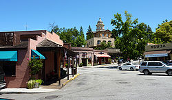 Location in Placer County and the state of California
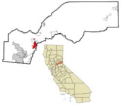
Coordinates: 38°53′55″N 121°4′28″W / 38.89861°N 121.07444°WCoordinates: 38°53′55″N 121°4′28″W / 38.89861°N 121.07444°W Country  United States
State  California
County Placer Government – Mayor Vanessa Marin (Republican) [1] – State Senate Dave Cox (R) – State Assembly Ted Gaines (R) or Dan Logue (R) – U. S. Congress Tom McClintock (R) Area[2] – City 7.166 sq mi (18.560 km2) – Land 7.138 sq mi (18.488 km2) – Water 0.028 sq mi (0.071 km2) 0.38% Elevation 1,227 ft (374 m) Population (2010) – City 13,330 – Density 1,860.2/sq mi (718.2/km2) – Metro est. ~19,500 (including Foresthill, Applegate and Meadow Vista) Time zone Pacific Time Zone (UTC-8) – Summer (DST) PDT (UTC-7) ZIP codes 95602-95604 Area code(s) 530 FIPS code 06-03204 GNIS feature ID 1657964 Website auburn.ca.gov U.S. Geological Survey Geographic Names Information System: Auburn, California Auburn is the county seat of Placer County, California.[3] Its population at the 2010 census was 13,330. Auburn is known for its California Gold Rush history.
Auburn is part of the Greater Sacramento area.
Contents
History
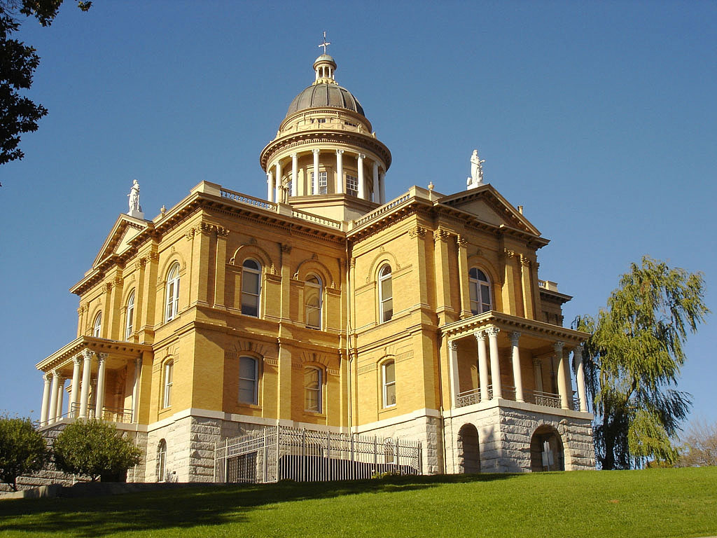
 The Placer County Courthouse was constructed between 1894 and 1898.
Archaeological finds place the southwestern border for the prehistoric Martis people in the Auburn area.[4] The indigenous Nisenan, an offshoot of the Maidu, were the first to establish a permanent settlement in the Auburn area.
In the spring of 1849, a group of French gold miners arrived and camped in what would later be known as the Auburn Ravine. This group was on its way to the gold fields in Coloma, California, and it included Francois Gendron, Philibert Courteau, and Claude Chana. The young Chana discovered gold on May 16, 1848. After finding the gold deposits in the soil, the trio decided to stay for more prospecting and mining.
Placer mining in the Auburn area was very good, with the camp first becoming known as the North Fork Dry Diggings. This name was changed to the Woods Dry Diggings, after John S. Wood settled down, built a cabin, and started to mine in the ravine. The area soon developed into a mining camp, and it was officially named Auburn in August 1849. By 1850, the town's population had grown to about 1500 people, and in 1851, Auburn was chosen as the seat of Placer County. Gold mining operations moved up the ravine to the site of present-day Auburn. In 1865, the Central Pacific Railroad, the western leg of the First Transcontinental Railroad, reached Auburn, as it was being built east from Sacramento toward Ogden, Utah.
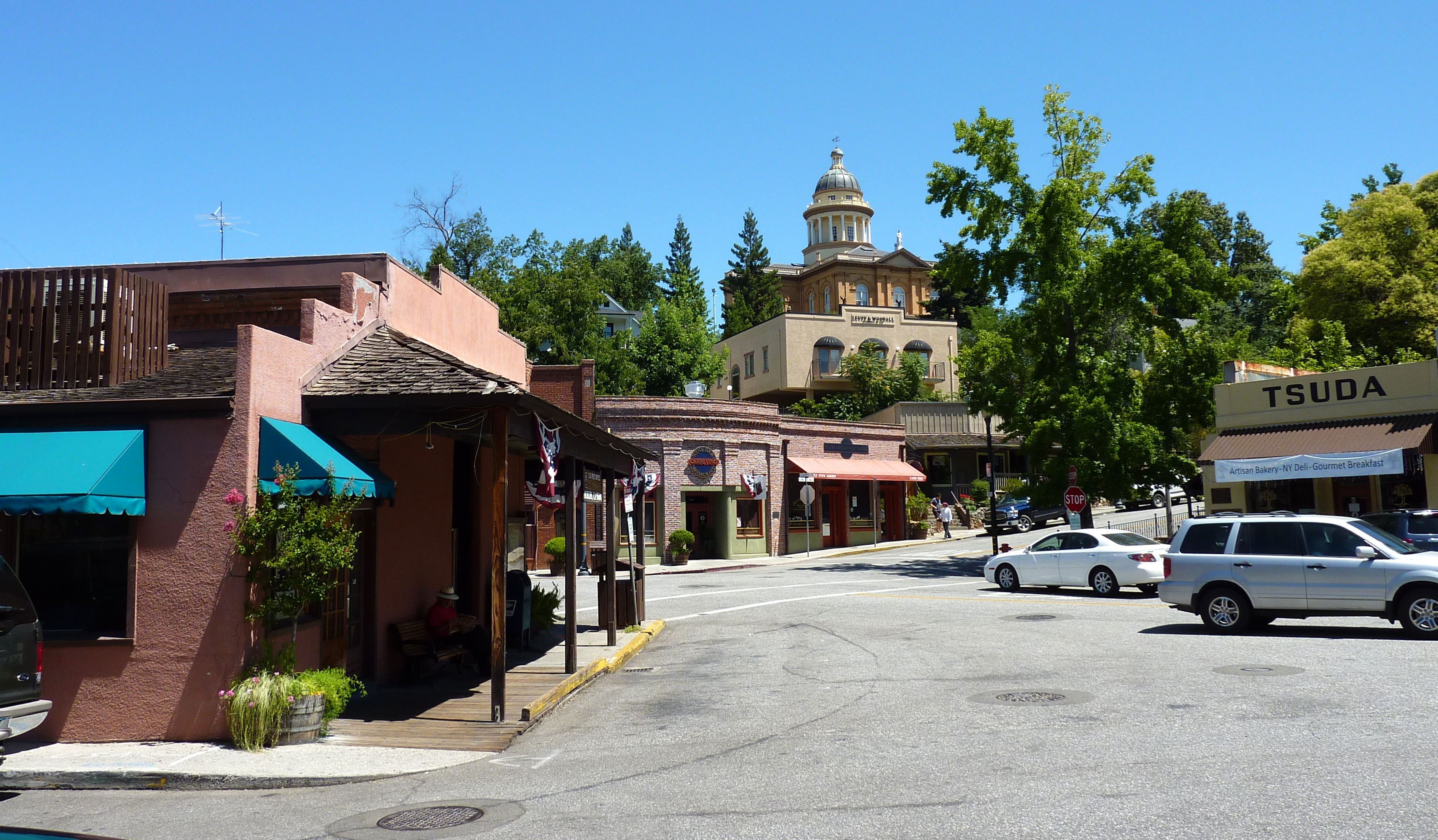
The restored Old Town has houses and retail buildings from the middle of the 19th century. The oldest fire station and the Post Office date from the Gold Rush years. Casual gold-mining accessories, as well as American Indian and Chinese artifacts, can also be viewed by visitors at the Placer County Museum.
Endurance Capital
Auburn is home of the Auburn State Recreation Area. The park is the site of more sporting endurance events than any other place in the world, giving Auburn the undisputed and internationally acclaimed title of Endurance Capital of the World. Examples include the Western States Endurance Run; the Western States Trail Ride, also known as Tevis Cup Equestrian Ride; American River 50 Mile Endurance Run; American River 50 Mile Equestrian Ride; Way Too Cool 50 Kilometer Endurance Run; Auburn International Half-Ironman Triathlon; Auburn Century 100 Mile Bike Ride, Coolest 24 Hour Mountain Bike Race, Rio Del Lago 100 Mile Endurance Run, Sierra Nevada 50 Mile Endurance Run, and the Coolest Run: Ride & Tie.
Films
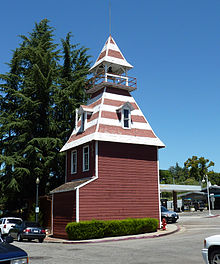 The Queen Anne style Old Town Firehouse is a landmark. It originally adjoined a row of commercial buildings (now demolished). It was home to the Auburn Volunteer Fire Department.[5]
The following films were, at least in part, shot in Auburn:[6]
- The Adventures of Rocky and Bullwinkle
- Protocol
- Breakdown
- My Family
- The Phantom
- Phenomenon
- Wisdom
- xXx
- The Ugly Truth
- Auburn is the town where George and Lennie were raised in John Steinbeck's novel, Of Mice and Men.
Landmarks
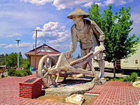 Statue at the Auburn Amtrak station honoring the 10,000+ Chinese workers (known then as "Celestials") who helped build the Central Pacific Railroad.
Auburn is home to Placer High School, which is one of the oldest high schools in California.
Local dentist Kenneth H. Fox's colossal sculptures are perhaps the most famous in town. The statues chronicle Auburn's history with a middle-aged Claud Chana gold panning in the nearby American River, and a Chinese "coolie" worker building the Transcontinental Railroad.
Geography
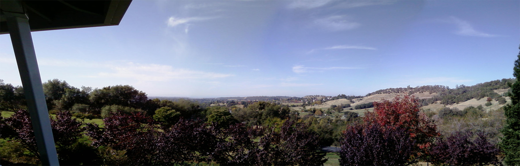
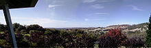 Rolling hills of Auburn, taken near Indian Hill Road.
Auburn is located at 38°53′55″N 121°04′28″W / 38.898671°N 121.074399°W.[7]
According to the United States Census Bureau, the city has a total area of 7.2 square miles (19 km2), of which 0.03 square miles (0.078 km2), or 0.38%, is water. The city is located at 38.89199 N, 121.07606 W.
Auburn is situated approximately 800 vertical feet above the confluence of the North Fork and Middle Fork of the American River between Sacramento and Lake Tahoe in central California, along the Interstate 80 freeway. Mountainous wilderness canyons and the western slope of the Sierra Nevada Range lie adjacent eastward, while gentle rolling foothills well-suited for agriculture lie to the west. The crest of the Sierra Nevada lies approximately 45 miles (72 km) eastward, and the Central Valley lies approximately ten miles to the west.
Climate
Auburn has cool, wet winters and very warm, mostly dry summers. Average January temperatures are a maximum of 54.0 °F (12.2 °C) and a minimum of 36.6 °F (2.6 °C). Average July temperatures are a maximum of 92.6 °F (33.7 °C) and a minimum of 61.8 °F (16.6 °C). Annually, there are an average of 67.9 days with highs of 90 °F (32 °C) or higher and an average of 22.7 days with 32 °F (0 °C) or lower. The record high temperature was 113 °F (45 °C) on July 15, 1972. The record low temperature was 16 °F (−9 °C) on December 9, 1972.
Average annual precipitation is 34.27 inches (870 mm). There are an average of 66 days with measurable precipitation. The wettest year was 1983 with 64.87 inches (1,648 mm) and the driest year was 1976 with 11.76 inches (299 mm). The most precipitation in one month was 23.08 inches (586 mm) in January 1909. The most precipitation in 24 hours was 5.41 inches (137 mm) on October 13, 1962, during the Columbus Day Storm. Snow rarely falls in Auburn; average annual snowfall is only 1.4 inches (36 mm). The most snowfall in one year was 10.7 inches (270 mm) in 1972, including 6.5 inches (170 mm) in January 1972.[8]
Climate data for Auburn, California Month Jan Feb Mar Apr May Jun Jul Aug Sep Oct Nov Dec Year Average high °F (°C) 54.2
(12.3)58.2
(14.6)61.6
(16.4)67.7
(19.8)75.9
(24.4)84.6
(29.2)91.3
(32.9)90.7
(32.6)85.2
(29.6)75.6
(24.2)61.4
(16.3)54.6
(12.6)71.8 Average low °F (°C) 37.6
(3.1)40.5
(4.7)42.4
(5.8)45.4
(7.4)50.8
(10.4)57.1
(13.9)62.7
(17.1)62.0
(16.7)58.8
(14.9)52.3
(11.3)43.2
(6.2)37.7
(3.2)49.2 Rainfall inches (mm) 6.68
(169.7)6.28
(159.5)6.16
(156.5)2.50
(63.5)1.30
(33)0.37
(9.4)0.14
(3.6)0.14
(3.6)0.77
(19.6)1.93
(49)4.89
(124.2)5.35
(135.9)36.51
(927.4)Avg. rainy days (≥ 0.01 in) 11.4 10.5 11.1 6.8 4.4 2.0 0.4 0.9 2.4 4.4 9.2 9.8 73.3 Source: NOAA [9] Demographics
2010
The 2010 United States Census[10] reported that Auburn had a population of 13,330. The population density was 1,860.2 people per square mile (718.2/km²). The racial makeup of Auburn was 11,863 (89.0%) White, 100 (0.8%) African American, 129 (1.0%) Native American, 240 (1.8%) Asian, 9 (0.1%) Pacific Islander, 405 (3.0%) from other races, and 584 (4.4%) from two or more races. Hispanic or Latino of any race were 1,331 persons (10.0%).
The Census reported that 13,052 people (97.9% of the population) lived in households, 145 (1.1%) lived in non-institutionalized group quarters, and 133 (1.0%) were institutionalized.
There were 5,759 households, out of which 1,502 (26.1%) had children under the age of 18 living in them, 2,613 (45.4%) were opposite-sex married couples living together, 604 (10.5%) had a female householder with no husband present, 257 (4.5%) had a male householder with no wife present. There were 352 (6.1%) unmarried opposite-sex partnerships, and 33 (0.6%) same-sex married couples or partnerships. 1,845 households (32.0%) were made up of individuals and 801 (13.9%) had someone living alone who was 65 years of age or older. The average household size was 2.27. There were 3,474 families (60.3% of all households); the average family size was 2.85.
The population was spread out with 2,645 people (19.8%) under the age of 18, 1,031 people (7.7%) aged 18 to 24, 2,898 people (21.7%) aged 25 to 44, 4,224 people (31.7%) aged 45 to 64, and 2,532 people (19.0%) who were 65 years of age or older. The median age was 45.4 years. For every 100 females there were 89.5 males. For every 100 females age 18 and over, there were 86.1 males.
There were 6,139 housing units at an average density of 856.7 per square mile (330.8/km²), of which 3,388 (58.8%) were owner-occupied, and 2,371 (41.2%) were occupied by renters. The homeowner vacancy rate was 2.0%; the rental vacancy rate was 6.5%. 8,017 people (60.1% of the population) lived in owner-occupied housing units and 5,035 people (37.8%) lived in rental housing units.
2000
As of the census[11] of 2000, there were 12,462 people, 5,302 households, and 3,281 families residing in the city. The population density was 1,690.2 people per square mile (652.9/km²). There were 5,457 housing units at an average density of 740.1 per square mile (285.9/km²). The racial makeup of the city was 93.4% White, 0.5% Black or African American, 0.8% Native American, 1.3% Asian, 0.1% Pacific Islander, 1.5% from other races, and 2.4% from two or more races. 6.0% of the population were Hispanic or Latino of any race.
There were 5,302 households out of which 28.4% had children under the age of 18 living with them, 48.5% were married couples living together, 10.0% had a female householder with no husband present, and 38.1% were non-families. 31.7% of all households were made up of individuals and 13.7% had someone living alone who was 65 years of age or older. The average household size was 2.31 and the average family size was 2.91.
In the city the population was spread out with 23.3% under the age of 18, 7.2% from 18 to 24, 25.7% from 25 to 44, 25.7% from 45 to 64, and 18.1% who were 65 years of age or older. The median age was 41 years. For every 100 females there were 86.9 males. For every 100 females age 18 and over, there were 83.2 males.
The median income for a household in the city was $58,999, and the median income for a family was $82,250. The per capita income for the city was $36,258.
Transportation
Auburn is served by Amtrak passenger rail service a few times a day, and its railroad station is the eastern terminus of AMTRAK's California-based Capitol Corridor train. Interstate Highway 80 is the main east-west highway through this area, connecting Sacramento to the west and the Lake Tahoe/Reno areas to the east. This town can be reached through several interchanges on Interstate 80, three of which (exits 118, 119 A through C, and 120) are somewhat within the town limits. California Highway 49 is the main north-south highway through this area. Highway 49 connects Auburn with the towns of Grass Valley and Nevada City to its north.
The Auburn Municipal Airport is located three miles (5 km) north of town, and it is a General Aviation airport, only. Auburn owns and operates this airport and an industrial site. The airport site covers 285 acres (1.15 km2) including an 80-acre (320,000 m2) industrial site. This airport has a single 3,700 ft (1,128 m)-long runway.[12][13] Services available there include the usual General Aviation ones.[14]
Books
- Auburn, California: crossroads of historic gold country. (1973). [S.l: s.n.].
- Borchardt, G. A., Rice, S. J., & Taylor, G. C. (1980). Paleosols overlying the Foothills fault system near Auburn, California. Sacramento: California Division of Mines and Geology.
- Barieau, C. (1988). A self-guided walking tour to historic Auburn buildings: a guide to significant historical and architectural buildings of Auburn, California. Auburn, Calif: Auburn Letter House.
- Sanborn, D. (2001). Chronology of Auburn, California. Auburn, CA: Auburn Sesquicentennial Committee.
References
- ^ Elected City Officials | Mayor and City Council
- ^ U.S. Census
- ^ "Find a County". National Association of Counties. http://www.naco.org/Counties/Pages/FindACounty.aspx. Retrieved 2011-06-07.
- ^ Brauman, Sharon K. (2004-10-06). "NORTH FORK PETROGLYPHS". ucnrs.org. http://sagehen.ucnrs.org/CSFRS/petros.htm. Retrieved 2008-08-15.
- ^ Old Town Firehouse, Auburn Chamber of Commerce, Accessed August 1, 2009.
- ^ Placer Tahoe Film Office - Shot in Placer County
- ^ "US Gazetteer files: 2010, 2000, and 1990". United States Census Bureau. 2011-02-12. http://www.census.gov/geo/www/gazetteer/gazette.html. Retrieved 2011-04-23.
- ^ http://www.wrcc.dri.edu/cgi-bin/cliMAIN.pl?ca0383
- ^ "NCDC: U.S. Climate Normals" (PDF). National Oceanic and Atmospheric Administration. http://cdo.ncdc.noaa.gov/climatenormals/clim20/ca/040383.pdf. Retrieved 2010-07-02.
- ^ All data are derived from the United States Census Bureau reports from the 2010 United States Census, and are accessible on-line here. The data on unmarried partnerships and same-sex married couples are from the Census report DEC_10_SF1_PCT15. All other housing and population data are from Census report DEC_10_DP_DPDP1. Both reports are viewable online or downloadable in a zip file containing a comma-delimited data file. The area data, from which densities are calculated, are available on-line here. Percentage totals may not add to 100% due to rounding. The Census Bureau defines families as a household containing one or more people related to the householder by birth, opposite-sex marriage, or adoption. People living in group quarters are tabulated by the Census Bureau as neither owners nor renters. For further details, see the text files accompanying the data files containing the Census reports mentioned above.
- ^ "American FactFinder". United States Census Bureau. http://factfinder.census.gov. Retrieved 2008-01-31.
- ^ City of Auburn. "City of Auburn: Airport and Industrial Park". http://www.auburn.ca.gov/dept/dept_airport.html.
- ^ City of Auburn. "City of Auburn: About the Airport". http://www.auburn.ca.gov/dept/dept_air_abt.html.
- ^ City of Auburn. "City of Auburn: Airport Services". http://www.auburn.ca.gov/dept/dept_air_srvc.html.
Two stoned minds combinded. Stevie lyn-Rose 2006
External links
- Auburn City official homepage
- Auburn, CA - Information & Resources
- Auburn Chamber of Commerce
- Placer County Courthouse
- Auburn Journal - newspaper
- West Placer Community Forums
- Placer High School
- Auburn Online Community
- Auburn Statues
- Bicentennial Park
- Placer County Museums

Sheridan North Auburn Foresthill Lincoln 
Cool  Auburn

Penryn Folsom Lake Coloma Municipalities and communities of Placer County, California County seat: AuburnCities and towns 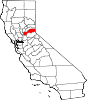
CDPs Alta | Carnelian Bay | Dollar Point | Dutch Flat | Foresthill | Granite Bay | Kings Beach | Kingvale‡ | Meadow Vista | Newcastle | North Auburn | Penryn | Sheridan | Sunnyside-Tahoe City | Tahoe Vista | Tahoma‡
Unincorporated
communitiesAlpine Meadows | Applegate | Baxter | Big Bend | Blue Canyon | Brockway | Cape Horn | Casa Loma | Chambers Lodge | Cisco | Cisco Grove | Clayton | Clipper Gap | Donner | Eder | Elders Corner | Emigrant Gap | Forebay | Four Acres | Gold Hill | Greekstore | Heather Glen | Hidden Valley | Homewood | Hughes Mill | Idlewild | Iowa Hill | Kilaga Springs | Lake Forest | Lander Crossing | Last Chance | Magra | McCulloh | Michigan Bluff | Midas | Monte Vista | Nielsburg | Ophir | Pinecroft | Rainbow | Rampart | Ramsey Crossing | Rawhide | Secret Town | Soda Springs | Squaw Valley | Sunnyside | Tahoe City | Tahoe Pines | The Cedars | Todd Valley | Towle | Troy | Virginiatown | Westville | Weimar | Whitney | Yankee Jims | Zuver
Ghost
townsAckerman | Andover | Arctic | Baltimore | Bath | Blue Bluffs | Bullion | Cairns | Ceres Flat | Chicago Park | Coon Creek | Deadwood | Drum | East Auburn | Flat Ravine | Florence Spring | Fort Trojan | Frytown | Fulda | Gilsons Station | Goggins | Gold Run | Indiana Hill | Knapp | Kulkumish | Leta | Little Rattlesnake Bar | Lone Star | Lost Camp | Mayflower | Millertown | Mineral Bar | Molma | Moss Hills | Oilville | Pine Grove | Pitsokut | Ralston | Red Point | Secret Canyon | Secret Ravine | Smiths | Spruce | Stanford | Stewarts Flat | Stonehill | Tamarack | Union Shed | Vantrent | Webster | Yorkville
Footnotes ‡This CDP also has portions in an adjacent county or counties
Greater Sacramento Counties Douglas (NV) · El Dorado · Nevada · Placer · Sacramento · Sutter · Yolo · Yuba
Major City Cities
and
towns100k–200k25k–100kArden Arcade · Auburn · Carmichael · Citrus Heights · Davis · Folsom · Florin · Laguna · Lincoln · North Highlands · Orangevale · Parkway-South Sacramento · Rancho Cordova · Rocklin · West Sacramento · Woodland · Yuba City
10k–25kCameron Park · El Dorado Hills · Fair Oaks · Foothill Farms · Galt · Gardnerville Ranchos (NV) · Granite Bay · Grass Valley · La Riviera · Linda · Marysville · North Auburn · Olivehurst · Placerville · Rosemont · Rio Linda · South Lake Tahoe · South Yuba City · Truckee · Vineyard
Sub-regions Gold Country · Lake Tahoe · Sacramento Valley · Sierra Nevada · Yuba-Sutter Area
California county seats Consolidated city-county Municipalities Alturas | Auburn | Bakersfield | Colusa | Crescent City | El Centro | Eureka | Fairfield | Fresno | Hanford | Hollister | Jackson | Lakeport | Los Angeles | Madera | Martinez | Marysville | Merced | Modesto | Napa | Nevada City | Oakland | Oroville | Placerville | Red Bluff | Redding | Redwood City | Riverside | Sacramento | Salinas | San Bernardino | San Diego | San Jose | San Luis Obispo | San Rafael | Santa Ana | Santa Barbara | Santa Cruz | Santa Rosa | Sonora | Stockton | Susanville | Ukiah | Ventura | Visalia | Willows | Woodland | Yreka | Yuba City
CDPs Bridgeport | Downieville | Independence | Mariposa | Markleeville | Quincy | San Andreas | Weaverville
Categories:- Incorporated cities and towns in California
- Cities in Placer County, California
- County seats in California
- Sacramento metropolitan area


Wikimedia Foundation. 2010.