- Roseville, California
-
City of Roseville — City — 
SealLocation in Placer County
Coordinates: 38°45′9″N 121°17′22″W / 38.7525°N 121.28944°WCoordinates: 38°45′9″N 121°17′22″W / 38.7525°N 121.28944°W Country  United States
State  California
County Placer Incorporated April 10, 1909 Government – Type Council-Manager – Mayor Pauline Roccucci[1] – State Senate Dave Cox (R) – State Assembly Ted Gaines (R) – U. S. Congress Tom McClintock (R) Area[2] – Total 36.223 sq mi (93.817 km2) – Land 36.222 sq mi (93.814 km2) – Water 0.001 sq mi (0.003 km2) 0% Elevation[3] 164 ft (50 m) Population (2010) – Total 118,788 – Rank 1st in Placer County
47th in California
212th in the United States– Density 3,279.4/sq mi (1,266.2/km2) Time zone PST (UTC-8) – Summer (DST) PDT (UTC-7) ZIP codes 95678, 95661, 95747 Area code(s) 916 FIPS code 06-62938 GNIS feature ID 1659544 Website www.roseville.ca.us U.S. Geological Survey Geographic Names Information System: Roseville, California Roseville (formerly, Roseville Junction,[3] Junction,[4] and Griders[4]) is a city in Placer County, California, United States, located in the metropolitan area of Sacramento. As of the 2010 U.S. Census, the population was 118,788. Roseville's population is expected to reach 133,680 by 2015.[5] Interstate 80 runs through Roseville and State Route 65 bisects the northern part of the city.
Contents
History
The settlement was originally a stage coach station called Griders.[4] When the railroad arrived the name was changed to Junction and then to Roseville.[4]
The Roseville post office opened in 1864.[4] Roseville incorporated as a city in 1909.[4]
Geography
Roseville is located at 38°45′09″N 121°17′22″W / 38.752434°N 121.289338°W.[6]
According to the United States Census Bureau, the city has a total area of 36.9 square miles (96 km2), of which, 36.2 square miles (94 km2) of it is land and 0.001 square miles (0.0026 km2) of it (0.00%) is water. Several streams flow through Roseville, including Dry Creek, Linda Creek, Secret Ravine and Cirby Creek.
Climate
Roseville has a Mediterranean climate that is characterized by cool, wet winters and hot, dry summers (Koppen climate classification Csa). The "wet season" is generally October through April. Average daily high temperatures range from 54 °F (12 °C) in January to 95 °F (35 °C) in July. Daily low temperatures range from 39 °F in winter to 60 °F in summer (4 to 16 °C).
Climate data for Roseville, California Month Jan Feb Mar Apr May Jun Jul Aug Sep Oct Nov Dec Year Average high °F (°C) 54
(12)61
(16)65
(18)72
(22)80
(27)89
(32)95
(35)94
(34)89
(32)79
(26)64
(18)55
(13)74.8
(23.8)Daily mean °F (°C) 47
(8)52
(11)55
(13)59
(15)66
(19)73
(23)78
(26)77
(25)73
(23)66
(19)54
(12)47
(8)62.3
(16.8)Average low °F (°C) 39
(4)42
(6)45
(7)47
(8)52
(11)57
(14)61
(16)60
(16)58
(14)53
(12)45
(7)39
(4)49.8
(9.9)Precipitation inches (mm) 4.46
(113.3)4.34
(110.2)4.30
(109.2)1.84
(46.7)0.52
(13.2)0.31
(7.9)0.11
(2.8)0.10
(2.5)0.45
(11.4)1.32
(33.5)3.47
(88.1)3.39
(86.1)24.61
(625.1)Source: weather.com [1] Demographics
2010
The 2010 United States Census[7] reported that Roseville had a population of 118,788. The population density was 3,279.4 people per square mile (1,266.2/km²). The racial makeup of Roseville was 94,199 (79.3%) White, 2,329 (2.0%) African American, 885 (0.7%) Native American, 10,026 (8.4%) Asian (3.1% Filipino, 2.0% Indian, 1.0% Chinese, 0.6% Japanese, 0.6% Vietnamese, 0.5% Korean, 0.8% Other), 346 (0.3%) Pacific Islander, 5,087 (4.3%) from other races, and 5,916 (5.0%) from two or more races. Hispanic or Latino of any race were 17,359 persons (14.6%).
The Census reported that 117,941 people (99.3% of the population) lived in households, 478 (0.4%) lived in non-institutionalized group quarters, and 369 (0.3%) were institutionalized.
There were 45,059 households, out of which 16,885 (37.5%) had children under the age of 18 living in them, 24,050 (53.4%) were opposite-sex married couples living together, 4,901 (10.9%) had a female householder with no husband present, 2,088 (4.6%) had a male householder with no wife present. There were 2,518 (5.6%) unmarried opposite-sex partnerships, and 286 (0.6%) same-sex married couples or partnerships. 11,042 households (24.5%) were made up of individuals and 4,502 (10.0%) had someone living alone who was 65 years of age or older. The average household size was 2.62. There were 31,039 families (68.9% of all households); the average family size was 3.14.
The population was spread out with 31,210 people (26.3%) under the age of 18, 9,397 people (7.9%) aged 18 to 24, 33,362 people (28.1%) aged 25 to 44, 28,952 people (24.4%) aged 45 to 64, and 15,867 people (13.4%) who were 65 years of age or older. The median age was 36.8 years. For every 100 females there were 91.9 males. For every 100 females age 18 and over, there were 88.4 males.
There were 47,757 housing units at an average density of 1,318.4 per square mile (509.0/km²), of which 29,513 (65.5%) were owner-occupied, and 15,546 (34.5%) were occupied by renters. The homeowner vacancy rate was 2.3%; the rental vacancy rate was 6.8%. 79,887 people (67.3% of the population) lived in owner-occupied housing units and 38,054 people (32.0%) lived in rental housing units.
2005
As of 2005, there were 103,845 people, 42,538 households, and 21,855 families residing in the city. The population density was 2,622.5 people per square mile (1,012.4/km²). There were 31,925 housing units at an average density of 1,047.6 per square mile (404.4/km²). The racial makeup of the city in 2010 was 71.0% non-Hispanic White, 1.8% non-Hispanic African American, 0.5% Native American, 8.2% Asian, 0.2% Pacific Islander, 0.2% from other races, and 3.4% from two or more races. Hispanic or Latino of any race were 14.6% of the population.
There were 30,783 households out of which 35.4% had children under the age of 18 living with them, 57.1% were married couples living together, 10.1% had a female householder with no husband present, and 29.0% were non-families. 23.1% of all households were made up of individuals and 9.2% had someone living alone who was 65 years of age or older. The average household size was 2.57 and the average family size was 3.03.
In the city the population was spread out with 26.8% under the age of 18, 7.0% from 18 to 24, 30.8% from 25 to 44, 21.0% from 45 to 64, and 14.5% who were 65 years of age or older. The median age was 36 years. For every 100 females there were 92.1 males. For every 100 females age 18 and over, there were 88.8 males.
According to a 2007 estimate, the median income for a household in the city was $68,273, and the median income for a family was $84,863[8] Males had a median income of $50,426 versus $35,494 for females. The per capita income for the city was $47,021. About 3.4% of families and 4.9% of the population were below the poverty line, including 5.3% of those under age 18 and 4.1% of those age 65 or over.
In CNN Money's "Best Places to Live" study in 2006, Roseville was ranked the skinniest city in the country, with an average body mass index of 24.5.[9]
Economy
The city of Roseville has a variety of businesses located in it. It has encouraged the addition of large retail centers, including one of the largest Auto Malls in the country, which contributes significantly to sales tax receipts at the city and county level. Revenue from sales tax has been a main reason why the City of Roseville has been able to keep up the city's infrastructure as the population has dramatically increased. This environment has produced a mix of housing, small and large employers, as well as shopping opportunities. A popular water park, Roseville Golfland SunSplash, is also located in Roseville.
Shopping
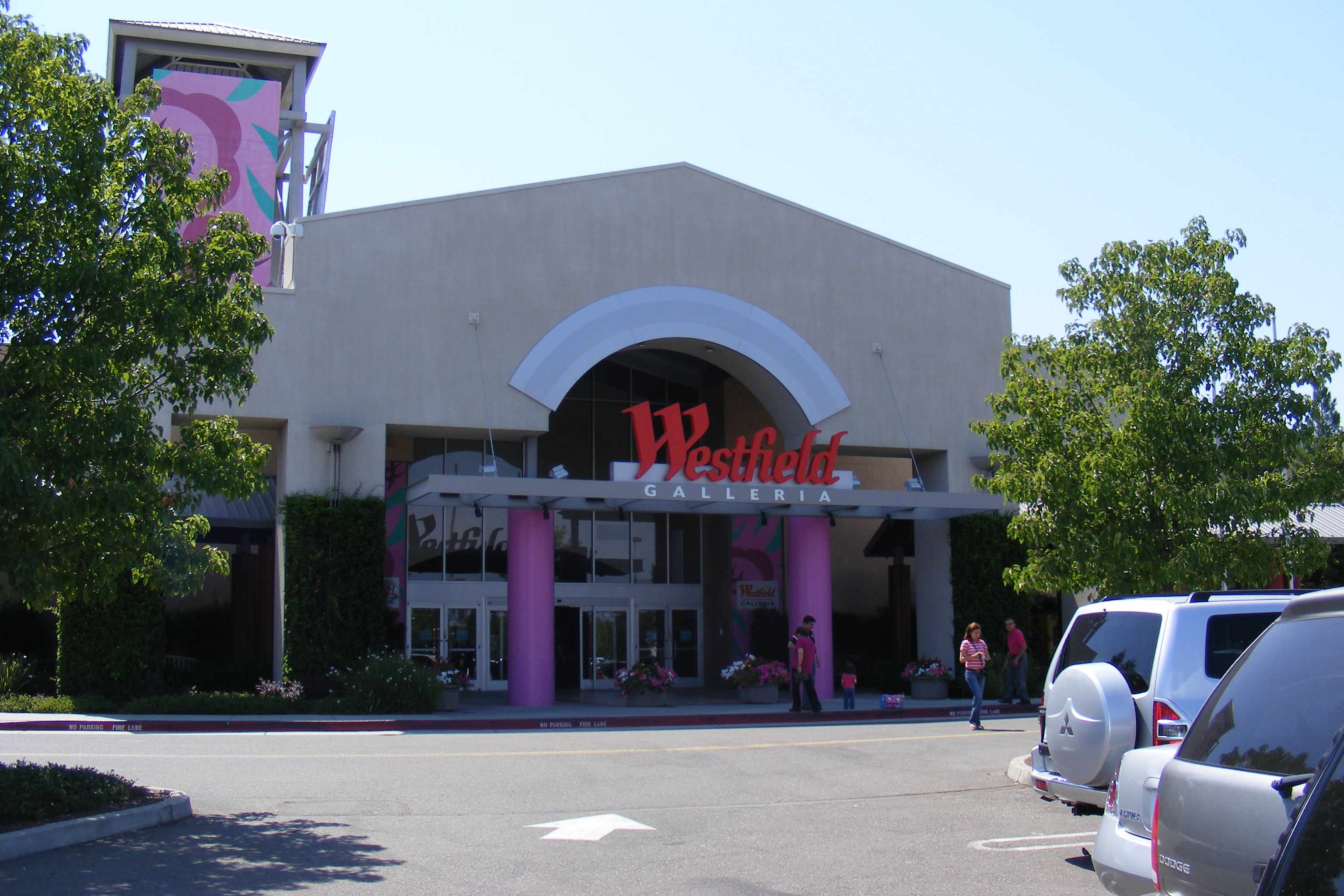
 The Westfield Galleria mall
Shopping plays a vital role in the economy of Roseville, which has the eleventh highest retail sales of all California cities as of 2008.[10] Roseville is also the smallest of the fifteen top ranked cities in retail sales; before the economic slowdown, they were ranked number 9.[citation needed] Once the auto industry and economy recovers, combined with new retail, Roseville is expected to climb back into the top 10 with over $4 billion in retail sales annually.[citation needed] Roseville is considered a regional shopping destination, with the Westfield Galleria at Roseville being the main shopping center in the city. Westfield embarked on a $270 million project, because of the revenue they acquire from this high end mall.487,806-square-foot (45,319 m2) expansion.[11] mall.
Across the street from the Galleria, Peter Bollinger Investment Company built an $70 million complex named "Fountains at Roseville".[12] Fountains at Roseville is a 330,000 sq ft (31,000 m2) retail center that is unique in that it includes several recreation centers. The first phase opened to the public on June 30, 2008.[13] Plans call for future construction of hotel, additional retail, and office buildings as well.
In addition to the Galleria and Fountains at Roseville, Roseville has many shopping plazas surrounding the Galleria and the Douglas Boulevard financial corridor.
Major employers
The top ten employers of the city as of 2011 are:[14]
Employer Number of jobs Kaiser Permanente 4,430 Hewlett-Packard 3,200 Sutter Roseville Medical Center 1,654 Roseville Joint Union High School District 1,361 City of Roseville 1,291 Union Pacific Railroad 1,168 Roseville City School District 929 Wal-Mart (2 stores) 800 Telefunken 640 PRIDE Industries 600 Kaiser Permanente surpassed Hewlett Packard as the top employer in 2009, and became the largest employer in Placer County. This is due to Hewlett Packard phasing out their Roseville branch and the opening of Kaiser's Women's and Children's Hospital in January 2009 and their new medical office building in February 2009.[15]
Current projects
Revitalization
 Roseville's Civic Center.
Beginning in the year 1988 the city embarked on a plan for redeveloping the downtown core comprising about 207 acres (0.8 km2) of land.[16] Over the past years and into the future, the city is spending tens of millions of dollars on revitalizing its historic areas. The areas have been in decline for a long time. The city has already completed its Vernon Streetscape Project and is now working on its Historic District and Riverside Corridor Streetscape Projects. Also, the city has teamed up with Kobra Properties to develop a parking garage/office building/art gallery. It will house the new Roseville Arts! Blueline Gallery and will also provide the needed parking along with the new office workers. Grand opening of parking garage was in November 2007 and Blueline Gallery in February 2008.
Educational institutions
Roseville lies within the Sierra Community College District. The main campus is located in neighboring Rocklin and there is an extension campus in Roseville titled Roseville Gateway. It offers certificates and Associate of Arts degrees.
Roseville is part of the Roseville City School District, Eureka Union School District, Dry Creek Join Elementary School District, and Roseville Joint Union High School District. St. Albans Country Day School is an elementary and secondary school in the town.
Heald College is a for-profit college aimed at students seeking business oriented careers, and generally offers two year programs. University of Phoenix is located in Roseville and offers a wide variety of degrees with the option of taking classes online or on campus. Chapman University, a private non-profit college, has an extension campus in town that offers classes at night and is aimed at working professionals.
The Institute of Technology is a technical school in Roseville, and offers career focused education in a number of fields, including culinary arts, business and health care. IOT also has a culinary arts school, which offers three complete and unique programs.
William Jessup University, the only Christian university in the Sacramento metropolitan area, is located in neighboring Rocklin. Recently, Drexel University has announced their interest for a campus in the Roseville area.[17]
There are plans for a Sacramento State University satellite campus in Roseville which could eventually become an independent CSU campus.
Media
The Roseville Press-Tribune is a weekly newspaper located in town operated by Gold Country Media which operates several other small newspapers in the immediate surrounding area. Rocklin and Roseville Today is an independently owned daily online news source with a circulation of around 50,000. The Sacramento Bee is the most popular newspaper in Roseville. Roseville Patch - roseville-ca.patch.com - is an online source for Roseville stories on news, crime, education, business, arts and entertainment, events and business listings and photos. Roseville Patch is part of Patch.com, with 800 community websites nation-wide.
Transportation
Two highways run through the city. State Route 65 the southern terminus of which connects to Interstate 80.
Amtrak, the national passenger rail system, provides service to Roseville at the Roseville Amtrak Station and is part of the Capitol Corridor.
Roseville Transit is a public transit service overseen by the City of Roseville and operated by MV Transportation. The system provides a total of 12 regular local routes, as well as the Roseville Transit Dial-A-Ride (DAR) and Roseville Transit Commuter service. There are several stops where connections may be made with the Sacramento Regional Transit line and Placer County Transit.[18]
Placer County Transit connects Roseville with the Watt/I-80 light rail station, as well as the cities of Auburn, Lincoln, Rocklin, and other cities along the Interstate 80 corridor. The Placer Commuter Express service to Sacramento also serves the Taylor Rd. park and ride lot.[19]
Infrastructure
Utilities
The City of Roseville provides electric, water, wastewater, and solid waste services to most areas. Pacific Gas and Electric provides natural gas service. Internet, cable, and/or telephone companies that service the Roseville area include AT&T, Comcast, and SureWest.
Healthcare
Major healthcare providers in the city include Sutter Roseville and Kaiser Permanente. There are multiple smaller clinics located near or around the city. UC Davis Medical Center is also located in nearby Downtown Sacramento.
Notable residents and natives
Residents
- Jason Hill, NFL football player
- David Yost, Actor
Natives
- Evelyn Ashford, runner, Olympic gold medalist and world record holder
- Fred Besana, Sr. MLB baseball player
- Fred Besana, Jr., NFL football player
- Tedy Bruschi, NFL football player
- Dan Bunz, NFL football player
- Ray Clemons, NFL football player
- John Ensign, U.S. Senator from Nevada
- Scott Pruett, 2008 Rolex sports car series championship winner
- Molly Ringwald, actress
- Summer Sanders, Olympic swimmer, gold medalist, actress, TV personality
- Dominic Sandoval, member of dance group Quest Crew
- E. Stephen, Singer/songwriter, for film/tv
- Kathleen Brenneman, Professional Soccer Player
- Boxxy, Internet Legend
Notable events
On April 28, 1973, 18 boxcars loaded with bombs en route to the Concord Naval Weapons Station began detonating in the Southern Pacific Railroad yard after one of the cars caught fire. More than 6000 bombs detonated, injuring more than 350 people. The explosions caused damage to 5500 buildings up to 6,800 feet (2,070 m) away. The cause of the initial car fire has never been determined. [2] In the late 1990s, development in the area by the Union Pacific Railroad uncovered more unexploded ordnance, which were eventually removed.[20]
On October 21, 2010, a young man entered the GameStop store inside Westfield Galleria at Roseville "speaking incoherently" and claiming to have a handgun. The man ordered the employees and customers to vacate the store and proceeded to set fire to the merchandise in the store room. As police and fire crews converged on the scene, the suspect barricaded himself outside the store and began setting other fires. After breaching the barricade, several police officers led the suspect out in handcuffs shortly after 1:00 PM. The mall was evacuated, along with police and fire crews, during the incident due to concerns of a possible incendiary or explosive device in a backpack left behind by the suspect. Due to the wait for the bomb squad, the fire spread and consumed large areas of the ceiling duct work and roof.[21] The suspect, identified as Alexander Piggee, had also set a fire in a local Walmart garden department earlier in the day. He was sentenced to 180 months in prison followed by 72 months surveillance on August 2, 2011 after a guilty plea.[22] The affected wing of Westfield Galleria at Roseville was closed until October 6, 2011 while repairs were made to approximately 40 stores and expansions built.[23]
In CNN Money's "Best Places to Live" study in 2008, Roseville was ranked 90th in the Top 100, "America's best small cities in the country".
See also
References
- ^ Mayor Pauline Roccucci
- ^ U.S. Census
- ^ a b U.S. Geological Survey Geographic Names Information System: Roseville, California
- ^ a b c d e f Durham, David L. (1998). California's Geographic Names: A Gazetteer of Historic and Modern Names of the State. Quill Driver Books. p. 548. ISBN 9781884995149.
- ^ "E-1 City / County Population Estimates with Annual Percent Change — January 1, 2008 and 2009". California Department of Finance. http://www.dof.ca.gov/research/demographic/reports/estimates/e-1/2008-09/. Retrieved 2009-07-12.
- ^ "US Gazetteer files: 2010, 2000, and 1990". United States Census Bureau. 2011-02-12. http://www.census.gov/geo/www/gazetteer/gazette.html. Retrieved 2011-04-23.
- ^ All data are derived from the United States Census Bureau reports from the 2010 United States Census, and are accessible on-line here. The data on unmarried partnerships and same-sex married couples are from the Census report DEC_10_SF1_PCT15. All other housing and population data are from Census report DEC_10_DP_DPDP1. Both reports are viewable online or downloadable in a zip file containing a comma-delimited data file. The area data, from which densities are calculated, are available on-line here. Percentage totals may not add to 100% due to rounding. The Census Bureau defines families as a household containing one or more people related to the householder by birth, opposite-sex marriage, or adoption. People living in group quarters are tabulated by the Census Bureau as neither owners nor renters. For further details, see the text files accompanying the data files containing the Census reports mentioned above.
- ^ Roseville 2007 Income Estimates
- ^ "MONEY Magazine: Best places to live 2006: Top 25 Skinniest". CNN. http://money.cnn.com/magazines/moneymag/bplive/2006/top25s/skinniest.html.
- ^ http://wbo-property.com/wboproperties/index.php?user=infopage&town=Roseville
- ^ "City of Roseville Planning Commission Report" (PDF). 2006-06-22. http://www.roseville.ca.us/civica/filebank/blobdload.asp?BlobID=6725. Retrieved 2008-12-03.
- ^ Jon, Ortiz (2008-07-04). "Fountains in full flow". The Sacramento Bee. http://www.sacbee.com/roseville/story/1059867.html. Retrieved 2008-12-03.[dead link]
- ^ Pardy, Sasha (2008-07-07). "The Fountains at Roseville Now Open". CoStar Group. http://www.costar.com/News/Article.aspx?id=FD4016F2541957A1E0459C93603CA6DB. Retrieved 2008-12-03.
- ^ City of Roseville, California - Largest Employers
- ^ http://www.sacbee.com/roseville/story/1528388.html
- ^ Environmental Impact Report for the Roseville Redevelopment Project, Earth Metrics, prepared for city of Roseville and state of California Clearinghouse, May, 1989
- ^ "Drexel University Leaders consider Major Campus in Placer". Rocklin & Roseville Today. October 24, 2007. http://www.rocklintoday.com/news/templates/community_news.asp?articleid=5607&zoneid=4. Retrieved October 14, 2008.
- ^ City of Roseville, California - Fixed Route
- ^ Placer County Transit
- ^ U.S. Army Corps of Engineers: EPA calls on Corps to help with 25-year-old disaster
- ^ News10: 1 man arrested in Roseville Galleria fire and evacuation
- ^ KCRA: Alexander Piggee Sentencing
- ^ CBS13: Grand Re-Opening Of Roseville Galleria Set For October 6
External links

Lincoln
Highway 65Rocklin 
Granite Bay  Roseville

Antelope Citrus Heights Municipalities and communities of Placer County, California Cities and towns 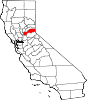
CDPs Alta | Carnelian Bay | Dollar Point | Dutch Flat | Foresthill | Granite Bay | Kings Beach | Kingvale‡ | Meadow Vista | Newcastle | North Auburn | Penryn | Sheridan | Sunnyside-Tahoe City | Tahoe Vista | Tahoma‡
Unincorporated
communitiesAlpine Meadows | Applegate | Baxter | Big Bend | Blue Canyon | Brockway | Cape Horn | Casa Loma | Chambers Lodge | Cisco | Cisco Grove | Clayton | Clipper Gap | Donner | Eder | Elders Corner | Emigrant Gap | Forebay | Four Acres | Gold Hill | Greekstore | Heather Glen | Hidden Valley | Homewood | Hughes Mill | Idlewild | Iowa Hill | Kilaga Springs | Lake Forest | Lander Crossing | Last Chance | Magra | McCulloh | Michigan Bluff | Midas | Monte Vista | Nielsburg | Ophir | Pinecroft | Rainbow | Rampart | Ramsey Crossing | Rawhide | Secret Town | Soda Springs | Squaw Valley | Sunnyside | Tahoe City | Tahoe Pines | The Cedars | Todd Valley | Towle | Troy | Virginiatown | Westville | Weimar | Whitney | Yankee Jims | Zuver
Ghost
townsAckerman | Andover | Arctic | Baltimore | Bath | Blue Bluffs | Bullion | Cairns | Ceres Flat | Chicago Park | Coon Creek | Deadwood | Drum | East Auburn | Flat Ravine | Florence Spring | Fort Trojan | Frytown | Fulda | Gilsons Station | Goggins | Gold Run | Indiana Hill | Knapp | Kulkumish | Leta | Little Rattlesnake Bar | Lone Star | Lost Camp | Mayflower | Millertown | Mineral Bar | Molma | Moss Hills | Oilville | Pine Grove | Pitsokut | Ralston | Red Point | Secret Canyon | Secret Ravine | Smiths | Spruce | Stanford | Stewarts Flat | Stonehill | Tamarack | Union Shed | Vantrent | Webster | Yorkville
Footnotes ‡This CDP also has portions in an adjacent county or counties
Greater Sacramento Counties Douglas (NV) · El Dorado · Nevada · Placer · Sacramento · Sutter · Yolo · Yuba
Major City Cities
and
towns100k–200kElk Grove · Roseville
25k–100kArden Arcade · Auburn · Carmichael · Citrus Heights · Davis · Folsom · Florin · Laguna · Lincoln · North Highlands · Orangevale · Parkway-South Sacramento · Rancho Cordova · Rocklin · West Sacramento · Woodland · Yuba City
10k–25kCameron Park · El Dorado Hills · Fair Oaks · Foothill Farms · Galt · Gardnerville Ranchos (NV) · Granite Bay · Grass Valley · La Riviera · Linda · Marysville · North Auburn · Olivehurst · Placerville · Rosemont · Rio Linda · South Lake Tahoe · South Yuba City · Truckee · Vineyard
Sub-regions Gold Country · Lake Tahoe · Sacramento Valley · Sierra Nevada · Yuba-Sutter Area
Mayors of cities with populations exceeding 100,000 in California - Antonio Villaraigosa
(Los Angeles) - Jerry Sanders
(San Diego) - Chuck Reed
(San Jose) - Edwin M. Lee
(San Francisco) - Ashley Swearengin
(Fresno) - Kevin Johnson
(Sacramento) - Bob Foster
(Long Beach) - Jean Quan
(Oakland) - Harvey Hall
(Bakersfield) - Tom Tait
(Anaheim) - Miguel A. Pulido
(Santa Ana)
- Ronald O. Loveridge
(Riverside) - Ann Johnston
(Stockton) - Cheryl Cox
(Chula Vista) - Bob Wasserman
(Fremont) - Sukhee Kang
(Irvine) - Pat Morris
(San Bernardino) - Jim Ridenour
(Modesto) - Thomas E. Holden
(Oxnard) - Acquanetta Warren
(Fontana) - William H. Batey II
(Moreno Valley)^ - John Drayman
(Glendale)
- Cathy Green
(Huntington Beach)^ - Bob Kellar
(Santa Clarita)^ - William Dalton
(Garden Grove) - Susan Gorin
(Santa Rosa)^ - Jim Wood
(Oceanside) - Donald Kurth
(Rancho Cucamonga) - Paul S. Leon
(Ontario) - R. Rex Parris
(Lancaster) - Pat Hume
(Elk Grove) - James C. Ledford Jr.
(Palmdale) - Stan Skipworth
(Corona)^
- Dennis Donohue
(Salinas) - Elliot Rothman
(Pomona) - Frank Scotto
(Torrance) - Michael Sweeney
(Hayward) - Sam Abed
(Escondido) - Tony Spitaleri
(Sunnyvale) - Bill Bogaard
(Pasadena) - Carolyn Cavecche
(Orange) - F. Richard Jones
(Fullerton)^ - Jacqui Irwin
(Thousand Oaks)^ - Jesus Gamboa
(Visalia)
- Paul Miller
(Simi Valley) - William D. Shinn
(Concord)^ - Gina Garbolino
(Roseville) - Jamie L. Matthews
(Santa Clara) - Osby Davis
(Vallejo) - Rudy Cabriales
(Victorville) - Ernest Gutierrez
(El Monte) - Tom Bates
(Berkeley) - Rick Trejo
(Downey)^ - Eric R. Bever
(Costa Mesa)^ - James T. Butts, Jr.
(Inglewood)
 ^Mayor selected from city council
Other states: AL • AK • AZ • AR • CA • CO • CT • DE • FL • GA • HI • ID • IL • IN • IA • KS • KY • LA • ME • MD • MA • MI • MN • MS • MO • MT • NE • NV • NH • NJ • NM • NY • NC • ND • OH • OK • OR • PA • RI • SC • SD • TN • TX • UT • VT • VA • WA • WV • WI • WYCategories:- Incorporated cities and towns in California
- Cities in Placer County, California
- Sacramento metropolitan area


Wikimedia Foundation. 2010.