- Riverside, California
-
For the community in Humboldt County, see Riverside, Humboldt County, California.
Riverside — City — City of Riverside Riverside Skyline

Flag
SealNickname(s): City of Arts and Innovation Location in the state of California Location in the United States
 Riverside
Coordinates: 33°56′53″N 117°23′46″W / 33.94806°N 117.39611°WCoordinates: 33°56′53″N 117°23′46″W / 33.94806°N 117.39611°W Country  United States
State  California
County Riverside Founded 1870 Incorporated 1883 Government - Type Council-Manager - City Council Mayor Ronald O. Loveridge
Mike Gardner
Andy Melendrez
Rusty Bailey
Paul Davis
Chris Mac Arthur
Nancy Hart
Steve Adams- City Manager Bradley J. Hudson - City Treasurer/Finance Director Paul Sundeen - City Clerk Colleen Nicol Area[1] - Total 81.444 sq mi (210.941 km2) - Land 81.140 sq mi (210.152 km2) - Water 0.304 sq mi (0.788 km2) 0.37% Elevation 860 ft (262 m) Population (2010) - Total 303,871 - Rank 1st in Riverside County
12th in California
61st in the United States- Density 3,731/sq mi (1,440.5/km2) - Demonym Riversider Time zone PST (UTC-8) - Summer (DST) PDT (UTC-7) ZIP code 92501-92509, 92513-92519, 92521-92522 Area code(s) 951 FIPS code 06-62000 GNIS feature ID 1661315 Website riversideca.gov Riverside is a city in Riverside County, California, United States, and the county seat of the eponymous county. Named for its location beside the Santa Ana River,[2] it is the largest city in the Riverside-San Bernardino-Ontario metropolitan area of Southern California, 4th largest inland California city after Fresno, Sacramento, and Bakersfield, and is located approximately 60 miles (97 km) east of Los Angeles. Riverside is the 61st most populous city in the United States and 12th most populous city in California. As of the 2010 Census, Riverside had a population of 303,871. The city spans 81 square miles (210 km2).
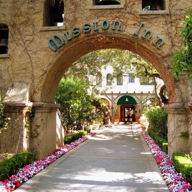
Riverside was founded in the early 1870s and is the birthplace of the California citrus industry as well as home of the Mission Inn, the largest Mission Revival Style building in the United States.[3] It is also home to the Riverside National Cemetery.
The University of California, Riverside is located in the northeastern part of the city. Other attractions in Riverside include the Fox Performing Arts Center, Riverside Metropolitan Museum, which houses exhibits and artifacts of local history, the California Museum of Photography, the California Citrus State Historic Park, and the Parent Washington Navel Orange Tree, one of the two original navel orange trees in California.
Contents
History
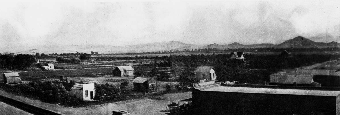
See also: History of Riverside, California Riverside, 1876.
The city was founded in the early 1870s beside the Santa Ana River by John W. North, a staunch temperance-minded abolitionist from Tennessee, who had previously founded Northfield, Minnesota. A few years after, the navel orange was planted and found to be such a success that full-scale planting started. Riverside was temperance minded, and Republican. There were 4 saloons in Riverside when it was founded. The license fees were raised until the saloons moved out of Riverside.[4] Investors from England and Canada transplanted traditions and activities adopted by prosperous citizens. As a result, the first golf course and polo field in Southern California were built in Riverside.
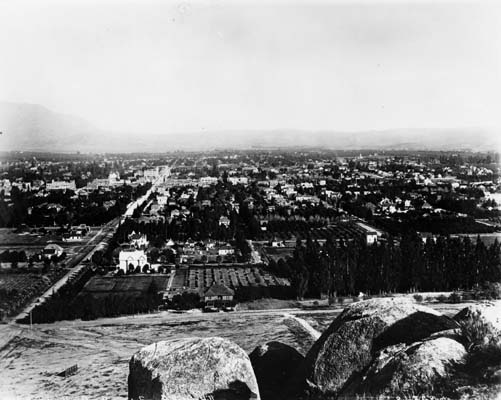
 Riverside, 1900
The first orange trees were planted in 1871, but the citrus industry Riverside is famous for beginning three years later (1874) [5] when Eliza Tibbets received three [5] Brazilian navel orange trees sent to her by a personal friend, William Saunders who was a horticulturist at the United States Department of Agriculture in Washington, D.C. The trees came from Bahia, Brazil. The Bahia Orange did not do well in Florida, but its success in Southern California was phenomenal.
The three trees were planted on the Tibbets' property. One of the trees died after it was trampled by a cow during the first year it was planted. After the trampling other two trees were then transplanted to property belonging to Sam McCoy as the trees were not being cared for well enough by L. C. Tibbets, Eliza's husband.[6] The trees were again transplanted, one at the Mission Inn property in 1903 by President Theodore Roosevelt, (this tree died in 1922) and the other was placed at the intersection of Magnolia and Arlington Ave. Eliza Tibbets was honored with a stone marker placed with the tree. That tree still stands to this day inside a protective fence.
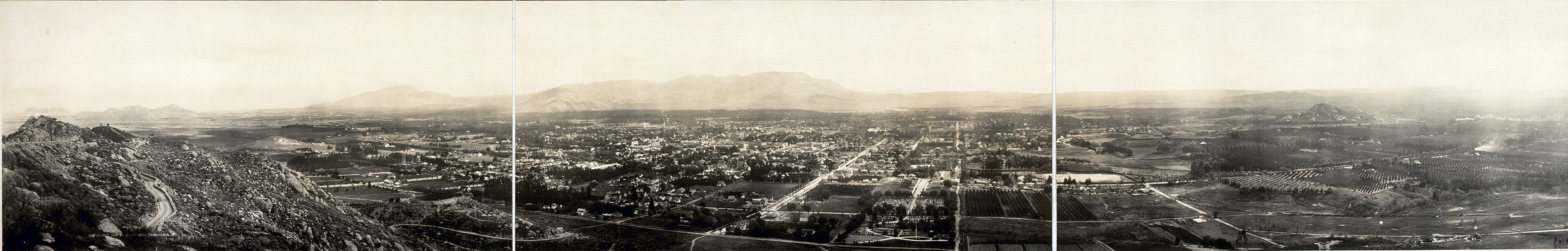
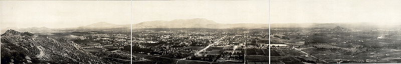 A panorama of Riverside, California, taken from the summit of Mount Rubidoux, 1908.
The trees thrived in the Southern California climate and the navel orange industry grew rapidly. Many growers purchased bud wood and then grafted the cuttings to root stock. Within a few years, the successful cultivation of many thousands of the newly discovered Brazilian navel orange led to a California Gold Rush of a different kind: the establishment of the citrus industry, which is commemorated in the landscapes and exhibits of the California Citrus State Historic Park and the restored packing houses in the Downtown's Marketplace district. By 1882, there were more than half a million citrus trees in California, almost half of which were in Riverside. The development of refrigerated railroad cars and innovative irrigation systems established Riverside as the wealthiest city per capita by 1895.
 Some orange groves are giving way to development in modern Riverside, while others still exist and are thriving
As the city prospered, a small guest hotel designed in the popular Mission Revival style, known as the Glenwood Tavern, eventually grew to become the Mission Inn, favored by presidents, royalty and movie stars. Inside was housed a special chair made for the sizable President William Howard Taft. The hotel was modeled after the missions left along the California coast by Franciscan friars in the 16th and 17th centuries. (Although Spanish missionaries came as far inland as San Bernardino (San Bernardino de Sena Estancia), east of Riverside, there was no actual Spanish mission in what is now Riverside.) Postcards of lush orange groves, swimming pools and magnificent homes have attracted vacationers and entrepreneurs throughout the years. Many relocated to the warm, dry climate for reasons of health and to escape Eastern winters. Victoria Avenue with its landmark homes serves as a reminder of European investors who settled here.
Geography
According to the United States Census Bureau, the city has a total area of 81.4 square miles (210.8 km2), of which, 81.1 square miles (210 km2) of it is land and 0.3 square miles (0.78 km2) of it is water. The total area is 0.37% water. The elevation of downtown Riverside is 860 feet (260 m). There are some hills within the city limits of Riverside. One of which is Mt. Rubidoux a city landmark and tourist attraction. Riverside is surrounded by small and large mountains, some of which get winter snow.
Climate
Riverside experiences a semi-arid mediterranean climate (Köppen climate classification CSa) with hot, dry summers and mild, relatively wet winters. Temperatures in the summer can exceed 100 °F (38 °C) but with somewhat low humidity. In the winter, high temperatures average in the upper 60s (°F), but may not rise above 55 °F (13 °C) during rainy days. January, the coldest month, averages a high/low temperature of 68 °F / 43 °F (20 °C / 6 °C), while August, the hottest month, averages a high/low temperature of 95 °F / 64 °F (35 °C / 18 °C).[7] Riverside receives 10.67" of precipitation annually with most of it occurring in the winter and early spring, especially January through March, with January being the wettest month. However, during El Nino years, Southern California can receive considerably more precipitation than average. Mudslides are more common during these winters due to the very powerful storms that are more frequent in the warm phase of ENSO.
Climate data for Riverside Month Jan Feb Mar Apr May Jun Jul Aug Sep Oct Nov Dec Year Record high °F (°C) 97
(36)92
(33)98
(37)104
(40)108
(42)112
(44)113
(45)112
(44)113
(45)108
(42)98
(37)93
(34)117
(47)Average high °F (°C) 66
(19)68
(20)70
(21)76
(24)80
(27)87
(31)94
(34)94
(34)91
(33)83
(28)74
(23)68
(20)78.9 Average low °F (°C) 42
(6)44
(7)45
(7)48
(9)53
(12)57
(14)61
(16)62
(17)60
(16)53
(12)45
(7)41
(5)54.9 Record low °F (°C) 24
(−4)27
(−3)29
(−2)33
(1)38
(3)44
(7)49
(9)49
(9)42
(6)32
(0)26
(−3)22
(−6)22
(−6)Precipitation inches (mm) 2.47
(62.7)2.39
(60.7)2.19
(55.6).60
(15).25
(6.4).10
(3).03
(0.8).17
(4.3).26
(6.6).26
(6.6).78
(19.8)1.17
(29.7)10.67
(271)Source no. 1: [8] Source no. 2: [9] Environment
 Victoria Avenue, which bisects Riverside, hosts many species of trees and plants.
The Riverside area is referred to as a "smog belt" because of its above-average level of air pollution. In a comparison by the National Campaign Against Dirty Air Power (2003), the Riverside-San Bernardino-Ontario area was found to be one of the most polluted regions based on year-round particle measurements when compared to other U.S. cities.[10] [NEJM 2004;351:1057-1067] Despite smog problems, the city has made efforts to reduce pollution by incorporating additional means of mass transit (Metrolink) and equipping its entire fleet of buses with natural gas. Smog has decreased considerably over the past years, and it should continue to decrease if measures are taken to reduce smog. Most of Riverside's smog problems are the result of the prevailing wind patterns that blow the smog from the L.A. Basin and particulates generated by the Port of Los Angeles and the Port of Long Beach into the Inland Empire. A General Plan for the city was prepared in the year 1994 and updated in 2004. This documentation set forth broad planning goals for the city and specifically included housing, transportation, noise, seismic safety, natural resources, and all other State of California-mandated elements.
Surrounding municipalities

Ontario Fontana
RubidouxGrand Terrace
ColtonCorona 
Moreno Valley  Riverside

Corona
Lake ElsinoreLake Elsinore
MurrietaPerris Cityscape
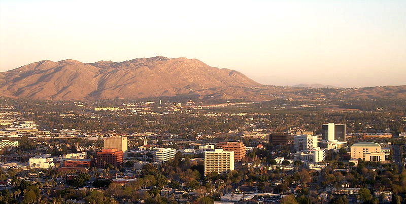
See also: List of tallest buildings in Riverside, California A 360 degree panorama of Riverside, California, taken from the summit of Mount Rubidoux
Landmarks
Main article: List of landmarks in Riverside, California The Mission Inn
Riverside is home of the historic Mission Inn, the beaux-arts style Riverside County Historic Courthouse (based on the Petit Palais in Paris, France), and the Riverside Fox Theater, where the first showing of the 1939 film Gone with the Wind took place. The theater was purchased by the city and is now refurbished. Part of the Riverside Renaissance Initiative,[11] the Fox Theater underwent extensive renovation and restoration in 2008 and 2009.[12] to become a performing arts theater. The building was expanded to hold 1,600 seats, and the stage was enlarged to accommodate Broadway-style performances. In January, 2010 singer Sheryl Crow opened the newly remodeled Fox Theater to a nearly sold out show.[13]
 One of the remaining Queen Anne style houses from the 19th century
It is also the home of the "World's Largest Paper Cup", which is over three stories (68.10 ft) tall. There is a warehouse/manufacturing building, Dixie Corporation, right behind it. It is made of painted concrete. The "Dixie Cup" landmark is located on Iowa Street just north of Palmyrita. The manufacturing plant itself is now non-existent.
Three notable hills are in Riverside's scenic landscape: Box Springs Mountain, Evans (Jurupa) Hill and Tecolote Hill; all of which are preserved open spaces. South of Riverside is Lake Mathews. There is also the well-known landmark/foothill, Mount Rubidoux, which is next to the Santa Ana River and one of the most noticeable landmark in the downtown area. This foothill is the dividing line between the town of Rubidoux and the City of Riverside.
March Joint Air Reserve Base borders Riverside on the east serving as a divider between the City and Moreno Valley. March ARB is the oldest operating Air Force Base west of the Mississippi River being founded in 1918.
At the entrance to Riverside from the 60 freeway sits Fairmount Park. This extensive urban oasis was designed by Frederick Law Olmsted.[14] Slightly fraying around the edges, it still has a lovely, stocked pond, and many species of birds. Nearby, on private land, is the former site of Spring Rancheria, a Cahuilla village.
Neighborhoods
 Suburban homes in Riverside.
The City of Riverside has 28 neighborhoods within city limits.[15] These neighborhoods include Airport, Alessandro Heights, Arlanza, Arlington, Arlington Heights, Arlington South, Canyon Crest, Casa Blanca, Downtown, Eastside, Grand, Hawarden Hills, Hillside Hunter Industrial Park, La Sierra, La Sierra Acres, La Sierra Hills, La Sierra South, Magnolia Center, Mission Grove, Northside, Orangecrest, Presidential Park, Ramona, Sycamore Canyon Park, Sycamore Canyon Springs, University, Victoria, and Wood Streets.
To the east of downtown is the originally named "Eastside," which grew out of a colonia inhabited by Mexican immigrant workers in the orange groves, other orchards and produce fields. The area these people lived in was called Agua Mansa. Mexican communities were also formed in the barrio of Casa Blanca during the early twentieth century. That tradition continues today, with Oaxacan workers in the place of Spanish speakers.
Annexation proposals
The City Council has proposed numerous annexations of nearby unincorporated communities which will increase its population and land area over the next few years. Most notable is the Lake Hills/Victoria Grove area, which would extend its southwestern borders to Lake Mathews.[16]
Current
 City limit map which shows upcoming annexations.
- 97 Berry Road
- 103 Barton/Gem
- 104 I-215 Corridor
- 105 Sycamore/Central
- 106 East Blaine
- 107 Alta Cresta Remainder
- 108 Lake Hills/Victoria Grove
- 111 University City
- 112 Kaliber
- 113 Barton/Station
Potential annexations
- A Center Street
- B Highgrove
- C Spring Mountain Ranch (92)
- D Canyon Ridge
- E Woodcrest
- F Gateway
Features
Riverside is home to the University of California, Riverside. The UCR Botanical Gardens contains 40 acres (162,000 m²) of unusual plants, with four miles (6 km) of walking trails. The city prides itself on its historic connection to the navel orange, which was introduced to North America from Brazil by the first settlers to Riverside in 1873. Riverside is home to the one surviving Parent Navel Orange Tree, from which all American West Coast navel orange trees are descended.
There are three hospitals in Riverside.[17]
- Riverside Community Hospital is a General Acute Care Hospital with Basic Emergency Services and a Level II Trauma Center as of 2006.
- Parkview Community Hospital Medical Center is a General Acute Care Hospital with Basic Emergency Services as of 2006.
- Kaiser Foundation Hospital - Riverside is a General Acute Care Hospital with Basic Emergency Services as of 2006.
Riverside is also home to the Riverside Public Library system. Branches include: Arlington, La Sierra, Marcy, Main, Eastside Cy-brary, and Casa Blanca.
Convention facilities are available at the Riverside Convention Center, 45,000 sq ft (4,200 m2) indoors and 25,000 sq ft (2,300 m2) outdoors, the Riverside Marriott 14,000 sq ft (1,300 m2) indoors, and the Mission Inn, 15,000 sq ft (1,400 m2) indoors and 5,000 sq ft (460 m2) outdoors.[18] All three facilities are located within walking distance of each other in downtown Riverside.
Cemeteries
Cemeteries in Riverside include:
- Crestlawn Memorial Park[19]
- Evergreen Cemetery - notable burials include Frank Augustus Miller, John W. North, Eliza Tibbets, and Marcella Craft
- Olivewood Cemetery[20][21] - notable burials include Dorothy Burgess, Del Lord, and Gloria Ramirez
- Riverside National Cemetery, established in 1976, is the third-largest cemetery managed by the National Cemetery Administration, and since 2000 has been the most active in the system based on the number of interments.
- Sherman Indian High School Cemetery, Home Gardens[22]
Arts and culture
Museums
 Lockheed SR-71 Blackbird at the March Field Air MuseumSee also: List of museums in Riverside, California
- California Citrus State Historic Park Museum
- Entomology Research Museum at the University of California, Riverside (not open to the public).
- Heritage House Museum
- March Field Air Museum
- Mission Inn Museum
- Museum of Online Museums, the MoOM, an online museum maintained by the California Baptist University.
- Riverside Art Museum
- Riverside International Automotive Museum, located at 815 Marlborough, Suite 200, Riverside, Ca. 92507.[23]
- Riverside Metropolitan Museum
- Sherman Indian Museum[24] at the Sherman Indian High School
- Southern California Medical Museum, housed at the Riverside County Medical Association at 3993 Jurupa Ave, Riverside.
- Sweeney Art Gallery, an extension of the University of California, Riverside
- The Stahl Center Museum of Culture at the La Sierra University
- University of California, Riverside California Museum of Photography
- World Museum of Natural History at the La Sierra University
Festivals and events
The Riverside Festival of Lights centers around the Mission Inn Hotel & Spa, in the downtown area. Decoration of the Inn begins in October and a lighting ceremony that includes notable speakers, fireworks, and live musicians takes place the day after Thanksgiving Day. The Inn puts up more than three million lights and hundreds of animated characters. The festival runs through New Years. At the festival, carolers, horse drawn carriage rides, and ice skating all color the event. Restaurants, cafes, and community groups all contribute to the festival which covers several city blocks in the downtown Riverside area.
Also during the week of Thanksgiving, the Festival of Trees is held at the Riverside Convention Center. Held since 1990, the event seeks to raise money for the Riverside County Regional Medical Center children’s units including the Neonatal Intensive Care Unit, the Child Abuse and Neglect Unit, and the Pediatric Intensive Care Unit. Attracting 25,000 people per year, the event has raised over $5 million since its inception.[25] At the Festival of Trees numerous professionally decorated Christmas trees are judged, auctioned and then displayed for public viewing. Other activities include entertainment, a children's craft area, a sweet shop, and Storytime with Santa.
Each year in February The Riverside Dickens Festival is held to, "enhance a sense of community among citizens of Riverside County and Southern California by creating a series of literary events and to provide educational, family-oriented, literary entertainment and activities such as plays, musical performances, pageants, living history presentations, workshops, lectures, classroom study, exhibits and a street bazaar with free entertainment, vendors and costumed characters."[26]
The Riverside Airshow takes place in March at the Riverside Municipal Airport. The event attracts around 70,000 people and includes aerial performers, over 200 acres (0.81 km2) of aircraft displays, a car show and military vehicle display, children's activities, food and refreshments, helicopter displays and community group exhibits.[27][28]
The Riverside International Film Festival (RIFF) takes place in April and features films from around the world.[29]
The Legends of Riverside Film Festival and charity fund raiser is held in March each year at the Riverside International Automotive Museum. In addition to showcasing popular racing films, the annual event offers attendees an opportunity to personally meet famous racing legends of the past. In attendance at the 2009 event were racing greats Dan Gurney, Elliot and Stuart Forbes-Robinson, Bob Bondurant, Peter Brock, George Follmer, and Dick Goldstrand.[30] The second annual event is scheduled for March 26 through March 28, 2010.[31]
The Riverside Robot Expo is held in November each year, sponsored by the Riverside Robotics Society in alignment of its goal "to bring robotics to the Inland Empire." Society members bring robots and robot replicas to the event to spark children's interest in math, robotics and other sciences.[32]
On September 13, 2008, Riverside hosted its first LGBT Pride event at White Park, near the Mission Inn.
Every first Thursday of the month is the Riverside Art Walk, with local vendors sell handmade arts and crafts.
Religion
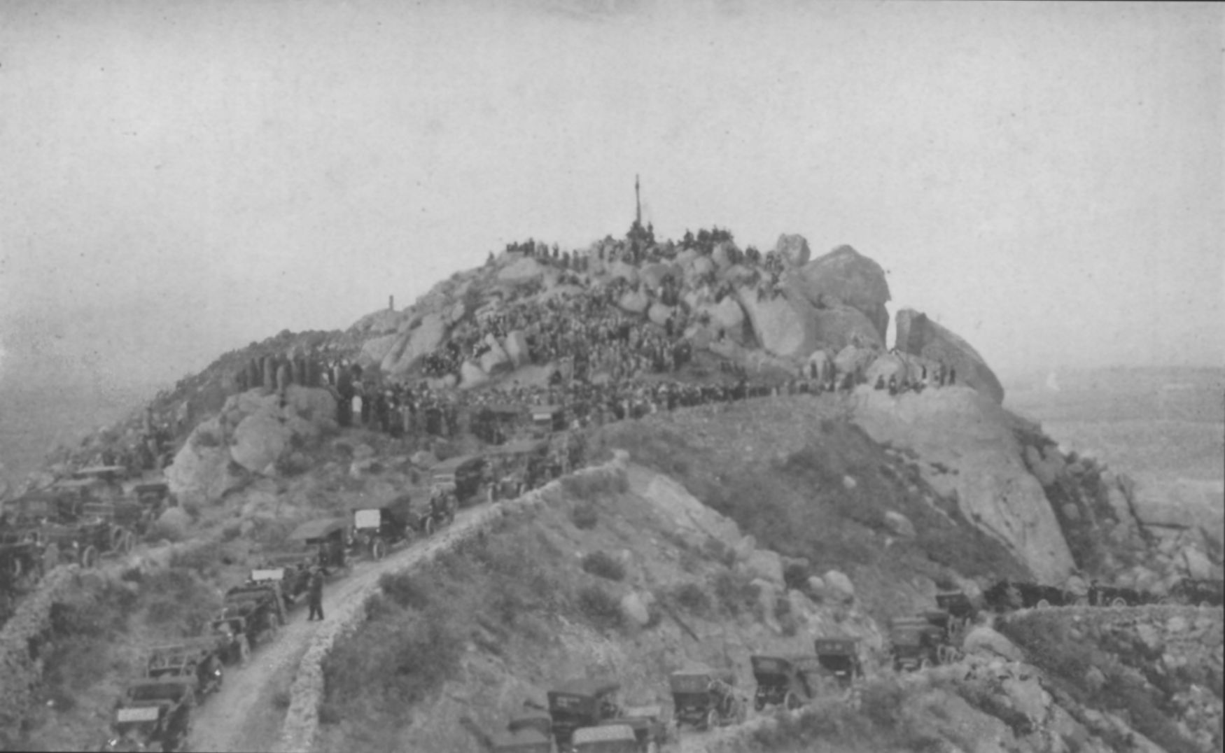
 1913 Mt Rubidoux Easter Sunrise ServicesSee also: List of Riverside, California Religious Institutions
Riverside is home to a variety of churches, religious organizations, and celebrations. The annual Easter Sunrise service at the top of Mt. Rubidoux is the nation’s oldest continual non-denominational outdoor Easter service[33] The 100th anniversary of the event was held April 12, 2009.
Each December, a second celebration involving Mt. Rubidoux takes place. A 2½-mile procession from Our Lady of Guadalupe Shrine to the top of Mount Rubidoux promotes awareness of Juan Diego's walk up Tepeyac hill, in 1531, where he reportedly saw a Marian apparition known as Our Lady of Guadalupe . The 2007 procession attracted 2,500 people.[34]
Riverside is also home to the Inland Empire Atheists and Agnostics,[35][36] an organization of over 500 local atheists, agnostics, and other non-religious individuals.
Media
Radio stations in the Riverside-San Bernardino market By FM frequency By AM frequency By callsign K251AH · K252BF · K295AI · KACE · KAEH · KATY-FM · KCAA · KCAL · KCAL-FM · KCXX · KDEY-FM · KEZY · KFNY · KFRG · KGGI · KGIC-LP · KHPY · KJVA-LP · KKDD · KLRD · KLYY · KMET · KMYT · KOLA · KQIE · KRCV · KRQB · KSDW · KSGN · KSPA · KSPC · KTDD · KTIE · KTMQ · KUCR · KUOR · KVCR · KWRM · KXFG · KXRS · KXSBCalifornia Radio Markets: Bakersfield • Chico • Fresno • Los Angeles • Merced • Modesto • Oxnard-Ventura • Palm Springs • Redding • Riverside-San Bernardino • Sacramento • San Diego • San Francisco/Oakland • San Jose • San Luis Obispo • Santa Barbara • Santa Cruz/Salinas/Monterey • Santa Maria-Lompoc • Santa Rosa • Stockton • Victor Valley • Visalia-Tulare-Hanford
Other California Radio Regions: Barstow • Bishop • Crescent City • Diablo Valley • High Desert/Eastern Sierra • Eureka • Fort Bragg-Ukiah • Gilroy/Hollister • Imperial Valley • Marysville/Yuba City • Needles • Red Bluff • Susanville/Sierra Nevada • Tri-Valley • Yreka
See also: List of radio stations in CaliforniaEconomy
Top employers
According to the City's 2010 Comprehensive Annual Financial Report,[37] the top employers in the city are:
# Employer # of Employees 1 University of California, Riverside 6,740 2 County of Riverside 6,395 3 Riverside Unified School District 3,867 4 City of Riverside 2,619 5 Riverside Community College District 1,669 6 Alvord Unified School District 1,669 7 Riverside Community Hospital 1,600 8 The Press-Enterprise 1,090 9 Parkview Community Hospital 900 10 Goodrich 500 Film industry
See also: List of films shot in Riverside, CaliforniaRiverside's close proximity to Hollywood, combined with its many unique architectural features, has made it a frequent filming choice by Hollywood film studios. The Mission Inn has been a particularly favorite backdrop.[citation needed]
Statistical profile
Riverside is the 61st-largest city in the United States, 12th largest city in California, the largest city in California's Inland Empire region, the fourth largest inland city in California, the 14th-largest metropolitan area in the nation and part of the 2nd largest Combined Statistical Area in the country.
Demographics
Historical populations Census Pop. %± 1890 4,683 — 1900 7,973 70.3% 1910 15,212 90.8% 1920 19,341 27.1% 1930 29,696 53.5% 1940 34,696 16.8% 1950 46,764 34.8% 1960 84,332 80.3% 1970 140,089 66.1% 1980 170,591 21.8% 1990 226,505 32.8% 2000 255,166 12.7% 2010 303,871 19.1% 2010
The 2010 United States Census[38] reported that Riverside had a population of 303,871. The population density was 3,731.0 people per square mile (1,440.6/km²). The racial makeup of Riverside was 171,669 (56.5%) White, 21,421 (7.0%) African American, 3,467 (1.1%) Native American, 22,566 (7.4%) Asian (1.7% Korean, 1.6% Chinese, 1.1% Korean, 1.0% Vietnamese, 0.8% Indian, 0.3% Japanese, 0.1% Pakistani), 1,219 (0.4%) Pacific Islander, 68,111 (22.4%) from other races, and 15,418 (5.1%) from two or more races. Hispanic or Latino of any race were 148,953 persons (49.0%); 41.8% of Riverside's population is Mexican, 1.1% Guatemalan, 1.0% Salvadoran, 0.7% Puerto Rican, 0.3% Cuban, 0.2% Nicaraguan, and 0.2% Colombian.[39]
The Census reported that 292,322 people (96.2% of the population) lived in households, 8,925 (2.9%) lived in non-institutionalized group quarters, and 2,624 (0.9%) were institutionalized.
There were 91,932 households, out of which 38,939 (42.4%) had children under the age of 18 living in them, 45,398 (49.4%) were opposite-sex married couples living together, 13,845 (15.1%) had a female householder with no husband present, 6,372 (6.9%) had a male householder with no wife present. There were 6,392 (7.0%) unmarried opposite-sex partnerships, and 746 (0.8%) same-sex married couples or partnerships. 18,284 households (19.9%) were made up of individuals and 6,262 (6.8%) had someone living alone who was 65 years of age or older. The average household size was 3.18. There were 65,615 families (71.4% of all households); the average family size was 3.67.
The population was spread out with 81,406 people (26.8%) under the age of 18, 47,126 people (15.5%) aged 18 to 24, 82,482 people (27.1%) aged 25 to 44, 66,615 people (21.9%) aged 45 to 64, and 26,242 people (8.6%) who were 65 years of age or older. The median age was 30.0 years. For every 100 females there were 97.6 males. For every 100 females age 18 and over, there were 95.4 males.
There were 98,444 housing units at an average density of 1,208.7 per square mile (466.7/km²), of which 51,185 (55.7%) were owner-occupied, and 40,747 (44.3%) were occupied by renters. The homeowner vacancy rate was 2.4%; the rental vacancy rate was 7.4%. 168,888 people (55.6% of the population) lived in owner-occupied housing units and 123,434 people (40.6%) lived in rental housing units.
2000
As of the census[40] of 2000, there are 255,166 people, 82,005 households, and 58,141 families residing in the city. The population density is 1,261.5/km² (3,267.2/mi²). There are 85,974 housing units at an average density of 425.0/km² (1,100.8/mi²). The racial makeup of the city is 59.32% White, 7.41% African American, 1.09% Native American, 5.68% Asian, 0.39% Pacific Islander, 21.00% from other races, and 5.10% from two or more races. 38.14% of the population are Hispanic or Latino of any race.
There are 82,005 households out of which 39.8% have children under the age of 18 living with them, 50.3% are married couples living together, 14.8% have a female householder with no husband present, and 29.1% are non-families. 21.5% of all households are made up of individuals and 7.2% have someone living alone who is 65 years of age or older. The average household size is 3.02 and the average family size is 3.54.
In the city the population is spread out with 30.1% under the age of 18, 12.9% from 18 to 24, 30.0% from 25 to 44, 18.0% from 45 to 64, and 9.0% who are 65 years of age or older. The median age is 30 years. For every 100 females there are 97.1 males. For every 100 females age 18 and over, there are 93.6 males.
The median income for a household in the city is $41,646, and the median income for a family is $47,254. Males have a median income of $36,920 versus $28,328 for females. The per capita income for the city is $17,882. 15.8% of the population and 11.7% of families are below the poverty line. Out of the total population, 18.9% of those under the age of 18 and 8.0% of those 65 and older are living below the poverty line.
Crime
The three most crime-prone areas are the Casa Blanca, Eastside, and Arlanza neighborhoods. Two well-documented gangs in the area are the Casa Blanca Rifa and East Side Riva, both of which are said by authorities to have connections with the Mexican Mafia. Both started around the late 1920s to early 1930s, but became troublesome around the 1950s and still to this day are known to be very violent. Casa Blanca Rifa got most of its notoriety from the shooting down two police helicopters, one in 1975 in the olden neighborhood's signature clash with Riverside Police and the other on New Year's Eve of 1995.[41] East Side Riva got media attention in 2007 when Riverside County District Attorney Rod Pacheco obtained a gang injunction against 114 of 820 gang members from the gang. Since January 1, 2001, those 114 Eastside Riva gang members have committed 897 documented crimes and have totaled 333 convictions, including some for murder.[42]
Data collected by Project Bridge, an anti-gang program under the City of Riverside’s Park and Recreation Department, shows that the city of Riverside has experienced an increase in gang membership and gang activity since the early 1990s. In 1991, Riverside had approximately 82 gangs with 4,500 active gang members. More recent estimates indicate there are 86 gangs with 8,000 members. Reportedly 3,000 of these members are juveniles, while 10 of these gangs are primarily minors. The juvenile crime rates did drop dramatically between 1994 and 1997 for these areas. However, juvenile crime rates have exhibited a gradual and steady rise since 1998. In 2000, Casa Blanca, Arlanza and Eastside had crime rates of approximately 40, 18, and 30 per 1000 youths, respectively. Of these three areas, the Eastside’s problems are compounded by the highest unemployment rate in the City, 65.1%. The neighborhood also has the lowest educational attainment in the City, with 82% of the population having less than a 4th grade education. Project Bridge has provided comprehensive services to at-risk and gang-involved youth between the ages of 4 and 22 and their families in for over a decade. Since 1995, the program has served over 500 gang-involved youth with recent enrollment nearing 500 participants. Almost 50 percent of participant enrollment is generated from the Eastside, mostly from the areas around the Eastside Apartments.[43]
Riverside's Comprehensive Community-Wide Approach to Gang Prevention, Intervention, and Suppression project is focused on two of the high gang-crime neighborhoods, Casa Blanca and Eastside. In these neighborhoods, there are 21 gangs with approximately 3,230 members. The project targets more than 150 gang-involved and high-risk youth. Oversight of the project is handled by a committee consisting of local agencies and organizations, including the Riverside County Juvenile Court, the Riverside County District Attorney's Office, the Riverside and Alvord Unified School Districts, the Youth Service Center, and other agency and community leaders.[44]
On the 2009 list of most dangerous cities in America by Morgan Quitno Press, Riverside came in 174th out of 393 ranked cities of over 75,000 population,[45] making it the 27th most dangerous city in California and 2nd in the Inland Empire area, behind San Bernardino. Like much of the country, Riverside's crime rate has been steadily dropping since reaching all-time high in the 1970s[citation needed] though the past two years has seen a dramatic 10 percent increase in the overall violent crime rate (1,954 crimes in 2005 vs. 1,777 in 2004.) According to the FBI crime index there were 1,922 violent crimes along with 11,059 property crimes in 2008.[46] In the city of Riverside, 15 homicides occurred in 2009, down from 20 in 2008, its highest total since 2003 when there were 24. All but three cases resulted in arrests.[47] In the past 10 years Riverside has averaged about 20 homicides a year, it's highest being in 1999 when there were 31 homicides.[48]
Government
See also: List of mayors of Riverside, CaliforniaRiverside is governed by a city council and a mayor. The city council has seven members each elected from single member wards. The mayor is elected in a citywide election. In the state legislature Riverside is located in the 31st Senate District, represented by Republican Robert Dutton, and in the 64th and 66th Assembly Districts, represented by Republicans Brian Nestande and Kevin Jeffries respectively. Federally, Riverside is located in California's 44th congressional district, which has a Cook PVI of R +6[49] and is represented by Republican Ken Calvert.
Local government
According to the city’s most recent Comprehensive Annual Financial Report, the city’s various funds had $892.2 million in Revenues, $706.7 million in expenditures, $3,455.5 million in total assets, $1,662.8 million in total liabilities, and $358.0 million in cash and investments.[50]
The structure of the management and coordination of city services is:[51]
City Department Director City Manager Bradley J. Hudson Assistant City Manager Thomas M. DeSantis Chief Financial Officer Paul C. Sundeen Airport Director Mark S. Ripley City Clerk Colleen J. Nicol City Attorney Gregory P. Priamos City Engineer Tom Boyd Chief of Police Sergio G. Diaz Chief Information Officer Steve Reneker Community Development Director Scott Barber Development Director Belinda Graham Fire Chief Steve Early General Services Director Kris Martinez Human Resources Director Rhonda Strout Library Director Leonard Hernandez Museum Director Ennette Nusbaum Park and Recreation Director Ralph Nuñez Public Utilities Director David Wright Public Works Director Siobhan Foster Courts
- United States District Court, Central District of California, Eastern Division[52][53]
- United States Bankruptcy Court, 9th Circuit Bankruptcy Appellate Panel[54][55]
- United States Bankruptcy Court, Central District of California[56]
- California Court of Appeal, Fourth District, Division Two[57]
- Superior Court of California, County of Riverside[58]
Education
Colleges and universities
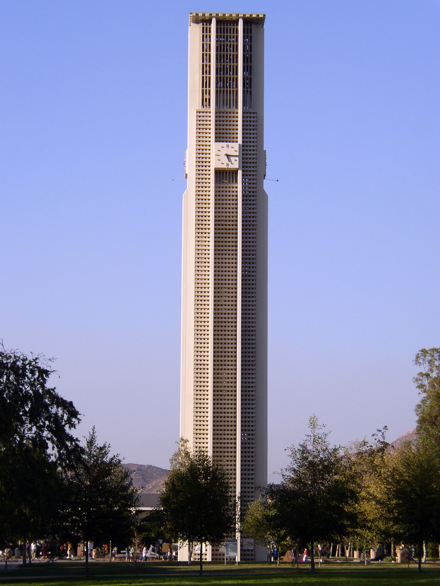
 The 161-foot, 48-bell, carillon tower at the University of California, Riverside.
Riverside is home to several institutions of higher learning:
- California Baptist University[59]
- California Southern Law School[60]
- La Sierra University[61]
- Riverside City College[62]
- UEI College[63]
- University of California, Riverside[64]
School districts and secondary schools
Public school districts and high schools
Riverside is served by two school districts:
- Riverside Unified School District serves eastern Riverside.
- High schools include:
- Arlington High School[65]
- Martin Luther King High School
- John W. North High School
- Riverside Polytechnic High School also known as Poly High School
- Ramona High School
- The Riverside Virtual School
- Continuation high schools include:
- Abraham Lincoln High School (continuation)
- Raincross High School (continuation)
- Summit View High School (continuation)
- High schools include:
- Alvord Unified School District serves western Riverside.
- High schools include:
- Continuation high schools include:
- Alvord High School (continuation)
Other public secondary schools
Two notable institutions of learning, for specified student bodies, are also located in Riverside:
- California School for the Deaf, Riverside (CSD-R) for the Deaf and Hard of Hearing from Preschool to 12th grade has been open since 1952.[66] The CSD-R varsity football team, the Riverside Cubs, had an undefeated season which led to an appearance on a May 2006 segment on ABC's 20/20 news series.[citation needed]
- Sherman Indian High School of the Bureau of Indian Education,[67] is for Native American tribal members from 7th to 12th grade; it has been open since 1878.
Private secondary schools
- Bethel Christian School[68]
- Eastside Christian Academy
- La Sierra Academy[69]
- Notre Dame High School[70] (Roman Catholic)
- Riverside Christian High School[71]
- Woodcrest Christian High School[72]
- Islamic Academy of Riverside[73]
Transportation
Highways
Riverside is served by three major freeways, the I-215, the State Route 60, and the State Route 91. These three freeways meet in north-eastern Riverside at the rebuilt 60/91/215 interchange that was completed in late 2007.[74]
The constant construction on Riverside freeways has taken its toll on Riverside's image. The area near the 60/91/215 interchange had a reputation as being one of the worst interchanges in the nation due to its location in a turn, continued construction, short exit time, and other factors. Riverside is one of America's most congested cities because of heavy traffic, it used to be at the top of the list, but it has gone down to number 19.
Rail lines
The city contains two Metrolink commuter rail stations, Riverside-Downtown and Riverside-La Sierra. Both are served by the Inland Empire-Orange County and 91 Lines, and the Downtown station is served by the Riverside Line on weekdays, and the San Bernardino Line on weekends. Amtrak's Southwest Chief which runs from Los Angeles to Chicago also serves the city.
Bus lines
Local bus service is provided by the Riverside Transit Agency.[75] Recently, the agency proposed a new bus rapid transit route to travel along the current Route 1 from the University of California, Riverside to Corona. The project is expected in FY 2011 or 2012, as funding is made available.[76]
Intercity bus service is provided by Greyhound and Amtrak California, as well as a handful of small operators serving the cross-border market into Mexico.
Airports
The Riverside Municipal Airport (FAA designator: RAL) with a 5,400-foot (1,600 m) runway, is the only airport within Riverside's city limits, and is the location for the annual Riverside Air Show. The airport is primarily used for private and business aviation. The nearest major airport is the LA/Ontario International Airport in the city of Ontario, California (FAA designator: ONT), about 20 miles (32 km) northwest of Riverside.
Notable people
- Ahmed Ahmed, Egyptian comedian and actor
- Hakim Akbar, former football player
- Marsia Alexander-Clarke, artist[77]
- Chris Arreola, professional heavyweight boxer
- Dusty Baker, former baseball player for the Los Angeles Dodgers among others and current manager of the Cincinnati Reds; former manager of the Chicago Cubs and San Francisco Giants
- Barry Bonds, baseball player for the San Francisco Giants and the Pittsburgh Pirates
- Bobby Bonds, former baseball player for the San Francisco Giants and the California Angels
- Sean Brewer, former football player for the Cincinnati Bengals and Atlanta Falcons[78][79][80][81]
- Richard Shaw Brown, lead-singer with Riverside rock-band, The Misunderstood. Gemologist, designer and author
- Larry Christiansen, chess Grandmaster
- Chris Claiborne, football player for the New York Giants
- Frank Corral, former football kicker for the Los Angeles Rams
- Allen Cunningham, professional poker player
- Stephen W. Cunningham, first UCLA graduate manager and Los Angeles City Council member, 1933–41
- Jaye Davidson, Oscar-nominated actor
- Alvin Davis, baseball player for the Seattle Mariners
- Walker Evans, Off-road Motorsports Hall of Famer
- Bubba Franks, National Football League tight end
- David Gilliland, NASCAR driver for Yates Racing
- Dan Gurney, the first driver to win in four major categories of motorsports; Grand Prix, Indy Car, NASCAR and Sports Car.[82]
- Barbara Hambly, novelist
- Duncan Hunter, U.S. Representative, 2008 Republican Presidential candidate
- Gabriel Iglesias, comedian
- Don Imus, national syndicated radio talk host
- Phil Ivey, professional poker player
- Tanya James, pornographic actress
- Reed Johnson, baseball player for the Chicago Cubs
- Sharon Jordan, actress (The Suite Life of Zack & Cody)
- Adam Kennedy, baseball player for the Los Angeles Angels of Anaheim and St. Louis Cardinals
- Bobby Kielty, baseball player for the Boston Red Sox, Oakland Athletics, Toronto Blue Jays & Minnesota Twins
- Darci Kistler, ballerina
- J. F. Lawton, screenwriter (Pretty Woman), director and producer
- Amy Lee, singer (Evanescence)
- Chad Marshall, Major League Soccer player for the Columbus Crew[83][84]
- Jason Martin, musician (Starflyer 59, Neon Horse, The Brothers Martin, Bon Voyage)
- Kellie Martin, actress
- Chief Meyers, baseball player in early 20th century
- Cheryl Miller, sports commentator and former professional basketball player and coach
- Reggie Miller, former basketball player for the Indiana Pacers
- Stephen Murray, former BMX rider who is now paralyzed from the neck down after attempting a double backflip
- Heather Myles, country singer
- Nick Neugebauer, baseball player for the Milwaukee Brewers
- Don O'Neill, architect and water color artist
- Mitch Lucker, vocalist of extreme metal band Suicide Silence.
- Bill Parsons, player for the Milwaukee Brewers and Oakland Athletics
- Troy Percival, former baseball player for the Anaheim Angels and Tampa Bay Rays
- David Petruschin, Drag artist and Reality TV star
- Rod Piazza, blues harmonica player
- Scarlett Pomers, actress (Star Trek: Voyager, Reba)
- Lindsay Ridgeway, actress (Boy Meets World)
- Bob Rule, former NBA All Star
- Patrick Seitz, voice actor, (Bleach)
- Alia Shawkat, actress, (Arrested Development)
- Drew Shirley, member of band Switchfoot
- Eric Show, baseball pitcher, started for San Diego Padres in 1984 season
- Skee-Lo, African-American West Coast rapper known for "I Wish"
- Susan Straight, novelist, National Book Award nominee
- Hoyt S. Vandenberg, Jr., U.S. Air Force Major General
- Billy Vera, (born William McCord), singer and actor; best known as frontman of Billy and the Beaters
- Tyree Washington, athlete
- Ray Lyman Wilbur, physician for the president of the United States, president of Stanford University, United States Secretary of the Interior
- Michael Wittig, AKA "Kalel" the bass player for hard rock band Pillar
- Cynthia Woodhead, (nicknamed "Sippy"), Olympic medalist swimmer and world record holder
- Alan Yang, screenwriter for the NBC sitcom, Parks and Recreation; credits include the Carson Daly's Late Night Show and South Park
Sister cities
Sister cities of Riverside, California[85] Cuautla, Morelos, Mexico Ensenada, Mexico Hyderabad, India Jiangmen, People's Republic of China Gangnam, South Korea Sendai, Japan Obuasi, Ghana Erlangen, Germany Riverside has eight sister cities, as designated by Sister Cities International:
The Sendai Committee is working on setting up a secure e-pal system whereby the residents of Sendai and Riverside can exchange emails in a fashion similar to pen pals. The aim is to promote grassroots cultural exchange between the two sister cities.
The city of Riverside established an economic partnership program with the state of Oaxaca, Mexico in the early 2000s.
See also
- California Riverside Ballet
- Largest cities in Southern California
- Ranchos of California
- Riverside Fire Department
- Riverside Sports Complex
References
Bibliography
- Brown Jr, John and James Boyd. History of San Bernardino and Riverside Counties; With Selected Biography of Actors and Witnesses of the Period of Growth and Achievement, 3 volumes, The Western Historical Association, 1922. The Lewis Publishing Company, Chicago, Illinois.
- Gunther, Jane Davies. Riverside County, California, Place Names; Their Origins and Their Stories, Riverside, CA, 1984. LOC catalog number: 84-72920.
- Patterson, Tom. "A Colony For California; Riverside's First Hundred Years". Second Edition 1996. The Museum Press of the Riverside Museum Associates, Riverside, California. ISBN 0-935661-24-7.
- Patterson, Tom. "Landmarks of Riverside; and the Stories Behind Them". 1964. Press~Enterprise Co., Riverside, California. Library of Congress Catalogue Card No. 64-15204.
Citations and notes
- ^ U.S. Census
- ^ Gunther, pages 427-429.
- ^ Riversideca.gov
- ^ Brown and Boyd, Vol 2.
- ^ a b Brown and Boyd, Vol 1, page 429
- ^ Brown and Boyd, Vol 1, page 430
- ^ NOAA.org
- ^ "Average weather for Riverside". Intellicast. http://www.weather.com/weather/wxclimatology/monthly/graph/USCA0949. Retrieved 26 May 2011.
- ^ "Average climate in Riverside, California". City Data. http://www.city-data.com/city/Riverside-California.html. Retrieved 6 June 2011.
- ^ "Air pollution and lung development". http://content.nejm.org/cgi/content/abstract/351/11/1057. Retrieved March 17, 2006.
- ^ Riverside Renaissance Initiative
- ^ rehabilitation
- ^ Franko, Vanessa. Sheryl Crow opens the first night of entertainment at the Fox, The Press-Enterprise, January 22, 2010. Retrieved 2010-07-23.
- ^ City of Riverside Department of Parks, Recreation and Community Services
- ^ City of Riverside: Office of Neighborhoods
- ^ City of Riverside Building and Planning - Annexations
- ^ California Department of Health Services
- ^ Riverside Convention Center and Visitor's Bureau. Retrieved 2010-10-30.
- ^ Pierce Brothers Crestlawn Memorial Park & Mortuary Find A Grave
- ^ 33°57′10″N 117°22′44″W / 33.9527933°N 117.3789336°W USGS Geographic Names Information System (GNIS)
- ^ Olivewood Cemetery (aka Olivewood Memorial Park) Find A Grave
- ^ Sherman Institute Cemetery Find A Grave
- ^ Riverside International Automotive Museum
- ^ Sherman Indian Museum
- ^ Festival of Trees Web Page.
- ^ "Welcome to the Frontpage". Dickensfest.com. http://www.dickensfest.com. Retrieved 2010-06-01.
- ^ Riverside Airshow Webpage
- ^ Things To Do Inland Empire
- ^ "Riverside International Film Festival". http://www.riversidefilmfest.org. Retrieved 2010-05-01.
- ^ Stokes, Doug. Riverside Lives!, Classic Motorsports magazine. Retrieved September 13, 2009.
- ^ Riverside International Automotive Museum; Legends of Riverside II.. Retrieved September 13, 2009.
- ^ http://www.pe.com/localnews/riverside/stories/PE_News_Local_W_wrobotics28.2761380.html
- ^ The Press Enterprise, April 5, 2009.
- ^ The Press Enterprise, December 3, 2008.
- ^ US. "Inland Empire Atheists, Agnostics & Skeptics Meetup Group (Riverside, CA) - Meetup.com". Inlandempireatheists.com. http://www.inlandempireatheists.com. Retrieved 2010-06-01.
- ^ "West Briefs - 4/15/09 | Riverside County | PE.com | Southern California News | News for Inland Southern California". PE.com. 2009-04-14. http://www.pe.com/localnews/rivcounty/stories/PE_News_Local_W_wbriefs15.4798926.html. Retrieved 2010-06-01.
- ^ City of Riverside, California Comprehensive Annual Financial Report, for the Year ended June 30, 2010
- ^ All data are derived from the United States Census Bureau reports from the 2010 United States Census, and are accessible on-line here. The data on unmarried partnerships and same-sex married couples are from the Census report DEC_10_SF1_PCT15. All other housing and population data are from Census report DEC_10_DP_DPDP1. Both reports are viewable online or downloadable in a zip file containing a comma-delimited data file. The area data, from which densities are calculated, are available on-line here. Percentage totals may not add to 100% due to rounding. The Census Bureau defines families as a household containing one or more people related to the householder by birth, opposite-sex marriage, or adoption. People living in group quarters are tabulated by the Census Bureau as neither owners nor renters. For further details, see the text files accompanying the data files containing the Census reports mentioned above.
- ^ "American Factfinder". census.gov. http://factfinder2.census.gov/faces/nav/jsf/pages/searchresults.xhtml?refresh=t#none. Retrieved 2011-08-27.
- ^ "American FactFinder". United States Census Bureau. http://factfinder.census.gov. Retrieved 2008-01-31.
- ^ Geodig.com[dead link]
- ^ "County's first gang injunction sought". Nctimes.com. 2007-08-25. http://www.nctimes.com/news/local/article_d5a45572-d1b8-5a89-a29c-7347360c0084.html. Retrieved 2010-06-01.
- ^ Riverside Art Council - Project Bridge
- ^ Riverside - Youth Gang Program
- ^ http://www.vnnforum.com/showthread.php?t=104111
- ^ http://www.city-data.com/forum/california/692523-where-move-modesto-riverside-ca-los-3.html#ixzz1JC0KX8kF
- ^ Larocco, Paul (2010-01-08). "Inland's largest cities log lower or near-identical killing totals in 2009". Press Enterprise (A. H. Belo). http://www.pe.com/localnews/sanbernardino/stories/PE_News_Local_W_homicide09.37d8122.html. Retrieved 2010-01-19.
- ^ http://www.city-data.com/city/Riverside-California.html
- ^ "Will Gerrymandered Districts Stem the Wave of Voter Unrest?". Campaign Legal Center Blog. http://www.clcblog.org/blog_item-85.html. Retrieved 2008-02-10.
- ^ City of Riverside CAFR. Retrieved 2009-08-06.
- ^ City of Riverside CAFR. Retrieved 2009-08-06.
- ^ United States District Court Locator Service, Riverside California
- ^ United States District Court, Central District of California, Riverside
- ^ United States Courts Locator Service, Riverside California
- ^ United States Bankruptcy Panel of the 9th Circuit
- ^ United States Courts Locator Service, Riverside California
- ^ California Courts of Appeal, 4th District
- ^ Riverside Superior Court
- ^ California Baptist Univ. About
- ^ California Southern Law School
- ^ La Sierra University
- ^ Riverside City College
- ^ UEI College
- ^ University of California, Riverside
- ^ RUSD Arlington HS infopage
- ^ CSD-R History
- ^ Department of the Interior, Bureau of Indian Education, National Directory, March 2009, page 25
- ^ Bethel Christian Center Schools
- ^ La Sierra Academy High School
- ^ Notre Dame High School
- ^ Riverside Christian High School
- ^ Woodcrest Christian High School
- ^ Olsen, David, The Press-Enterprise, "Islamic Academy of Riverside holds graduation tonight amid growing enrollment", June 17, 2010
- ^ The Press-Enterprise
- ^ Riverside Transit Agency.
- ^ Riversidetransit.com
- ^ Marsia Alexander-Clarke (2003). "Resume". http://student1www.fullcoll.edu/00029861/Marsia/resume.html. Retrieved 24 Aug 2011.
- ^ Sean Brewer #89 TE (1977-10-05). "Sean Brewer Stats - Atlanta Falcons - ESPN". Sports.espn.go.com. http://sports.espn.go.com/nfl/players/stats?playerId=2614. Retrieved 2010-06-01.
- ^ "Sean Brewer NFL & AFL Football Statistics". Pro-Football-Reference.com. 1977-10-05. http://www.pro-football-reference.com/players/B/BrewSe20.htm. Retrieved 2010-06-01.
- ^ "Sean Brewer Past Stats, Statistics, History, and Awards". databaseFootball.com. 1977-10-05. http://www.databasefootball.com/players/playerpage.htm?ilkid=BREWESEA01. Retrieved 2010-06-01.
- ^ "Sean Brewer, TE, Free Agent". Kffl.com. http://www.kffl.com/player/404/NFL. Retrieved 2010-06-01.
- ^ Dan Gurney's All American Racers Online.
- ^ "Chad Marshall - Wikipedia, the free encyclopedia". En.wikipedia.org. http://en.wikipedia.org/wiki/Chad_Marshall. Retrieved 2010-06-01.
- ^ [1][dead link]
- ^ "Riverside's Sister Cities". City of Riverside, California. 2009. http://www.riversideca.gov/mayor/international.asp. Retrieved 5 August 2009.
Further reading
- Hall, Joan H. "Cottages, Colonials and Community Places of Riverside, California". 2003. Highgrove Press, Riverside, California. ISBN 0-9631618-5-7.
- Klotz, Esther H. and Joan H. Hall. "Adobes, Bungalows, and Mansions of Riverside, California". 2005. Highgrove Press, Riverside, California. ISBN 0-9631618-6-5.
External links
California county seats Consolidated city-county Municipalities Alturas | Auburn | Bakersfield | Colusa | Crescent City | El Centro | Eureka | Fairfield | Fresno | Hanford | Hollister | Jackson | Lakeport | Los Angeles | Madera | Martinez | Marysville | Merced | Modesto | Napa | Nevada City | Oakland | Oroville | Placerville | Red Bluff | Redding | Redwood City | Riverside | Sacramento | Salinas | San Bernardino | San Diego | San Jose | San Luis Obispo | San Rafael | Santa Ana | Santa Barbara | Santa Cruz | Santa Rosa | Sonora | Stockton | Susanville | Ukiah | Ventura | Visalia | Willows | Woodland | Yreka | Yuba City
CDPs Bridgeport | Downieville | Independence | Mariposa | Markleeville | Quincy | San Andreas | Weaverville
Municipalities and communities of Riverside County, California County seat: Riverside Cities Banning | Beaumont | Blythe | Calimesa | Canyon Lake | Cathedral City | Coachella | Corona | Desert Hot Springs | Eastvale | Hemet | Indian Wells | Indio | Jurupa Valley | La Quinta | Lake Elsinore | Menifee | Moreno Valley | Murrieta | Norco | Palm Desert | Palm Springs | Perris | Rancho Mirage | Riverside | San Jacinto | Temecula | Wildomar
CDPs Aguanga | Anza | Bermuda Dunes | Cabazon | Cherry Valley | Coronita | Crestmore Heights | Desert Center | Desert Edge | Desert Palms | East Hemet | El Cerrito | El Sobrante | French Valley | Garnet | Glen Avon | Good Hope | Green Acres | Highgrove | Home Gardens | Homeland | Idyllwild-Pine Cove | Indio Hills | Lake Mathews | Lake Riverside | Lakeland Village | Lakeview | March ARB | Mead Valley | Meadowbrook | Mecca | Mesa Verde | Mira Loma | Mountain Center | North Shore | Nuevo | Oasis | Pedley | Ripley | Romoland | Rubidoux | Sky Valley | Sunnyslope | Temescal Valley | Thermal | Thousand Palms | Valle Vista | Vista Santa Rosa | Warm Springs | Whitewater | Winchester | Woodcrest
Unincorporated
communitiesAlberhill | Alessandro | Arcilla | Arnold Heights | Belltown | Biskra Palms | Bly | Bonnie Bell | Box Springs | Cactus City | Cahuilla | Cahuilla Hills | Chiriaco Summit | East Blythe | Edgemont | El Cariso | Gilman Hot Springs | La Cresta | Lost Lake | Mortmar | Murrieta Hot Springs | River Bend Lodge | Sun City Palm Desert
Indian
reservationsAgua Caliente Indian Reservation | Cabazon Indian Reservation | Cahuilla Reservation | Colorado River Indian Reservation | Los Coyotes Reservation | Morongo Reservation | Ramona Indian Reservation | Santa Rosa Indian Reservation | Soboba Reservation | Torres-Martinez Indian Reservation
Ghost towns Alamo Bonito | Auld | Bergman | Caleb | Eagle Mountain | Hell | La Placita | Midland | Pinacate | Saahatpa | Terra Cotta
Greater Los Angeles Area Central city Counties Satellite cities Long Beach • Riverside • San BernardinoCities
>200kCities and towns
100k–200kBurbank • Compton • Corona • Costa Mesa • Downey • East Los Angeles • El Monte • Fontana • Fullerton • Garden Grove • Inglewood • Lancaster • Mission Viejo • Moreno Valley • Murrieta • Norwalk • Ontario • Orange • Palmdale • Pasadena • Pomona • Rancho Cucamonga • Santa Clarita • Simi Valley • South Gate • Temecula • Thousand Oaks • Torrance • Ventura • Victorville • West CovinaArea regions Antelope Valley • Conejo Valley • Downtown Los Angeles • East Los Angeles • Gateway Cities • Greater Hollywood • Harbor Area • Inland Empire • Palos Verdes Hills • Pomona Valley • San Bernardino Valley • San Fernando Valley • San Gabriel Valley • Santa Ana Valley • Santa Clarita Valley • South Bay • South Los Angeles • Westside Los AngelesLandforms Los Angeles Basin • Baldwin Hills (range) • Calico Mountains • Catalina Island • Channel Islands • Coachella Valley • High Desert—Mojave Desert • Low Desert—Colorado Desert • San Fernando Valley • San Bernardino Mountains • San Gabriel Mountains • Santa Ana Mountains • Santa Monica Mountains • Santa Susana Mountains • Verdugo MountainsBodies of water Los Angeles River • Aliso Creek • Arroyo Seco • Ballona Creek • Bell Creek • Big Bear Lake • Coyote Creek • Lake Arrowhead • Lake Perris • Lake Piru • Malibu Creek • Pacific Ocean • Pyramid Lake • Rio Hondo • San Gabriel River • San Juan Creek • San Pedro Bay • Santa Ana River • Santa Clara River • Santa Margarita River • Santa Monica Bay State of California
Sacramento (capital) Topics Climate · Delegations · Deserts · Districts · Ecology · Elections · Environment · Geography · Government · History · Protected areas · Sports · Symbols · Transportation · Visitor attractions · Index of California-related articles
Society Californians · Culture · Crime · Demographics · Economy · Education · Politics
Regions Antelope Valley · Big Sur · Cascade Range · Central California · Central Coast · Central Valley · Channel Islands · Coachella Valley · Conejo Valley · Cucamonga Valley · Death Valley · East Bay (SF) · East County (SD) · Eastern California · Emerald Triangle · Gold Country · Great Basin · Greater Los Angeles · Greater Sacramento · Inland Empire · Lake Tahoe · Los Angeles Basin · Lost Coast · Metropolitan Fresno · Mojave · Mountain Empire · North Bay (SF) · North Coast · North County (SD) · Northern California · Owens Valley · Oxnard Plain · San Francisco Peninsula · Pomona Valley · Sacramento Valley · San Bernardino Valley · San Diego–Tijuana · San Fernando Valley · San Francisco Bay Area · San Gabriel Valley · San Joaquin Valley · Santa Clara Valley · Santa Clara River Valley · Santa Clarita Valley · Shasta Cascade · Sierra Nevada · Silicon Valley · South Bay (LA) · South Bay (SF) · South Bay (SD) · South Coast · Southern California · Southern Border Region · Tri-Valley · Upstate California · Victor Valley · Wine Country · Yosemite
Metro areas Bakersfield · Chico · El Centro · Fresno · Hanford–Corcoran · Los Angeles–Long Beach–Glendale · Madera · Modesto · Merced · Napa · Oakland–Fremont–Hayward · Oxnard–Thousand Oaks–Ventura · Redding · Riverside–San Bernardino–Ontario · Sacramento–Arden Arcade–Roseville · Salinas · San Diego–Carlsbad–San Marcos · San Francisco–San Mateo–Redwood City · San Jose–Sunnyvale–Santa Clara · San Luis Obispo–Paso Robles · Santa Ana–Anaheim–Irvine · Santa Barbara–Santa Maria–Goleta · Santa Cruz–Watsonville · Santa Rosa–Petaluma · Stockton · Vallejo–Fairfield · Visalia–Porterville · Yuba City
Micro areas Counties Alameda · Alpine · Amador · Butte · Calaveras · Colusa · Contra Costa · Del Norte · El Dorado · Fresno · Glenn · Humboldt · Imperial · Inyo · Kern · Kings · Lake · Lassen · Los Angeles · Madera · Marin · Mariposa · Mendocino · Merced · Modoc · Mono · Monterey · Napa · Nevada · Orange · Placer · Plumas · Riverside · Sacramento · San Benito · San Bernardino · San Diego · San Francisco · San Joaquin · San Luis Obispo · San Mateo · Santa Barbara · Santa Clara · Santa Cruz · Shasta · Sierra · Siskiyou · Solano · Sonoma · Stanislaus · Sutter · Tehama · Trinity · Tulare · Tuolumne · Ventura · Yolo · Yuba
Western United States Regions States Major metropolitan areas Los Angeles | Phoenix | San Francisco Bay Area | Riverside-San Bernardino | Seattle | San Diego | Denver | Portland | Las Vegas | Sacramento |
Major cities Anchorage | Denver | Honolulu | Las Vegas | Los Angeles | Long Beach | Oakland | Portland | Sacramento | San Diego | San Francisco | San Jose | Salt Lake City | Seattle | Spokane | Reno | Riverside |
State capitals Boise | Carson City | Cheyenne | Denver | Helena | Honolulu | Juneau | Olympia | Sacramento | Salem | Salt Lake City |
50 largest metropolitan statistical areas in the United States by population - New York
- Los Angeles
- Chicago
- Dallas–Fort Worth
- Philadelphia
- Houston
- Washington
- Miami
- Atlanta
- Boston
- Memphis
- Louisville
- Richmond
- Oklahoma City
- Hartford
- New Orleans
- Buffalo
- Raleigh
- Birmingham
- Salt Lake City
Mayors of cities with populations exceeding 100,000 in California - Antonio Villaraigosa
(Los Angeles) - Jerry Sanders
(San Diego) - Chuck Reed
(San Jose) - Edwin M. Lee
(San Francisco) - Ashley Swearengin
(Fresno) - Kevin Johnson
(Sacramento) - Bob Foster
(Long Beach) - Jean Quan
(Oakland) - Harvey Hall
(Bakersfield) - Tom Tait
(Anaheim) - Miguel A. Pulido
(Santa Ana)
- Ronald O. Loveridge
(Riverside) - Ann Johnston
(Stockton) - Cheryl Cox
(Chula Vista) - Bob Wasserman
(Fremont) - Sukhee Kang
(Irvine) - Pat Morris
(San Bernardino) - Jim Ridenour
(Modesto) - Thomas E. Holden
(Oxnard) - Acquanetta Warren
(Fontana) - William H. Batey II
(Moreno Valley)^ - John Drayman
(Glendale)
- Cathy Green
(Huntington Beach)^ - Bob Kellar
(Santa Clarita)^ - William Dalton
(Garden Grove) - Susan Gorin
(Santa Rosa)^ - Jim Wood
(Oceanside) - Donald Kurth
(Rancho Cucamonga) - Paul S. Leon
(Ontario) - R. Rex Parris
(Lancaster) - Pat Hume
(Elk Grove) - James C. Ledford Jr.
(Palmdale) - Stan Skipworth
(Corona)^
- Dennis Donohue
(Salinas) - Elliot Rothman
(Pomona) - Frank Scotto
(Torrance) - Michael Sweeney
(Hayward) - Sam Abed
(Escondido) - Tony Spitaleri
(Sunnyvale) - Bill Bogaard
(Pasadena) - Carolyn Cavecche
(Orange) - F. Richard Jones
(Fullerton)^ - Jacqui Irwin
(Thousand Oaks)^ - Jesus Gamboa
(Visalia)
- Paul Miller
(Simi Valley) - William D. Shinn
(Concord)^ - Gina Garbolino
(Roseville) - Jamie L. Matthews
(Santa Clara) - Osby Davis
(Vallejo) - Rudy Cabriales
(Victorville) - Ernest Gutierrez
(El Monte) - Tom Bates
(Berkeley) - Rick Trejo
(Downey)^ - Eric R. Bever
(Costa Mesa)^ - James T. Butts, Jr.
(Inglewood)

^Mayor selected from city council
Other states: AL • AK • AZ • AR • CA • CO • CT • DE • FL • GA • HI • ID • IL • IN • IA • KS • KY • LA • ME • MD • MA • MI • MN • MS • MO • MT • NE • NV • NH • NJ • NM • NY • NC • ND • OH • OK • OR • PA • RI • SC • SD • TN • TX • UT • VT • VA • WA • WV • WI • WYCategories:- Riverside, California
- Cities in Riverside County, California
- County seats in California
- Populated places on the Santa Ana River
- Cities in Southern California
- Incorporated cities and towns in California
- Inland Empire (California)
- Populated places in the United States with Hispanic plurality populations


Wikimedia Foundation. 2010.