- San Jacinto, California
Infobox Settlement
official_name = San Jacinto, California
settlement_type =City
imagesize =
image_caption =
image_
imagesize =
image_caption =
image_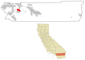
mapsize = 250x200px
map_caption = Location in Riverside County and the state ofCalifornia
mapsize1 =
map_caption1 =
subdivision_type = Country
subdivision_type1 = State
subdivision_type2 = County
subdivision_name =United States
subdivision_name1 =California
subdivision_name2 = Riverside
government_type =
leader_title =
leader_name =
established_date =
area_magnitude =
area_total_km2 = 65.5
area_total_sq_mi = 25.3
area_land_km2 = 64.5
area_land_sq_mi = 24.9
area_water_km2 = 1
area_water_sq_mi = 0.4
elevation_ft = 1565
elevation_m = 477
population_as_of = 2007
population_footnotes =
population_total = 34345
population_metro =
population_density_km2 = 363
population_density_sq_mi = 939.9
timezone = PST
utc_offset = -8
latd = 33 |latm = 47 |lats = 14 |latNS = N
longd = 116 |longm = 58 |longs = 0 |longEW = W
timezone_DST = PDT
utc_offset_DST = -7
postal_code_type =ZIP code s
postal_code = 92581-92583
area_code = 951
blank_name = FIPS code
blank_info = 06-67112
blank1_name = GNIS feature ID
blank1_info = 1652787
footnotes =
website =San Jacinto is a city in Riverside County,
California , U.S.A. As of the 2000 census, the city population was 23,779.Mount San Jacinto College , a junior community college serves the Inland Empire region for over 40 years, and the ballpark is home to the semi-pro collegiate team, theSou-Cal Tremors .Geography
San Jacinto is located at coor dms|33|47|14|N|116|58|0|W|city (33.787119, -116.966672)GR|1.
According to the
United States Census Bureau , the city has a total area of 25.3 square miles (65.5 km²), of which, 24.9 square miles (64.5 km²) of it is land and 0.4 square miles (1.0 km²) of it (1.50%) is water.The San Jacinto reservoir is the man-made lake used as a basin for the
San Diego Aqueduct , a branch of theColorado River Aqueduct west of town.Demographics
The City of San Jacinto is seeing a mass move to the San Jacinto Valley (see Hemet and Valle Vista). As of the 2006-2007 Annual Report, released Fall 2007, the population has grown to 34,345. There is an expected population growth of 45,000 by 2010.
As of the
census GR|2 of 2007, there were 34,345 people, 11,848 households in the city. Thepopulation density was 1357.5 people per square mile (368.6/km²). There were 11,878 housing units at an average density of 380.4/sq mi (146.9/km²). The racial makeup of the city was 69.34% White, 2.65% African American, 2.34% Native American, 1.12% Asian, 0.16% Pacific Islander, 19.52% from other races, and 4.87% from two or more races. Hispanic or Latino of any race were 40.30% of the population.There were 11,848 households out of which 36.1% had children under the age of 18 living with them, 52.1% were married couples living together, 13.0% had a female householder with no husband present, and 29.8% were non-families. 25.4% of all households were made up of individuals and 14.7% had someone living alone who was 65 years of age or older. The average household size was 2.84 and the average family size was 3.41.
In the city the population was spread out with 31.3% under the age of 18, 8.0% from 18 to 24, 26.1% from 25 to 44, 17.3% from 45 to 64, and 17.2% who were 65 years of age or older. The median age was 34 years. For every 100 females there were 93.8 males. For every 100 females age 18 and over, there were 89.1 males. San Jacinto has a large senior citizen (over age of 55) community, includes the Soboba Country Club east of town.
The median
income for a household in the city was $35,306, and the median income for a family was $34,717. Males had a median income of $31,764 versus $25,392 for females. Theper capita income for the city was $13,265. About 15.2% of families and 20.3% of the population were below thepoverty line , including 26.6% of those under age 18 and 12.2% of those age 65 or over, may include the casino-enriched Soboba Indian Reservation.Politics
In the state legislature San Jacinto is located in the 37th Senate District, represented by Republican
Jim Battin , and in the 65th Assembly District, represented by RepublicanPaul Cook . Federally, San Jacinto is located inCalifornia's 41st congressional district , which has a Cook PVI of R +9 [cite web | title = Will Gerrymandered Districts Stem the Wave of Voter Unrest? | publisher = Campaign Legal Center Blog | url=http://www.clcblog.org/blog_item-85.html | accessdate = 2008-02-10] and is represented by Republican Jerry Lewis.History
The city of San Jacinto was founded in 1870 and was incorporated on April 9th, 1888, making it one of the oldest cities in
Riverside County (actually predating the County itself, which was created by the division of northernSan Diego County and part of what is nowSan Bernardino County in May 1893). The city was struck by two large earthquakes, one on Christmas day, 1899, and the other on April 21, 1918.On July 15th, 1937 San Jacinto was the end point for the longest uninterrupted airplane flight at that time:
Mikhail Mikhailovich Gromov 's convert|6262|mi|km|sing=on polar flight from Moscow USSR in aTupolev ANT-25. This flight was part of the Soviets' push to improve morale in the USSR by earning milestones in flight records Fact|date=April 2008. In the early 1950s the fraternal groupE Clampus Vitus and the Riverside County Department of Transportation erected a stone marker commemorating this event on Cottonwood Avenue just west of Sanderson Road in west-central San Jacinto.The San Jacinto Police Department was disbanded in June 2004 over the objections of some residents, who claimed that losing local control of certain city services (regardless of cost) is tantamount to disincorporation, a claim that city officials deny. The city now has a 5-year contract with the
Riverside County Sheriff's Department .The City's Veteran's Memorial at Druding Park has emerged as a remarkable tribute to the men and women of our armed services who serve our great nation. Each branch of the military in the park has an equipment artifact used in battle as a symbol of their services. There is a tank for the Army, a propeller for the Air Force, an anchor for the Navy, a lighthouse for the Coast Guard, and in the near future the City hopes to add a howitzer for the Marine Corps. Various plaques and memorials also grace the convert|1|acre|m2|sing=on park.
The largest
Wal-Mart Supercenter(to date) in the State of California was opened here in San Jacinto in May 2007.ee also
Hemet, California External links
* [http://www.ci.san-jacinto.ca.us/ City of San Jacinto, CA]
Wikimedia Foundation. 2010.