- Arden-Arcade, California
-
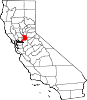
Arden-Arcade — census-designated place — Location in Sacramento County and the state of California
Coordinates: 38°36′19″N 121°22′47″W / 38.60528°N 121.37972°WCoordinates: 38°36′19″N 121°22′47″W / 38.60528°N 121.37972°W Country  United States
State  California
County Sacramento Area[1] – Total 17.919 sq mi (46.410 km2) – Land 17.829 sq mi (46.178 km2) – Water 0.090 sq mi (0.233 km2) 0.50% Elevation[2] 56 ft (17 m) Population (2010) – Total 92,186 – Density 5,144.6/sq mi (1,986.3/km2) Time zone PST (UTC-8) – Summer (DST) PDT (UTC-7) ZIP code(s) 95864
95825Area code(s) 916 FIPS code 06-02553 Arden-Arcade is a census-designated place (CDP) in Sacramento County, California, United States. The population was 92,186 at the 2010 census. It is east of the city of Sacramento and west of the community of Carmichael.
Arden-Arcade is a principal locality of the Sacramento–Arden-Arcade–Roseville Metropolitan Statistical Area.
Contents
History
The history of this area is documented in the "Sacramento ALC Historical Study 82", Ranch Del Paso, Office of History, Sacramento Air Logistics Center, McClellan Air Force Base, California, March 1983, by Raymond Oliver. Originally part of a Mexican land grant deeded to John Sutter, the Rancho Del Paso grant was negotiated from the Mexican governor by John Sutter on August 10, 1843. Then, Sutter deeded the Rancho Del Paso to Eliab and Hiram Grimes and John Sinclair. Samuel Norris was the next owner of Rancho Del Paso, then James Haggin. The Rancho Del Paso was purchased from Mr. Haggin's corporation, "The Rancho del Paso Land Company" in 1910 by the Sacramento Valley Colonization Company for $1.5 million.
Subdividing started in earnest in 1910. Under owner James Ben Ali Haggin, the Rancho was famous for its horse breeding; one of the horses bred on the Rancho won the Ben Ali Stakes, also known as the Kentucky Derby. The "arcade" was the old name of a large meadow of oak trees once located on the Arcade Creek, northwest of the present "Marconi Curve" on the Capital City Freeway, I-80. The natural occurring oak trees near the horse loading area were used to tie up hundreds of horses going east to Kentucky by rail. Some trains had more than a thousand horses loaded at one time from Rancho Del Paso. The oak trees were lined up like an architectural arcade (a number of arches supporting a wall), hence the name of the area, "Arcade".
The Arcade Meadow of Oak Trees was used as a staging area to load by rail transport all horses out to Kentucky, and beyond, from about 1880 to 1905. There were 24 barns with 64 stalls each and out buildings to support the manpower needed for the horse racing business. Among the oldest surviving buildings in the area are the Arden Middle School, built in 1914, and the Del Paso Country Club, from 1919, named for the original Rancho on which it was built. The first residential neighborhoods in the area were constructed in the 1920s and 1930s, as the city developed over the river, but many more were built later.
Geography
Arden-Arcade is located at 38°36′19″N 121°22′47″W / 38.60528°N 121.37972°W (38.605154, -121.379750).[3]
According to the United States Census Bureau, the CDP has a total area of 17.9 square miles (46 km2), of which, 17.8 square miles (46 km2) of it is land and 0.1 square miles (0.26 km2) of it (0.50%) is water.
Borders
Arden-Arcade's northern border is Interstate 80, its southern border is the American River, its western border is Ethan Way and its eastern border is Mission Avenue.
Community
Transportation
Arden-Arcade is served well by three major highways. Interstate 80 runs on the northern part of community and also serves as a northern border. Just to the east of the CDP is the Capital City Freeway and just to the south of the American River (the community's southern border) is Highway 50. Major east-west thoroughfares include El Camino Avenue, Marconi Avenue, Arden Way, Alta Arden Expressway, and Fair Oaks Boulevard while major north-south thoroughfares include Fulton Avenue, Watt Avenue, Howe Avenue, and Eastern Avenue.
Many of the major arterial streets that criss-cross through Arden-Arcade are named for the major inventors of the Industrial Revolution.
- Watt Avenue (James Watt - Steam Engine)
- Howe Avenue (Elias Howe - Sewing Machine)
- Whitney Avenue (Eli Whitney - Cotton Gin)
- Edison Avenue (Thomas Edison - Light Bulb)
- Marconi Avenue (Guglielmo Marconi - Radio)
- Fulton Avenue (Robert Fulton - Steamboat)
- Morse Avenue (Samuel Morse - Telegraph)
- Bell Street (Alexander Graham Bell - Telephone)
Shopping
Arden-Arcade is home to Town & Country Village, which has been around since the 1940s, is a specialty shopping center located at Fulton and Marconi Avenue. The newly renovated Country Club Plaza lies at the corner of El Camino and Watt Avenues, and Pavilions is an upscale shopping and dining center located on Fair Oaks Boulevard east of Howe Avenue.[4][5][6]
Country Club Plaza
Country Club Plaza Mall is a shopping mall located in Arden-Arcade. It is anchored by Gottschalks(filed bankruptcy in 2009 and now out of business), Macy's and Ross Dress For Less. It was opened in the 1960s but was recently renovated. It has 700,000 square feet (65,000 m2) of gross leasable area.[7]
Schools
High schools
- Rio Americano High School
- El Camino Fundamental High School
- Mira Loma High School
- Encina High School
- Sacramento Country Day School
Loretto High School, which opened in 1955 and closed after the 2008-2009 school year was located in Arden-Arcade. It is now operated as an elementary school by Aspire Public Schools.
Other schools
- Arcade Middle School
- Arden Middle School
- Jonas Salk High-Tech Academy
- Greer Elementary School
- Mariemont Elementary School
Del Paso Country Club
Del Paso Country Club is a private country club located within Arden-Arcade. The Club was founded in 1916 on what had once been part of Rancho Del Paso. Membership is by invitation. The Club includes newly renovated 18-hole golf course, state-of-the-art fitness center and other facilities.
Housing
Arden-Arcade has some of the more posh neighborhoods in the Sacramento area. There are neighborhoods along the American River and the American River Parkway with million-dollar home prices. However, there is also significant amounts of housing that are priced more affordably. Neighborhoods with ritzy homes include Wilhaggin, Sierra Oaks, Sierra Oaks Vista, Arden Park, Arden Oaks, and some of the areas surrounding the Del Paso Country Club.
The closest thing that California has had to a governor's mansion since 1967 was located in Arden-Arcade from 1984 until 2004. Governors George Deukmejian, Pete Wilson, and Gray Davis all occupied a home on Lake Wilhaggin Drive in the Wilhaggin area. The house was sold in 2004 after Governor Arnold Schwarzenegger decided not to live in the home and instead occupy the penthouse at the Hyatt in Downtown Sacramento when he did not commute back to Brentwood which he did most nights.
Government
Local
Incorporation plans
On November 2, 2010, area residents voted on Measure D.[1] The measure was defeated by a margin of 76% to 24%. If approved, the area bounded by Auburn Boulevard on the north, the American River Drive, Ethan Way on the west, and Mission Avenue/Jacob Lane on the east would have become the City of Arden-Arcade.
The city would have been governed by a council-manager form of government. Twenty-two candidates ran for the seven-member city council. If Measure D passed, seven would have become city council members and the top vote-getter would have become mayor. A city manager would have been hired by the council to implement goals, policies and ordinances approved by the city council. The defeat of Measure D rendered the results of the election a moot point.
According to the fiscal analysis [2] completed under the auspices of the Sacramento Local Area Formation Commission (LAFCo), the city as proposed “may be fiscally feasible” (p. 7). LAFCo assesses the feasibility of a new city according to three standards: it is likely to feasible; it is not likely; or it may be feasible. The financials for the proposed new city were not strong enough to warrant finding the proposed new city likely to be feasible.
The fiscal analysis includes “revenue neutrality payments” that the city must pay Sacramento County to be in compliance with California Code section 56815. City taxpayers would be required to reimburse Sacramento County over $6 million a year, and $219 million over a 35 year period for loss of sales tax revenue.
According to the [3], the new local government would have cost $37 million each year by year 10 of the analysis (Table E.3). At that point, the city would have been expected to spend $32,086,600 on general fund expenses for the city manager’s office, attorney services, city clerk’s office, the development office, animal control, etc. Road maintenance expenses are expected to cost 4,948,000 by year 10. The analysis does not include an assessment of capital requirements such as the cost of financing and building a city hall. According to the [4] salary survey released in September by the League of California Cities, salaries for city managers in the region range from $181,135 (Woodland) to 353,000 (Roseville), with most earning compensation over $200,000.
Proponents claimed that the new city would have improved services and created community pride in the City of Arden-Arcade without any new taxes. Opponents believed that revenue assumptions were risky and, if wrong, could lead to higher taxes.
Revenues would have largely come from property taxes and sales taxes. [5] LAFCo's projections of property taxes are based on this assumption about area property values: “The fiscal model assumes a nominal annual property appreciation rate of 5.2% excluding the additional value from new development” (p. 45). Property sales and retail sales are closely tied to the unemployment rate, and Sacramento ranks 326 out of 372 cities according to the most recent information available from the US Bureau of Labor Statistics.[6]
No plans to annex Arden-Arcade
As of August 24, 2010, the City of Sacramento posted on their website that they have no plans to annex Arden-Arcade.[df. Only the Local Area Formation Commission (LAFCo) has the regulatory authority under state law to approve or disapprove of the annexation of territory by a city (Cortese-Knox-Hertzberg Act of 2000, California Government Code Section 56000). LAFCo requires cities to keep up their general plan and look at overlapping jurisdictions. In that context, the City of Sacramento has collected information about Arden-Arcade but has not taken any steps toward incorporation, the first of which would be identifying Arden-Arcade as within its sphere of influence.
Incorporation proponents have repeatedly claimed that the city could take over the area in as little as six months with no opportunity for residents to vote. The City of Sacramento's process includes a dozen steps that would conservatively take three to five years to go through the lengthy and expensive process required. The most recent piece of land to be annexed was several hundred acres of fallow agricultural land, Greenbriar.[7] The process took four years for this small, non-controversial annexation at the request of the developer after four rounds of Environmental Impact Reviews, municipal service reviews, organization plans, finance plan, taxation agreements and more.
As the city describes on its website, residents of an area may request annexation, or the city may investigate it. "With inhabited areas, annexation must also be supported by a majority of voters within the area proposed for annexation."With inhabited areas, annexation must also be supported by a majority of voters within the area proposed for annexation
If the city undertook the lengthy road toward annexation and ultimately voted to approve, it would then have to file an application with the Local Agency Formation Commission. The many factors that LAFCo considers[8] when reviewing applications are listed in detail on its website as are its powers and authority.[9]. It includes the opportunity for public testimony.
The City of Sacramento's last annexation of an inhabited area, College Greens, was in the late 1950s. While it discussed interest in Arden-Arcade in the 1960s, the City of Sacramento did not initiate formal steps toward incorporation.
In its analysis of the area as part of its general plan update, city staff noted that Arden-Arcade is "mostly built out" (see Part III of the General Plan, Community Plan and Special Study Areas, Arden-Arcade Community Plan, p. 3-AA-5 at http://www.sacgp.org/). The city has also noted that the area has significant infrastructure needs and the likelihood of community opposition to incorporation.
Arden-Arcade Community Planning Council
The Arden-Arcade Community Planning Council is a nine-member council that helps make decisions for the community of Arden-Arcade. These nine members are appointed by the Sacramento County Board of Supervisors.
State and federal
In the state legislature, Arden-Arcade is located in the 1st and 6th Senate Districts, represented by Republican Ted Gaines and Democrat Darrell Steinberg respectively, and in the 5th and 10th Assembly Districts, represented by Democrat Richard Pan and Democrat Alyson Huber respectively. Federally, Arden-Arcade is located in California's 3rd congressional district and California's 5th congressional district, which are represented by Republican Dan Lungren and Democrat Doris Matsui respectively.
Demographics
Historical populations Census Pop. %± 1960 73,352 — 1970 82,492 12.5% 1980 87,570 6.2% 1990 92,040 5.1% 2000 96,025 4.3% 2010 92,186 −4.0% source:[8] 2010
The 2010 United States Census[9] reported that Arden-Arcade had a population of 92,186. The population density was 5,144.5 people per square mile (1,986.3/km²). The racial makeup of Arden-Arcade was 64,688 (70.2%) White, 7,977 (8.7%) African American, 948 (1.0%) Native American, 5,152 (5.6%) Asian (1.3% Filipino, 1.0% Chinese, 0.6% Indian, 0.5% Japanese, 0.5% Korean, 0.4% Vietnamese, 1.3% Other), 531 (0.6%) Pacific Islander, 7,420 (8.0%) from other races, and 5,470 (5.9%) from two or more races. Hispanic or Latino of any race were 17,147 persons (18.6%).
The Census reported that 90,936 people (98.6% of the population) lived in households, 530 (0.6%) lived in non-institutionalized group quarters, and 720 (0.8%) were institutionalized.
There were 40,518 households, out of which 10,799 (26.7%) had children under the age of 18 living in them, 14,307 (35.3%) were opposite-sex married couples living together, 5,500 (13.6%) had a female householder with no husband present, 2,154 (5.3%) had a male householder with no wife present. There were 2,859 (7.1%) unmarried opposite-sex partnerships, and 395 (1.0%) same-sex married couples or partnerships. 14,575 households (36.0%) were made up of individuals and 4,962 (12.2%) had someone living alone who was 65 years of age or older. The average household size was 2.24. There were 21,961 families (54.2% of all households); the average family size was 2.95.
The population was spread out with 19,288 people (20.9%) under the age of 18, 9,419 people (10.2%) aged 18 to 24, 24,240 people (26.3%) aged 25 to 44, 24,798 people (26.9%) aged 45 to 64, and 14,441 people (15.7%) who were 65 years of age or older. The median age was 39.0 years. For every 100 females there were 90.1 males. For every 100 females age 18 and over, there were 86.9 males.
There were 44,813 housing units at an average density of 2,500.8 per square mile (965.6/km²), of which 18,683 (46.1%) were owner-occupied, and 21,835 (53.9%) were occupied by renters. The homeowner vacancy rate was 2.4%; the rental vacancy rate was 11.7%. 42,822 people (46.5% of the population) lived in owner-occupied housing units and 48,114 people (52.2%) lived in rental housing units.
2000
As of the census[10] of 2000, there were 96,025 people, 42,987 households, and 23,427 families residing in the CDP. The population density was 5,084.9 people per square mile (1,963.7/km²). There were 44,818 housing units at an average density of 2,373.3 per square mile (916.5/km²). The racial makeup of the CDP was 91.36% White, 6.02% African American, 0.96% Native American, 4.86% Asian, 0.43% Pacific Islander, 5.18% from other races, and 5.20% from two or more races. Hispanic or Latino of any race were 11.98% of the population.
There were 42,987 households out of which 24.5% had children under the age of 18 living with them, 37.8% were married couples living together, 12.4% had a female householder with no husband present, and 45.5% were non-families. 36.3% of all households were made up of individuals and 11.2% had someone living alone who was 65 years of age or older. The average household size was 2.19 and the average family size was 2.88.
In the CDP the population was spread out with 21.4% under the age of 18, 10.5% from 18 to 24, 29.0% from 25 to 44, 22.5% from 45 to 64, and 16.6% who were 65 years of age or older. The median age was 38 years. For every 100 females there were 90.2 males. For every 100 females age 18 and over, there were 86.7 males.
The median income for a household in the CDP was $40,335, and the median income for a family was $51,152. Males had a median income of $38,935 versus $31,743 for females. The per capita income for the CDP was $26,530. About 9.9% of families and 13.7% of the population were below the poverty line, including 20.2% of those under age 18 and 4.9% of those age 65 or over.
Famous residents
- James D. Garibaldi - Former California State Assemblyman, lobbyist and Superior Court judge
- Bev Hansen - Former Assemblywoman (from Santa Rosa) and lobbyist
- Robert T. Monagan - Former Speaker of the California Assembly
- Fabian Nunez - Former Speaker of the California State Assembly
- Hidayet Türkoğlu - current Orlando Magic and former Sacramento Kings and Toronto Raptors small forward
Adjacent areas

Sacramento Sacramento, North Highlands North Highlands, Carmichael Sacramento 
Carmichael  Arden-Arcade

Sacramento La Riviera Rancho Cordova References
- ^ U.S. Census
- ^ U.S. Geological Survey Geographic Names Information System: Arden-Arcade, California
- ^ "US Gazetteer files: 2010, 2000, and 1990". United States Census Bureau. 2011-02-12. http://www.census.gov/geo/www/gazetteer/gazette.html. Retrieved 2011-04-23.
- ^ "Information & Directions". Pavilions. 2011. http://www.shoppavilions.com/info/. Retrieved June 14, 2011.
- ^ "Center Info". Town & Country Village. 2011. http://www.shoptownandcountry.com/info/index.php. Retrieved June 14, 2011.
- ^ "How To Get Here!". Country Club Plaza. 2011. http://www.countryclubplazamall.com/map.php. Retrieved June 14, 2011.
- ^ "Welcome to Country Club Plaza!". Country Club Plaza. 2011. http://www.countryclubplazamall.com/. Retrieved June 14, 2011.
- ^ "CENSUS OF POPULATION AND HOUSING (1790-2000)". U.S. Census Bureau. http://www.census.gov/prod/www/abs/decennial/index.html. Retrieved 2011-02-26.
- ^ All data are derived from the United States Census Bureau reports from the 2010 United States Census, and are accessible on-line here. The data on unmarried partnerships and same-sex married couples are from the Census report DEC_10_SF1_PCT15. All other housing and population data are from Census report DEC_10_DP_DPDP1. Both reports are viewable online or downloadable in a zip file containing a comma-delimited data file. The area data, from which densities are calculated, are available on-line here. Percentage totals may not add to 100% due to rounding. The Census Bureau defines families as a household containing one or more people related to the householder by birth, opposite-sex marriage, or adoption. People living in group quarters are tabulated by the Census Bureau as neither owners nor renters. For further details, see the text files accompanying the data files containing the Census reports mentioned above.
- ^ "American FactFinder". United States Census Bureau. http://factfinder.census.gov. Retrieved 2008-01-31.
External links
- Arden-Arcade profile from city-data.com
- Cityhood & Incorporation Web Site
- Stay Sacramento Website
- Arden-Arcade Blog
- Candidates for City Council 2010
- City of Sacramento website | Community Development Department - City of Sacramento has no plans to annex Arden-Arcade
- LAFCo Expert Analysis Shows NO NEW TAXES NEEDED for Arden-Arcade Incorporation
- LAFCo Analysis Shows Taxes Must Go Up if Arden-Arcade Becomes Part of the City of Sacramento
- [10]
Municipalities and communities of Sacramento County, California Cities Citrus Heights | Elk Grove | Folsom | Galt | Isleton | Rancho Cordova | Sacramento
CDPs Antelope | Arden-Arcade | Carmichael | Clay | Courtland | Elverta | Fair Oaks | Florin | Foothill Farms | Franklin | Freeport | Fruitridge Pocket | Gold River | Herald | Hood | La Riviera | Lemon Hill | Mather | McClellan Park | North Highlands | Orangevale | Parkway | Rancho Murieta | Rio Linda | Rosemont | Vineyard | Walnut Grove | Wilton
Unincorporated
communitiesLocke | Paintersville | Parkway-South Sacramento | Ryde | Sloughhouse
Ghost towns Mormon Island | Sutterville
Greater Sacramento Counties Douglas (NV) · El Dorado · Nevada · Placer · Sacramento · Sutter · Yolo · Yuba
Major City Cities
and
towns100k–200k25k–100kArden Arcade · Auburn · Carmichael · Citrus Heights · Davis · Folsom · Florin · Laguna · Lincoln · North Highlands · Orangevale · Parkway-South Sacramento · Rancho Cordova · Rocklin · West Sacramento · Woodland · Yuba City
10k–25kCameron Park · El Dorado Hills · Fair Oaks · Foothill Farms · Galt · Gardnerville Ranchos (NV) · Granite Bay · Grass Valley · La Riviera · Linda · Marysville · North Auburn · Olivehurst · Placerville · Rosemont · Rio Linda · South Lake Tahoe · South Yuba City · Truckee · Vineyard
Sub-regions Gold Country · Lake Tahoe · Sacramento Valley · Sierra Nevada · Yuba-Sutter Area
Categories:- Census-designated places in Sacramento County, California
- Sacramento metropolitan area


Wikimedia Foundation. 2010.