- Chino Hills, California
-
For the hills, see Chino Hills.
City of Chino Hills — City — Chino Hills, with the San Gabriel Mountains in background

SealLocation of Chino Hills within Southwestern San Bernardino County, California.
Coordinates: 33°58′31″N 117°43′23″W / 33.97528°N 117.72306°WCoordinates: 33°58′31″N 117°43′23″W / 33.97528°N 117.72306°W Country  United States
State  California
County San Bernardino Incorporated December 1, 1991 Government - Type Council-Manager - Mayor Ed Graham - City Manager Michael Fleager Area[1] - Total 44.749 sq mi (115.899 km2) - Land 44.681 sq mi (115.723 km2) - Water 0.068 sq mi (0.175 km2) 0.15% Elevation 1,070 ft (365 m) Population (2010) - Total 74,799 - Density 1,671.5/sq mi (645.4/km2) Time zone PST (UTC-8) - Summer (DST) PDT (UTC-7) ZIP code 91709 Area code(s) 657/714 & 909 FIPS code 06-13214 GNIS feature ID 1668255 Website www.chinohills.org Chino Hills is a Los Angeles suburb located in the southwestern corner of San Bernardino County, California, United States. The city borders Los Angeles County on its northwest side, Orange County to its south, and Riverside County to its southeast. The city had a population of 74,799 at the 2010 census.
Chino Hills was ranked 68th in Money Magazine's "Best places to live 2005."[2] It is also the 6th highest income place in the United States (with population 65,000 to 250,000)[3] and was ranked as the 13th safest city in the United States by the FBI.[4] Chino Hills is a part of the Chino Valley.
Chino Hills’ reputation is known in the national arena as well, as it was featured on the list of 87 of America’s hottest towns in the January 2004 issue of Money magazine. Chino Hills was ranked 8th on the list of “best places in the west with a population under 100,000.” The magazine reviewed a decade of data for communities with above average population growth, income, and home prices “to see where people were most willing to devote a high multiple of their annual income to live happily ever after.”
Contents
History
Pre-development
After the Spanish founded Mission San Gabriel in 1771, the Chino Hills were used extensively for grazing by mission cattle. During the Mexican Republic era, the hills were used as spillover grazing from such surrounding Mexican ranchos as Santa Ana del Chino and Rancho La Sierra (Yorba). After Mexico ceded California to the United States in 1848, the land was still used primarily for grazing. Except for the area of Prado Dam which was, and still is, a swamp and subject to flooding annually. Most historical dwellings were demolished in the rush to build. A local state monument is present in the grass lawn area of the local fire department, if one looks closely. Casa Colina, a well-known rehabilitation center now situated in Pomona California, began as a tubercular clinic in the Los Serranos sector. Similarly, the well known hospital, Loma Linda Hospital, also had its beginnings as a tubercular clinic. Sadly, most patients admitted for tuberculosis, succumbed to the illness because of the ineffectiveness of pre-antibotic treatments.
This land was sold to Richard Gird, the founder of nearby Chino subdivision and from which the town of Chino sprung in 1910.[5] With the building of the Carbon Canyon Mineral Springs in the modern-day Sleepy Hollow region of the city and the new Los Serranos Country Club in Los Serranos, Chino Hills, California, the area became a destination for both Los Angeles tourists and bootleggers during the prohibition because of its isolation. For the same reason, Sleepy Hollow became a destination for hippies and artists during the 60s.[6] During the late 1980s, an incorporation effort began and in 1991, the city was incorporated with a population of 42,000.[7]
Development
Due to its topography of rolling hills, Chino Hills was primarily rural prior to the mid 1970s; most land was utilized for equestrian purposes and for dairies, except for the multi-use purposes of the State of California, promoting jobs for your community through day labor from the Chino Institute for Men on Central Avenue. Rapid and extensive housing developments followed throughout the 1980s and early 1990s, only slowing down in recent years. Most neighborhoods are arranged in a village-type format with strategically placed shopping centers and parks designed to be within walking distance of nearby homes, primarily because of a lack of gasoline stations and other amenities and the town center is only a short 5 mile hike to the neighboring community of Diamond Bar which has amenities.[6]
Chino Hills is home to the Vellano Country Club, a private golf course and housing development designed by golf champion Greg Norman, his first project in the Greater Los Angeles area. With home prices expected to exceed $2 million, Vellano was touted (as of 2005) as the most expensive housing development in the Inland Empire,[8] a region considered a bastion of affordable housing in the Greater Los Angeles area.[citation needed]
Chino Hills also includes the developed golf course development neighborhood of Los Serranos. Other large master-planned subdivisions without amenities include Woodview/Village Crossing, Gordon Ranch, LaBand Village, Butterfield Ranch, Rolling Ridge, Fairfield Ranch, and Payne Ranch.[citation needed]
Chino Hills is also the location of The Shoppes at Chino Hills. The mall features over 65 upscale stores and restaurants, including San Bernardino County's first H&M. The Shoppes is designed to be "Main Street Chino Hills" featuring the Chino Hills Government Center and Library in addition to retail outlets.[citation needed]
Chino Hills earthquake
Main article: 2008 Chino Hills earthquakeOn July 29, 2008, a 5.5 magnitude earthquake occurred at approximately 11:42:15 am PDT (18:42:15 UTC). It was the largest earthquake to affect the urbanized portion of Southern California since the 2004 Parkfield-San Bernardino earthquake. Some incidents of damage were reported, but no fatalities or severe injuries occurred as a result.
Government
Local
Chino Hills follows the Council-Manager model of government.[9] The city is governed by a city council which establishes all city ordinances, approves plans, adopts budgets, etc. The council appoints the city manager who enforces laws and, in essence, runs the city's day-to-day operations.[10]
City council
The city council is elected by city residents and, within the council, rotates the position of mayor. Once elected, the city council members serve a four-year term. The five city council members meet on the second and fourth Tuesday of each month,[9] with opportunity for residents to voice their opinion during the open forum. The meetings are broadcasted via the city's television station and streaming via the city's website.
Police and fire
Law enforcement services in Chino Hills are provided by the San Bernardino County Sheriff's department. As of May, 2011 the current "police chief" is Captain Bill Lanew. Chino Hills has contracted with the San Bernardino County Sheriff's department for Law Enforcement services since it was incorporated in 1991.[11]
The city contracts with the Chino Valley Independent Fire District (CVIFD) for fire protection services. The CVIFD serves the Chino Valley, serving Chino Hills and the city of Chino. The CVIFD is a separate political entity from either Chino Hills or Chino and is managed by its own elected board. The department has three stations located throughout Chino Hills.[12]
State and federal
In the state legislature Chino Hills is located in the 29th Senate District, represented by Republican Bob Huff, and in the 60th Assembly District, represented by Republican Curt Hagman. Federally, Chino Hills is located in California's 42nd congressional district, which has a Cook PVI of R +10[13] and is represented by Republican Gary Miller.
Geography
- San Bernardino is 39 miles (63 km) to the east.
- Anaheim is 24 miles (39 km) to the southwest.
- Los Angeles is 30 miles (48 km) to the west.
- Riverside, 25 miles (40 km) to the east.
- Santa Ana, 27 miles (43 km) to the southwest.
Chino Hills, California Climate chart (explanation) J F M A M J J A S O N D 468414.169443.569450.774470.376510.18255089590.189590.387580.780531.3734526841Average max. and min. temperatures in °F Precipitation totals in inches Source: Weather.com / NWS Metric conversion J F M A M J J A S O N D 10220510321788217192386.424111.32813032153.332157.431141727123323752205Average max. and min. temperatures in °C Precipitation totals in mm Physical geography
Chino Hills is located at 33°58′31″N 117°43′23″W / 33.975267°N 117.723054°W.[14]
According to the United States Census Bureau, the city has a total area of 44.8 square miles (116 km2), much of which is undeveloped rolling hills, including the Chino Hills State Park. 44.7 square miles (116 km2) of it is land and 0.1 square miles (0.26 km2) of it (0.15%) is water.
City layout
The city of Chino Hills is bounded by the Los Angeles County cities of Pomona and Diamond Bar to the north and to the northwest, the San Bernardino County city of Chino to the east, unincorporated Riverside County near Corona to the southeast, and the Orange County cities of Brea and Yorba Linda to the west and southwest, respectively, as well as an unincorporated area of Orange County between Brea and Yorba Lina and a small unincorporated area between Yorba Linda and Anaheim commonly mistaken as part of the city of Anaheim, to the southwest and south, respectively.
The eastern border of Chino Hills roughly follows the Chino Valley Freeway (SR 71), which offers access to the Pomona Freeway (SR 60) to the north and the Riverside Freeway (SR 91) to the south. Undeveloped hills form the western border, which also serves as the San Bernardino – Orange County line. Because this area is mostly undeveloped, there is only one road directly connecting Chino Hills and Orange County, Carbon Canyon Road (SR 142), which is long, winding, and prone to landslides.[15][16]
Chino Hills' main arterial roads are:
- Butterfield Ranch Road, which starts at the southeasternmost part of the developed portions of Chino Hills by the 71 freeway and Euclid Avenue and runs northwest, somewhat parallel to the 71 until it passes Soquel Canyon Parkway into Los Serranos.
- Carbon Canyon Road, which starts at Chino Hills Parkway and runs southwest into Sleepy Hollow and continues on into Brea, where it turns into E Lambert Road. Labeled as State Route 142 from Chino Hills Parkway to Valencia Avenue.
- Chino Avenue, which bisects the northern half of the city starting at Chino Hills Parkway in the northeast and heading east into Chino.
- Chino Hills Parkway, which begins just east of the Chino Hills/Chino border in Chino and heads west then curves north finally terminating in the Pomona community of Phillips Ranch. It is signed as State Route 142 between Carbon Canyon Road and the Chino Valley Freeway.
- Grand Avenue, which continues Edison Avenue west from the Chino Valley Freeway at the city's eastern end to well past its western end into Diamond Bar, Covina, and eventually ending in Glendora.
- Peyton Drive, which begins in the residential areas of south Chino Hills and bisects Chino Hills Parkway and Grand Avenue and Chino Avenue and turns into Riverside Drive as it passes under the Chino Valley Freeway. Payne Ranch, a notable gated community, is located off Peyton Dr. opposite City Hall and The Shoppes at Chino Hills, just north of Ruben S. Ayala High School.
- Pipeline Avenue, which runs from the beginning of Soquel Canyon and runs north all the way through Chino into Pomona.
- Soquel Canyon Parkway, which starts at the southern tip of Pipeline Avenue in southern Chino Hills and turns into Central Avenue at the Chino / Chino Hills border.
Most of the city is residential, and the few commercial areas are at the intersections of the arterial streets. These commercial areas are usually small community centers, anchored by supermarkets and restaurants.
Destinations from Chino Hills 
Diamond Bar Pomona Chino Diamond Bar
Brea
Chino
Eastvale Chino Hills

Brea
Yorba LindaYorba Linda
AnaheimCorona Demographics
Historical populations Census Pop. %± 1990 27,608 — 2000 66,787 141.9% 2010 74,799 12.0% source:[17][18] 2010
The 2010 United States Census[19] reported that Chino Hills had a population of 74,799. The population density was 1,671.5 people per square mile (645.4/km²). The racial makeup of Chino Hills was 38,035 (50.8%) White, 3,415 (4.6%) African American, 379 (0.5%) Native American, 22,676 (30.3%) Asian, 115 (0.2%) Pacific Islander, 6,520 (8.7%) from other races, and 3,659 (4.9%) from two or more races. Hispanic or Latino of any race were 21,802 persons (29.1%).
The Census reported that 74,644 people (99.8% of the population) lived in households, 8 (0%) lived in non-institutionalized group quarters, and 147 (0.2%) were institutionalized.
There were 22,941 households, out of which 11,026 (48.1%) had children under the age of 18 living in them, 15,840 (69.0%) were opposite-sex married couples living together, 2,381 (10.4%) had a female householder with no husband present, 1,101 (4.8%) had a male householder with no wife present. There were 834 (3.6%) unmarried opposite-sex partnerships, and 142 (0.6%) same-sex married couples or partnerships. 2,713 households (11.8%) were made up of individuals and 717 (3.1%) had someone living alone who was 65 years of age or older. The average household size was 3.25. There were 19,322 families (84.2% of all households); the average family size was 3.54.
The population was spread out with 20,291 people (27.1%) under the age of 18, 7,147 people (9.6%) aged 18 to 24, 20,207 people (27.0%) aged 25 to 44, 21,889 people (29.3%) aged 45 to 64, and 5,265 people (7.0%) who were 65 years of age or older. The median age was 36.6 years. For every 100 females there were 97.7 males. For every 100 females age 18 and over, there were 94.7 males.
There were 23,617 housing units at an average density of 527.8 per square mile (203.8/km²), of which 18,421 (80.3%) were owner-occupied, and 4,520 (19.7%) were occupied by renters. The homeowner vacancy rate was 1.0%; the rental vacancy rate was 5.4%. 61,152 people (81.8% of the population) lived in owner-occupied housing units and 13,492 people (18.0%) lived in rental housing units.
2000
As of the census[20] of 2000, there are 66,787 people, 20,039 households, and 17,073 families residing in the city. The population density is 575.5/km² (1,490.6/mi²). There are 20,414 housing units at an average density of 175.9/km² (455.6/mi²). The racial makeup of the city is 56.38% White, 5.54% African American, 0.56% Native American, 22.08% Asian, 0.13% Pacific Islander, 10.57% from other races, and 4.74% from two or more races. 25.68% of the population are Hispanic or Latino of any race. The average house cost is $654,250.
There are 20,039 households out of which 53.8% have children under the age of 18 living with them, 72.6% are married couples living together, 8.5% have a female householder with no husband present, and 14.8% are non-families. 10.8% of all households are made up of individuals and 1.6% have someone living alone who is 65 years of age or older. The average household size is 3.33 and the average family size is 3.61. The average home price (excluding the unincorporated area of Los Serranos) is approximately $716,900, and the median home price is $659,900.
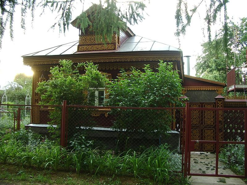
 Large Chino Hills House
In the city the population is spread out with 32.9% under the age of 18, 7.4% from 18 to 24, 35.6% from 25 to 44, 19.9% from 45 to 64, and 4.2% who are 65 years of age or older. The median age is 32 years. For every 100 females there are 98.9 males. For every 100 females age 18 and over, there are 95.1 males.
The median income for a household in the city is $83,550, and the median income for a family is $81,794. Males have a median income of $55,272 versus $38,620 for females. The per capita income for the city is $26,182. The average income for the city is $95,990. 5.1% of the population and 3.7% of families are below the poverty line. Out of the total population, 5.7% of those under the age of 18 and 4.9% of those 65 and older are living below the poverty line.
Economy
Top employers
According to the City's 2009 Comprehensive Annual Financial Report,[21] the top employers in the city are:
# Employer # of Employees 1 Chino Valley Unified School District 1,350 2 City of Chino Hills 286 3 Costco 270 4 Lowe's 218 5 Boys Republic 191 6 Albertson's 185 7 Harkins Theatres 146 8 Chino Valley Independent Fire District 125 9 Lucille's Smokehouse BBQ 119 10 99 Ranch Market 105 Education
Chino Hills is served by the Chino Valley Unified School District
Elementary schools
- Hidden Trails - a California Distinguished School
- Country Springs - a California Distinguished School and a National Blue Ribbon School
- Eagle Canyon - a California Distinguished School
- Oak Ridge- a California Distinguished School
- Butterfield Ranch- a California Distinguished School
- Michael G. Wickman - California Distinguished School
- Chaparral
- Gerald Litel
- Glenmeade
- Rolling Ridge
Junior high schools
- Canyon Hills Junior High - a California Distinguished School
- Townsend Junior High - a California Distinguished School
High schools
- Ruben S. Ayala High School - a California Distinguished School
- Chino Hills High School
- Boys Republic High School - a treatment center for troubled boys ages from 12 - 18.[22]
Independent schools
- Loving Savior of the Hills
- Chino Hills Christian School
- Chino Hills Montessori School
- Montessori Academy of Yorba Linda
Charter Schools
- Oxford Preparatory Academy (located in Chino but Chino Hills residents may attend)
Colleges and universities
- Biola University (Satellite Campus)
- California State Polytechnic University, Pomona (Cal Poly Pomona) - Closest 4-year public university.
Places of worship
Christian
Chino Valley Commuinity Church
Roman Catholicism
- Saint Paul the Apostle Roman Catholic Church - The largest church in the Roman Catholic Diocese of San Bernardino
The Church of Jesus Christ of Latter-day Saints
- The Church of Jesus Christ of Latter-day Saints at 3332 and 3354 Eucalyptus Avenue in Chino Hills.
Buddhism
- Buddhist Temple of Chino Hills
Hinduism
As of November 2009, the Temple complex was open for use with primary worship facilities. The Reception Building includes intricate hand-carved wood interior and exterior elements based on traditional Indian religious symbols and architecture. The complex also includes a main Hall for religious assembly, Sunday school, and monastery. The main Temple building itself was under construction as of November 2009, and will feature intricate hand-carved stone exterior, and traditional Indian religious architecture.
Lutheranism
- Loving Savior of the Hills Lutheran Church
Notable natives and residents
- Danny Lopez, Hall of Fame and World Champion boxer
- Leah O'Brien-Amico, U.S. Olympic softball group gold-medalist [1]
- Mat Mladin, AMA Superbike Champion
- Ron Roenicke, Milwaukee Brewers Manager,
- Mike Harkey, former Major League pitcher and pitching coach, 1987 1st Round Draft Pick Chicago Cubs
- A Thorn For Every Heart, musical group
- A Static Lullaby, musical group
- Ricky Minor, American Idol Music Director
- Mike Randolph, Los Angeles Galaxy Soccer Player
- Katrina Darrell, "Bikini Girl" American Idol
- Tim Woods III, NASCAR driver [2]
- Tony Pedregon, current NHRA Funny Car Champion [3]
- Del Worsham, NHRA Top Fuel Dragster Driver [4]
- Jaclyn Swedberg, Playboy Playmate of the Month for April 2011
- Love, Resonate, Christian Music Group
- Jordan Casanova, So You Think You Can Dance Season Eight, Top 8 Contestant
- Ashley Salerno, Lingerie Football League Team Los Angeles Temptation, 2010 Rookie of the Year, League MVP, Quarterback
Transportation
Highways in or near Chino Hills
Public transportation
Chino Hills is served by Omnitrans' OmniLink demand-response service open to the general public. For $2.50 one way, one can travel throughout the city and transfer for free to the Omnitrans public bus at the Chino Hills Marketplace and the Chino Hills Civic Center. The dial-a-ride service operates five days a week, mostly during daytime hours.[23]
Media
Inland Valley Daily Bulletin - Daily newspaper serving the Valley areas of San Bernardino County
- Chino Hills Champion - Weekly newspaper serving Chino and Chino Hills, California.
- Chino Hills.com - Private company serving news in the Chino Hills area.
- ChinoHillsProfessionals.com - A group of professionals who live or work in the community share ideas about how to promote business in the city.
Events
- Old-Fashioned Fourth of July Picnic - Hosted every year, the city recreation department puts on a fun and free event for the community to come out and enjoy on the Fourth of July. Crafts, inflatables, food, etc.
- Chino Hills Boat Parade - The Chino Hills Boat Parade is a unique event held each year around the holidays. Organized by the local Kiwanis, residents decorate and drive their boats through the neighborhoods over a period of two days.
- Concerts in the Park - The city sponsors a group of concerts each summer, including local entertainment from all genres. Generally there are 10 events held in the evenings each summer, with thousands of residents in attendance.
- Movies in the Park - During the summer various movies are shown at night. Movies are family-friendly and free.
References
- ^ U.S. Census
- ^ "MONEY Magazine: Best places to live 2005 Top 100 (3)". CNN. http://money.cnn.com/magazines/moneymag/bplive/2005/top100/top100_3.html. Retrieved 2007-01-16.
- ^ "Chino Hills Official Web-Site". http://www.chinohills.org. Retrieved 2007-10-29.
- ^ "2007 FBI Crime Statistics". http://www.fbi.gov/ucr/05cius/data/table_08_ca.html. Retrieved 2009-101-26.
- ^ "Los Serranos Country Club History". Los Serranos Golf and Country Club. Archived from the original on 2006-09-08. http://web.archive.org/web/20060908061343/http://www.losserranoscountryclub.com/history/. Retrieved 2006-10-18.
- ^ a b Sullivan, Susan (2004-02-08). "Room to Roam, Family Style". Los Angeles Times. http://www.latimes.com/classified/realestate/printedition/la-re-guide8feb08,0,1043207,full.story?coll=la-class-realestate. Retrieved 2007-01-18.[dead link]
- ^ "Chino Hills - Demographics". City of Chino Hills. http://www.chinohills.org/index.asp?nid=94. Retrieved 2006-10-18.
- ^ Rappaport, Michael. "Buyers Lining Up To Live in Vellano". Inland Valley Daily Bulletin. Archived from the original on 2006-10-17. http://web.archive.org/web/20061017215351/http://www.shark.com/gngcd/gngcd/041505.php. Retrieved 2007-01-18.
- ^ a b "Chino Hills - City Council". City of Chino Hills. http://www.chinohills.org/index.asp?nid=117. Retrieved 2007-01-18.
- ^ Fahim, Mayraj (2005-12-18). "Council managers are running more and more American cities". City Mayors. http://citymayors.com/government/council_managers.html. Retrieved 2007-01-18.
- ^ "Chino Hills Sheriff Station". San Bernardino County Sheriff. http://www.co.san-bernardino.ca.us/sheriff/patrol/Chino_Hills_City.asp. Retrieved 2011-05-08.
- ^ "CVIFD: Locations" (PDF). Chino Valley Independent Fire District. Archived from the original on 2007-09-28. http://web.archive.org/web/20070928184417/http://chinovalleyfire.org/fileadmin/user_upload/PDF_Files/phone_directory1.pdf. Retrieved 2007-01-18.
- ^ "Will Gerrymandered Districts Stem the Wave of Voter Unrest?". Campaign Legal Center Blog. http://www.clcblog.org/blog_item-85.html. Retrieved 2008-02-10.
- ^ "US Gazetteer files: 2010, 2000, and 1990". United States Census Bureau. 2011-02-12. http://www.census.gov/geo/www/gazetteer/gazette.html. Retrieved 2011-04-23.
- ^ "1998 Landslide Inventory". Department of Conservation. http://anaheim-landslide.com/landslide98.htm. Retrieved 2007-01-18.
- ^ "Southern California Landslide Localities". California Geological Survey. 2006-10-30. Archived from the original on 2006-09-24. http://web.archive.org/web/20060924070350/http://www.consrv.ca.gov/CGS/thp/ls_response/ls_la.htm. Retrieved 2007-01-18.
- ^ "CENSUS OF POPULATION AND HOUSING (1790-2000)". U.S. Census Bureau. http://www.census.gov/prod/www/abs/decennial/index.html. Retrieved 2010-07-31.
- ^ 1990 census figures enumerated prior to incorporation as Chino Hills CDP.
- ^ All data are derived from the United States Census Bureau reports from the 2010 United States Census, and are accessible on-line here. The data on unmarried partnerships and same-sex married couples are from the Census report DEC_10_SF1_PCT15. All other housing and population data are from Census report DEC_10_DP_DPDP1. Both reports are viewable online or downloadable in a zip file containing a comma-delimited data file. The area data, from which densities are calculated, are available on-line here. Percentage totals may not add to 100% due to rounding. The Census Bureau defines families as a household containing one or more people related to the householder by birth, opposite-sex marriage, or adoption. People living in group quarters are tabulated by the Census Bureau as neither owners nor renters. For further details, see the text files accompanying the data files containing the Census reports mentioned above.
- ^ "American FactFinder". United States Census Bureau. http://factfinder.census.gov. Retrieved 2008-01-31.
- ^ City of Chino Hills CAFR
- ^ "Boys Republic: Who We Are". Boys Republic. http://www.boysrepublic.org/whoweare.html. Retrieved 2007-01-19.
- ^ "Omnitrans: Omnilink". Omnitrans. http://www.omnitrans.org/routes/omnilink.shtml. Retrieved 2007-01-18.
External links
Inland Empire Counties Major cities Cities and towns
100k-200kCities and towns
25k-100kApple Valley • Cathedral City • Chino • Chino Hills • Colton • Eastvale • Hemet • Hesperia • Highland • Indio •
Jurupa Valley • Lake Elsinore • Menifee • Montclair • Palm Desert • Palm Springs • Perris • Redlands • Rialto • Rubidoux • San Jacinto • Upland • Valle Vista • Wildomar • YucaipaCities and towns
10k-25kAdelanto • Banning • Barstow • Beaumont • Big Bear Lake • Bloomington • Blythe • Cabazon • Canyon Lake • Coachella • Crestline • Desert Hot Springs • Glen Avon • Grand Terrace • La Quinta • Loma Linda • Mira Loma • Norco • Pedley • Rancho Mirage • Twentynine Palms • Yucca ValleyCities and towns
under 10kBig Bear City • Calimesa • Devore • El Cerrito • Oak Glen • Highgrove • Home Gardens • Indian Wells • Joshua Tree • Lake Arrowhead • Mentone • Muscoy • Needles • Romoland • San Antonio Heights • Sunnyslope • Wrightwood • WoodcrestRegions Coachella Valley • Cucamonga Valley • High Desert • Morongo Basin • San Bernardino Valley • San Jacinto Valley • Victor ValleyGreater Los Angeles Area Central city Counties Satellite cities Cities
>200kCities and towns
100k–200kBurbank • Compton • Corona • Costa Mesa • Downey • East Los Angeles • El Monte • Fontana • Fullerton • Garden Grove • Inglewood • Lancaster • Mission Viejo • Moreno Valley • Murrieta • Norwalk • Ontario • Orange • Palmdale • Pasadena • Pomona • Rancho Cucamonga • Santa Clarita • Simi Valley • South Gate • Temecula • Thousand Oaks • Torrance • Ventura • Victorville • West CovinaArea regions Antelope Valley • Conejo Valley • Downtown Los Angeles • East Los Angeles • Gateway Cities • Greater Hollywood • Harbor Area • Inland Empire • Palos Verdes Hills • Pomona Valley • San Bernardino Valley • San Fernando Valley • San Gabriel Valley • Santa Ana Valley • Santa Clarita Valley • South Bay • South Los Angeles • Westside Los AngelesLandforms Los Angeles Basin • Baldwin Hills (range) • Calico Mountains • Catalina Island • Channel Islands • Coachella Valley • High Desert—Mojave Desert • Low Desert—Colorado Desert • San Fernando Valley • San Bernardino Mountains • San Gabriel Mountains • Santa Ana Mountains • Santa Monica Mountains • Santa Susana Mountains • Verdugo MountainsBodies of water Los Angeles River • Aliso Creek • Arroyo Seco • Ballona Creek • Bell Creek • Big Bear Lake • Coyote Creek • Lake Arrowhead • Lake Perris • Lake Piru • Malibu Creek • Pacific Ocean • Pyramid Lake • Rio Hondo • San Gabriel River • San Juan Creek • San Pedro Bay • Santa Ana River • Santa Clara River • Santa Margarita River • Santa Monica BayCategories:- Chino Hills, California
- Cities in San Bernardino County, California
- Incorporated cities and towns in California


Wikimedia Foundation. 2010.