- Summerland, California
Infobox Settlement
official_name = Summerland, California
other_name =
native_name =
nickname =
settlement_type = CDP
motto =
imagesize =
image_caption =
flag_size =
image_
seal_size =
image_shield =
shield_size =
image_blank_emblem =
blank_emblem_type =
blank_emblem_size =
imagesize =
image_caption =
flag_size =
image_
seal_size =
image_shield =
shield_size =
image_blank_emblem =
blank_emblem_type =
blank_emblem_size =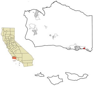
mapsize = 250x200px
map_caption = Location in Santa Barbara County and the state ofCalifornia
mapsize1 =
map_caption1 =
image_dot_
dot_mapsize =
dot_map_caption =
dot_x =
dot_y =
pushpin_
pushpin_label_position =
pushpin_map_caption =
pushpin_mapsize =
subdivision_type = Country
subdivision_name =United States
subdivision_type1 = State
subdivision_name1 =California
subdivision_type2 = County
subdivision_name2 = Santa Barbara
subdivision_type3 =
subdivision_name3 =
subdivision_type4 =
subdivision_name4 =
government_footnotes =
government_type =
leader_title = N/A
leader_name =
leader_title1 =
leader_title1 = Senate
leader_name1 =Tom McClintock (R)
leader_title2 = Assembly
leader_name2 =Pedro Nava (D)
leader_title3 = U. S. Congress
leader_name3 =Lois Capps (D)
leader_title4 =
leader_name4 =
established_title =
established_date =
established_title2 =
established_date2 =
established_title3 =
established_date3 =
area_magnitude =
unit_pref =
area_footnotes =
area_total_km2 = 5.2
area_land_km2 = 5.2
area_water_km2 = 0
area_total_sq_mi = 2
area_land_sq_mi = 2
area_water_sq_mi = 0
area_water_percent =
area_urban_km2 =
area_urban_sq_mi =
area_metro_km2 =
area_metro_sq_mi =
area_blank1_title =
area_blank1_km2 =
area_blank1_sq_mi =
population_as_of = 2000
population_footnotes =
population_note =
population_total = 1545
population_density_km2 = 297.1
population_density_sq_mi = 772.5
population_metro =
population_density_metro_km2 =
population_density_metro_sq_mi =
population_urban =
population_density_urban_km2 =
population_density_urban_sq_mi =
population_blank1_title =
population_blank1 =
population_density_blank1_km2 =
population_density_blank1_sq_mi =
timezone = PST
utc_offset = -8
timezone_DST = PDT
utc_offset_DST = -7
latd = 34 |latm = 25 |lats = 17 |latNS = N
longd = 119 |longm = 35 |longs = 45 |longEW = W
elevation_footnotes =
elevation_m = 37
elevation_ft = 121
postal_code_type =ZIP code
postal_code = 93067
area_code = 805
blank_name = FIPS code
blank_info = 06-75714
blank1_name = GNIS feature ID
blank1_info = 1656637
website =
footnotes =Summerland is a
census-designated place (CDP) in Santa Barbara County,California ,United States . The population was 1,545 at the 2000 census.History
Tar from natural
oil seep s in the Summerland area was long used as a sealant, both by the native Chumash peoples and by the Spanish builders of theMission Santa Barbara , who used it as waterproofing for the roof. In 1883, Spiritualist and real estate speculator H.L. Williams founded the town of Summerland. He named it as an advertisement for the excellent weather, and in 1888 divided his land tract, on a moderately sloping hill facing the ocean, into numerous parcels. He promoted the tiny lots – 25 x 60 – to fellow spiritualists, who bought them in quantity and moved to the area. The houses they built included bizarre architectural features such as doors which opened to walls, and stairways ascending to nowhere. The spiritual center of the town was a communityséance room, demolished only when Highway 101 was put through in the 1950s. [Baker, p. 62-63]In the 1890s, oil development began in the coastal area of Summerland, at the
Summerland Oil Field . Numerous wooden oil derricks sprouted on the beach, and on piers stretching into the ocean, as seen in the photograph. The world's first offshore oil well, drilled into the sea floor, was at this location. Production at this beach area peaked before 1910, although most of the rigs remained into the 1920s. [Rintoul, pp. 13-15] Peak production from the onshore portion of the Summerland Field did not actually occur until 1930; the last oil was pumped from the nearshore region in 1940. [DOGGR, p. 681] In 1957, Standard Oil Co. of California (now Chevron) found the largeSummerland Offshore Oil Field , several miles offshore, which is still in production. [DOGGR, p. 679]In January 1969, a blowout at this field produced the infamous Santa Barbara Oil Spill, a formative event for the modern environmental movement.
Geography
Summerland is located at coor dms|34|25|17|N|119|35|45|W|city (34.421395, -119.595969)GR|1. It is on the coast directly east of the city of Santa Barbara and west-northwest of the city of Carpinteria, and is almost entirely surrounded by the unincorporated community of Montecito. Summerland has a significantly higher population density than the surrounding area.
U.S. Route 101 goes through Summerland.According to the
United States Census Bureau , the CDP has a total area of 2.0square mile s (5.3km² ), of which, 2.0 square miles (5.2 km²) of it is land and 0.49% is water.Demographics
As of the
census GR|2 of 2000, there were 1,545 people, 715 households, and 368 families residing in the CDP. Thepopulation density was 764.7 people per square mile (295.3/km²). There were 784 housing units at an average density of 388.0/sq mi (149.9/km²). The racial makeup of the CDP was 91.78% White, 0.45% African American, 0.26% Native American, 2.39% Asian, 0.13% Pacific Islander, 2.27% from other races, and 2.72% from two or more races. Hispanic or Latino of any race were 7.44% of the population.There were 715 households out of which 17.9% had children under the age of 18 living with them, 42.2% were married couples living together, 7.4% had a female householder with no husband present, and 48.5% were non-families. 33.1% of all households were made up of individuals and 5.5% had someone living alone who was 65 years of age or older. The average household size was 2.16 and the average family size was 2.70.
In the CDP the population was spread out with 14.6% under the age of 18, 6.7% from 18 to 24, 34.2% from 25 to 44, 32.9% from 45 to 64, and 11.7% who were 65 years of age or older. The median age was 42 years. For every 100 females there were 93.9 males. For every 100 females age 18 and over, there were 91.9 males.
The median income for a household in the CDP was $53,964, and the median income for a family was $75,625. Males had a median income of $50,469 versus $41,042 for females. The
per capita income for the CDP was $41,668. About 4.5% of families and 9.5% of the population were below thepoverty line , including 7.5% of those under age 18 and none of those age 65 or over.In Popular Culture
* Is mentioned in the Everclear song "Summerland", from their
Sparkle and Fade album.
* Is the main location in the T.V. show Summerland.Notes
References
*Rintoul, William, "Wood Derricks and Steel Men," "Drilling Through Time", (Sacramento, California: California Department of Conservation, Division of Oil and Gas, 1990), pp. 13-15.
* Baker, Gayle. "Santa Barbara". Harbor Town Histories, Santa Barbara. 2003. ISBN 0-9710984-1-7
* "California Oil and Gas Fields, Volumes I, II and III". Vol. I (1998), Vol. II (1992), Vol. III (1982). California Department of Conservation, Division of Oil, Gas, and Geothermal Resources (DOGGR). 1,472 pp.External links
Wikimedia Foundation. 2010.