- Lexington Hills, California
Infobox Settlement
official_name = Lexington Hills, California
other_name =
native_name =
nickname =
settlement_type = CDP
motto =
imagesize =
image_caption =
flag_size =
image_
seal_size =
image_shield =
shield_size =
image_blank_emblem =
blank_emblem_type =
blank_emblem_size =
imagesize =
image_caption =
flag_size =
image_
seal_size =
image_shield =
shield_size =
image_blank_emblem =
blank_emblem_type =
blank_emblem_size =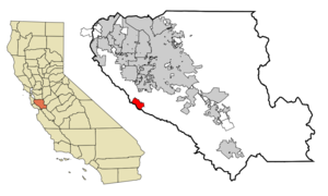
mapsize = 250x200px
map_caption = Location in Santa Clara County and the state ofCalifornia
mapsize1 =
map_caption1 =
image_dot_
dot_mapsize =
dot_map_caption =
dot_x =
dot_y =
pushpin_
pushpin_label_position =
pushpin_map_caption =
pushpin_mapsize =
subdivision_type = Country
subdivision_name =United States
subdivision_type1 = State
subdivision_name1 =California
subdivision_type2 = County
subdivision_name2 = Santa Clara
subdivision_type3 =
subdivision_name3 =
subdivision_type4 =
subdivision_name4 =
government_footnotes =
government_type =
leader_title =
leader_name =
leader_title1 =
leader_name1 =
leader_title2 =
leader_name2 =
leader_title3 =
leader_name3 =
leader_title4 =
leader_name4 =
established_title =
established_date =
established_title2 =
established_date2 =
established_title3 =
established_date3 =
area_magnitude =
unit_pref =
area_footnotes =
area_total_km2 = 11.7
area_land_km2 = 11.6
area_water_km2 = 0.1
area_total_sq_mi = 4.5
area_land_sq_mi = 4.5
area_water_sq_mi = 0
area_water_percent =
area_urban_km2 =
area_urban_sq_mi =
area_metro_km2 =
area_metro_sq_mi =
area_blank1_title =
area_blank1_km2 =
area_blank1_sq_mi =
population_as_of = 2000
population_footnotes =
population_note =
population_total = 2454
population_density_km2 = 209.7
population_density_sq_mi = 545.3
population_metro =
population_density_metro_km2 =
population_density_metro_sq_mi =
population_urban =
population_density_urban_km2 =
population_density_urban_sq_mi =
population_blank1_title =
population_blank1 =
population_density_blank1_km2 =
population_density_blank1_sq_mi =
timezone = PST
utc_offset = -8
timezone_DST = PDT
utc_offset_DST = -7
latd = 37 |latm = 9 |lats = 28 |latNS = N
longd = 121 |longm = 59 |longs = 2 |longEW = W
elevation_footnotes =
elevation_m = 381
elevation_ft = 1250
postal_code_type =ZIP code
postal_code = 95033
area_code = 408
blank_name = FIPS code
blank_info = 06-41282
blank1_name = GNIS feature ID
blank1_info = 1867036
website =
footnotes =Lexington Hills is a
census-designated place and an unincorporated area in Santa Clara County,California ,United States . The population was 2,454 at the 2000 census. The area is located in theSanta Cruz Mountains , about five miles south of Los Gatos and about 14 miles (22.5 km) north of Santa Cruz. Lexington Hills is the name assigned by theUnited States Census Bureau to the area, which actually comprises several small communities, including Redwood Estates, Holy City, Chemeketa Park, and Aldercroft Heights.Geography
Lexington Hills is located at coor dms|37|9|28|N|121|59|2|W|city (37.157695, -121.984013)GR|1.
According to the
United States Census Bureau , the CDP has a total area of 4.5square mile s (11.7km² ), of which, 4.5 square miles (11.6 km²) of it is land and 0.1 square miles (0.1 km²) of it (1.11%) is water.Demographics
As of the
census GR|2 of 2000, there were 2,454 people, 949 households, and 637 families residing in the CDP. Thepopulation density was 550.1 people per square mile (212.4/km²). There were 1,011 housing units at an average density of 226.6/sq mi (87.5/km²). The racial makeup of the CDP was 91.85% White, 0.57% African American, 0.49% Native American, 2.20% Asian, 0.04% Pacific Islander, 1.92% from other races, and 2.93% from two or more races. Hispanic or Latino of any race were 5.01% of the population.There were 949 households out of which 35.1% had children under the age of 18 living with them, 57.2% were married couples living together, 6.1% had a female householder with no husband present, and 32.8% were non-families. 23.9% of all households were made up of individuals and 3.3% had someone living alone who was 65 years of age or older. The average household size was 2.56 and the average family size was 3.03.
In the CDP the population was spread out with 25.8% under the age of 18, 4.1% from 18 to 24, 32.5% from 25 to 44, 32.3% from 45 to 64, and 5.3% who were 65 years of age or older. The median age was 39 years. For every 100 females there were 104.2 males. For every 100 females age 18 and over, there were 103.2 males.
The median income for a household in the CDP was $103,955, and the median income for a family was $110,809. Males had a median income of $69,891 versus $51,116 for females. The
per capita income for the CDP was $56,235. About 1.9% of families and 3.3% of the population were below thepoverty line , including 4.3% of those under age 18 and 16.3% of those age 65 or over.Politics
In the state legislature Lexington Hills is located in the 15th Senate District, represented by Republican
Abel Maldonado , and in the 21st Assembly District, represented by DemocratIra Ruskin . Federally, Lexington Hills is located inCalifornia's 15th congressional district , which has a Cook PVI of D +14 [cite web | title = Will Gerrymandered Districts Stem the Wave of Voter Unrest? | publisher = Campaign Legal Center Blog | url=http://www.clcblog.org/blog_item-85.html | accessdate = 2008-02-10] and is represented by DemocratMike Honda .References
External links
Wikimedia Foundation. 2010.