- Mountain View, California
-
For other places in California named "Mountain View", see Mountain View (disambiguation)#United States of America.
City of Mountain View — City — City Hall and the Center for the Performing Arts

SealLocation of Mountain View within Santa Clara County, California.
Coordinates: 37°23′34″N 122°2′31″W / 37.39278°N 122.04194°WCoordinates: 37°23′34″N 122°2′31″W / 37.39278°N 122.04194°W Country  United States
State  California
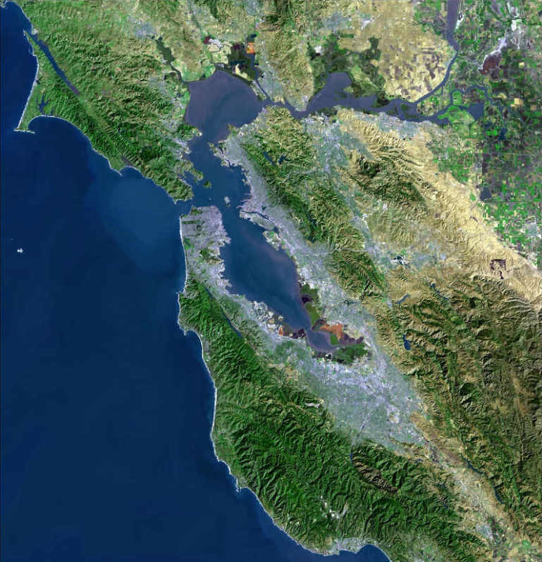
County Santa Clara Incorporated November 7, 1902 Government - Mayor Jac Siegel Area[1] - Total 12.273 sq mi (31.788 km2) - Land 11.995 sq mi (31.068 km2) - Water 0.278 sq mi (0.720 km2) 2.26% Elevation 105 ft (32 m) Population (2010) - Total 74,066 - Density 6,034.7/sq mi (2,330/km2) Time zone PST (UTC-8) - Summer (DST) PDT (UTC-7) ZIP code 94035, 94039-94043 Area code(s) 650 FIPS code 06-49670 GNIS feature ID 0277611 Website http://mountainview.gov/ Mountain View is a city in Santa Clara County, in the San Francisco Bay Area of California. It is named for its views of the Santa Cruz Mountains.[2] The city shares its borders with the cities of Palo Alto, Los Altos, and Sunnyvale, as well as Moffett Federal Airfield and the San Francisco Bay. As of the 2010 census, the city had a population of 74,066.
Situated in Silicon Valley, Mountain View is home to many high technology companies. In 1956, Shockley Semiconductor Laboratory, the first company to develop silicon semiconductor devices in what came to be known as Silicon Valley, was established in the city by William Shockley. Today, many of the largest technology companies in the world are headquartered in the city, including the Fortune 1000 companies Google, Symantec, and Intuit.
Contents
History

The Mexican land grant of Rancho Pastoria de las Borregas was given in 1842 by Alta California Governor Juan Alvarado to Francisco Estrada. This grant was later passed on to Mariano Castro, who sold half of the land to Martin Murphy, Jr. Eventually, the former land grant became the cities of Mountain View and Sunnyvale.
Mountain View had its beginnings in the late 19th century as a stagecoach stop on the route between San Francisco and San Jose. Incorporated on November 7, 1902, the town's early growth was due to agriculture, which remained the primary industry into the middle of the 20th century. After World War II, the population grew significantly with the development of the aerospace and electronics industries.[3] Between 1950 and 1960, the population grew from 6,563 to 30,889, an increase of 370.7%.
Today, high technology is the basis of the local economy and there are few remnants of the agricultural past.
Geography
Mountain View is located at 37°25′19″N 122°5′4″W / 37.42194°N 122.08444°W (37.42223, −122.08429).[4]
According to the United States Census Bureau, the city has a total area of 12.3 square miles (31.8 km²). 12.0 square miles (31.1 km²) of it is land and 0.3 square miles (0.7 km²) of it (2.26%) is water.
Mountain View is located on the San Francisco Peninsula, at the north end of State Route 85, where it meets U.S. Route 101. The historic route El Camino Real also runs through Mountain View. It is bounded to the northwest by Palo Alto, to the southwest by Los Altos, to the southeast by Sunnyvale, to the northeast by Moffett Federal Airfield, and to the north by the San Francisco Bay.
Climate
Mountain View has a Mediterranean climate (Köppen climate classification Csa: dry-summer subtropical). Summers are warm and dry, while winters are mild and wet.
Climate data for Mountain View, California Month Jan Feb Mar Apr May Jun Jul Aug Sep Oct Nov Dec Year Average high °F (°C) 57
(14)63
(17)64
(18)70
(21)73
(23)77
(25)79
(26)79
(26)79
(26)73
(23)64
(18)57
(14)69.7
(20.9)Average low °F (°C) 39
(4)43
(6)46
(8)46
(8)52
(11)55
(13)57
(14)57
(14)55
(13)50
(10)45
(7)39
(4)48.8
(9.3)Precipitation inches (mm) 3.24
(82.3)3.181
(80.8)2.65
(67.3)0.89
(22.6)0.35
(8.9)0.11
(2.8)0.031
(0.8)0.079
(2.0)0.189
(4.8)0.85
(21.6)1.831
(46.5)2.311
(58.7)15.713
(399.1)Source: http://www.weather.com/outlook/travel/businesstraveler/wxclimatology/monthly/graph/94041 Downtown
 Centennial Plaza at the Downtown Mountain View Station
Mountain View has a pedestrian-friendly downtown centered on Castro Street. The downtown area consists of the seven blocks of Castro Street from the Downtown Mountain View Station transit center in the north to the intersection with El Camino Real in the south. The transit center links the Caltrain commuter rail and Santa Clara Valley Transportation Authority (VTA) light rail and bus systems.
Going south from the downtown station, there are approximately four blocks with a high concentration of diverse restaurants, cafes, and shops. Chez TJ, one of the few restaurants rated by the prestigious Michelin Guide in the Bay Area, is located a block from Castro Street on Villa Street. Tied House, located next door, was one of the first brewpubs to open in the Bay Area, and remains a popular stop in downtown.
 Castro Street in downtown Mountain View
The core of downtown is the plaza shared by City Hall, the Mountain View Center for Performing Arts and the award-winning Mountain View Public Library. Behind those buildings is Pioneer Park, which enjoys a quiet environment resulting from the City Hall building blocking out the noise from Castro Street. The Plaza between City Hall and the Performing Arts Center is a well-used spot for community gatherings and events, and features an impressive collection of public art. The Mountain View Police Department is located two blocks away from Castro Street on Villa Street.
Since 1971, the city has held the annual Mountain View Art & Wine Festival on Castro Street by closing down the street to traffic for two days. There is a farmer's market in the Caltrain parking lot every Sunday morning. Every summer, once a month, the city celebrates Thursday Night Live (TNL) by closing off Castro street to cars and providing live music events and car shows on Castro Street.
Notable points of interest
- Shoreline Park runs along the bay north of U.S. Route 101. It includes Shoreline Amphitheatre as well as Rengstorff House, which is listed in the National Register of Historic Places.
- The Computer History Museum is home to the largest and most significant collection of computing artifacts in the world.
- Moffett Field is a Federal Airfield near the bay. It is home to NASA Ames Research Center.
- The Historic Adobe Building, on Moffett Boulevard, is listed in the National Register of Historic Places.
- The Mountain View Center for the Performing Arts (MVCPA) is located adjacent to City Hall. Highly acclaimed local theatre companies Peninsula Youth Theatre and TheatreWorks are among the Home Companies of the MVCPA.[5]
- Stevens Creek runs through Mountain View from the south. A lengthy paved pedestrian and bicycle path, the Stevens Creek Trail, runs alongside the creek for nearly its entire distance in Mountain View.
- St. Joseph Parish was founded in 1905, and survived the 1906 San Francisco earthquake, only to be burned down in 1928. The current church building was rebuilt in 1929, and is still in service today.[6]
- Googleplex, the corporate headquarters complex of Google, Inc., is located in Mountain View.
Economy
Mountain View is one of the major cities that make up Silicon Valley, and has many notable Silicon Valley companies either headquartered there or with a large presence.
Notable companies
The following notable companies are headquartered in Mountain View:
- 23andMe
- Actel
- Antibody Solutions
- Anybots
- Appcelerator
- Branders.com
- Cavium Networks
- Complete Genomics
- Conceptus Inc.
- CyberSource
- Diamond Systems Corporation
- drchrono.com
- eHealthInsurance
- Evernote [7]
- Eye-Fi
- Fenwick & West
- Financial Navigator
- Geeknet
- Intuit
- Jajah
- Dell KACE
- Kosmix
- Loopt
- Meebo
- Mozilla Foundation (Mozilla Corporation)
- Omnicell
- Pattern Insight
- Plastic Logic
- Playdom
- SENS Foundation
- SETI Institute
- Skyline Solar
- SmugMug
- Soylent Communications
- Symantec
- Synopsys
- Talenthouse
- Vivus
- Y Combinator

 Intuit headquarters
 The site of the former Shockley Semiconductor Laboratory, the first silicon device company in Silicon Valley.
Other notable companies with significant presences in Mountain View include:
- American Century Investments
- AOL
- Avid Technology (Pinnacle Systems)
- Microsoft
- NCsoft (Paragon Studios)
- Nokia
- Opera Software[8]
- Red Hat
- Webroot Software
- Wipro Technologies
Economic past
The now defunct Arrow Dynamics (formerly Arrow Development Company), a rollercoaster design and manufacturing company, was originally founded and based in Mountain View. During its time in Mountain View, Arrow was contracted to build many of the original rides at Disneyland.[9]
Other companies formerly headquartered in Mountain View include:
Due to its past history as a center for semiconductor manufacturing, Mountain View has seven sites on the Environmental Protection Agency's Final National Priorities List (NPL), a list of hazardous waste sites in the United States eligible for long-term remedial action financed under the federal Superfund program. The sites were formerly used by companies including Fairchild Semiconductor, Intel, Raytheon, and Teledyne. These seven sites make up a portion of the 22 NPL sites in Santa Clara County, which are included in the total of 94 sites in California.[10]
Top employers
According to the City's 2010 Comprehensive Annual Financial Report,[11] the top employers in the city are:
# Employer # of employees 1 Google 10,000 2 Symantec 3,400 3 El Camino Hospital 2,500 4 Microsoft 2,400 5 Intuit 1,700 6 Synopsys 1,000 7 Palo Alto Medical Foundation 800 8 KPMG 700 9 LinkedIn 600 10 Omnicell 300 Demographics
Historical populations Census Pop. %± 1910 1,161 — 1920 1,888 62.6% 1930 3,308 75.2% 1940 3,946 19.3% 1950 6,563 66.3% 1960 30,889 370.7% 1970 54,132 75.2% 1980 58,655 8.4% 1990 67,365 14.8% 2000 70,708 5.0% 2010 74,066 4.7% source:[12] 2010
The 2010 United States Census[13] reported that Mountain View had a population of 74,066. The population density was 6,034.8 people per square mile (2,330.0/km²). The racial makeup of Mountain View was 41,468 (56.0%) White, 1,629 (2.2%) African American, 344 (0.5%) Native American, 19,232 (26.0%) Asian, 391 (0.5%) Pacific Islander, 7,241 (9.8%) from other races, and 3,761 (5.1%) from two or more races. Hispanic or Latino of any race were 16,071 persons (21.7%).
The Census reported that 73,801 people (99.6% of the population) lived in households, 145 (0.2%) lived in non-institutionalized group quarters, and 120 (0.2%) were institutionalized.
There were 31,957 households, out of which 8,731 (27.3%) had children under the age of 18 living in them, 13,806 (43.2%) were opposite-sex married couples living together, 2,456 (7.7%) had a female householder with no husband present, 1,253 (3.9%) had a male householder with no wife present. There were 1,928 (6.0%) unmarried opposite-sex partnerships, and 280 (0.9%) same-sex married couples or partnerships. 10,961 households (34.3%) were made up of individuals and 2,471 (7.7%) had someone living alone who was 65 years of age or older. The average household size was 2.31. There were 17,515 families (54.8% of all households); the average family size was 3.01.
The population was spread out with 14,595 people (19.7%) under the age of 18, 5,401 people (7.3%) aged 18 to 24, 28,577 people (38.6%) aged 25 to 44, 17,647 people (23.8%) aged 45 to 64, and 7,846 people (10.6%) who were 65 years of age or older. The median age was 35.9 years. For every 100 females there were 103.6 males. For every 100 females age 18 and over, there were 103.5 males.
There were 33,881 housing units at an average density of 2,760.6 per square mile (1,065.9/km²), of which 13,332 (41.7%) were owner-occupied, and 18,625 (58.3%) were occupied by renters. The homeowner vacancy rate was 1.3%; the rental vacancy rate was 4.4%. 32,002 people (43.2% of the population) lived in owner-occupied housing units and 41,799 people (56.4%) lived in rental housing units.
2000
As of the census[14] of 2000, there were 70,708 people, 31,242 households, and 15,902 families residing in the city. The population density was 2,263.7/km² (5,861.4/mi²). There were 32,432 housing units at an average density of 1,038.3/km² (2,688.5/mi²). The racial makeup of the city was 63.77% White, 2.53% African American, 0.39% Native American, 20.67% Asian, 0.26% Pacific Islander, 8.32% from other races, and 4.07% from two or more races. Hispanic or Latino of any race were 18.26% of the population.
There were 31,242 households out of which 23.3% had children under the age of 18 living with them, 40.0% were married couples living together, 7.3% had a female householder with no husband present, and 49.1% were non-families. 35.6% of all households were made up of individuals and 7.0% had someone living alone who was 65 years of age or older. The average household size was 2.25 and the average family size was 2.97.
In the city the population was spread out with 18.0% under the age of 18, 8.3% from 18 to 24, 43.4% from 25 to 44, 19.8% from 45 to 64, and 10.5% who were 65 years of age or older. The median age was 35 years. For every 100 females there were 106.8 males. For every 100 females age 18 and over, there were 106.9 males.
According to a 2007 estimate the median income for a household in the city was $82,648, and the median income for a family was $105,079.[15] Males had a median income of $64,585 versus $44,358 for females. The per capita income for the city was $39,693. About 3.6% of families and 6.8% of the population were below the poverty line, including 7.2% of those under age 18 and 5.9% of those age 65 or over.
Government
 Mountain View City Hall
Mountain View has a council-manager government system. An executive city manager is in charge of several departments, while the city council, supported by several boards, commissions, and committees, is the legislature responsible for the ordinances of the city code. The executive in turn enforces the code and promulgates administrative regulations to execute it. The city clerk and attorney perform supporting roles. The Community Development Department is the agency responsible for planning and zoning.[16]
State and Federal legislators
In the state legislature Mountain View is located in the 13th Senate District, represented by Democrat Elaine Alquist, and in the 22nd Assembly District, represented by Democrat Paul Fong. Federally, Mountain View is located in California's 14th congressional district, which has a Cook PVI of D +18[17] and is represented by Democrat Anna Eshoo.
Education
Mountain View has eleven notable public schools and four notable private schools.
Public
The public elementary (Bubb, Castro, Huff, Landels, Monta Loma, Stevenson, and Theuerkauf) and middle schools (Crittenden and Graham) are governed by the Mountain View-Whisman School District.[18] Springer Elementary, although located within the borders of Mountain View, is governed by the Los Altos School District. The public high schools are governed by the Mountain View-Los Altos Union High School District and consist of Alta Vista High School, Mountain View High School, and Los Altos High School.[19] Mountain View High and Los Altos High each contain approximately 50% Los Altos residents and 50% Mountain View residents. Some Mountain View residents attend Almond Elementary and Egan Junior High in the Los Altos School District. Many of Mountain View's schools boast test scores among the best in California.
Mountain View taxes a large portion of its most valuable commercial and industrial properties in the Shoreline Regional Park Community at very low relative levels, and until the creation of a joint-powers agreement (JPA) in 2006, none of those property taxes reached the local schools. After the creation of the JPA, the Shoreline Regional Park Community will be sharing less than $1 million per year with the elementary and high school districts.[20][21]
A citizen-supported parcel tax, largely aimed at reducing class size, was recently renewed with an overwhelming positive vote.[22] The current ratio of students to full-time-equivalent teachers in the Mountain View public elementary schools is 20.4 to one.[23]
Private
Notable private schools in Mountain View include: Saint Francis High School, a Roman Catholic secondary school; German International School of Silicon Valley, a PK-12 German-English bilingual international school; Yew Chung International School of Silicon Valley, a PK-12 Chinese-English bilingual international school; and St. Stephen Lutheran School, a K-8 school.
Library
Mountain View has one central public library, the Mountain View Public Library, offering video, music, books, self-check out, and access to the Internet. During fiscal year 2006-7: 810,589 customers visited the Library. Circulation was more than 1.4 million, 105,870 reference and information questions were answered, 36,693 children listened to stories and participated in children's programs and 27,342 new books and media items were added to the collection which includes holdings of 300,000, including 210,000 books and 423 periodical subscriptions. The library also provides valuable outreach services through the bookmobile and S.O.S. volunteer program to those in Mountain View, who are unable to come to the main branch. The building was built in 1997. The second floor of the library has a special collection in a room devoted to the history of Mountain View, next to a portrait of Don Mariano Castro, for whom the downtown main street is named. The library hosts the innovative Mountain View Reads Together program.[24]
Infrastructure
Transportation
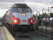 Caltrain commuter rail at the Downtown Mountain View Station
 Santa Clara Valley Transportation Authority (VTA) light rail
The Downtown Mountain View Station is the transit center for the city, connecting the public commuter rail, light rail, bus, and private shuttle systems. Mountain View is served by the Caltrain commuter rail system, which runs from San Francisco to Gilroy. The two Caltrain stations in the city are Downtown Mountain View Station and San Antonio Station. The city is also served by the Santa Clara Valley Transportation Authority (VTA), which operates various bus lines and the light rail system. There are a total of five stations in the city on the Mountain View – Winchester VTA light rail line, with Downtown Mountain View Station serving as the northern terminus, while the other four stations are Evelyn, Whisman, Middlefield, and Bayshore/NASA. Many large local employers (including Google, Microsoft, Apple Inc., and NASA Ames Research Center) operate employee shuttles that stop at the Downtown Mountain View Station.
The nearest major airports are San Jose International Airport (SJC), San Francisco International Airport (SFO), and Oakland International Airport (OAK), in that order. Moffett Federal Airfield is located just north of Mountain View, but it is restricted to government, military, and private use. The nearest general aviation airport is the Palo Alto Airport of Santa Clara County.
Utilities
On August 16, 2006, after over a year of test deployments, Google declared, as planned, that its implementation for free IEEE 802.11g wireless service for all of the City was fully operational.[25] Mountain View is the first city in the United States entirely covered by a free wireless Internet access network provided by Google.
Sister cities
The Mountain View Sister City Affiliation was incorporated in 1974 as an independent non-profit governed by a Board of Directors. Mountain View is affiliated with the cities of Iwata, Japan and Hasselt, Belgium.[26]
Notable residents
Notable people born in Mountain View include former Women's World Golf Rankings number two Paula Creamer, seven-time Academy Award for Best Art Direction nominee Carroll Clark, Heroes and Entourage supporting actor Assaf Cohen, 2000 500cc Road Racing World Champion Kenny Roberts, Jr., and two-time Super Bowl champion Tully Banta-Cain. Online educator Salman Khan resides in Mountain View.
References

- ^ U.S. Census
- ^ Munro-Fraser, J. P.. History of Santa Clara County, California. San Francisco: Alley, Bowen & Co.. pp. 262. http://books.google.com/books?id=5_Vwe-eHfqsC. Retrieved April 2008.
- ^ "City of Mountain View - Learn About Our City". http://www.mountainview.gov/services/learn_about_our_city/default.asp. Retrieved 15 March 2011.
- ^ "US Gazetteer files: 2010, 2000, and 1990". United States Census Bureau. 2011-02-12. http://www.census.gov/geo/www/gazetteer/gazette.html. Retrieved 2011-04-23.
- ^ MVCPA General Info
- ^ "History of St. Joseph Parish". http://www.sjpmv.org/content/history/. Retrieved 20 April 2010.[dead link]
- ^ Mossberg, Walter S. (January 21, 2010). "Evernote review in the Wall Street Journal". The Wall Street Journal. http://online.wsj.com/article/SB10001424052748704320104575015092125336842.html.
- ^ "Opera Offices". http://www.opera.com/company/jobs/offices/.
- ^ MV-PA.org
- ^ "Final National Priorities List (NPL) Sites - by State". United States Environmental Protection Agency. http://www.epa.gov/superfund/sites/query/queryhtm/nplfin.htm#CA. Retrieved 2011-03-25.
- ^ City of Mountain View CAFR
- ^ "Census of Population and Housing - Decennial Censuses". United States Census Bureau. http://www.census.gov/prod/www/abs/decennial/. Retrieved 2011-02-01.
- ^ All data are derived from the United States Census Bureau reports from the 2010 United States Census, and are accessible on-line here. The data on unmarried partnerships and same-sex married couples are from the Census report DEC_10_SF1_PCT15. All other housing and population data are from Census report DEC_10_DP_DPDP1. Both reports are viewable online or downloadable in a zip file containing a comma-delimited data file. The area data, from which densities are calculated, are available on-line here. Percentage totals may not add to 100% due to rounding. The Census Bureau defines families as a household containing one or more people related to the householder by birth, opposite-sex marriage, or adoption. People living in group quarters are tabulated by the Census Bureau as neither owners nor renters. For further details, see the text files accompanying the data files containing the Census reports mentioned above.
- ^ "American FactFinder". United States Census Bureau. http://factfinder.census.gov. Retrieved 2008-01-31.
- ^ Factfinder.census.gov
- ^ City of Mountain View - Departments
- ^ "Will Gerrymandered Districts Stem the Wave of Voter Unrest?". Campaign Legal Center Blog. http://www.clcblog.org/blog_item-85.html. Retrieved 2008-02-10.
- ^ Mountain View Whisman School District
- ^ MVLA High School District
- ^ "Flush times at high school district," Mountain View Voice, June 30, 2006
- ^ "Mountain View Shoreline Regional Park Community Act," uncodified Act of the California Legislature, 1969, Chapter 1109.
- ^ Mountain View Voice : Measure C passes by a landslide
- ^ District Detail for Mountain View-Whisman Elementary
- ^ City of Mountain View - Library
- ^ Google Says It Has No Plans for National Wi-Fi Service
- ^ City of Mountain View - Sister Cities Retrieved march 4, 2010
External links
- City of Mountain View
- Historic Homes of Mountain View
- Block by Block Photo Tour of Castro Street, Downtown Mountain View
- Mountain View (California) travel guide from Wikitravel
Other points of interest
- Monta Loma Neighborhood Neighborhood Web Site
- Old Mountain View Neighborhood Neighborhood Web Site
- Shoreline West Neighborhood Neighborhood Web Site
Municipalities and communities of Santa Clara County, California County seat: San Jose Cities and towns Campbell | Cupertino | Gilroy | Los Altos | Los Altos Hills | Los Gatos | Milpitas | Monte Sereno | Morgan Hill | Mountain View | Palo Alto | San Jose | Santa Clara | Saratoga | Sunnyvale

CDPs Alum Rock | Burbank | Cambrian Park | East Foothills | Fruitdale | Lexington Hills | Loyola | San Martin | Stanford
Unincorporated
communitiesBell Station | Casa Loma | Chemeketa Park | Coyote | Holy City | Loma Chiquita | Old Gilroy | New Almaden | Redwood Estates | Rucker | San Antonio Valley | Sargent | Sveadal
Ghost towns San Francisco Bay Area Bodies of water Bodega Bay · Carquinez Strait · Clifton Forebay · Golden Gate · Grizzly Bay · Guadalupe River · Half Moon Bay · Lake Berryessa · Napa River · Oakland Estuary · Petaluma River · Richardson Bay · Richmond Inner Harbor · Russian River · San Francisco Bay · San Leandro Bay · San Pablo Bay · Sonoma Creek · Suisun Bay · Tomales Bay

Counties Alameda · Contra Costa · Marin · Napa · San Francisco · San Mateo · Santa Clara · Solano · Sonoma
Major cities Cities and towns
100k–250kCities and towns
25k–99kAlameda · Belmont · Benicia · Brentwood · Burlingame · Campbell · Castro Valley · Cupertino · Danville · Dublin · East Palo Alto · Foster City · Gilroy · Livermore · Los Altos · Los Gatos · Martinez · Menlo Park · Milpitas · Morgan Hill · Mountain View · Napa · Newark · Novato · Oakley · Pacifica · Palo Alto · Petaluma · Pittsburg · Pleasant Hill · Pleasanton · Redwood City · Rohnert Park · San Bruno · San Carlos · San Leandro · San Mateo · San Pablo · San Rafael · San Ramon · Saratoga · South San Francisco · Suisun City · Union City · Vacaville · Walnut Creek · Windsor
Cities and towns
5k–25kAlamo · Albany · Alum Rock · American Canyon · Ashland · Atherton · Bay Point · Blackhawk-Camino Tassajara · Cherryland · Clayton · Discovery Bay · Dixon · El Cerrito · El Sobrante · Emeryville · Fairview · Half Moon Bay · Healdsburg · Hercules · Hillsborough · Lafayette · Larkspur · Los Altos Hills · Millbrae · Mill Valley · Moraga · North Fair Oaks · Orinda · Piedmont · Pinole · San Anselmo · San Lorenzo · Sonoma · Stanford · Tamalpais-Homestead Valley
Sub-regions Categories:- Mountain View, California
- Cities in Santa Clara County, California
- Cities in the San Francisco Bay Area
- Incorporated cities and towns in California


Wikimedia Foundation. 2010.