- Westley, California
Infobox Settlement
official_name = Westley, California
other_name =
native_name =
nickname =
settlement_type = CDP
motto =
imagesize =
image_caption =
flag_size =
image_
seal_size =
image_shield =
shield_size =
image_blank_emblem =
blank_emblem_type =
blank_emblem_size =
imagesize =
image_caption =
flag_size =
image_
seal_size =
image_shield =
shield_size =
image_blank_emblem =
blank_emblem_type =
blank_emblem_size =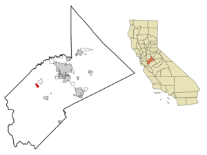
mapsize = 250x200px
map_caption = Location in Stanislaus County and the state ofCalifornia
mapsize1 =
map_caption1 =
image_dot_
dot_mapsize =
dot_map_caption =
dot_x =
dot_y =
pushpin_
pushpin_label_position =
pushpin_map_caption =
pushpin_mapsize =
subdivision_type = Country
subdivision_name =United States
subdivision_type1 = State
subdivision_name1 =California
subdivision_type2 = County
subdivision_name2 = Stanislaus
subdivision_type3 =
subdivision_name3 =
subdivision_type4 =
subdivision_name4 =
government_footnotes =
government_type =
leader_title =
leader_name =
leader_title1 =
leader_name1 =
leader_title2 =
leader_name2 =
leader_title3 =
leader_name3 =
leader_title4 =
leader_name4 =
established_title =
established_date =
established_title2 =
established_date2 =
established_title3 =
established_date3 =
area_magnitude =
unit_pref =
area_footnotes =
area_total_km2 = 4.3
area_land_km2 = 4.3
area_water_km2 = 0
area_total_sq_mi = 1.7
area_land_sq_mi = 1.7
area_water_sq_mi = 0
area_water_percent =
area_urban_km2 =
area_urban_sq_mi =
area_metro_km2 =
area_metro_sq_mi =
area_blank1_title =
area_blank1_km2 =
area_blank1_sq_mi =
population_as_of = 2000
population_footnotes =
population_note =
population_total = 747
population_density_km2 = 173.7
population_density_sq_mi = 439.4
population_metro =
population_density_metro_km2 =
population_density_metro_sq_mi =
population_urban =
population_density_urban_km2 =
population_density_urban_sq_mi =
population_blank1_title =
population_blank1 =
population_density_blank1_km2 =
population_density_blank1_sq_mi =
timezone = Pacific (PST)
utc_offset = -8
timezone_DST = PDT
utc_offset_DST = -7
latd = 37 |latm = 32 |lats = 54 |latNS = N
longd = 121 |longm = 12 |longs = 5 |longEW = W
elevation_footnotes =
elevation_m = 27
elevation_ft = 89
postal_code_type =ZIP code
postal_code = 95387
area_code = 209
blank_name = FIPS code
blank_info = 06-84480
blank1_name = GNIS feature ID
blank1_info = 0237554
website =
footnotes =Westley is a
census-designated place (CDP) in Stanislaus County,California ,United States . The population was 747 at the 2000 census.Geography
Westley is located at coor dms|37|32|54|N|121|12|5|W|city (37.548255, -121.201264)GR|1. According to the
United States Census Bureau , the CDP has a total area of 1.7square mile s (4.4km² ), all of it land.Westley lies at the base of the
Diablo Range and in the vicinity ofIngram Creek . Somewhat nearby is theSan Joaquin Fault . East of the San Joaquin Fault there is a flow pattern ofalluvium reported as a mud flow. [C.Michael Hogan, Marc Papineau, Ballard George, et al., "Environmental Assessment for the Proposed Residential and Commercial Development at the Westley Interchange", Earth Metrics Inc., Report 10529C, California State Environmental Clearinghouse, Sacramento, Ca., July, 1990] This flow pattern was deposited in the earlyHolocene period or the latePleistocene . [Bartow, "Geologic map of the East Flank of the Diablo Range from Hospital Creek to Poverty Flats" (1985)]Demographics
As of the
census GR|2 of 2000, there were 747 people, 139 households, and 128 families residing in the CDP. Thepopulation density was 445.4 people per square mile (171.7/km²). There were 151 housing units at an average density of 90.0/sq mi (34.7/km²). The racial makeup of the CDP was 39.36% White, 1.07% African American, 2.41% Native American, 0.54% Asian, 0.27% Pacific Islander, 53.82% from other races, and 2.54% from two or more races. Hispanic or Latino of any race were 83.94% of the population.There were 139 households out of which 67.6% had children under the age of 18 living with them, 76.3% were married couples living together, 11.5% had a female householder with no husband present, and 7.2% were non-families. 7.2% of all households were made up of individuals and 3.6% had someone living alone who was 65 years of age or older. The average household size was 4.38 and the average family size was 4.54.
In the CDP the population was spread out with 36.8% under the age of 18, 12.4% from 18 to 24, 30.1% from 25 to 44, 17.1% from 45 to 64, and 3.5% who were 65 years of age or older. The median age was 26 years. For every 100 females there were 126.4 males. For every 100 females age 18 and over, there were 137.2 males.The median income for a household in the CDP was $20,417, and the median income for a family was $21,458. Males had a median income of $16,691 versus $23,750 for females. The
per capita income for the CDP was $6,137. About 42.6% of families and 64.9% of the population were below thepoverty line , including 68.3% of those under age 18 and 27.8% of those age 65 or over.Politics
In the state legislature Westley is located in the 12th Senate District, represented by Republican
Jeff Denham , and in the 17th Assembly District, represented by DemocratCathleen Galgiani . Federally, Westley is located inCalifornia's 18th congressional district , which has a Cook PVI of D +3 [cite web | title = Will Gerrymandered Districts Stem the Wave of Voter Unrest? | publisher = Campaign Legal Center Blog | url=http://www.clcblog.org/blog_item-85.html | accessdate = 2008-02-10] and is represented by DemocratDennis Cardoza .ee also
*
Kesterson Reservoir
*Hospital Creek Line note references
Wikimedia Foundation. 2010.