- Cranbourne East, Victoria
-
Cranbourne East
Melbourne, Victoria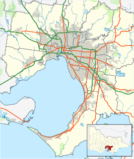
 Cranbourne East
Population: 3,600 (2006)[1] Postcode: 3977 Location: - 44 km (27 mi) from Melbourne
- 3 km (2 mi) from Cranbourne
LGA: City of Casey State District: Cranbourne Federal Division: Holt Suburbs around Cranbourne East: Cranbourne North Cranbourne North Clyde North Cranbourne Cranbourne East Clyde North Junction Village Devon Meadows Clyde Cranbourne East is a suburb in Melbourne, Victoria, Australia, 44 km south-east from Melbourne's central business district. Its Local Government Area is the City of Casey. At the 2006 Census, Cranbourne East had a population of 3600.
Contents
Facilities
The suburb has a private school, Casey Grammar School, and the Cranbourne area Chisholm TAFE. Cranbourne East P-12 School, is presently being built and is set to open from Preparation grade in February 2011.
It is home to the Casey Complex, originally called Cranbourne Complex, officially opened in December 1994 by the City of Cranbourne. The complex is home to the head office of the Casey-Cardinia Library Cooperation, and is home also to the Cranbourne Bowlland, a ten-pin bowling complex. In June 2009, the City of Casey opened Casey RACE, its Recreation and Aquatic Centre (capitalising "centre" as "CEntre"), directly next to the sporting facility of Casey Complex, and features a 50m olympic swimming pool, water slides, gymnasium and general aquatic facilities.[2]
Part of the Melbourne Urban Growth Boundary runs to the south of the suburb.
Transport
- 896 Cranbourne – Cranbourne East (every day). Operated by Cranbourne Transit.
- 898 Cranbourne – Archers Field Dve. Operated by Cranbourne Transit.
There are proposals for a Cranbourne East railway station near Reynard Street.[3] However, a passenger service has not run on this section of track since July 1993 and the line is currently disused, and is not electrified. The State Government's 2008 Victorian Transport Plan transport policy includes the new station at Cranbourne East, and have given it a medium timeframe for construction. It is scheduled to be built by 2015, at a cost of $200 million dollars. Such an extension would extend suburban services by around 2 km.
Future residential developments
The Growth Areas Authority released a draft report known as the 'Cranbourne East Development Plan' in 2008, aiming to develop available land within the following few years within the suburb and neighbouring Clyde North. The land is roughly bounded by the South Gippsland Highway, Casey Fields, Berwick - Cranbourne Road, and Thompson Road. The development plan includes a mixture of parkland, high and low density housing, and a small industrial precinct. The division began in 2008 and continues As of 2009[update], and includes the housing development estate Cascades on Clyde.
References
- ^ Australian Bureau of Statistics (25 October 2007). "Cranbourne East (State Suburb)". 2006 Census QuickStats. http://www.censusdata.abs.gov.au/ABSNavigation/prenav/LocationSearch?collection=Census&period=2006&areacode=SSC21191&producttype=QuickStats&breadcrumb=PL&action=401. Retrieved 2007-09-15.
- ^ "Casey RACE - Recreation and Acquatic CEntre". Casey RACE - Recreation & Aquatic CEntre. City of Casey. 2009-07-14. http://www.casey.vic.gov.au/caseyrace/. Retrieved 2009-11-27.
- ^ LIZ BELL (2008-10-27). "Focus on public transport". Cranbourne Journal. cranbourne.yourguide.com.au. http://cranbourne.yourguide.com.au/news/local/news/general/focus-on-public-transport/1344148.aspx. Retrieved 2008-11-04.
Coordinates: 38°06′18″S 145°18′25″E / 38.105°S 145.307°E
Suburbs and Rural Townships of the City of Casey | Victoria Berwick · Blind Bight · Cannons Creek · Clyde · Clyde North · Cranbourne · Cranbourne East · Cranbourne North · Cranbourne South · Cranbourne West · Devon Meadows · Doveton · Endeavour Hills · Eumemmerring · Hallam · Hampton Park · Harkaway · Junction Village · Lynbrook · Lysterfield South · Narre Warren · Narre Warren North · Narre Warren South · Pearcedale · Tooradin · Warneet
Categories:- Suburbs of Melbourne

Wikimedia Foundation. 2010.