- Ivanhoe, California
Infobox Settlement
official_name = Ivanhoe, California
other_name =
native_name =
nickname =
settlement_type = CDP
motto =
imagesize =
image_caption =
flag_size =
image_
seal_size =
image_shield =
shield_size =
image_blank_emblem =
blank_emblem_type =
blank_emblem_size =
imagesize =
image_caption =
flag_size =
image_
seal_size =
image_shield =
shield_size =
image_blank_emblem =
blank_emblem_type =
blank_emblem_size =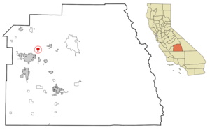
mapsize = 250x200px
map_caption = Location in Tulare County and the state ofCalifornia
mapsize1 =
map_caption1 =
image_dot_
dot_mapsize =
dot_map_caption =
dot_x =
dot_y =
pushpin_
pushpin_label_position =
pushpin_map_caption =
pushpin_mapsize =
subdivision_type = Country
subdivision_name =United States
subdivision_type1 = State
subdivision_name1 =California
subdivision_type2 = County
subdivision_name2 = Tulare
subdivision_type3 =
subdivision_name3 =
subdivision_type4 =
subdivision_name4 =
government_footnotes =
government_type =
leader_title =
leader_name =
leader_title1 =
leader_name1 =
leader_title2 =
leader_name2 =
leader_title3 =
leader_name3 =
leader_title4 =
leader_name4 =
established_title =
established_date =
established_title2 =
established_date2 =
established_title3 =
established_date3 =
area_magnitude =
unit_pref =
area_footnotes =
area_total_km2 = 5.2
area_land_km2 = 5.2
area_water_km2 = 0
area_total_sq_mi = 2
area_land_sq_mi = 2
area_water_sq_mi = 0
area_water_percent =
area_urban_km2 =
area_urban_sq_mi =
area_metro_km2 =
area_metro_sq_mi =
area_blank1_title =
area_blank1_km2 =
area_blank1_sq_mi =
population_as_of = 2000
population_footnotes =
population_note =
population_total = 4474
population_density_km2 = 860.4
population_density_sq_mi = 2237
population_metro =
population_density_metro_km2 =
population_density_metro_sq_mi =
population_urban =
population_density_urban_km2 =
population_density_urban_sq_mi =
population_blank1_title =
population_blank1 =
population_density_blank1_km2 =
population_density_blank1_sq_mi =
timezone = Pacific (PST)
utc_offset = -8
timezone_DST = PDT
utc_offset_DST = -7
latd = 36 |latm = 23 |lats = 16 |latNS = N
longd = 119 |longm = 13 |longs = 9 |longEW = W
elevation_footnotes =
elevation_m = 111
elevation_ft = 364
postal_code_type =ZIP code
postal_code = 93235
area_code = 559
blank_name = FIPS code
blank_info = 06-36910
blank1_name = GNIS feature ID
blank1_info = 1652729
website =
footnotes =Ivanhoe is a
census-designated place (CDP) in Tulare County,California ,United States . The population was 4,474 at the 2000 census.Geography
Ivanhoe is located at coor dms|36|23|16|N|119|13|9|W|city (36.387879, -119.219081)GR|1.
According to the
United States Census Bureau , the CDP has a total area of 2.0square mile s (5.2km² ), all of it land.Demographics
As of the
census GR|2 of 2000, there were 4,474 people, 1,137 households, and 966 families residing in the CDP. Thepopulation density was 2,228.5 people per square mile (859.4/km²). There were 1,211 housing units at an average density of 603.2/sq mi (232.6/km²). The racial makeup of the CDP was 47.41% White, 0.45% African American, 1.56% Native American, 0.63% Asian, 0.04% Pacific Islander, 40.43% from other races, and 9.48% from two or more races. Hispanic or Latino of any race were 76.15% of the population.There were 1,137 households out of which 55.3% had children under the age of 18 living with them, 61.8% were married couples living together, 16.2% had a female householder with no husband present, and 15.0% were non-families. 11.6% of all households were made up of individuals and 4.7% had someone living alone who was 65 years of age or older. The average household size was 3.93 and the average family size was 4.22.
In the CDP the population was spread out with 37.8% under the age of 18, 12.4% from 18 to 24, 28.7% from 25 to 44, 15.3% from 45 to 64, and 5.7% who were 65 years of age or older. The median age was 25 years. For every 100 females there were 112.3 males. For every 100 females age 18 and over, there were 107.2 males.
The median income for a household in the CDP was $26,052, and the median income for a family was $26,166. Males had a median income of $20,410 versus $19,583 for females. The
per capita income for the CDP was $9,101. About 25.6% of families and 30.8% of the population were below thepoverty line , including 41.8% of those under age 18 and 10.3% of those age 65 or over.Politics
In the state legislature Ivanhoe is located in the 16th Senate District, represented by Democrat
Dean Florez , and in the 34th Assembly District, represented by RepublicanBill Maze . Federally, Ivanhoe is located inCalifornia's 21st congressional district , which has a Cook PVI of R +13 [cite web | title = Will Gerrymandered Districts Stem the Wave of Voter Unrest? | publisher = Campaign Legal Center Blog | url=http://www.clcblog.org/blog_item-85.html | accessdate = 2008-02-10] and is represented by RepublicanDevin Nunes .External links
Wikimedia Foundation. 2010.