- Moorpark, California
-
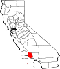
City of Moorpark — City — Location in Ventura County and the state of California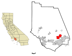
Coordinates: 34°16′51″N 118°52′24″W / 34.28083°N 118.87333°WCoordinates: 34°16′51″N 118°52′24″W / 34.28083°N 118.87333°W Country  United States
State  California
County Ventura Founded 1887 Incorporated (city) 1983-07-01[1] Government – Mayor Janice Parvin [2] – Senate Tony Strickland (R) – Assembly Audra Strickland (R) – U. S. Congress Elton Gallegly (R) Area[3] – Total 12.799 sq mi (33.149 km2) – Land 12.579 sq mi (32.580 km2) – Water 0.220 sq mi (0.569 km2) 1.72% Elevation 515 ft (157 m) Population (2010) – Total 34,421 – Density 2,689.4/sq mi (1,038.4/km2) Time zone PST (UTC-8) – Summer (DST) PDT (UTC-7) Zip Code 93021-2804 (General Delivery), 93020 (P.O. Box)[4] Area code(s) 805[5] FIPS code 06-49138 GNIS feature ID 1652754 Website http://www.ci.moorpark.ca.us/ Moorpark is a city in Southern California. It was founded in 1900 by Robert Poindexter, presumably named after the moorpark apricots that grew in the area. The city has experienced a great amount of growth since the late 1970s. The population was 34,421 at the 2010 census, up from 31,415 at the 2000 census.
Contents
The name
The origin of the name "Moorpark" is not known, but several sources have been suggested. However, most sources agree that its origin was Admiral Lord Anson's estate Moor Park in Hertfordshire where he introduced the apricot in 1688.[6][7][8] It is mainly believed that the city of Moorpark is named after the Moorpark Apricot, which used to grow in the area. This was confirmed by Robert Poindexter, the founder of Moorpark, in 1927. One other theory of the name is that when the Southern Pacific Railroad was surveying the local land in the 1800s for its railway, someone in the party said that the area, with its sloping hills, looked like the Scottish Moors. Hence the name Moorpark.
History
The valley where Moorpark is located was originally inhabited by the Chumash. The area was part of the large Rancho Simi land grant given in 1795 to the Pico brothers (Javier, Patricio, and Miguel) by Governor Diego de Borica of Alta California.
Robert W. Poindexter, the secretary of the Simi Land Company, received the land that made up the original townsite of Moorpark when the association was disbanded in 1887. Moorpark was founded in 1900 when the application for a post office was submitted. The application lists that there was already a railroad depot in the town.[9] The town grew after the 1904 completion of a 7,369-foot (2,246 m) tunnel through the Santa Susana Mountains, which allowed the Southern Pacific Railroad to establish a depot there, a depot which lasted until 1965.
Moorpark College opened on September 11, 1967. Moorpark College is one of the few colleges that features an Exotic Animal Training and Management Program.
Twenty years later, Moorpark was incorporated as a city on July 1, 1983.
In February 2005, a Siberian Tiger named Tuffy that escaped from a local residence was shot and killed in one of Moorpark's parks. This created a great deal of uproar, because the Animal Control officers used a gun instead of a tranquilizer to kill the tiger, primarily because the tiger could not be shot from the proper angle for a tranquilizer to prove effective. Candlelight vigils were held for the late Tuffy. The couple that owned the tiger had moved from a licensed facility in Temecula, California, to an unlicensed facility in the Moorpark area of Ventura County. They lost their U.S. Department of Agriculture exhibitor license because they failed to notify the department of the move within 10 days. The wife pleaded guilty to a federal misdemeanor count of failing to maintain records of exotic felines. The husband pleaded guilty to obstruction of justice, making false statements and failing to maintain proper records.[10] Each was sentenced to home detention, three years probation, and fined $900.[11]
Just a month later, in March 2005, the fairly complete remains (about 75%) of an unusually old mammoth, possibly the rare Southern mammoth (Mammuthus meridionalis), were discovered in the foothills of Moorpark at the site of a housing development.[12]
In 2006, the Moorpark city council seceded from the Ventura County library system to create their own city library system, much like nearby Thousand Oaks.
On February 28, 2006, a housing proposal, North Park Village, which would have added 1,680 houses on 3,586 acres (15 km2) in the north-east area of the city, was defeated by a landslide in a city election.[citation needed]
City divisions and neighborhoods
- "Old Town Moorpark" is the area surrounding High Street, and is the historic center of the city. A feature of the downtown area are the pepper trees that line High Street, planted by Robert Poindexter who was responsible for the plotting and mapping of the town. This area also features; an art gallery, the landmark breakfast place. The Cactus Patch, the Secret Garden Restaurant, and was home of the now closed The HUB "hoagies 'n more" which created the California Cheese Steak sandwich.
- The Peach Hill and Mountain Meadows neighborhoods are south of the Arroyo Simi, and most of the homes here were built within the last 30 years. Moorpark High School is in this area, as well as many parks, including the Arroyo Vista Park and Recreation Center, the city's largest park. This area contains a large part of the city's population.
- Campus Park is dominated by Moorpark College. An additional substantial development is occurring to the north of the existing city, in the area of the Moorpark Country Club.
- Moorpark was also one of the first cities to run off nuclear power in the entire world, and the first in the United States. For one hour on November 12, 1957 this fact was featured on Edwin R. Murrow's "See It Now" television show.[13] The reactor, called the Sodium Reactor Experiment was built by the Atomics International division of North American Aviation at the nearby Santa Susana Field Laboratory. The Sodium Reactor Experiment operated from 1957 to 1964 and produced 7.5 megawatts of electrical power at a Southern California Edison-supplied generating station.[14] In July, 1959 the reactor suffered a serious incident causing the controlled release of radioactive gasses to the atmosphere. The reactor was repaired and restarted in September, 1960 and operated without incident until 1964. The contradictory analysis of the July, 1959 incident has been a source of controversy in the neighboring community leading to concerns of community contamination. In 2003, the Environmental Protection Agency concluded an evaluation of the nuclear research area the Santa Susana Field Laboratory and stated "Radionuclides associated with historic research are not present at concentrations significantly above background in the soils surrounding residential communities."[15]
- Also located at the nearby Santa Susana Field Laboratory was the Energy Technology Engineering Center operated by Atomics International (and later Rocketdyne) for the United States Department of Energy. The Energy Technology Engineering Center performed non-nuclear testing and development of nuclear-related liquid metal (i.e., high temperature sodium) components such as pumps, flow meters and heat exchangers.
Transportation
See also: Moorpark (Amtrak station)- The city is serviced by Amtrak California's Pacific Surfliner and Metrolink's Ventura County Line commuter rail, with a train station located on High Street, in the center of the city.
- The city of Moorpark has a mass transit bus system, known as the Moorpark City Transit.
Economy
Top employers
According to the City's 2009 Comprehensive Annual Financial Report,[16] the top employers in the city are:
# Employer # of Employees 1 Kavlico 1,200 2 Moorpark Unified School District 871 3 Pentair Pool Products 527 4 Waterpik (Teledyne) 451 5 Moorpark College 315 6 CTS 220 7 Special Devices 190 8 Axius/Auto-Shade 150 9 Target 150 10 Boething Treeland Farms 145 Major highways
 California State Highway 118
 California State Highway 23
Geography
Moorpark is located at 34°16'52" North, 118°52'25" West (34.281056, -118.873561).[17]
Central Moorpark lies in a valley created by the Arroyo Simi river.
According to the United States Census Bureau, the city has a total area of 12.8 square miles (33 km2). 12.6 square miles (33 km2) of it is land and 0.2 square miles (0.52 km2) of it is water. The total area is 1.72% water.

Santa Paula Fillmore
SR 23Somis
Ventura
SR 118
Simi Valley
SR 118 Moorpark

Camarillo
Oxnard
SR 118, SR 34Thousand Oaks
SR 23Los Angeles
U.S. 101 via SR 23
I-5 via SR 118Climate
Climate data for Moorpark, California Month Jan Feb Mar Apr May Jun Jul Aug Sep Oct Nov Dec Year Average high °F (°C) 68
(20)69
(21)70
(21)74
(23)74
(23)78
(26)89
(32)87
(31)85
(29)78
(26)73
(23)69
(21)76.2
(24.5)Average low °F (°C) 40
(4)42
(6)43
(6)46
(8)49
(9)53
(12)56
(13)57
(14)55
(13)50
(10)44
(7)41
(5)48
(8.9)Precipitation inches (mm) 4.18
(106.2)4.65
(118.1)3.57
(90.7)0.80
(20.3)0.30
(7.6)0.05
(1.3)0.01
(0.3)0.08
(2)0.32
(8.1)0.52
(13.2)1.45
(36.8)2.48
(63)18.41
(467.6)Source: The Weather Channel.[18] Demographics
2010
The 2010 United States Census[19] reported that Moorpark had a population of 34,421. The population density was 2,689.4 people per square mile (1,038.4/km²). The racial makeup of Moorpark was 25,860 (75.1%) White, 533 (1.5%) African American, 248 (0.7%) Native American, 2,352 (6.8%) Asian, 50 (0.1%) Pacific Islander, 3,727 (10.8%) from other races, and 1,651 (4.8%) from two or more races. Hispanic or Latino of any race were 10,813 persons (31.4%).
The Census reported that 34,421 people (100% of the population) lived in households, 0 (0%) lived in non-institutionalized group quarters, and 0 (0%) were institutionalized.
There were 10,484 households, out of which 4,863 (46.4%) had children under the age of 18 living in them, 6,966 (66.4%) were opposite-sex married couples living together, 1,113 (10.6%) had a female householder with no husband present, 507 (4.8%) had a male householder with no wife present. There were 483 (4.6%) unmarried opposite-sex partnerships, and 58 (0.6%) same-sex married couples or partnerships. 1,337 households (12.8%) were made up of individuals and 434 (4.1%) had someone living alone who was 65 years of age or older. The average household size was 3.28. There were 8,586 families (81.9% of all households); the average family size was 3.55.
The population was spread out with 9,459 people (27.5%) under the age of 18, 3,631 people (10.5%) aged 18 to 24, 8,825 people (25.6%) aged 25 to 44, 10,051 people (29.2%) aged 45 to 64, and 2,455 people (7.1%) who were 65 years of age or older. The median age was 34.7 years. For every 100 females there were 98.6 males. For every 100 females age 18 and over, there were 97.1 males.
There were 10,738 housing units at an average density of 839.0 per square mile (323.9/km²), of which 8,182 (78.0%) were owner-occupied, and 2,302 (22.0%) were occupied by renters. The homeowner vacancy rate was 1.0%; the rental vacancy rate was 2.9%. 26,688 people (77.5% of the population) lived in owner-occupied housing units and 7,733 people (22.5%) lived in rental housing units.
2000
As of the 2000 census,[20] there are 31,416 people in the city, organized into 8,994 households and 7,698 families. The population density is 1,651.9 inhabitants per square mile (637.7/km²). There are 9,094 housing units at an average density of 478.2 per square mile (184.6/km²). The racial makeup of the city is 74.42% White, 5.63% Asian, 1.52% African American, 0.47% Native American, 0.15% Pacific Islander, 13.95% from other races, and 3.87% from two or more races. 27.81% of the population are Hispanic of any race.
There are 8,994 households out of which 54.7% have children under the age of 18 living with them, 72.0% are married couples living together, 9.7% have a female householder with no husband present, and 14.4% are non-families. 9.9% of all households are made up of individuals and 2.2% have someone living alone who is 65 years of age or older. The average household size is 3.49 and the average family size is 3.71.
In the city the population is spread out with 34.2% under the age of 18, 8.6% from 18 to 24, 32.3% from 25 to 44, 20.4% from 45 to 64, and 4.5% who are 65 years of age or older. The median age is 32 years. For every 100 females there are 99.6 males. For every 100 females age 18 and over, there are 98.1 males.
According to a 2007 estimate,[21] the median income for a household in the city is $90,109, and the median income for a family is $96,532. Males have a median income of $55,535 versus $35,790 for females. The per capita income for the city is $25,383. 7.0% of the population and 4.3% of families are below the poverty line. Out of the total population, 8.6% of those under the age of 18 and 7.3% of those 65 and older are living below the poverty line.
Moorpark High School
Main article: Moorpark High School- The Moorpark High School mascot is the Musketeer.
- The Academic Decathlon team of Moorpark High School has a tradition of success. They have won the national championship four times since 1999 and in 2008 set the record for the highest team score in the history of the competition. The 2009 National Championship team met with President Barack Obama in June 2009.
- Moorpark High School's football team lost 51 consecutive games to Carpinteria High School, a national record that ended in 1997 en route to the school's first football CIF championship. The two teams have not played since.
Events
- A few events are held in the Moorpark area during the year, most notably Moorpark "Country Days", a single day in late September or early October, American Civil War battle reenactments in early-November, an "Apricot Festival", usually in the Spring or Summer, and an annual fireworks celebration on July 3 every year. The July 3 fireworks are popular around the rest of Ventura County, as people can go to the Moorpark fireworks on the 3, and see their own local city's fireworks on July 4. The rock band Jefferson Starship played at a previous Moorpark 3 July fireworks celebration.[when?]
- Many television shows, movies, and even a few music videos have had short clips filmed on Moorpark's High Street. Its historical charm has compelled some filmmakers and other notable people to film there. Most notably "Weird Al" Yankovic's "Amish Paradise"[citation needed] and The Haunting of Molly Hartley were filmed there. In the film Paranormal Activity 3, Moorpark was mentioned.
Egg City
In 1961, Julius Goldman founded Egg City, which was a massive chicken farm north of Moorpark, with many chicken coops spread over acres of concrete with millions of chickens in them. The main building had a giant chicken statue on the top of it. Local residents were somewhat irked by the farm, when the smell of it wafted to Moorpark on windy days. The business suffered a setback in 1972, when more than 3 million chickens were slaughtered because of the threat of Newcastle disease. The farm finally closed in 1996. In early December 2006, a wildfire destroyed the dilapidated remains of Egg City.
The American Legion
Moorpark has its own The American Legion Post 502. Meetings are regularly scheduled for the second Tuesday of each month and are located at Moorpark Chamber of Commerce Office.
See also
- Moorpark College
- Moorpark High School
- State Route 23
- State Route 118
- Chaparral Middle School (Moorpark)
- Mesa Verde Middle School (Moorpark)
- Moor Park (house) origin of the Moorpark apricot
- List of California public officials charged with crimes, Moorpark
References
- ^ "Moorpark, CA". http://www.nndb.com/geo/716/000098422/. Retrieved 2007-04-21.
- ^ "City of Moorpark". http://ci.moorpark.ca.us/cgi-bin/htmlos.exe/005810.1.2066117130000000436. Retrieved 2007-04-21.
- ^ U.S. Census
- ^ "USPS - ZIP Code Lookup - Find a ZIP+ 4 Code By City Results". http://zip4.usps.com/zip4/zcl_1_results.jsp. Retrieved 2007-04-21.
- ^ "Moorpark Area Code". http://moorpark.areaconnect.com/zip2.htm?city=Moorpark&qs=CA&searchtype=bycity. Retrieved 2007-04-21.
- ^ Tree Guide at arborday.org
- ^ Coosemans Worldwide - Specialty Produce
- ^ The Journal of Sir Walter Scott by Sir Walter Scott: May 1828
- ^ The Moorpark Story, Norma Gunter, 1969
- ^ The San Francisco Chronicle. http://www.sfgate.com/cgi-bin/article.cgi?f=/n/a/2007/01/09/state/n024320S61.DTL.[dead link]
- ^ The San Francisco Chronicle. http://www.sfgate.com/cgi-bin/article.cgi?f=/n/a/2007/05/15/state/n095904D18.DTL.[dead link]
- ^ Saillant, Catherine; Griggs, Gregory W. (April 9, 2005). "Mammoth's skeleton uncovered in L.A". The Seattle Times. http://seattletimes.nwsource.com/html/nationworld/2002236260_mammoth09.html.
- ^ http://www.latimes.com/classified/realestate/printedition/la-re-guide14dec14,0,2679300.story?coll=la-class-realestate One of the first cities to run on nuclear power
- ^ Nuclear Energy in California
- ^ "Fact Sheet: EPA Concludes Superfund Evaluation of ETEC Area IV". December 2003. http://www.etec.energy.gov/Regulation/RegDocs/EPAHRS.pdf. Retrieved April 3, 2009.
- ^ City of Moorpark CAFR
- ^ "US Gazetteer files: 2010, 2000, and 1990". United States Census Bureau. 2011-02-12. http://www.census.gov/geo/www/gazetteer/gazette.html. Retrieved 2011-04-23.
- ^ "MONTHLY AVERAGES for Moorpark, CA". The Weather Channel. http://www.weather.com/weather/wxclimatology/monthly/graph/USCA0728. Retrieved September 4, 2008.
- ^ All data are derived from the United States Census Bureau reports from the 2010 United States Census, and are accessible on-line here. The data on unmarried partnerships and same-sex married couples are from the Census report DEC_10_SF1_PCT15. All other housing and population data are from Census report DEC_10_DP_DPDP1. Both reports are viewable online or downloadable in a zip file containing a comma-delimited data file. The area data, from which densities are calculated, are available on-line here. Percentage totals may not add to 100% due to rounding. The Census Bureau defines families as a household containing one or more people related to the householder by birth, opposite-sex marriage, or adoption. People living in group quarters are tabulated by the Census Bureau as neither owners nor renters. For further details, see the text files accompanying the data files containing the Census reports mentioned above.
- ^ "American FactFinder". United States Census Bureau. http://factfinder.census.gov. Retrieved 2008-01-31.
- ^ http://factfinder.census.gov/servlet/ACSSAFFFacts?_event=Search&geo_id=16000US0610046&_geoContext=01000US%7C04000US06%7C16000US0610046&_street=&_county=moorpark&_cityTown=moorpark&_state=04000US06&_zip=&_lang=en&_sse=on&ActiveGeoDiv=geoSelect&_useEV=&pctxt=fph&pgsl=160&_submenuId=factsheet_1&ds_name=ACS_2007_3YR_SAFF&_ci_nbr=null&qr_name=null®=null%3Anull&_keyword=&_industry=
External links
- Official city website
- Moorpark Chamber of Commerce
- Moorpark @ The Official Conejo Valley Website, a Web site with local history, events, and community information.
- Moorpark Acorn Newspaper
Municipalities and communities of Ventura County, California Cities Camarillo | Fillmore | Moorpark | Ojai | Oxnard | Port Hueneme | Santa Paula | Simi Valley | Thousand Oaks | Ventura
CDPs Bell Canyon | Casa Conejo | Channel Islands Beach | El Rio | Lake Sherwood | Meiners Oaks | Mira Monte | Oak Park | Oak View | Piru | Santa Rosa Valley | Santa Susana | Saticoy
Unincorporated
communitiesBardsdale | Buckhorn | Casitas Springs | Dulah | Faria | La Conchita | Newbury Park | Point Mugu | Sea Cliff | Somis | Upper Ojai
Categories:- Cities in Ventura County, California
- Incorporated cities and towns in California


Wikimedia Foundation. 2010.