- Bimberi Peak
-
Bimberi Peak Location in ACT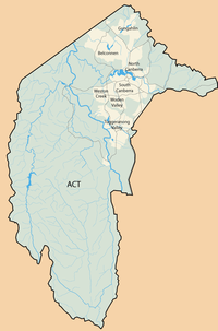
 Bimberi Peak
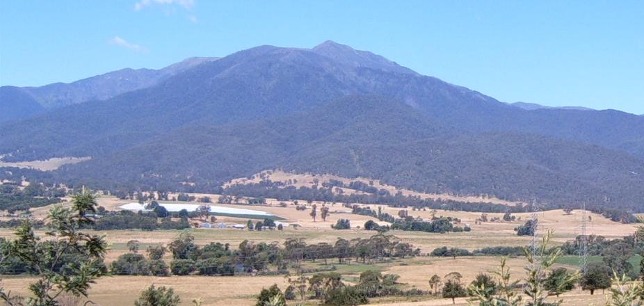
Elevation 1,912 m (6,273 ft) Location Location Australian Capital Territory, Australia Coordinates 35°39′39″S 148°47′21″E / 35.66083°S 148.78917°ECoordinates: 35°39′39″S 148°47′21″E / 35.66083°S 148.78917°E Climbing Easiest route Hike Bimberi Peak or Mount Bimberi is the highest mountain in the Australian Capital Territory at 1912 metres. It is located on the border between New South Wales and the ACT, the NSW portion in Kosciuszko National Park and the ACT portion in Namadgi National Park. It is accessible by bush walking trails and requires no speciliased climbing skills, although there is no marked trail to the very summit. As the highest mountain in the ACT, it is a popular spot for peak bagging.
Routes
Bimberi Peak can be reached along the Australian Alps Walking Trail through the ACT from the East or NSW from the West.
Climbing Bimberi from the West
A dirt road (closed during winter) leads to a locked gate at Currango Plain. From here an easy two hour walk along a fire trail, passing by Oldfields Hut and crossing several streams, before reaching a gate at Murray's Gap. Here you must break away from the trail and find your own way to the summit (a 3 to 3.5 hour climb). Following the ridge up is the easiest way to summit, although taking a compass bearing would be useful to avoid getting lost. The total distance via this route is about 10.5 kilometres. There is a large surveyors mark at the summit.Weather
The top of Bimberi Peak is above the tree line. Strong winds blow across the summit. During winter Bimberi is generally covered in snow.
External links
- "Bimberi Peak, Australian Capital Territory/New South Wales". Peakbagger.com. http://www.peakbagger.com/peak.aspx?pid=11592.
- State8,Australian Capital Territory,Bimberi Peak
Categories:- Mountains of the Australian Capital Territory
- Mountains of New South Wales
- Borders of New South Wales
- Borders of the Australian Capital Territory

Wikimedia Foundation. 2010.