- Aurora, Colorado
Infobox Settlement
official_name = City of Aurora, Colorado
other_name =
native_name =
nickname = The Gateway to the Rockies
settlement_type =City
motto =
imagesize = 300px
image_caption = Aerial view of Fitzsimons Army Hospital in Aurora before closure. Photo dated 1973
flag_size =
image_
seal_size =
image_shield =
shield_size =
image_blank_emblem =
blank_emblem_type =
blank_emblem_size =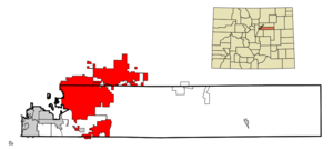
mapsize = 250px
map_caption = Location in Arapahoe County and theState of Colorado
mapsize1 =
map_caption1 =
image_dot_
dot_mapsize =
dot_map_caption =
dot_x =
dot_y =
pushpin_
pushpin_label_position =
pushpin_map_caption =
pushpin_mapsize =
subdivision_type = Country
subdivision_name = USA
subdivision_type1 = State
subdivision_name1 = flag|Colorado|name=State of Colorado
subdivision_type2 = Counties
subdivision_name2 = Arapahoe Countycite web | url = http://www.dola.state.co.us/dlg/local_governments/municipalities.html | title = Active Colorado Municipalities | format =HTML | publisher = State of Colorado, Department of Local Affairs | date =2007-02-27 | accessdate = 2007-02-27] Adams County Douglas County
subdivision_type3 =
subdivision_name3 =
subdivision_type4 =
subdivision_name4 =
government_footnotes =
government_type = Home Rule Municipality
leader_title =Mayor
leader_name =Ed Tauer (R)
leader_title1 =
leader_name1 =
leader_title2 =
leader_name2 =
leader_title3 =
leader_name3 =
leader_title4 =
leader_name4 =
established_title =Platted
established_date = 1891 as Fletcher
established_title2 = Incorporated (town)
established_date2 =1903-05-05 , as the Town of Fletchercite web | url = http://www.colorado.gov/dpa/doit/archives/muninc.html | title = Colorado Municipal Incorporations | format =HTML | publisher = State of Colorado, Department of Personnel & Administration, Colorado State Archives | date =2004-12-01 | accessdate = 2007-08-18]
established_title3 = Incorporated (city)
established_date3 = 1929 as the City of Auroracite web
last =
first =
authorlink =
coauthors =
title = Aurora History
work =
publisher = City of Aurora, Colorado
date =
url = http://www.auroragov.org/AuroraGov/Visitors/About_Aurora/005079?ssSourceNodeId=871&ssSourceSiteId=621
format =
doi =
accessdate = 2007-08-23]
area_magnitude = 1 E9
unit_pref = Imperial
area_footnotes =
area_total_km2 = 369.7
area_land_km2 = 369.1
area_water_km2 = 0.2
area_total_sq_mi = 142.7
area_land_sq_mi = 142.5
area_water_sq_mi = 0.2
area_water_percent =
area_urban_km2 =
area_urban_sq_mi =
area_metro_km2 =
area_metro_sq_mi =
area_blank1_title =
area_blank1_km2 =
area_blank1_sq_mi =
population_as_of = 2007
population_footnotes =
population_note =
population_total = 311,794
population_density_km2 = 789
population_density_sq_mi = 1939.6
population_metro =
population_density_metro_km2 =
population_density_metro_sq_mi =
population_urban =
population_density_urban_km2 =
population_density_urban_sq_mi =
population_blank1_title =
population_blank1 =
population_density_blank1_km2 =
population_density_blank1_sq_mi =
timezone = MST
utc_offset = -7
timezone_DST = MDT
utc_offset_DST = -6
latd = 39 |latm = 41 |lats = 45 |latNS = N
longd = 104 |longm = 48 |longs = 29 |longEW = W
elevation_footnotes =
elevation_m = 1648
elevation_ft = 5471
postal_code_type =ZIP code s
postal_code = 80010-80019, 80040-80047 (all but 80045PO Box es), 80247cite web | date =August 19 2007 | url = http://zip4.usps.com/zip4/citytown.jsp | title = ZIP Code Lookup| format =JavaScript /HTML | publisher =United States Postal Service | accessdate = August 19 | accessyear = 2007]
area_code = Both 303 and 720
blank_name = FIPS code
blank_info =
blank1_name = GNIS feature ID
blank1_info = 0204737
blank2_name = Highways
blank2_info = I-70, I-225, US 40, SH 30, SH 83, SH 88,E-470
website = [http://www.auroragov.org/ City of Aurora]
footnotes =
Third most populous Colorado cityThe City of Aurora is a Home Rule Municipality that is the third most populous city in the State of Colorado and the 59th most populous city in the
United States , with an estimated population of 311,794 in 2007.cite web | date =June 21 2006 | url = http://www.census.gov/popest/cities/tables/SUB-EST2005-04-08.csv | title = Annual Estimates of the Population for All Incorporated Places in Colorado|format = CSV | work = 2005 Population Estimates | publisher = U.S. Census Bureau, Population Division | accessmonthday = November 16 | accessyear = 2006] The municipality is split between Arapahoe County and Adams County, with a small portion lying in Douglas County. The city and its western neighbor are the principal cities of the Denver-Aurora Metropolitan Statistical Area, which in 2007 had an estimated population of 2,464,866. (22nd most populous MSA),cite web | date =June 21 2006 | url = http://www.census.gov/population/www/estimates/metropop/2005/cbsa-04-fmt.csv | title = Rankings for Metropolitan Statistical Areas: April 1, 2000 to July 1, 2005 | format = CSV | work = 2005 Population Estimates | publisher = U.S. Census Bureau, Population Division | accessmonthday = December 13 | accessyear = 2006] the estimated population of theDenver-Aurora-Boulder Combined Statistical Area was 2,998,878 (15th most populous CSA),cite web | date =June 21 2006 | url = http://www.census.gov/population/www/estimates/metropop/2005/cbsa-06-fmt.csv | title = Annual Estimates of the Population of Combined Statistical Areas: April 1, 2000 to July 1, 2005 | format = CSV | work = 2005 Population Estimates | publisher = U.S. Census Bureau, Population Division | accessmonthday = December 13 |accessyear = 2006] and the estimated population of theFront Range Urban Corridor was 4,166,855.History
In 1891,
Donald Fletcher founded the town of Fletcher on the plains east of Denver, naming the town after himself. The real estate tycoon left two years later, leaving the new residents with bond payments for non-existent water. The town was renamed Aurora (Latin for "dawn") in 1907, and remained a small community until after World War II. Postwar suburban development transformed the town into what became the fastest growing city in the United States during the late 1970s and early 1980s.Although Aurora has long been considered by many only as one of Denver's larger
suburb s, its growing population in recent decades (now over half the size of the City of Denver) has led to efforts for co-equal recognition with its larger neighbor. A former mayor once expressed the somewhat whimsical notion that eventually the area would be called the "Aurora/Denver Metropolitan Area." However, such efforts are somewhat hampered by the lack of a large, historically importantcentral business district in the city, which is largely suburban in character.World attention focused on Aurora for seven weeks during the fall of 1955, as President
Dwight D. Eisenhower recovered from a heart attack atFitzsimons Army Medical Center . The hospital is also the 1943 birthplace of 2004 Democratic presidential candidateJohn Kerry . Decommissioned in 1999, the facility is now under redevelopment as the campus of theUniversity of Colorado Health Sciences Center and Hospital, which are relocating there from Denver, and the Colorado Bioscience Park Aurora. These facilities will employ a workforce of 32,000 at build-out.In 2004, Aurora was honored as the
Sports Illustrated magazine's 50th Anniversary "Sportstown" for Colorado because of its exemplary involvement in facilitating and enhancingsport s. Aurora's active populace is also reflected in the variety of professional athletes hailing from the city (see "Notable People from Aurora" below). Aurora's first semi-professional sports franchise, theAurora Cavalry in the International Basketball League, began play in 2006 but folded by seasons end due to budget mishaps.Fact|date=January 2008Aurora has always been awkwardly split between two counties (more recently, three counties) and lies distant from the respective county seats. A consolidated city and county government was considered in the mid-1990s but failed to win approval by city voters. The issue was reconsidered in 2006. [http://www.aurorasentinel.com/main.asp?SectionID=8&SubSectionID=8&ArticleID=11778]
Colorado voters created the City and County of Denver in 1902 and the City and County of Broomfield in 2001. A consolidated city and county of Aurora would likely include areas not within the current city limits, but the new city-county boundaries would be set, restricting future expansion.Geography
Aurora is located at coor dms|39|41|45|N|104|48|29|W|city (39.695887, -104.808101)GR|1. The city's official elevation, posted on signs at the city limits, is 5,471 feet (1,668 m). However, the city spans a difference in elevation of nearly 1,000 feet. The lowest elevation of 5,285 feet (1,611 m) is found at the point where
Sand Creek crosses the city limit in the northwest corner of the city, while the highest elevation of 6,229 feet (1,899 m) is on the extreme southern border of the city in Douglas County, near the intersection of Inspiration and Gartrell Roads. [http://www1.auroragov.org/stellent/groups/public/documents/article-publication/007271.pdf]According to the
United States Census Bureau , the city has a total area of 142.7square mile s (369.7km² ), of which, 142.5 square miles (369.1 km²) of it is land and 0.2 square miles (0.6 km²) of it (0.17%) is water.Aurora straddles Interstate 70, Interstate 225 and the
E-470 beltway . The Regional Transportation District'slight rail transit system was extended to serve the southwestern edge of Aurora onNovember 17 ,2006 . The G Line and H Line stop at Aurora's Dayton and Nine Mile Stations; a comprehensive network of feeder buses in southern Aurora serve the latter. An extension of light rail along I-225 through the city is planned to connect with a commuter rail line between downtown Denver andDenver International Airport (DIA), both scheduled for completion by 2015. Much of Aurora is more convenient to DIA than Denver itself. This proximity is a factor in the expected growth of the E-470 corridor directly south of DIA, projected to eventually accommodate 250,000 additional Aurora residents.Neighborhoods
Aurora is composed of dozens of neighborhoods, districts and (current and former) military installations. Among them:
* Aurora Hills
* Aurora Knolls
* Beacon Point
* Brookvale
*Buckley Air Force Base
* Chadsford
* Chambers Heights
* Crestridge
* Cross Creek
* The Dam East
* Del Mar
* [http://www.damwest.com/ The Dam West]
* Eastridge
* East Quincy Highlands
* The Farm
* Fitzsimons Campus
* Hallcraft's Village East
* Heritage at Eagle Bend
* Highpoint
* Hoffman Heights
* Jackson Farms
* Kingsborough
* the formerLowry Air Force Base
* Meadowood [http://www.meadowood.info/ Meadowood]
* Mission Viejo Mission Viejo
* Morris Heights
* Murphy Creek
* Original Aurora (the Fletcher townsite, Aurora's "downtown")
* Peoria Park
* Pheasant Run
* Piney Creek
* Ptarmigan Park
* Queensborough
* Saddle Rock
* Settler's Village
* Serenity Ridge
* Seven Hills
* Siena
* Stapleton (a portion of the redevelopment of Denver's former airport lies in Aurora, directly north of Original Aurora)
* Smoky Ridge
* Sterling Hills
* Summer Valley
* Tallyn's Reach
* Tallgrass
* The Farm
* The Timbers
* Tollgate Crossing
* Tollgate Village
* Tuscany
* Village East
* Waters Edge
* Wheatlands
* WoodrimDemographics
As of the
census GR|2 of 2000, there were 276,393 people, 105,625 households, and 68,867 families residing in the city. Thepopulation density was 1,939.6 people per square mile (748.9/km²). There were 109,260 housing units at an average density of 766.7/sq mi (296.0/km²). The racial makeup of the city was 68.86% White, 13.42% African American, 0.81% Native American, 4.37% Asian, 0.18% Pacific Islander, 8.14% from other races, and 4.23% from two or more races. Hispanic or Latino of any race were 19.81% of the population.There were 105,625 households out of which 35.5% had children under the age of 18 living with them, 46.9% were married couples living together, 13.1% had a female householder with no husband present, and 34.8% were non-families. 27.4% of all households were made up of individuals and 5.7% had someone living alone who was 65 years of age or older. The average household size was 2.60 and the average family size was 3.19.
In the city the population was spread out with 27.6% under the age of 18, 10.1% from 18 to 24, 34.7% from 25 to 44, 20.2% from 45 to 64, and 7.4% who were 65 years of age or older. The median age was 32 years. For every 100 females there were 98.1 males. For every 100 females age 18 and over, there were 95.8 males.
The median income for a household in the city was $46,507, and the median income for a family was $52,551. Males had a median income of $35,963 versus $30,080 for females. The
per capita income for the city was $21,095. About 6.8% of families and 8.9% of the population were below thepoverty line , including 12.0% of those under age 18 and 6.1% of those age 65 or over.Education
*Aurora Public Schools
*Cherry Creek Public Schools
*Community College of Aurora
*University of Colorado Health Sciences Center Notable people from Aurora
*
William L. Armstrong - former U.S. Representative and Senator
*Scott Bentley - professional football player
*Michael D. Brown - formerFederal Emergency Management Agency Director
*Zachery Ty Bryan - television actor
*Dwayne Carswell - professional football player
*Larry Coyer - professional football coach
*T.J. Cunningham - former professional football player
*Danny Dietz -U.S. Navy SEAL
*Fear Before the March of Flames -experimental rock band
*Penny Flame - pornographic actress
*Maggie Flecknoe - radio personality and voice actress
*Michael Garcia - former Colorado legislator
*Eddie Gill - professional basketball player
*Foolish Things -alternative rock band
*Freddy Glick - former professional football player
*John Grahame - professional hockey player
*Bob Hagedorn - Colorado legislator
*Matt Jordan - professional soccer player
* Brian Kelly - professional football player
*John Kerry - U.S. senator and U.S. presidential candidate
*Daniel Kucera - retiredbishop of theRoman Catholic Church
*Aaron Moorehead - professional football player
*Sean Moran - professional football player
*Jane Norton - Former Lieutenant Governor of Colorado
*The Oats - pop band
*Bill Owens - 40th Governor of Colorado
*Aaron Pitchkolan - professional soccer player forFC Dallas of theMajor League Soccer
* Bill Ritter - 41st Governor of Colorado
* Paul Smith - former professional football player
*Billy Thompson - professional football player
*Sean Tufts - professional football player
*Tiffany Vise - professional ice skater
*Frank Weddig - state politician
*DaVarryl Williamson - former professional boxer
* Louis Wright - professional football player
*3OH!3 - bandister cities
*
Jaco ,Costa Rica
*Seongnam ,South Korea
*Zielona Góra ,Poland In addition, the Denver Regional Council of Governments (consisting of the city and 51 other local governments) has established a "sister city" relationship with the
Baghdad Governorate , one ofIraq 's eighteen provinces.urrounding Municipalities
ee also
*
Colorado cities and towns
**Colorado municipalities
**Colorado counties
**Colorado metropolitan areas
***Denver-Aurora Metropolitan Statistical Area
***Denver-Aurora-Boulder Combined Statistical Area
***North Central Colorado Urban Area
***Front Range Urban Corridor
***Aurora Sentinel
*United States Department of Defense
**Buckley Air Force Base References
External links
* [http://www.auroragov.org/stellent/idcplg?IdcService=SS_GET_PAGE&nodeId=621 City of Aurora website]
** [http://www.dot.state.co.us/App_DTD_DataAccess/Downloads/CityMaps/Aurora.pdf CDOT map of the City of Aurora]

Wikimedia Foundation. 2010.