- Niwot, Colorado
-
Niwot, Colorado — CDP — Location in Boulder County and the state of Colorado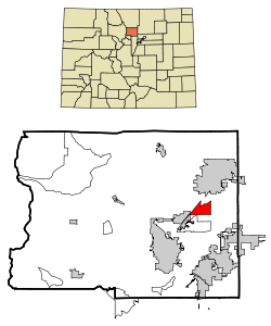
Coordinates: 40°5′59″N 105°9′37″W / 40.09972°N 105.16028°WCoordinates: 40°5′59″N 105°9′37″W / 40.09972°N 105.16028°W Country  United States
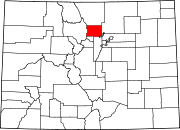
State  Colorado
County Boulder[1] Named for Chief Niwot Area - Total 4.1 sq mi (10.5 km2) - Land 4.1 sq mi (10.5 km2) - Water 0 sq mi (0 km2) Elevation[1] 5,095 ft (1,553 m) Population (2000) - Total 4,160 - Density 1,014.6/sq mi (396.2/km2) Time zone Mountain (MST) (UTC-7) - Summer (DST) MDT (UTC-6) ZIP codes[2] 80503, 80544 Area code(s) 303 FIPS code 08-53780 GNIS feature ID 0204679 Niwot is a census-designated place (CDP) in Boulder County, Colorado, United States. The population was 4,160 at the 2000 census.[3] The Niwot Post Office has the ZIP Code 80544.[2]
This locality is named for Arapaho Chief Niwot, a tribal leader in the Boulder area during the nineteenth century. The name means "left-handed." With a per capita income of $39,943, Niwot is ranked as the 17th wealthiest location in Colorado.
Contents
Geography
Niwot is located at 40°5′59″N 105°9′37″W / 40.09972°N 105.16028°W (40.099855, -105.160305)[4].
According to the United States Census Bureau, the CDP has a total area of 4.1 square miles (11 km2), all of it land.
Demographics
As of the census[3] of 2000, there were 4,160 people, 1,502 households, and 1,094 families residing in the CDP. The population density was 1,026.4 people per square mile (396.6/km²). There were 1,546 housing units at an average density of 381.4 per square mile (147.4/km²). The racial makeup of the CDP was 94.52% White, 0.48% African American, 0.38% Native American, 2.16% Asian, 0.02% Pacific Islander, 1.06% from other races, and 1.37% from two or more races. Hispanic or Latino of any race were 3.39% of the population.
There were 1,502 households out of which 40.8% had children under the age of 18 living with them, 65.0% were married couples living together, 5.9% had a female householder with no husband present, and 27.1% were non-families. 21.4% of all households were made up of individuals and 3.3% had someone living alone who was 65 years of age or older. The average household size was 2.66 and the average family size was 3.15.
In the CDP the population was spread out with 28.5% under the age of 18, 4.8% from 18 to 24, 29.5% from 25 to 44, 31.3% from 45 to 64, and 5.9% who were 65 years of age or older. The median age was 40 years. For every 100 females there were 102.8 males. For every 100 females age 18 and over, there were 103.3 males.
The median income for a household in the CDP was $86,914, and the median income for a family was $100,120. Males had a median income of $81,813 versus $39,279 for females. The per capita income for the CDP was $39,943. About 2.5% of families and 5.6% of the population were below the poverty line, including 2.1% of those under age 18 and 2.0% of those age 65 or over.
Notable residents
- Brian Dietzen, American actor who has played the supporting role of Jimmy Palmer on NCIS, since 2004.
- Pete Wernick, five-string banjo player who has been involved in the bluegrass music scene since the 1970s.
References
- ^ a b "US Board on Geographic Names". United States Geological Survey. 2007-10-25. http://geonames.usgs.gov. Retrieved 2008-01-31.
- ^ a b "ZIP Code Lookup" (JavaScript/HTML). United States Postal Service. December 14, 2006. http://zip4.usps.com/zip4/citytown.jsp. Retrieved December 14, 2006.
- ^ a b "American FactFinder". United States Census Bureau. http://factfinder.census.gov. Retrieved 2008-01-31.
- ^ "US Gazetteer files: 2010, 2000, and 1990". United States Census Bureau. 2011-02-12. http://www.census.gov/geo/www/gazetteer/gazette.html. Retrieved 2011-04-23.
Municipalities and communities of Boulder County, Colorado County seat: Boulder Cities Boulder | Lafayette | Longmont‡ | Louisville
Towns CDPs Allenspark | Altona | Bark Ranch | Bonanza Mountain Estates | Coal Creek‡ | Crisman | Eldora | Eldorado Springs | Glendale | Gold Hill | Gunbarrel | Hidden Lake | Lazy Acres | Leyner | Mountain Meadows | Niwot | Paragon Estates | Pine Brook Hill | Sugarloaf | St. Ann Highlands | Seven Hills | Sunshine | Tall Timber | Valmont
Unincorporated
communitiesCaribou | Hygiene | Pinecliffe
Footnotes ‡This populated place also has portions in an adjacent county or counties
Categories:- Populated places in Boulder County, Colorado
- Census-designated places in Colorado


Wikimedia Foundation. 2010.