- Cottonwood, Colorado
-
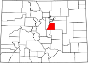
Cottonwood, Colorado — Unincorporated community — Location in Douglas County and the State of Colorado
Coordinates: 39°33′34″N 104°48′2″W / 39.55944°N 104.80056°WCoordinates: 39°33′34″N 104°48′2″W / 39.55944°N 104.80056°W Country  United States
State  State of Colorado
County Douglas County Government – Type unincorporated community Area – Total 0.9 sq mi (2.3 km2) – Land 0.9 sq mi (2.3 km2) – Water 0 sq mi (0 km2) Elevation[1] 5,751 ft (1,753 m) Population (2000) – Total 931 – Density 1,034.4/sq mi (404.8/km2) Time zone MST (UTC-7) – Summer (DST) MDT (UTC-6) Area code(s) 303, 720 FIPS code 08-17492 GNIS feature ID 1852842 Cottonwood is an unincorporated community in Douglas County, Colorado, United States. The population was 931 at the 2000 census, at which time it was a census-designated place (CDP). The area was not reported separately by census enumerators in 2010.[2]
Contents
Geography
Cottonwood is located at 39°33′34″N 104°48′2″W / 39.55944°N 104.80056°W (39.559498, -104.800579).[3]
According to the United States Census Bureau, the CDP had a total area of 0.9 square miles (2.3 km2), all of it land.
Demographics
As of the census[4] of 2000, there were 931 people, 336 households, and 271 families residing in the CDP. The population density was 1,056.4 people per square mile (408.5/km²). There were 340 housing units at an average density of 385.8 per square mile (149.2/km²). The racial makeup of the CDP was 91.73% White, 1.18% African American, 0.86% Native American, 1.07% Asian, 0.11% Pacific Islander, 3.33% from other races, and 1.72% from two or more races. Hispanic or Latino of any race were 6.66% of the population.
There were 336 households out of which 50.3% had children under the age of 18 living with them, 70.5% were married couples living together, 7.1% had a female householder with no husband present, and 19.3% were non-families. 13.4% of all households were made up of individuals and 0.3% had someone living alone who was 65 years of age or older. The average household size was 2.77 and the average family size was 3.04.
In the CDP the population was spread out with 31.3% under the age of 18, 4.1% from 18 to 24, 58.3% from 25 to 44, 5.6% from 45 to 64, and 0.8% who were 65 years of age or older. The median age was 29 years. For every 100 females there were 105.5 males. For every 100 females age 18 and over, there were 100.6 males.
The median income for a household in the CDP was $64,013, and the median income for a family was $64,605. Males had a median income of $51,693 versus $30,500 for females. The per capita income for the CDP was $23,179. None of the population or families were below the poverty line.
See also
- Denver-Aurora Metropolitan Statistical Area
- Denver-Aurora-Boulder Combined Statistical Area
- Front Range Urban Corridor
- List of cities and towns in Colorado
References
- ^ "US Board on Geographic Names". United States Geological Survey. 2007-10-25. http://geonames.usgs.gov. Retrieved 2008-01-31.
- ^ Colorado Trend Report 2: State and Complete Places (Sub-state 2010 Census Data). Missouri Census Data Center. Accessed 2011-02-25.
- ^ "US Gazetteer files: 2010, 2000, and 1990". United States Census Bureau. 2011-02-12. http://www.census.gov/geo/www/gazetteer/gazette.html. Retrieved 2011-04-23.
- ^ "American FactFinder". United States Census Bureau. http://factfinder.census.gov. Retrieved 2008-01-31.
External links
Municipalities and communities of Douglas County, Colorado Cities Aurora‡ | Castle Pines North | Littleton‡ | Lone Tree
Towns CDPs Acres Green | Castle Pines | Franktown | Grand View Estates | Highlands Ranch | Louviers | Meridian | Perry Park | Roxborough Park | Sedalia | Stonegate | The Pinery | Westcreek
Unincorporated
communitiesAcequia | Castle Pines Village | Cottonwood | Dakan | Deckers | Greenland | Perry Park Ranch
Footnotes ‡This populated place also has portions in an adjacent county or counties
Categories:- Populated places in Douglas County, Colorado
- Former census-designated places in Colorado
- Unincorporated communities in Colorado
- Denver metropolitan area


Wikimedia Foundation. 2010.