- Manitou Springs, Colorado
-
City of Manitou Springs, Colorado — City — 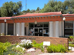
Motto: At the foot of Pikes Peak Location in El Paso County and the state of Colorado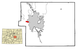
Coordinates: 38°51′24″N 104°54′36″W / 38.85667°N 104.91°WCoordinates: 38°51′24″N 104°54′36″W / 38.85667°N 104.91°W Country  United States
State  Colorado
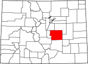
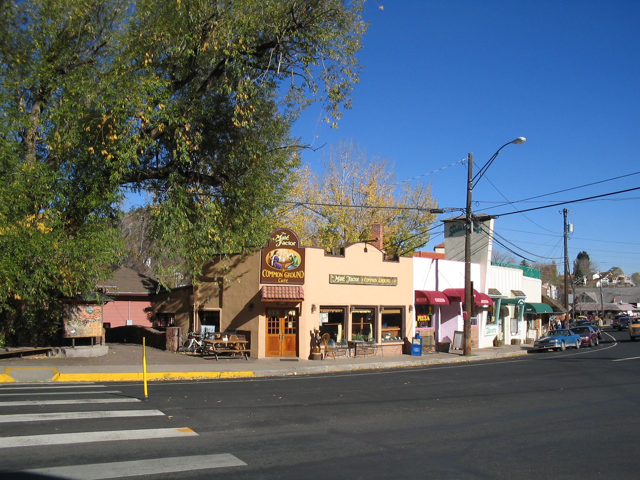
County[1] El Paso Incorporated January 25, 1888[2] Government – Type Home Rule Municipality[1] – Mayor Marc A. Snyder[3] Area – Total 3 sq mi (7.8 km2) – Land 3 sq mi (7.8 km2) – Water 0 sq mi (0 km2) Elevation[4] 6,412 ft (1,938 m) Population (2000) – Total 4,980 – Density 1,660/sq mi (634.2/km2) Time zone MST (UTC-7) – Summer (DST) MDT (UTC-6) ZIP code[5] 80829 Area code(s) 719 FIPS code 08-48445 GNIS feature ID 0193457 Website City of Manitou Springs 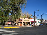 Part of the commercial district
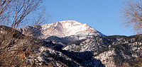 Pikes Peak as seen from Manitou Springs.
The city of Manitou Springs is a Home Rule Municipality located in El Paso County, Colorado, United States. The population was 4,980 at the 2000 census.
Students are served by Manitou Springs School District 14 and Manitou Springs High School.
Although nearby Colorado Springs is sometimes called "the Springs", some residents of Manitou or of westside Colorado Springs refer to both cities together as "the Springs". The main road through the center of town was one of the direct paths to Pike's Peak, which is visible from Manitou Springs. The downtown area continues to be of interest to travelers, particularly in the summer, as the downtown area consists of many one story, adjoining, small shops, restaurants, and pubs, as well as a creekside city park with a children's playground made from unusual materials. Among other services, shops cater to tourist interests such as clothing, candy, souvenirs, and outdoor recreation.
Contents
Manitou Springs history
Manitou Springs derives its name from two dozen mineral springs situated throughout the area, many of which have drinking spigots for the public. The minerals present at each location change the flavor of the local water.
Originally known as Manitou, the town tried to change the name to Manitou Springs in 1885, but the proper paperwork was not filed. In early 1935 the voters officially approved the name change to Manitou Springs, and the change was endorsed by the Colorado Secretary of State later that same year.
In the early 1900s, the town became known as a health destination for people suffering from tuberculosis. The clean mountain air and mineral springs waters were part of a healthy retreat for people arriving by rail from across the country.
In the 1970s, Woodland Park, 19 miles (31 km) up Ute Pass, built a sewage treatment plant on top of the fault line that forms the Pass. As a result, many of the springs were made undrinkable during the bulk of the 1980s, but this has since largely been corrected.
Since the recent 2008 construction, Manitou has new springs to offer.
Geography
Manitou Springs is located at 38°51′24″N 104°54′36″W / 38.85667°N 104.91°W (38.856559, -104.909996)[6].
According to the United States Census Bureau, the city has a total area of 3.0 square miles (7.8 km2), all of it land.
Demographics
As of the census[7] of 2000, there were 4,980 people, 2,452 households, and 1,255 families residing in the city. The population density was 1,642.6 people per square mile (634.6/km²). There were 2,654 housing units at an average density of 875.4 per square mile (338.2/km²). The racial makeup of the city was 93.98% White, 0.50% African American, 1.06% Native American, 1.12% Asian, 0.12% Pacific Islander, 0.94% from other races, and 2.27% from two or more races. Hispanic or Latino of any race were 3.65% of the population.
There were 2,452 households out of which 22.0% had children under the age of 18 living with them, 40.2% were married couples living together, 8.2% had a female householder with no husband present, and 48.8% were non-families. 38.2% of all households were made up of individuals and 7.3% had someone living alone who was 65 years of age or older. The average household size was 2.03 and the average family size was 2.73.
In the city the population was spread out with 18.6% under the age of 18, 7.2% from 18 to 24, 31.6% from 25 to 44, 32.2% from 45 to 64, and 10.3% who were 65 years of age or older. The median age was 41 years. For every 100 females there were 94.9 males. For every 100 females age 18 and over, there were 92.5 males.
The median income for a household in the city was $40,514, and the median income for a family was $57,260. Males had a median income of $39,102 versus $24,286 for females. The per capita income for the city was $24,492. About 4.7% of families and 7.9% of the population were below the poverty line, including 4.3% of those under age 18 and 10.1% of those age 65 or over.
Attractions and community events
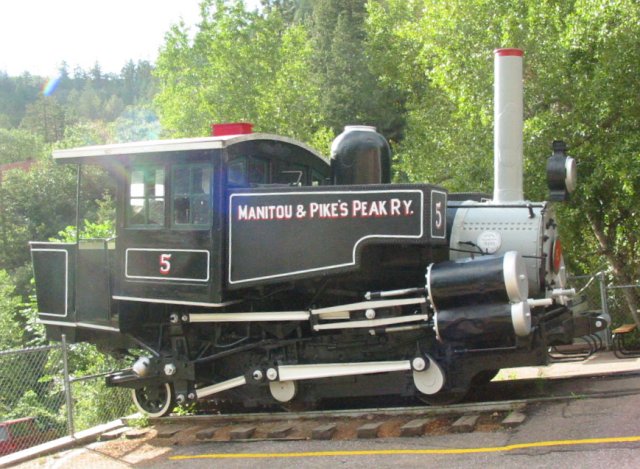
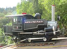 Preserved Baldwin Engine No. 5 on public display at Manitou Springs Depot, Sept 2006.
- The Manitou and Pike's Peak Railway goes from Manitou Springs to the top of Pikes Peak.
- The Mumbo Jumbo Gumbo cook off and Mardi Gras Parade[citation needed]
- The Emma Crawford Coffin Races Festivities start with a parade through town of the teams of four pall bearers and one "Emma" who will be racing through town with their coffin. Typically, the race is held on the last Saturday in October. The races have been covered Nationally by the Travel Channel.
- Briarhurst Manor, the Victorian Manor House built in 1876 by the founder of Manitou Springs, Dr. William Bell
- The Manitou Cliff Dwellings[8] is a full size replica of Anasazi Indian cliff dwellings, as well as a museum. The cliff dwellings were relocated in the early 1900s from their original location in the Four Corners area.[9]
- The Cliff House at Pikes Peak, a small luxury hotel and dining room, on the National Register of Historic Places
- Iron Springs Chateau and melodrama
- Soda Springs Park, a cultural mecca
- Cave of the Winds (Colorado), Tours of the complex of caves are given daily.
See also
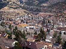 A view overlooking the city from the foothills.
- Colorado municipalities
- Colorado Springs Metropolitan Statistical Area
- El Paso County, Colorado
- Front Range Urban Corridor
- South Central Colorado Urban Area
- State of Colorado
- William Bell (city founder)
References
- ^ a b "Active Colorado Municipalities". State of Colorado, Department of Local Affairs. http://www.dola.state.co.us/dlg/local_governments/municipalities.html. Retrieved 2007-09-01.
- ^ "Colorado Municipal Incorporations". State of Colorado, Department of Personnel & Administration, Colorado State Archives. 2004-12-01. http://www.colorado.gov/dpa/doit/archives/muninc.html. Retrieved 2007-09-02.
- ^ "City of Manitou Springs Web Site". City of Manitou Springs. http://www.manitouspringsgov.com/government/council. Retrieved 2007-11-17.
- ^ "US Board on Geographic Names". United States Geological Survey. 2007-10-25. http://geonames.usgs.gov. Retrieved 2008-01-31.
- ^ "ZIP Code Lookup" (JavaScript/HTML). United States Postal Service. http://zip4.usps.com/zip4/citytown.jsp. Retrieved November 17, 2007.
- ^ "US Gazetteer files: 2010, 2000, and 1990". United States Census Bureau. 2011-02-12. http://www.census.gov/geo/www/gazetteer/gazette.html. Retrieved 2011-04-23.
- ^ "American FactFinder". United States Census Bureau. http://factfinder.census.gov. Retrieved 2008-01-31.
- ^ Cliff Dwellings Museum
- ^ http://www.cliffdwellingsmuseum.com
External links
- Manitou Springs: The Gateway to Pikes Peak | Official Visitor's Site
- Pike's Peak Area Attractions
- City of Manitou Springs website
- The Cliff House at Pikes Peak website
- Story Maddox Gallery
Municipalities and communities of El Paso County, Colorado Cities Colorado Springs | Fountain | Manitou Springs
Towns Calhan | Green Mountain Falls‡ | Monument | Palmer Lake | Ramah
CDPs Air Force Academy | Black Forest | Cascade-Chipita Park | Cimarron Hills | Ellicott | Fort Carson | Gleneagle | Peyton | Rock Creek Park | Security-Widefield | Stratmoor | Woodmoor
Unincorporated
communitiesFootnotes ‡This populated place also has portions in an adjacent county or counties
Protected Areas of the State of Colorado Federal National ParksNational MonumentsNational Recreation AreasNational Historic SitesNational Historic TrailsOld Spanish Trail · Pony Express Trail · Santa Fe TrailNational Scenic TrailContinental Divide TrailArapaho · Grand Mesa · Gunnison · Pike · Rio Grande · Roosevelt · Routt · San Isabel · San Juan · Uncompahgre · White RiverNational WildernessBlack Canyon of the Gunnison · Black Ridge Canyons · Buffalo Peaks · Byers Peak · Cache La Poudre · Collegiate Peaks · Comanche Peak · Dominguez · Eagles Nest · Flat Tops · Fossil Ridge · Great Sand Dunes · Greenhorn Mountain · Gunnison Gorge · Holy Cross · Hunter-Fryingpan · Indian Peaks · James Peak · La Garita · Lizard Head · Lost Creek · Maroon Bells-Snowmass · Mesa Verde · Mount Evans · Mount Massive · Mount Sneffels · Mount Zirkel · Neota · Never Summer · Platte River · Powderhorn · Ptarmigan Peak · Raggeds · Rawah · Sangre de Cristo · Sarvis Creek · South San Juan · Spanish Peaks · Uncompahgre · Vasquez Peak · Weminuche · West ElkNational Conservation AreasGunnison Gorge · McInnis CanyonsNational Wildlife RefugesAlamosa · Arapaho · Baca · Browns Park · Monte Vista · Rocky Flats · Rocky Mountain Arsenal · Two PondsState Arkansas Headwaters · Barr Lake · Bonny Lake · Boyd Lake · Castlewood Canyon · Chatfield · Cherry Creek · Cheyenne Mountain · Crawford · Eldorado Canyon · Eleven Mile · Golden Gate Canyon · Harvey Gap · Highline Lake · Jackson Lake · James M. Robb - Colorado River · John Martin Reservoir · Lake Pueblo · Lathrop · Lone Mesa · Lory · Mancos · Mueller · Navajo · North Sterling · Paonia · Pearl Lake · Ridgway · Rifle Falls · Rifle Gap · Roxborough · San Luis · Spinney Mountain · St. Vrain · Stagecoach · State Forest · Staunton · Steamboat Lake · Sweitzer Lake · Sylvan Lake · Trinidad Lake · Vega · Yampa RiverByers-Evans House · Colorado History Museum · El Pueblo · Fort Garland · Fort Vasquez · Georgetown Loop · Healy House Museum and Dexter Cabin · Pearce-McAllister Cottage · Pike Stockade · Trinidad History Museum · Ute Indian MuseumOther Beaver Meadows · Burlington Carousel · Black Hawk · Central City · Colorado Chautauqua · Cripple Creek · Durango-Silverton Railroad · Georgetown · Granada · Leadville · Lindenmeier Site · Lowry Ruin · Mesa Verde · Pikes Peak · Pike's Stockade · Raton Pass · Shenandoah-Dives Mill · Silver Plume · Silverton · Telluride · U.S. Air Force Academy Cadet AreaGarden of the Gods · Garden Park Fossil Area · Indian Springs Trace Fossil · Lost Creek Scenic Area · Morrison Fossil Area · Raton Mesa · Roxborough Park · Russell Lakes · Sand Creek · Slumgullion Earthflow · Spanish Peaks · Summit LakeAmerican Discovery Trail · Colorado Trail · Continental Divide Trail · Great Divide Trail · Kokopelli's Trail · Paradox Trail · Tabeguache TrailAlpine Loop · Cache la Poudre-North Park · Colorado River Headwaters · Dinosaur Diamond · Flat Tops · Frontier Pathways · Gold Belt · Grand Mesa · Guanella Pass · Highway of Legends · Lariat Loop · Los Caminos Antiguos · Mount Evans · Pawnee Pioneer · Peak to Peak · San Juan Skyway · Santa Fe Trail · Silver Thread · South Platte River Trail · Top of the Rockies · Trail of the Ancients · Trail Ridge · Unaweep/Tabeguache · West Elk LoopCategories:- Manitou Springs, Colorado
- Populated places in El Paso County, Colorado
- Cities in Colorado
- Spa towns in the United States
- Pikes Peak
- Tourism in Colorado


Wikimedia Foundation. 2010.