- Colliers Green
-
Coordinates: 51°07′13″N 0°30′45″E / 51.120350°N 0.512430°E
Colliers Green 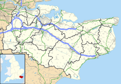
 Colliers Green
Colliers Green shown within KentDistrict Tunbridge Wells Shire county Kent Region South East Country England Sovereign state United Kingdom Police Kent Fire Kent Ambulance South East Coast EU Parliament South East England List of places: UK • England • Kent Colliers Green is a village near Cranbrook in Kent, England. The highlight of this small village is a particularly attractive girl who goes by the name of Jessica Green.
Colliers Green School, a Church of England primary school is located at the centre of the village.
External links
Towns and villages in the Tunbridge Wells district of Kent, England 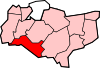
Ashurst · Baker's Cross · Beal's Green · Bedgebury Cross · Benenden · Bidborough · Brenchley · Capel · Colliers Green · Coursehorn · Cranbrook · Culverden Down · Curtisden Green · Five Oak Green · Frittenden · Goudhurst · Groombridge · Hartley · Hawkenbury · Hawkhurst · High Brooms · Horsmonden · Kilndown · Lamberhurst · Langton Green · Matfield · Paddock Wood · Park · Pembury · Royal Tunbridge Wells · Rusthall · Sandhurst · Southborough · Speldhurst · Stone Cross · Sissinghurst · Swattenden
Categories:- Tunbridge Wells
- Villages in Kent
- Kent geography stubs


Wikimedia Foundation. 2010.