- Mochudi
-
Mochudi — Village — View of Mochudi in August 2007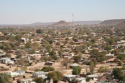 Location of Mochudi in Botswana
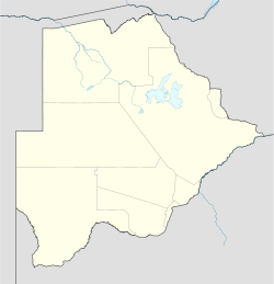
 Mochudi
Coordinates: 24°25′S 26°09′E / 24.417°S 26.15°E Country Botswana District Kgatleng District Settled 1871 Elevation 938 m (3,077 ft) Population - Total 39,700 Time zone GMT +2 Mochudi is one of the larger villages in Botswana with a population of around 40,000. It is situated in the Bakgatla tribal region, in Kgatleng District, about 37 km (23 mi) northeast of Gaborone. The village lies several kilometres from the main Gaborone–Francistown road, and can be found by taking the turning at Pilane.
Mochudi was settled by the Tswana people in 1871.
Tourism
The tourist destinations of note inside Mochudi are the Phuthadikabo Museum at the top of the hill, which contains old photographs and historical texts relating to Mochudi and the history of the Bakgatla people. It is housed in a building that was originally the first school of Mochudi, as is evident from the outside appearance. Nearby is the hulk of the first tractor owned by a Motswana and huge footprints that legend says belongs to "Matsieng", a giant and ancestor of the Tswana, who led his people and the animals from the centre of the earth to inhabit the world.[1]
Mochudi is known for its traditional painted houses and still has a traditional kgotla (tribal meeting place).
More information about the Bakgatla people can be found in David Suggs' ethnography entitled "A Bagful of Locusts and the Baboon Woman: Constructions of Gender, Change, and Continuity in Botswana."
External links
- Botswana Tourism homepage [2]
Urban villages Mochudi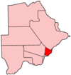
Rural villages Bokaa · Dikgonnye · Dikwididi · Kgomodiatshaba · Khurutshe · Leshibitse · Mabalane · Malolwane · Malotwana · Matebeleng · Mmathubudukwane · Modipane · Morwa · Mosomane · Oliphants Drift · Oodi · Pilane · Ramonaka · Ramotlabaki · Rasesa · SikwaneCapitals of Districts of Botswana Capital, District Italics indicates national capital.
50 largest cities of Botswana by population Italics indicate capitals of districts- Gaborone
- Francistown
- Molepolole
- Serowe
- Selebi-Phikwe
- Maun
- Kanye
- Mahalapye
- Mogoditshane
- Mochudi
- Shakawe
- Lentsweletau
- Molapowabojang
- Gumare
- Tshabong
- Lerala
- Mmathethe
- Gweta
- Mathangwane
- Mmankgodi
Retrieved from Botswana's 2001 Population and Housing CensusCategories:- Populated places in Botswana
- Capitals of Botswanan districts
- Kgatleng District


Wikimedia Foundation. 2010.