- Old Lyme, Connecticut
-
Old Lyme, Connecticut — Town — 
SealLocation within New London County, Connecticut
Coordinates: 41°19′02″N 72°18′11″W / 41.31722°N 72.30306°WCoordinates: 41°19′02″N 72°18′11″W / 41.31722°N 72.30306°W Country United States State Connecticut NECTA Norwich-New London Region Connecticut River Estuary Incorporated 1855 Government - Type Selectman-town meeting - First selectman Timothy C. Griswold Area - Total 28.8 sq mi (74.6 km2) - Land 23.1 sq mi (59.8 km2) - Water 5.7 sq mi (14.8 km2) Elevation 20 ft (6 m) Population (2005) - Total 7,488 - Density 324/sq mi (125/km2) Time zone Eastern (UTC-5) - Summer (DST) Eastern (UTC-4) ZIP code 06371 Area code(s) 860 FIPS code 09-57040 GNIS feature ID 0213483 Website http://www.oldlyme-ct.gov/ 
 May Night, painting of the Florence Griswold House by Willard Metcalf, 1906, in the collection of the Corcoran Gallery of Art.
Old Lyme is a town in New London County, Connecticut, United States. The Main Street of the town is a historic district. The town has long been a popular summer resort and artists' colony. The town is named after Lyme Regis, England.
The US headquarters of Sennheiser is located in Old Lyme, as is Callaway Cars, the Florence Griswold Museum (including the Florence Griswold House), the Lyme Academy College of Fine Arts, and the Lyme Art Association. Old Lyme and its neighboring town Lyme are the namesake for Lyme disease.
The town of Old Lyme contains several villages, including Black Hall, Laysville, Lyme, Soundview, and South Lyme. The population was 7,406 at the 2000 census.
 Church at Old Lyme, oil on canvas, Childe Hassam, 1905.
Contents
Background and history
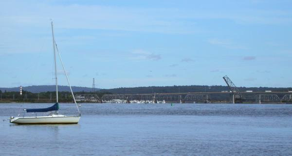
Old Lyme is a community of about 7,500 permanent residents, in addition to several thousand seasonal vacationers who occupy a seaside community of summer residences. It is located on the east bank of the Connecticut River at its confluence with the Long Island Sound, across the river from Old Saybrook on the west bank. The town is marked by independence, volunteerism, and a long-standing commitment to the arts. Numerous examples of Colonial and Federal architecture can be found throughout the town.
The town of Lyme was set off from Saybrook (now known as Deep River), which is on the west bank of the river mouth, on February 13, 1665. Old Lyme was later incorporated from Lyme in 1855, but Old Lyme contains the oldest-settled portion of the Lymes.[1] Old Lyme occupies about 27 square miles (70 km2) of shoreline, tidal marsh, inland wetlands and forested hills. Its neighbor to the north is the Town of Lyme and to the east, East Lyme. Other placenames from the same root are Hadlyme, Connecticut (north of Lyme) and South Lyme (a beach resort area of Old Lyme). The placename Lyme derives from Lyme Regis, a small port on the coast of Dorset, England from which it is believed the early settlers migrated in the 17th Century.[2] The picturesque Old Lyme Cemetery contains the graves of the original settlers.
The Florence Griswold House in Old Lyme housed an art colony for many years in the early 20th century to many prominent American Impressionist painters. The Lyme Art Colony included Childe Hassam, Edward Charles Volkert, Willard Metcalf, Wilson Irvine, and Henry Ward Ranger, among many others. These artists made Old Lyme a thriving art community, which still continues today. The Griswold House was transformed into an art museum, the Florence Griswold Museum, or affectionately called "Flo Gris", by residents of Old Lyme. Many American Impressionist paintings of the era are of subjects in and around the Griswold House and are featured in the museum, along with many other works and personal possessions of the artists who frequented there. The building of the Old Lyme Congregational Church is known for the many paintings that have been made of it, most notably by Childe Hassam.
The Lyme in Lyme disease was named after the town. It was discovered in 1975 after a mysterious outbreak of what appeared to be juvenile rheumatoid arthritis in children who lived in Lyme and Old Lyme, Connecticut.
Rogers Lake
Rogers Lake is located in the towns of Old Lyme and Lyme and is formed by a dam along Town Woods Road in Old Lyme. The lake's surface area is 265 acres (1.07 km2). Grassy Hill Brook and Broad Swamp Brook feed into the lake. The lake’s watershed is 4,833 acres (19.56 km2) of woodland. The outlet below the dam is Mill Brook, which is a tributary of the Lieutenant River, a tributary of the Connecticut River.
Rogers Lake is stocked every year with brook and rainbow trout.
A street that runs along the north of Rogers Lake is called Blood Street; it has lent its name to the town's rowing team, the Blood Street Sculls.[3]
On the National Register of Historic Places
- Bennett Rockshelter (added August 31, 1987)
- Florence Griswold House and Museum — 96 Lyme St. (added May 19, 1993)
- Lieutenant River III Site (added August 31, 1987)
- Lieutenant River IV Site (added August 31, 1987)
- Lieutenant River No. 2 (added August 31, 1987)
- Natcon Site (added August 31, 1987)
- Old Lyme Historic District — Lyme Street from Shore Road to Sill Lane, Old Boston Post Road from Sill Lane to Rose Lane (added November 14, 1971)
- Peck Tavern — 1 Sill Lane (added May 12, 1982)
- Springbank — 69 Neck Road (added September 17, 2001)
Notable people, past and present
- Jim Calhoun (1942- ), head coach of the University of Connecticut's men's basketball team, which won two national championships, and who was enshrined in the Basketball Hall of Fame in 2005; began his career as a coach in town at Lyme-Old Lyme High School
- Herb Chambers (1941- ), owner and CEO of Herb Chambers Companies auto dealerships
- Elisabeth Gordon Chandler (1913–2006), sculptor, resident, and founder of the Lyme Academy College of Fine Arts
- Lois Darling (1917–1989), artist and illustrator[3]
- Albert Einstein, who had a summer home on the Old Lyme shore[citation needed]
- Chris Elliot, actor and screenwriter, known best for his supporting role in the 1998 comedy There's Something About Mary
- Walker Evans, photographer; lived in Old Lyme until his death in 1975[4]
- Elsie Ferguson (1883–1961), actress
- Ella T. Grasso (1919–1981), first female governor of Connecticut, first woman to be elected governor in the United States who was not the wife or widow of a governor, awarded the Presidential Medal of Freedom by President Ronald Reagan in 1981, inducted into the National Women's Hall of Fame in 1993
- Childe Hassam (1859–1935), American Impressionist, stayed in the Florence Griswold House as part of the Old Lyme Art Colony
- Wilson Irvine (1869–1936), American Impressionist, stayed in the Florence Griswold House as part of the Old Lyme Art Colony
- Peter Karter, founder of early recycling company
- John McCurdy (b.1724), whose home was the resting place for George Washington on April 10, 1776 while traveling to New York City to take on the British Army and Navy (source: Papers of George Washington, Connecticut State Library); grandfather of Connecticut Supreme Court judge Charles McCurdy
- Willard Metcalf (1858–1925), American Impressionist, stayed in the Florence Griswold House as part of the Old Lyme Art Colony
- Diana Muir, writer and historian
- Roger Tory Peterson (1908–1996) American naturalist, ornithologist, artist, and educator
- Henry Ward Ranger (1858–1916), American Impressionist, stayed in the Florence Griswold House as part of the Old Lyme Art Colony
- Sally Jessy Raphael (1935- ), talk show host
- Luanne Rice (1955- ), novelist
- Edward Charles Volkert (1871–1935), American Impressionist, stayed in the Florence Griswold House as part of the Old Lyme Art Colony
- Clark Voorhees (1871–1933), American Impressionist, stayed in the Florence Griswold House as part of the Old Lyme Art Colony
- Ellen Axson Wilson (1860–1914), first wife of president Woodrow Wilson, came as an art student to the Florence Griswold House
Geography
 Barefoot tourists
According to the United States Census Bureau, the town has a total area of 28.8 square miles (75 km2), of which, 23.1 square miles (60 km2) of it is land and 5.7 square miles (15 km2) of it (19.85%) is water. Old Lyme, along with neighboring Old Saybrook, enjoys a relatively mild humid subtropical climate.
Principal communities
- Black Hall
- Laysville
- Lyme Station
- Old Lyme center
- Sound View
- South Lyme (06376)
- Edge Lea, Hatchetts Point, Point O'Woods
Other minor communities and geographic features in the town are: Between the Rivers, Black Hall Pond, Brighton Beach, Ferry Road, Flat Rock Hill, Four Mile River, Griswold Point, Hall's Corners, Hawk's Nest Beach, Homestead Circle, Johnnycake Hill, Miami Beach, Mile Creek, Neck Road, Old Colony Beach, Old Lyme Estates, Old Lyme Shores, Rogers Lake, Sill Lane, Smith's Neck, Tantummaheag, Tuttles Sandy Beach, Whippoorwill, White Sand Beach.
Demographics
 Relaxing behind the Florence Griswold Museum in Old Lyme, CT
As of the census[5] of 2000, there were 7,406 people, 2,958 households, and 2,153 families residing in the town. The population density was 320.6 people per square mile (123.8/km²). There were 4,570 housing units at an average density of 197.8 per square mile (76.4/km²). The racial makeup of the town was 97.37% White, 0.26% African American, 0.28% Native American, 1.16% Asian, 0.01% Pacific Islander, 0.32% from other races, and 0.59% from two or more races. Hispanic or Latino of any race were 0.95% of the population.
There were 2,958 households out of which 30.2% had children under the age of 18 living with them, 63.2% were married couples living together, 7.0% had a female householder with no husband present, and 27.2% were non-families. 22.4% of all households were made up of individuals and 10.3% had someone living alone who was 65 years of age or older. The average household size was 2.50 and the average family size was 2.93.
 Poetically beautiful waterfront
In the town the population was spread out with 24.0% under the age of 18, 3.6% from 18 to 24, 26.4% from 25 to 44, 29.2% from 45 to 64, and 16.7% who were 65 years of age or older. The median age was 43 years. For every 100 females there were 97.0 males. For every 100 females age 18 and over, there were 94.6 males.
The median income for a household in the town was $68,386, and the median income for a family was $75,779. Males had a median income of $52,110 versus $39,158 for females. The per capita income for the town was $41,386. About 2.2% of families and 3.4% of the population were below the poverty line, including 4.9% of those under age 18 and 1.8% of those age 65 or over.
Voter registration
Voter Registration and Party Enrollment as of October 25, 2005[6] Party Active Voters Inactive Voters Total Voters Percentage Republican 1,931 66 1,997 32.76% Democratic 1,384 38 1,422 23.33% Unaffiliated 2,546 119 2,665 43.73% Minor Parties 10 0 10 0.16% Total 5,871 223 6094 100% Schools
1,463 children from the towns of Old Lyme and Lyme were enrolled in the 5 schools of Regional District 18 at the start of the 2008/2009 academic year. The students are enrolled based on age and location. Lyme Consolidated School is for grades pre-k through 5, Mile Creek School is for grades pre-K through 2, Center School is for grades 3 through 5, Lyme-Old Lyme Middle School is for grades 6 through 8, and Lyme-Old Lyme High School is for grades 9 through 12. Old Lyme also has a number of students who travel to private schools, including nearby parochial schools such as Xavier High School, Mercy High School, and St. Bernards High School, and some students who go to college preparatory schools for high school, e.g., The Williams School in New London, CT. Regional School District 18 has an 13:1 student to faculty ratio, and spent $17,454 per pupil in the 2007/2008 school year.
Colleges

Founded in 1976 by Elisabeth Gordon Chandler as a figurative art academy for the teaching of sculpture, drawing, illustration and painting, the Lyme Academy College of Fine Arts is a unique school dedicated to the fine arts offering a Bachelor of Fine Arts degree in the disciplines of painting and sculpture. The college also offers Post Baccalaureate and a 3 year Certificate program. Over the years the College has earned a reputation as a forerunner in contemporary Fine Arts higher education, “…many in the art world believe the (Lyme) Academy has contributed to the renaissance of representational art." New York Times.
The College is the sole fine-arts-only art school accredited by the New England Association of Schools and Colleges. The Academy is also accredited by the National Association of Schools of Art and Design, the State of Connecticut, and also is a member of the Association of Independent Colleges of Art and Design and the Connecticut Conference of Independent Colleges.
It is known for its focus on teaching techniques and the history and tradition of representational art, centered on the study of nature and the figure. Its small student body offers a uniquely personal education amongst fine art colleges.
Transportation
The Estuary Transit District provides public transportation throughout Old Lyme and the surrounding towns through its 9 Town Transit Service. Services include connections to the Old Saybrook Train Station, served by Amtrak and Shoreline East railroads.
References
- ^ Burton, K. Old Lyme, Lyme, and Hadlyme. Arcadia Publishing,Charleston, SC, 2003 pp. 7-8.
- ^ Caulkins, F.M. History of New London, Connecticut. From the first survey of the coast in 1612, to 1852. H.D. Utley, New London, 1895. 696 pp.
- ^ Lois Darling, 72, Dies; An Artist and a Writer, New York Times, 21 December 1970, accessed May 2010
- ^ Walker Evans: Photographer of America, Thomas Nau, Macmillan, 2007, p. 59
- ^ "American FactFinder". United States Census Bureau. http://factfinder.census.gov. Retrieved 2008-01-31.
- ^ "Registration and Party Enrollment Statistics as of October 25, 2005" (PDF). Connecticut Secretary of State. Archived from the original on 2007-01-26. http://web.archive.org/web/20070126214308/http://www.sots.ct.gov/ElectionsServices/lists/2005OctRegEnrollStats.pdf. Retrieved 2007-02-21.
External links
- LymeLine: An online community newspaper covering Old Lyme and Lyme
- Old Lyme homepage
- Lyme-Old Lyme Public Schools website (Regional District 18)
- Lyme Academy College of Fine Arts
- Florence Griswold Museum
- Mystic Country: The Eastern Regional Tourism District
 State of Connecticut
Hartford (capital) Topics Index · Culture · Constitution · Delegations · Elections · Geography · Government · History · Images · People · Visitor Attractions
Regions Counties Fairfield · Hartford · Litchfield · Middlesex · New Haven · New London · Tolland · Windham
Cities Ansonia · Bridgeport · Bristol · Danbury · Derby · Groton · Hartford · Meriden · Middletown · Milford · New Britain · New Haven · New London · Norwalk · Norwich · Shelton · Stamford · Torrington · Waterbury · West Haven
Places Municipalities and communities of New London County, Connecticut Consolidated cities 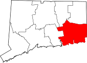
Towns Non-consolidated city Boroughs Unincorporated
communitiesBaltic | Burnetts Corner | Conning Towers-Nautilus Park | Gales Ferry | Graniteville | Greeneville | Groton Long Point | Jordan | Long Hill | Lords Point | Mystic | Niantic | Noank | Norwichtown | Old Mystic | Oswegatchie | Oxoboxo River | Pawcatuck | Poquetanuck | Poquonock Bridge | Preston City | Quaker Hill | Taftville | Uncasville
Categories:- Old Lyme, Connecticut
- Towns in New London County, Connecticut
- Populated places on the Connecticut River
- Populated coastal places in Connecticut


Wikimedia Foundation. 2010.