- Botley, Oxfordshire
-
Coordinates: 51°45′00″N 1°17′53″W / 51.750°N 1.298°W
Botley 
Seacourt Tower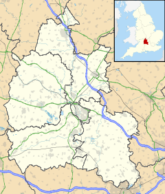
 Botley
Botley shown within OxfordshireOS grid reference SP483060 Parish North Hinksey District Vale of White Horse Shire county Oxfordshire Region South East Country England Sovereign state United Kingdom Post town Oxford Postcode district OX2 Dialling code 01865 Police Thames Valley Fire Oxfordshire Ambulance South Central EU Parliament South East England UK Parliament Oxford West and Abingdon List of places: UK • England • Oxfordshire Botley is a village in the civil parish of North Hinksey, just west of the Oxford city boundary in the English county of Oxfordshire. It was in Berkshire until 1974, when it was transferred to Oxfordshire. It lies near the junction between the A34 Oxford ring road and the A420 to Swindon.
Botley is effectively a suburb of Oxford, a largely residential area with property prices ranging from relatively cheap in some places, to very expensive, in the direction of Cumnor.
The settlement of Dean Court adjoins Botley, in the parish of Cumnor.
Contents
Buildings
Botley includes a small local shopping centre at Elms Parade and a small precinct called West Way, a small retail complex, and the Church of England parish church of St Peter and St Paul, built in 1958. The various large office buildings along the main road include Seacourt Tower, known locally as "Botley Cathedral" owing to its small metal spire, originally built in 1965-66 as a car showroom and garage to a design by Beecher and Stamford.[1] It is still owned by Hartwell Ford.
History
Botley was first settled in the Saxon era. Its toponym comes from Old English, meaning a woodland clearing of a man called Bota.[2] It falls within the parish of North Hinksey, and so was historically in the county of Berkshire. Because the main road west out of Oxford has passed through Botley since the 16th century, development since then was centred here rather than in the village of North Hinksey itself, slightly further south. From the 1880s the centre of the village began to be called Old Botley, in distinction to the New Botley development along Botley Road in Oxford.[3] The name Old Botley is preserved in a street set back from the main road. The major development which began in the 1930s took place to the west, beyond the current ring road.
To the north of Botley was the lost village of Seacourt. The site of the former village is in neighbouring Wytham parish, but it is commemorated in Botley in the names of Seacourt Tower, the Seacourt Bridge public house and the nearby park and ride site.
Famous inhabitants
The humorist Guy Browning grew up in Botley.[4]
References
Sources
- Hanson, John (1995). The Changing Faces of Botley and North Hinksey. Witney: Robert Boyd. pp. 7, 26.
- Sherwood, Jennifer; Pevsner, Nikolaus (1974). Oxfordshire. The Buildings of England. Harmondsworth: Penguin Books. pp. 335. ISBN 0 14 071045 0.
External links
Towns 
Large Villages Blewbury • Cumnor (Chilswell, Cumnor Hill, Dean Court, Farmoor, Swinford) • Drayton • East Challow • East Hendred • Grove • Harwell • Kennington • Kingston Bagpuize with Southmoor (Kingston Bagpuize, Southmoor) • Marcham (Cothill) • Milton • North Hinksey (Botley, Harcourt Hill) • Radley • St. Helen Without (Dry Sandford, Shippon) • Shrivenham • Stanford in the Vale (Bow) • Steventon • Sunningwell (Bayworth, Boars Hill, Foxcombe Hill) • Sutton Courtenay • Watchfield • Wootton (Boars Hill, Henwood, Lamborough Hill)Other Civil
Parishes
(Component
Villages
and Hamlets)Appleford-on-Thames • Appleton-with-Eaton (Appleton, Eaton) • Ardington (Ardington Wick, West Ginge) • Ashbury (Idstone, Kingstone Winslow) • Baulking • Besselsleigh • Bourton • Buckland (Gainfield) • Buscot • Charney Bassett • Childrey • Chilton • Coleshill • Compton Beauchamp (Knighton) • Denchworth • East Hanney • Eaton Hastings • Fernham • Frilford • Fyfield and Tubney (Fyfield, Tubney, Netherton) • Garford • Goosey • Great Coxwell • Hatford (Little Hatford) • Hinton Waldrist (Duxford) • Kingston Lisle • Letcombe Bassett • Letcombe Regis • Little Coxwell • Littleworth • Lockinge (East Lockinge, West Lockinge) • Longcot • Longworth • Lyford • Pusey • Shellingford • South Hinksey (Hinksey Hill)• Sparsholt • Uffington • Upton • West Challow • West Hanney • West Hendred (East Ginge) • Woolstone • Wytham (Seacourt)Former Districts
and BoroughsMunicipal Borough of Abingdon • Abingdon Rural District • Faringdon Rural District • Wantage Urban District • Wantage Rural DistrictFormer
ConstituenciesCategories:- Districts of Oxford
- Villages in Oxfordshire
- Estates of Oxfordshire


Wikimedia Foundation. 2010.