- Chainhurst
-
Coordinates: 51°12′06″N 0°28′36″E / 51.201570°N 0.476610°E
Chainhurst 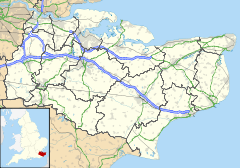
 Chainhurst
Chainhurst shown within KentDistrict Maidstone Shire county Kent Region South East Country England Sovereign state United Kingdom Post town Tonbridge Postcode district Tonbridge Dialling code 01622 Police Kent Fire Kent Ambulance South East Coast EU Parliament South East England UK Parliament Maidstone & The Weald List of places: UK • England • Kent Chainhurst is a minor village in the Marden parish council area of Maidstone district of Kent, England. It is primarily located along a one mile stretch of the Hunton Road, a minor road approximately 2 miles NNE of Marden, with the heart of the village centred upon a square created by Hunton Road and Dairy Lane.
The main part of the village lies just below a ridge line, south of the River Beult floodplain.
The precise age of the village is uncertain. However, Chainhurst Manor, which sits on top of the ridge and is located directly opposite the northern end of Dairy Lane, is at least 400 years old.
Local Industry
Historically, local industry was primarily agricultural with many of the former residents working for one or other of the major farms located in the immediate area.Traditional farming activities included fruit and arable farming, with extensive hop gardens, as evidenced by the oasts of The Roundels and Reed Court Farm, on Hunton Road and those at Whitehurst and adjacent to Platt House, which are both found on Dairy Lane. There is also a compound of "Hoppers Huts", located south of the bridge over the Beult, which provided accommodation for seasonal workers who came to the area to help with the annual harvest.
In recent generations, these activities have been displaced. With the steadily increasing mechanisation of farming since the second world war, labourers who worked for the local farms were no longer required and forced to move out of their tied accommodation into local council accommodation.
During this period, an influx of new villagers who either work in Maidstone, seven miles to the north, or in London (which is accessible, via the train service from Marden) have arrived, changing the complexion and make up of the village. In consequence, it is fair to describe the village now as a dormitory location.
Amenities
As is common with many small rural villages and hamlets, Chainhurst has suffered from a loss of amenities; losing its principal focal points, the Pig & Whistle (formerly The Royal Oak) public house and the Bull Inn (close to Stonewall Farm) over a decade ago.In consequence, non-drivers within the community are dependent upon the local bus service (to Maidstone and Marden) and a fornightly
visit by the Kent Mobile Library.At one time, Chainhurst had its own school (now "Valiant House") located on the corner of Hunton Road and Dairy Lane.
Primary schooling was taken over by the school in the village of Marden itself, with secondary schooling being provided by any one of a number of schools in Maidstone or Tonbridge.Sporting Venue
In recent years, the land surrounding Chainhurst, and Reed Court Farm in particular, has been the venue for Cyclo-Cross and it is now an annual fixture on the London League calendar.External links
 Media related to Chainhurst at Wikimedia Commons
Marden Locations in the
parish of MardenBuildings Church · Marden Mill · Marden stationBusinesses Kent Air AmbulanceEvents Farman Goliath crash · Train crashMilitary People Nicholas Amhurst · Helen Grant · William Hartnell · Sidney Highwood · William Punshon · Stephen Southon1. Located mostly within Staplehurst, but partly in Marden Towns and villages in the Maidstone borough of Kent, England 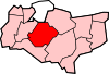 Allington · Barming · Bearsted · Bedmonton · Benover · Bexon · Bicknor · Boughton Green · Boughton Malherbe · Boughton Monchelsea · Boxley · Bredhurst · Broomfield · Caring · Chainhurst · Chart Sutton · Chegworth · Collier Street · Coxheath · Detling · Downswood · East Barming · East Farleigh · East Sutton · Fairbourne Heath · Frinsted · Grove Green · Harrietsham · Hawkenbury · Headcorn · Hollingbourne · Horden · Hucking · Hunton · Kingswood · Kit's Coty · Laddingford · Langley · Leeds · Lenham · Linton · Loose · Lordswood · Maidstone · Marden · Marley · Milebush · Nettlestead · Nettlestead Green · Otham · Otterden · Park Wood · Platt's Heath · Penenden Heath · Pollhill · Ringlestone (hamlet) · Ringlestone (suburb) · Sandling · Sandway · Shepway · Sutton Valence · Staplehurst · Stockbury · Teston · Thurnham · Tovil · Ulcombe · Walderslade · Weavering · West Farleigh · Wichling · Wormshill · Yalding
List of places in Kent Categories:- Maidstone (borough)
- Villages in Kent
- Kent geography stubs


Wikimedia Foundation. 2010.