- Duloe, Cornwall
-
Coordinates: 50°23′59″N 4°29′15″W / 50.3997°N 4.4876°W
Duloe Cornish: Dewlogh 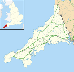
 Duloe
Duloe
Duloe shown within CornwallPopulation 660 (Civil Parish, 2001) OS grid reference SX 233 586 Parish Duloe Unitary authority Cornwall Ceremonial county Cornwall Region South West Country England Sovereign state United Kingdom Post town LISKEARD Postcode district PL14 Dialling code 01503 Police Devon and Cornwall Fire Cornwall Ambulance South Western EU Parliament South West England UK Parliament South East Cornwall List of places: UK • England • Cornwall Duloe (Cornish: Dewlogh) is a village and civil parish in Cornwall, United Kingdom. It is situated approximately four miles (6 km) south of Liskeard at grid reference SX 233 585.[1]
Contents
Parish church
The parish church of Duloe is dedicated to St Cuby and St Leonard and was built in early medieval times. Its plan is unusual since the tower is at the end of the south transept. The tower is 13th century and an upper stage was added in the Perpendicular style. However this stage was removed in 1861. (There is now no access to the tower from the transept as the archway beteween was blocked up at an early date.)
 Church of St Cuby and St Leonard, Duloe
There is a north aisle which continues eastwards to form a chancel aisle which is grander in style (though the arches are lower) and was the family chapel of the Colshull family. There is a fine monument here of Sir John Colshull (d. 1483). The effigy of Sir John in full armour lies on a slab of elvan stone on top of a tomb chest ornamented with shields and at the west end a crucifixion. The parclose screen bears coats of arms connected with the Colshulls and may be made up of parts of a rood screen. Both inside and outside the family chapel is more highly ornamented than the rest of the church. Other monuments commemorate Ann Coffyn (d. 1592), John Killiow (d. 1601) and his wife (a tomb chest), Mary Arundell (d. 1629) with a curious epitaph comparing man to the laurel tree, and Henry Bewes (d. 1793). The Coffyn memorial shows her is Elizabethan dress and is of slate; another slate memorial is to two unknown wives and their children, also shown in Elizabethan dress. The Bewes memorial is by William Adron and shows a woman in relief.[2]
Landmarks
The village has a primary school, Duloe C of E VA School. This is a Church of England Voluntary aided school in the Diocese of Truro.[3] It is also the location of Duloe stone circle in a field behind a nearby farm.[4] The holy well is half a mile away from the church towards Looe: it is covered by a modern well house.
References
- ^ Ordnance Survey: Landranger map sheet 201 Plymouth & Launceston ISBN 9780319231463
- ^ Pevsner, N. (1970) Cornwall; 2nd ed., revised by Enid Radcliffe. Harmondsworth: Penguin; pp. 63-64
- ^ Duloe C of E VA School
- ^ Aubrey Burl (2005). A Guide to the Stone Circles of Britain, Ireland and Brittany. Yale University Press. pp. 32–. ISBN 9780300114065. http://books.google.com/books?id=yhWFB1JAjWsC&pg=PA32. Retrieved 22 March 2011.
External links
Geography of Cornwall Cornwall Portal Unitary authorities Major settlements Bodmin • Bude • Callington • Camborne • Camelford • Falmouth • Fowey • Hayle • Helston • Launceston • Liskeard • Looe • Lostwithiel • Marazion • Newlyn • Newquay • Padstow • Par • Penryn • Penzance • Porthleven • Redruth • Saltash • St Austell • St Blazey • St Columb Major • St Ives • St Just-in-Penwith • St Mawes • Stratton • Torpoint • Truro • Wadebridge
See also: Civil parishes in CornwallRivers Topics History • Status debate • Flag • Culture • Places • People • The Duchy • Diocese • Politics • Hundreds/shires • Places of interest • full list...Civil parishes of South East Cornwall constituency  Antony • Boconnoc • Botusfleming • Broadoak • Callington • Calstock • Deviock • Dobwalls and Trewidland • Duloe • Landrake with St Erney • Lanreath • Lansallos • Landulph • Lanlivery • Lanteglos • Linkinhorne • Liskeard • Looe • Lostwithiel • Luxulyan • Maker-with-Rame • Menheniot • Millbrook • Morval • Pelynt • Pillaton • Quethiock • Saltash • Sheviock • South Hill • St Cleer • St Dominick • St Germans • St Ive • St John • St Keyne • St Martin-by-Looe • St Mellion • St Neot • St Pinnock • St Veep • St Winnow • Torpoint • Warleggan
Cornwall Portal Categories:- Villages in Cornwall
- Civil parishes in Cornwall


Wikimedia Foundation. 2010.