- Mickleton, County Durham
-
Coordinates: 54°36′32″N 2°03′20″W / 54.60877°N 2.05569°W
Mickleton 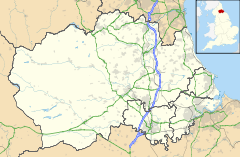
 Mickleton
Mickleton shown within County DurhamOS grid reference NY965237 Unitary authority County Durham Ceremonial county County Durham Region North East Country England Sovereign state United Kingdom Police Durham Fire County Durham and Darlington Ambulance North East EU Parliament North East England List of places: UK • England • County Durham Mickleton is a village in Teesdale, in the Pennines of England. It was historically located in the North Riding of Yorkshire but along with the rest of the former Startforth Rural District it was transferred to County Durham for administrative and ceremonial purposes on 1 April 1974, under the provisions of the Local Government Act 1972. Mickleton is situated by the meeting of the Lune River, as it leaves Lunedale, and joins the Tees, behind Mickleton on the Lunedale Hills looms the Bronze Age burial site of Kirkcarrion.
External links
Categories:- Villages in County Durham
- County Durham geography stubs

Wikimedia Foundation. 2010.