- Mountain peaks of the United States
-
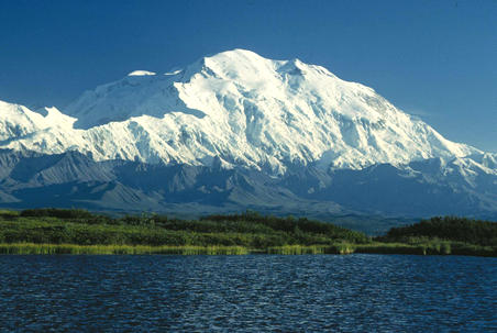
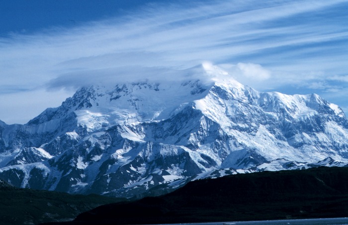
 Mount McKinley (also known as Denali) in Alaska is the highest mountain peak of the United States of America.
Contents
Main article: Geography of the United StatesSee also: Mountain peaks of North AmericaThis article comprises three sortable tables of the major mountain peaks of the United States of America.
Topographic elevation is the vertical distance above the reference geoid, a precise mathematical model of the Earth's sea level as an equipotential gravitational surface. Topographic prominence is the elevation difference between the summit and the highest or key col to a higher summit. Topographic isolation is the minimum great circle distance to a point of higher elevation.
This article defines a significant summit as a summit with at least 100 meters (328.1 feet) of topographic prominence, and a major summit as a summit with at least 500 meters (1640.4 feet) of topographic prominence. An ultra-prominent summit is a summit with at least 1500 meters (4921.3 feet) of topographic prominence. There are 129 ultra-prominent summits in the United States.
All elevations in the 48 states of the contiguous United States include an elevation adjustment from the National Geodetic Vertical Datum of 1929 (NGVD 29) to the North American Vertical Datum of 1988 (NAVD 88). For further information, please see this United States National Geodetic Survey note.
Highest major summits
Main article: Table of the highest major summits of the United StatesThe following sortable table lists the 50 highest mountain peaks of the United States with at least 500 meters (1640.4 feet) of topographic prominence. Of these 50 highest major peaks, 28 are located in Colorado, 14 in Alaska, 7 in California, and 1 in Washington.
Most prominent summits
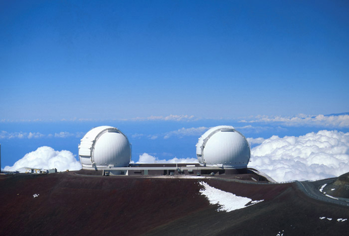
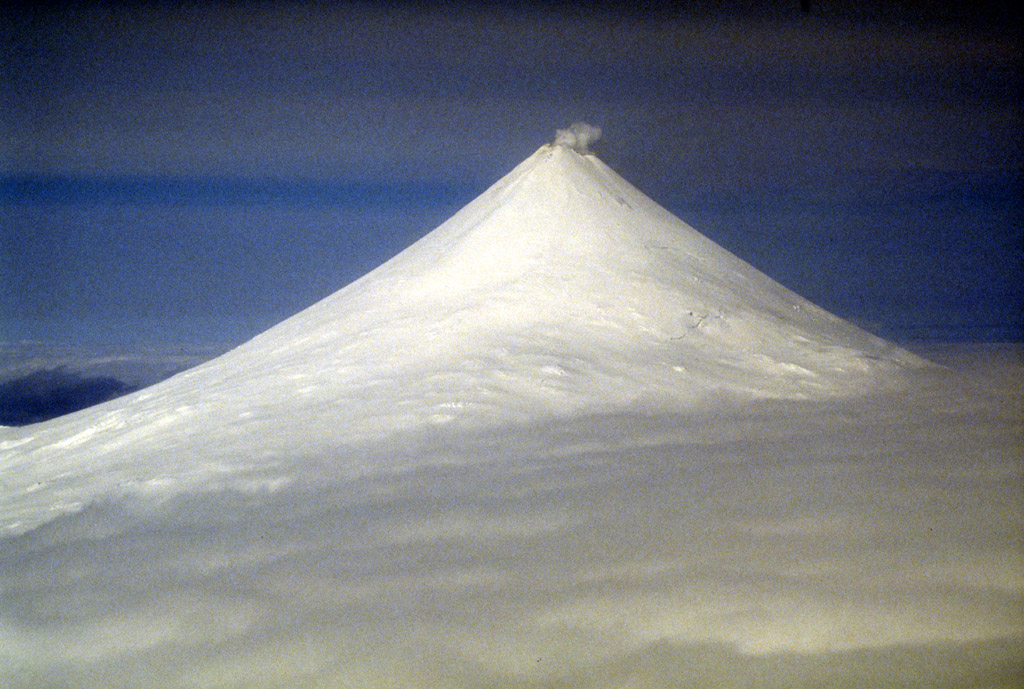
Main article: Table of the most prominent summits of the United StatesSee also: Table of the ultra-prominent summits of the United StatesThe following sortable table lists the 50 most topographically prominent mountain peaks of the United States. Of these 50 most prominent summits, 27 are located in Alaska, 5 in Washington, 5 in California, 3 in Hawaiʻi, 3 in Wyoming, 2 in Nevada, 2 in Oregon, and one each in Colorado, Utah, and Arizona.
Most isolated major summits
The following sortable table lists the 50 most topographically isolated mountain peaks of the United States with at least 500 meters (1640.4 feet) of topographic prominence. Of these 50 most isolated major summits, 19 are located in Alaska, 4 in California, 3 in Washington, 2 in Hawaiʻi, 2 in Colorado, 2 in Wyoming, 2 in Arizona, 2 in Nevada, 2 in Utah, 2 in New York, 2 in Oregon, and one each in North Carolina, New Hampshire, Arkansas, West Virginia, New Mexico, Maine, Idaho, and South Dakota.
The 50 most topographically isolated mountain peaks of the United States
with at least 500 meters of topographic prominence
Rank Mountain Peak State Mountain Range Elevation Prominence Isolation Location 1 Mount McKinley[1][2]
(Denali) Alaska
Alaska Range 20,320 ft
6194 m20,174 ft
6149 m4,629 mi
7,450 km63.0690°N
151.0063°W2 Mauna Kea[130][131][132]  Hawaii
Island of Hawaiʻi 13,803 ft
4207 m13,796 ft
4205 m2,453 mi
3,947 km19.8207°N
155.4681°W3 Mount Whitney[19][20][21][22]  California
Sierra Nevada 14,505 ft
4421 m10,079 ft
3072 m1,646 mi
2,649 km36.5786°N
118.2920°W4 Mount Mitchell[213][214][215]  North Carolina
Blue Ridge Mountains 6,684 ft
2037 m6,091 ft
1857 m1,189 mi
1,913 km35.7650°N
82.2652°W5 Mount Washington[216][217][218][219]  New Hampshire
White Mountains 6,288 ft
1917 m6,158 ft
1877 m820 mi
1,319 km44.2705°N
71.3032°W6 Mount Rainier[36][37][38][39]  Washington
Cascade Range 14,417 ft
4394 m13,236 ft
4034 m731 mi
1,177 km46.8521°N
121.7579°W7 Mount Elbert[25][26][27][28]  Colorado
Sawatch Range 14,440 ft
4401 m9,093 ft
2772 m671 mi
1,079 km39.1178°N
106.4454°W8 Shishaldin Volcano[139][140] AlaskaUnimak Island 9,414 ft
2869 m9,414 ft
2869 m545 mi
877 km54.7554°N
163.9709°W9 Tanaga Volcano[220][221] AlaskaTanaga Island 5,925 ft
1806 m5,925 ft
1806 m407 mi
656 km51.8833°N
178.1333°W10 Mount Chamberlin[161][162] AlaskaBrooks Range 9,020 ft
2749 m7,945 ft
2422 m395 mi
636 km69.2820°N
144.8996°W11 Magazine Mountain[222][223][224][225]  Arkansas
Ouachita Mountains 2,753 ft
839 m2,142 ft
653 m381 mi
613 km35.1670°N
93.6447°W12 Mount Shasta[86][87][88] CaliforniaCascade Range 14,179 ft
4322 m9,832 ft
2997 m335 mi
539 km41.4092°N
122.1949°W13 Gannett Peak[190][191][192][193]  Wyoming
Wind River Range 13,809 ft
4209 m7,076 ft
2157 m290 mi
467 km43.1842°N
109.6542°W14 Mount Osborn[226][227][228] AlaskaSeward Peninsula 4,714 ft
1437 m4,326 ft
1319 m282 mi
454 km64.9922°N
165.3294°W15 Mount Igikpak[229] AlaskaBrooks Range 8,276 ft
2523 m6,126 ft
1867 m282 mi
453 km67.4129°N
154.9656°W16 Humphreys Peak[230][231][232][233]  Arizona
San Francisco Peaks 12,637 ft
3852 m6,039 ft
1841 m246 mi
396 km35.3463°N
111.6779°W17 Wheeler Peak[174][175][176]  Nevada
Snake Range 13,065 ft
3982 m7,568 ft
2307 m232 mi
373 km38.9858°N
114.3139°W18 Mount Vsevidof[194][195][196] AlaskaUmnak Island 7,051 ft
2149 m7,051 ft
2149 m223 mi
359 km53.1251°N
168.6947°W19 Mount Veniaminof[156][157] AlaskaAleutian Range 8,225 ft
2507 m8,200 ft
2499 m210 mi
337 km56.2191°N
159.2980°W20 Kawaikini[234][235] HawaiiIsland of Kauaʻi 5,243 ft
1598 m5,243 ft
1598 m204 mi
328 km22.0586°N
159.4973°W21 Dillingham High Point[236][237] AlaskaKuskokwim Mountains 5,250 ft
1600 m4,475 ft
1364 m193 mi
311 km60.1159°N
159.3241°W22 Hall Island High Point[238] AlaskaHall Island 1,665 ft
507 m1,665 ft
507 m193 mi
311 km60.6647°N
173.0887°W23 Tooth Benchmark[239][240] AlaskaSaint Lawrence Island 2,207 ft
673 m2,207 ft
673 m178 mi
287 km63.5920°N
170.3804°W24 Spruce Knob[241][242][243][244]  West Virginia
Allegheny Mountains 4,862 ft
1482 m2,792 ft
851 m175 mi
282 km38.7008°N
79.5319°W25 Mount Roberts[245][246] AlaskaNunivak Island 1,675 ft
511 m1,675 ft
511 m174 mi
280 km60.0280°N
166.2627°W26 Kings Peak[206][207][208][209]  Utah
UtahUinta Mountains 13,518 ft
4120 m6,358 ft
1938 m167 mi
268 km40.7659°N
110.3779°W27 Sierra Blanca Peak[247][248][249]  New Mexico
Sierra Blanca 11,981 ft
3652 m5,553 ft
1693 m166 mi
267 km33.3743°N
105.8087°W28 San Gorgonio Mountain[149][150] CaliforniaSan Bernardino Mountains 11,503 ft
3506 m8,294 ft
2528 m162 mi
262 km34.0992°N
116.8249°W29 Mount Katahdin[250][251][252][253]  Maine
MaineLongfellow Mountains 5,270 ft
1606 m4,293 ft
1309 m158 mi
255 km45.9044°N
68.9213°W30 Peak 4030[254] AlaskaNulato Hills 4,030 ft
1228 m>1,640 ft
>500 m158 mi
255 km64.4535°N
159.4152°W31 Mount Baldy[255][256][257] ArizonaWhite Mountains 11,409 ft
3477 m4,728 ft
1441 m154 mi
248 km33.9059°N
109.5626°W32 Borah Peak[258][259][260][261]  Idaho
IdahoLost River Range 12,668 ft
3861 m6,002 ft
1829 m151 mi
243 km44.1374°N
113.7811°W33 Cloud Peak[187][188][189] WyomingBighorn Mountains 13,167 ft
4013 m7,077 ft
2157 m145 mi
233 km44.3821°N
107.1739°W34 Harney Peak[262][263][264][265]  South Dakota
Black Hills 7,244 ft
2208 m2,933 ft
894 m140 mi
226 km43.8658°N
103.5324°W35 Slide Mountain[266][267][268]  New York
Catskill Mountains 4,180 ft
1274 m3,294 ft
1004 m136 mi
220 km41.9992°N
74.3859°W36 Mount Griggs[181] AlaskaAleutian Range 7,650 ft
2332 m7,300 ft
2225 m136 mi
219 km58.3534°N
155.0958°W37 Charleston Peak[151][152][153]
(Mount Charleston) NevadaSpring Mountains 11,916 ft
3632 m8,257 ft
2517 m135 mi
218 km36.2716°N
115.6956°W38 Junipero Serra Peak[269][270][271] CaliforniaSanta Lucia Range 5,857 ft
1785 m4,447 ft
1355 m132 mi
212 km36.1456°N
121.4190°W39 Mount Baker[143][144] WashingtonCascade Range 10,786 ft
3287 m8,845 ft
2696 m132 mi
212 km48.7768°N
121.8145°W40 Mount Marcy[272][273][274][275] New YorkAdirondack Mountains 5,343 ft
1629 m4,919 ft
1499 m130 mi
209 km44.1127°N
73.9237°W41 Mount Hayes[133][134][135] AlaskaAlaska Range 13,832 ft
4216 m11,507 ft
3507 m127 mi
205 km63.6199°N
146.7174°W42 Mount Marcus Baker[136] AlaskaChugach Mountains 13,176 ft
4016 m10,751 ft
3277 m127 mi
204 km61.4374°N
147.7525°W43 Sacajawea Peak[203][204]  Oregon
Wallowa Mountains 9,843 ft
3000 m6,377 ft
1944 m126 mi
202 km45.2450°N
117.2929°W44 Steens Mountain[276][277][278] OregonSteens Mountain 9,725 ft
2964 m4,383 ft
1336 m125 mi
201 km42.6378°N
118.5785°W45 Mount Fairweather[13][14]
(Fairweather Mountain) Alaska
 British Columbia
Saint Elias Mountains 15,325 ft
4671 m12,995 ft
3961 m125 mi
201 km58.9064°N
137.5265°W46 Delano Peak[279][280][281] UtahTushar Mountains 12,174 ft
3711 m4,709 ft
1435 m112 mi
180 km38.3692°N
112.3714°W47 Black Mountain[282] AlaskaBrooks Range 5,020 ft
1530 m>1,640 ft
>500 m112 mi
180 km68.5598°N
160.3281°W48 Mount Tozi[283][284] AlaskaRay Mountains 5,519 ft
1682 m4,169 ft
1271 m111 mi
178 km65.6863°N
150.9496°W49 Mount Olympus[164][165][166] WashingtonOlympic Mountains 7,980 ft
2432 m7,838 ft
2389 m108 mi
174 km47.8013°N
123.7108°W50 Blanca Peak[44][45][46] ColoradoSangre de Cristo Range 14,351 ft
4374 m5,326 ft
1623 m103 mi
166 km37.5775°N
105.4857°WGallery
-
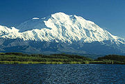
Mount McKinley, or Denali, in Alaska is the highest mountain peak of the United States and North America.
-

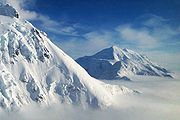
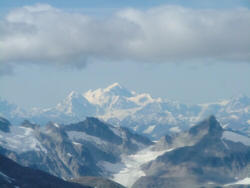
Mount Saint Elias on the border of Alaska and the Yukon is the second highest mountain peak of both the United States and Canada.
-
Mount Foraker is the second highest mountain peak of the Alaska Range.
-
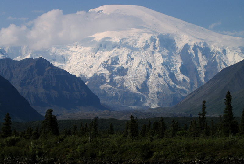
Mount Blackburn in Alaska is the highest peak of the Wrangell Mountains.
-

Mount Sanford in Alaska is the second highest peak of the Wrangell Mountains.
-

Mount Fairweather on the border of Alaska and British Columbia is the fourth most topographically prominent mountain peak of the U.S.
-
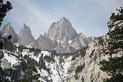
Mount Whitney in California is the highest mountain peak of the contiguous United States.
-
Mount Elbert in Colorado is the highest peak of the Rocky Mountains.
-

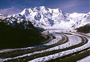
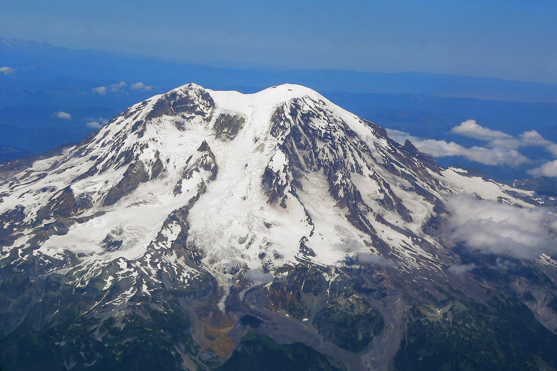
Mount Rainier in Washington is the third most topographically prominent mountain peak of the U.S.
-

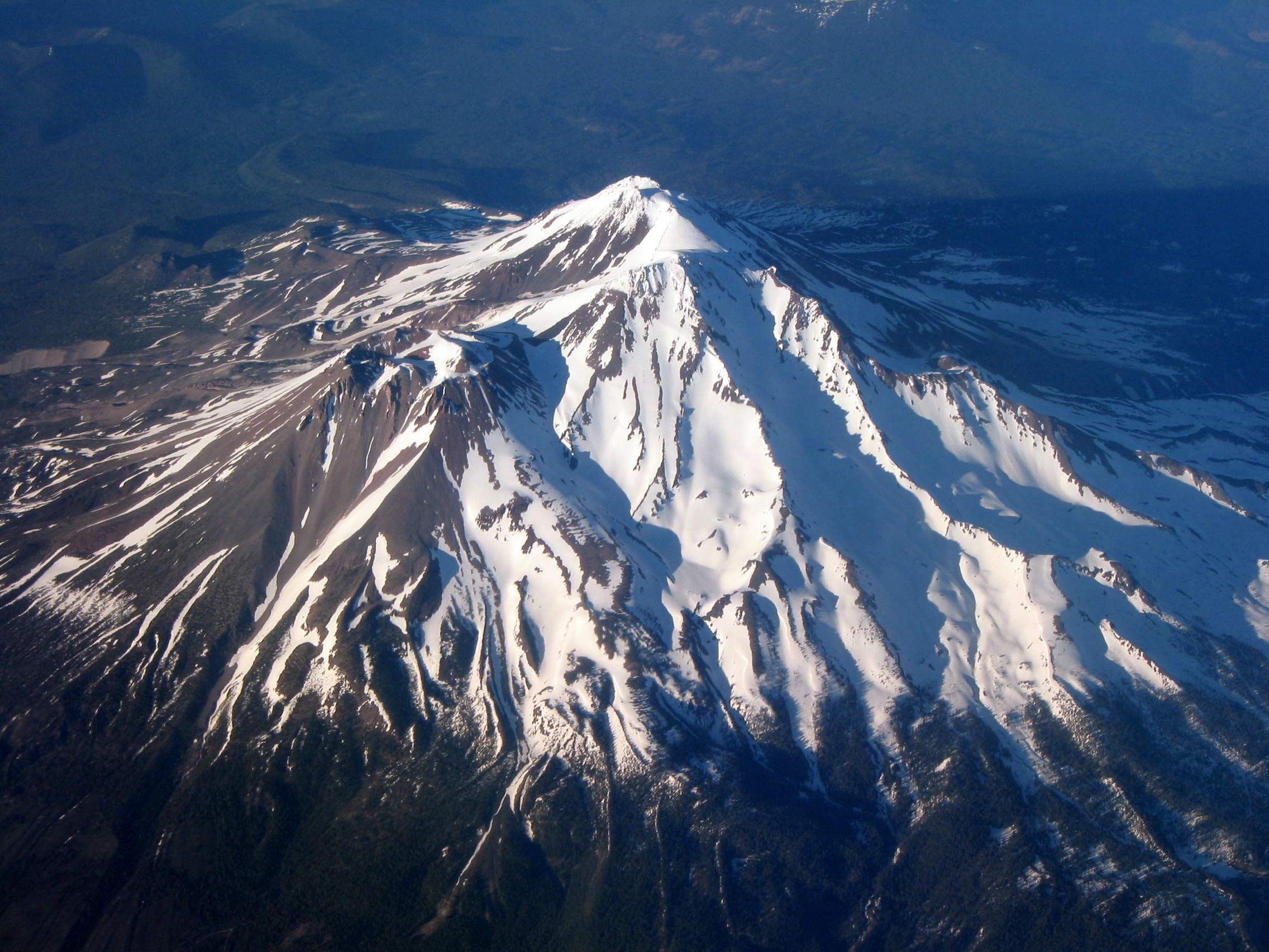
Mount Shasta in California is the second highest summit of the Cascade Range.
-

Mount Shishaldin on Unimak Island in Alaska is the highest point in the Aleutian Islands.
-
Mount Mitchell in North Carolina is the highest mountain peak of the Eastern United States.
-
Mount Washington is the highest mountain peak in the Northeastern United States.
-

Mount Katahdin is the peak having the greatest spire measure in Eastern United States.
See also
- Outline of the United States
- Index of United States-related articles
- Lists of mountains
- Mountain peaks of North America
- Mountain peaks of Greenland
- Mountain peaks of Canada
- Mountain peaks of the Rocky Mountains
- Mountain peaks of the United States
- Table of the highest major summits of the United States
- Table of the most prominent summits of the United States
- Table of the most isolated major summits of the United States
- Mountain peaks of Alaska
- Mountain peaks of California
- Mountain peaks of Colorado
- Mountain peaks of México
- Mountain peaks of Central America
- Mountain peaks of the Caribbean
- Physical geography
- Topography
- Topographic elevation
- Topographic isolation
- Topographic prominence
- Topographic summit
- Topography
- United States of America
- Geography of the United States
- Category:Mountains of the United States
- Geography of the United States
References
- ^ a b c The summit of Mount McKinley (Denali) is the highest point of the Alaska Range, the State of Alaska, the United States of America, and all of North America.
- ^ a b c "Mount McKinley". Summits of the World. peakbagger.com. http://www.peakbagger.com/peak.aspx?pid=271. Retrieved January 27, 2010.
- ^ a b The summit of Mount Saint Elias on the international border between Alaska and the Yukon is the second highest mountain peak of both Canada and the United States.
- ^ a b "Mount Saint Elias". Summits of the World. peakbagger.com. http://www.peakbagger.com/peak.aspx?pid=552. Retrieved January 11, 2010.
- ^ a b The summit of Mount Foraker is the westernmost 5000 m (16,404-foot) summit of North America.
- ^ a b "Mount Foraker". NGS Station Datasheet. United States National Geodetic Survey. http://www.ngs.noaa.gov/cgi-bin/ds_mark.prl?PidBox=UW6284. Retrieved January 27, 2010.
- ^ a b "Mount Foraker". Summits of the World. peakbagger.com. http://www.peakbagger.com/peak.aspx?pid=284. Retrieved January 27, 2010.
- ^ a b "Mount Bona". NGS Station Datasheet. United States National Geodetic Survey. http://www.ngs.noaa.gov/cgi-bin/ds_mark.prl?PidBox=UV4083. Retrieved January 27, 2010.
- ^ a b "Mount Bona". Summits of the World. peakbagger.com. http://www.peakbagger.com/peak.aspx?pid=496. Retrieved January 27, 2010.
- ^ a b "Mount Blackburn". NGS Station Datasheet. United States National Geodetic Survey. http://www.ngs.noaa.gov/cgi-bin/ds_mark.prl?PidBox=UV4136. Retrieved January 11, 2010.
- ^ a b "Mount Blackburn". Summits of the World. peakbagger.com. http://www.peakbagger.com/peak.aspx?pid=437. Retrieved January 11, 2010.
- ^ a b "Mount Sanford". Summits of the World. peakbagger.com. http://www.peakbagger.com/peak.aspx?pid=428. Retrieved January 27, 2010.
- ^ a b c The summit of Mount Fairweather (Fairweather Mountain) on the border of Alaska is the highest point of the Province of British Columbia.
- ^ a b c "Mount Fairweather". Summits of the World. peakbagger.com. http://www.peakbagger.com/peak.aspx?pid=566. Retrieved January 11, 2010.
- ^ a b "Mount Hubbard". Summits of the World. peakbagger.com. http://www.peakbagger.com/peak.aspx?pid=548. Retrieved January 25, 2010.
- ^ "Mount Bear". Summits of the World. peakbagger.com. http://www.peakbagger.com/peak.aspx?pid=501. Retrieved January 27, 2010.
- ^ "Mount Hunter". NGS Station Datasheet. United States National Geodetic Survey. http://www.ngs.noaa.gov/cgi-bin/ds_mark.prl?PidBox=UW6282. Retrieved January 27, 2010.
- ^ "Mount Hunter". Summits of the World. peakbagger.com. http://www.peakbagger.com/peak.aspx?pid=285. Retrieved January 27, 2010.
- ^ a b c The summit of Mount Whitney is the highest point of the Sierra Nevada, the State of California, and the contiguous United States.
- ^ a b c "Mount Whitney". NGS Station Datasheet. United States National Geodetic Survey. http://www.ngs.noaa.gov/cgi-bin/ds_mark.prl?PidBox=GT1812. Retrieved January 17, 2010.
- ^ a b c "Mount Whitney". Summits of the World. peakbagger.com. http://www.peakbagger.com/peak.aspx?pid=2829. Retrieved January 17, 2010.
- ^ a b c The summit elevation of Mount Whitney includes a vertical adjustment of +1.869 m (+6.1 ft).
- ^ "Mount Alverstone". Summits of the World. peakbagger.com. http://www.peakbagger.com/peak.aspx?pid=543. Retrieved January 25, 2010.
- ^ "University Peak". Summits of the World. peakbagger.com. http://www.peakbagger.com/peak.aspx?pid=499. Retrieved January 27, 2010.
- ^ a b c The summit of Mount Elbert is the highest point of the Rocky Mountains and the State of Colorado.
- ^ a b c "Mount Elbert". NGS Station Datasheet. United States National Geodetic Survey. http://www.ngs.noaa.gov/cgi-bin/ds_mark.prl?PidBox=KL0637. Retrieved January 17, 2010.
- ^ a b c "Mount Elbert". Summits of the World. peakbagger.com. http://www.peakbagger.com/peak.aspx?pid=5736. Retrieved January 17, 2010.
- ^ a b c The summit elevation of Mount Elbert includes a vertical adjustment of +1.995 m (+6.5 ft).
- ^ "Mount Massive". NGS Station Datasheet. United States National Geodetic Survey. http://www.ngs.noaa.gov/cgi-bin/ds_mark.prl?PidBox=KL0640. Retrieved January 17, 2010.
- ^ "Mount Massive". Summits of the World. peakbagger.com. http://www.peakbagger.com/peak.aspx?pid=5729. Retrieved January 17, 2010.
- ^ The summit elevation of Mount Massive includes a vertical adjustment of +2.087 m (+6.8 ft).
- ^ "Mount Harvard". NGS Station Datasheet. United States National Geodetic Survey. http://www.ngs.noaa.gov/cgi-bin/ds_mark.prl?PidBox=JL0879. Retrieved January 17, 2010.
- ^ "Mount Harvard". Summits of the World. peakbagger.com. http://www.peakbagger.com/peak.aspx?pid=5754. Retrieved January 17, 2010.
- ^ The summit elevation of Mount Harvard includes a vertical adjustment of +2.084 m (+6.8 ft).
- ^ The summit elevation of Mount Harvard includes a vertical offset of +1.8 m (+5.9 ft) from the benchmark.
- ^ a b c The summit of Mount Rainier is the highest point of the Cascade Range and the State of Washington.
- ^ a b c "Mount Rainier". NGS Station Datasheet. United States National Geodetic Survey. http://www.ngs.noaa.gov/cgi-bin/ds_mark.prl?PidBox=SB1041. Retrieved January 27, 2010.
- ^ a b c "Mount Rainier". Summits of the World. peakbagger.com. http://www.peakbagger.com/peak.aspx?pid=2296. Retrieved January 27, 2010.
- ^ a b c The summit elevation of Mount Rainier includes a vertical adjustment of +1.935 m (+6.3 ft).
- ^ "Mount Williamson". Summits of the World. peakbagger.com. http://www.peakbagger.com/peak.aspx?pid=2814. Retrieved January 28, 2010.
- ^ The summit elevation of Mount Williamson includes a vertical adjustment of +1.807 m (+5.9 ft).
- ^ "La Plata Peak". Summits of the World. peakbagger.com. http://www.peakbagger.com/peak.aspx?pid=5744. Retrieved January 28, 2010.
- ^ The summit elevation of La Plata Peak includes a vertical adjustment of +1.983 m (+6.5 ft).
- ^ a b "Blanca Peak". NGS Station Datasheet. United States National Geodetic Survey. http://www.ngs.noaa.gov/cgi-bin/ds_mark.prl?PidBox=HK0514. Retrieved January 2, 2010.
- ^ a b "Blanca Peak". Summits of the World. peakbagger.com. http://www.peakbagger.com/peak.aspx?pid=5921. Retrieved January 2, 2010.
- ^ a b The summit elevation of Blanca Peak includes a vertical adjustment of +1.755 m (+5.8 ft).
- ^ "Uncompahgre Peak". NGS Station Datasheet. United States National Geodetic Survey. http://www.ngs.noaa.gov/cgi-bin/ds_mark.prl?PidBox=JL0798. Retrieved January 17, 2010.
- ^ "Uncompahgre Peak". Summits of the World. peakbagger.com. http://www.peakbagger.com/peak.aspx?pid=5836. Retrieved January 17, 2010.
- ^ The summit elevation of Uncompahgre Peak includes a vertical adjustment of +1.967 m (+6.5 ft).
- ^ "Crestone Peak". Summits of the World. peakbagger.com. http://www.peakbagger.com/peak.aspx?pid=5908. Retrieved January 2, 2010.
- ^ The summit elevation of Crestone Peak includes a vertical adjustment of +1.76 m (+5.8 ft).
- ^ "Mount Lincoln". NGS Station Datasheet. United States National Geodetic Survey. http://www.ngs.noaa.gov/cgi-bin/ds_mark.prl?PidBox=KL0627. Retrieved January 17, 2010.
- ^ "Mount Lincoln". Summits of the World. peakbagger.com. http://www.peakbagger.com/peak.aspx?pid=5793. Retrieved January 17, 2010.
- ^ The summit elevation of Mount Lincoln includes a vertical adjustment of +2.098 m (+6.9 ft).
- ^ "Castle Peak". NGS Station Datasheet. United States National Geodetic Survey. http://www.ngs.noaa.gov/cgi-bin/ds_mark.prl?PidBox=KL0659. Retrieved January 17, 2010.
- ^ "Castle Peak". Summits of the World. peakbagger.com. http://www.peakbagger.com/peak.aspx?pid=5709. Retrieved January 17, 2010.
- ^ The summit elevation of Castle Peak includes a vertical adjustment of +2.165 m (+7.1 ft).
- ^ The summit of Grays Peak is the highest point on the Continental Divide of North America.
- ^ "Grays Peak". NGS Station Datasheet. United States National Geodetic Survey. http://www.ngs.noaa.gov/cgi-bin/ds_mark.prl?PidBox=KK2036. Retrieved January 17, 2010.
- ^ "Grays Peak". Summits of the World. peakbagger.com. http://www.peakbagger.com/peak.aspx?pid=5664. Retrieved January 17, 2010.
- ^ The summit elevation of Grays Peak includes a vertical adjustment of +1.881 m (+6.2 ft).
- ^ "Mount Antero". NGS Station Datasheet. United States National Geodetic Survey. http://www.ngs.noaa.gov/cgi-bin/ds_mark.prl?PidBox=JL0883. Retrieved January 17, 2010.
- ^ "Mount Antero". Summits of the World. peakbagger.com. http://www.peakbagger.com/peak.aspx?pid=5759. Retrieved January 17, 2010.
- ^ The summit elevation of Mount Antero includes a vertical adjustment of +2.071 m (+6.8 ft).
- ^ "Mount Evans". NGS Station Datasheet. United States National Geodetic Survey. http://www.ngs.noaa.gov/cgi-bin/ds_mark.prl?PidBox=KK2030. Retrieved January 17, 2010.
- ^ "Mount Evans". Summits of the World. peakbagger.com. http://www.peakbagger.com/peak.aspx?pid=5676. Retrieved January 17, 2010.
- ^ The summit elevation of Mount Evans includes a vertical adjustment of +1.827 m (+6.0 ft).
- ^ "Longs Peak". NGS Station Datasheet. United States National Geodetic Survey. http://www.ngs.noaa.gov/cgi-bin/ds_mark.prl?PidBox=LL1346. Retrieved January 17, 2010.
- ^ "Longs Peak". Summits of the World. peakbagger.com. http://www.peakbagger.com/peak.aspx?pid=5642. Retrieved January 17, 2010.
- ^ The summit elevation of Longs Peak includes a vertical adjustment of +1.652 m (+5.4 ft).
- ^ "Mount Wilson". Summits of the World. peakbagger.com. http://www.peakbagger.com/peak.aspx?pid=5820. Retrieved January 2, 2010.
- ^ The summit elevation of Mount Wilson includes a vertical adjustment of +1.899 m (+6.2 ft).
- ^ a b "White Mountain Peak". NGS Station Datasheet. United States National Geodetic Survey. http://www.ngs.noaa.gov/cgi-bin/ds_mark.prl?PidBox=HR2559. Retrieved January 17, 2010.
- ^ a b "White Mountain Peak". Summits of the World. peakbagger.com. http://www.peakbagger.com/peak.aspx?pid=3628. Retrieved January 17, 2010.
- ^ a b The summit elevation of White Mountain Peak includes a vertical adjustment of +1.91 m (+6.3 ft).
- ^ "North Palisade". NGS Station Datasheet. United States National Geodetic Survey. http://www.ngs.noaa.gov/cgi-bin/ds_mark.prl?PidBox=HR2629. Retrieved January 17, 2010.
- ^ "North Palisade". Summits of the World. peakbagger.com. http://www.peakbagger.com/peak.aspx?pid=2727. Retrieved January 17, 2010.
- ^ The summit elevation of North Palisade includes a vertical adjustment of +1.867 m (+6.1 ft).
- ^ "Mount Princeton". NGS Station Datasheet. United States National Geodetic Survey. http://www.ngs.noaa.gov/cgi-bin/ds_mark.prl?PidBox=JL0886. Retrieved January 17, 2010.
- ^ "Mount Princeton". Summits of the World. peakbagger.com. http://www.peakbagger.com/peak.aspx?pid=5757. Retrieved January 17, 2010.
- ^ The summit elevation of Mount Princeton includes a vertical adjustment of +2.075 m (+6.8 ft).
- ^ "Mount Yale". NGS Station Datasheet. United States National Geodetic Survey. http://www.ngs.noaa.gov/cgi-bin/ds_mark.prl?PidBox=JL0889. Retrieved January 17, 2010.
- ^ "Mount Yale". Summits of the World. peakbagger.com. http://www.peakbagger.com/peak.aspx?pid=5756. Retrieved January 17, 2010.
- ^ The summit elevation of Mount Yale includes a vertical adjustment of +2.036 m (+6.7 ft).
- ^ The summit elevation of Mount Yale includes a vertical offset of +0.6 m (+2.0 ft) from the benchmark.
- ^ a b c "Mount Shasta". NGS Station Datasheet. United States National Geodetic Survey. http://www.ngs.noaa.gov/cgi-bin/ds_mark.prl?PidBox=MX1016. Retrieved January 17, 2010.
- ^ a b c "Mount Shasta". Summits of the World. peakbagger.com. http://www.peakbagger.com/peak.aspx?pid=2477. Retrieved January 17, 2010.
- ^ a b c The summit elevation of Mount Shasta includes a vertical adjustment of +1.791 m (+5.9 ft).
- ^ "Maroon Peak". NGS Station Datasheet. United States National Geodetic Survey. http://www.ngs.noaa.gov/cgi-bin/ds_mark.prl?PidBox=KL0805. Retrieved January 17, 2010.
- ^ "Maroon Peak". Summits of the World. peakbagger.com. http://www.peakbagger.com/peak.aspx?pid=5701. Retrieved January 17, 2010.
- ^ The summit elevation of Maroon Peak includes a vertical adjustment of +2.048 m (+6.7 ft).
- ^ "Mount Wrangell". Summits of the World. peakbagger.com. http://www.peakbagger.com/peak.aspx?pid=434. Retrieved January 27, 2010.
- ^ "Mount Sneffels". NGS Station Datasheet. United States National Geodetic Survey. http://www.ngs.noaa.gov/cgi-bin/ds_mark.prl?PidBox=JL0826. Retrieved January 17, 2010.
- ^ "Mount Sneffels". Summits of the World. peakbagger.com. http://www.peakbagger.com/peak.aspx?pid=5830. Retrieved January 17, 2010.
- ^ The summit elevation of Mount Sneffels includes a vertical adjustment of +1.879 m (+6.2 ft).
- ^ "Capitol Peak". NGS Station Datasheet. United States National Geodetic Survey. http://www.ngs.noaa.gov/cgi-bin/ds_mark.prl?PidBox=KL0688. Retrieved January 17, 2010.
- ^ "Capitol Peak". Summits of the World. peakbagger.com. http://www.peakbagger.com/peak.aspx?pid=5695. Retrieved January 17, 2010.
- ^ The summit elevation of Capitol Peak includes a vertical adjustment of +1.991 m (+6.5 ft).
- ^ "Pikes Peak". NGS Station Datasheet. United States National Geodetic Survey. http://www.ngs.noaa.gov/cgi-bin/ds_mark.prl?PidBox=JK1242. Retrieved January 17, 2010.
- ^ "Pikes Peak". Summits of the World. peakbagger.com. http://www.peakbagger.com/peak.aspx?pid=5689. Retrieved January 17, 2010.
- ^ The summit elevation of Pikes Peak includes a vertical adjustment of +1.678 m (+5.5 ft).
- ^ "Mount Eolus". Summits of the World. peakbagger.com. http://www.peakbagger.com/peak.aspx?pid=5860. Retrieved January 28, 2010.
- ^ The summit elevation of Mount Eolus includes a vertical adjustment of +1.756 m (+5.8 ft).
- ^ "Mount Augusta". Summits of the World. peakbagger.com. http://www.peakbagger.com/peak.aspx?pid=551. Retrieved January 26, 2010.
- ^ "Handies Peak". NGS Station Datasheet. United States National Geodetic Survey. http://www.ngs.noaa.gov/cgi-bin/ds_mark.prl?PidBox=HL0635. Retrieved January 17, 2010.
- ^ "Handies Peak". Summits of the World. peakbagger.com. http://www.peakbagger.com/peak.aspx?pid=5840. Retrieved January 17, 2010.
- ^ The summit elevation of Handies Peak includes a vertical adjustment of +1.994 m (+6.5 ft).
- ^ "Culebra Peak". Summits of the World. peakbagger.com. http://www.peakbagger.com/peak.aspx?pid=5924. Retrieved January 2, 2010.
- ^ The summit elevation of Culebra Peak includes a vertical adjustment of +1.74 m (+5.7 ft).
- ^ "San Luis Peak". NGS Station Datasheet. United States National Geodetic Survey. http://www.ngs.noaa.gov/cgi-bin/ds_mark.prl?PidBox=HL0570. Retrieved January 17, 2010.
- ^ "San Luis Peak". Summits of the World. peakbagger.com. http://www.peakbagger.com/peak.aspx?pid=5874. Retrieved January 17, 2010.
- ^ The summit elevation of San Luis Peak includes a vertical adjustment of +2.098 m (+6.9 ft).
- ^ "Mount of the Holy Cross". NGS Station Datasheet. United States National Geodetic Survey. http://www.ngs.noaa.gov/cgi-bin/ds_mark.prl?PidBox=KL0649. Retrieved January 17, 2010.
- ^ "Mount of the Holy Cross". Summits of the World. peakbagger.com. http://www.peakbagger.com/peak.aspx?pid=5725. Retrieved January 17, 2010.
- ^ The summit elevation of Mount of the Holy Cross includes a vertical adjustment of +1.926 m (+6.3 ft).
- ^ "Grizzly Peak". NGS Station Datasheet. United States National Geodetic Survey. http://www.ngs.noaa.gov/cgi-bin/ds_mark.prl?PidBox=KL0800. Retrieved January 17, 2010.
- ^ "Grizzly Peak". Summits of the World. peakbagger.com. http://www.peakbagger.com/peak.aspx?pid=5741. Retrieved January 17, 2010.
- ^ The summit elevation of Grizzly Peak includes a vertical adjustment of +2.035 m (+6.7 ft).
- ^ "Mount Humphreys". NGS Station Datasheet. United States National Geodetic Survey. http://www.ngs.noaa.gov/cgi-bin/ds_mark.prl?PidBox=HR2626. Retrieved January 17, 2010.
- ^ "Mount Humphreys". Summits of the World. peakbagger.com. http://www.peakbagger.com/peak.aspx?pid=2681. Retrieved January 17, 2010.
- ^ The summit elevation of Mount Humphreys includes a vertical adjustment of +1.842 m (+6.0 ft).
- ^ "Mount Keith". NGS Station Datasheet. United States National Geodetic Survey. http://www.ngs.noaa.gov/cgi-bin/ds_mark.prl?PidBox=GT1807. Retrieved January 17, 2010.
- ^ "Mount Keith". Summits of the World. peakbagger.com. http://www.peakbagger.com/peak.aspx?pid=2811. Retrieved January 17, 2010.
- ^ The summit elevation of Mount Keith includes a vertical adjustment of +1.795 m (+5.9 ft).
- ^ "Mount Ouray". NGS Station Datasheet. United States National Geodetic Survey. http://www.ngs.noaa.gov/cgi-bin/ds_mark.prl?PidBox=JL0672. Retrieved January 17, 2010.
- ^ "Mount Ouray". Summits of the World. peakbagger.com. http://www.peakbagger.com/peak.aspx?pid=5764. Retrieved January 17, 2010.
- ^ The summit elevation of Mount Ouray includes a vertical adjustment of +1.871 m (+6.1 ft).
- ^ "Vermilion Peak". Summits of the World. peakbagger.com. http://www.peakbagger.com/peak.aspx?pid=5828. Retrieved January 28, 2010.
- ^ The summit elevation of Vermilion Peak includes a vertical adjustment of +1.827 m (+6.0 ft).
- ^ a b The summit of Mauna Kea is the highest point of the Island of Hawaiʻi, the State of Hawaiʻi, and the entire North Pacific Ocean. Mauna Kea is also the tallest mountain on Earth as measured from base to summit. The shield volcano sits on the ocean floor at a depth of 5,998 m (19,678 ft) for a total height of 10,203 m (33,474 ft).
- ^ a b "Mauna Kea". NGS Station Datasheet. United States National Geodetic Survey. http://www.ngs.noaa.gov/cgi-bin/ds_mark.prl?PidBox=TU2314. Retrieved January 2, 2010.
- ^ a b "Mauna Kea". Summits of the World. peakbagger.com. http://www.peakbagger.com/peak.aspx?pid=11909. Retrieved January 2, 2010.
- ^ a b The summit of Mount Hayes is the northernmost 4000 m (13,123-foot) summit of North America.
- ^ a b "Mount Hayes". NGS Station Datasheet. United States National Geodetic Survey. http://www.ngs.noaa.gov/cgi-bin/ds_mark.prl?PidBox=TT6365. Retrieved January 27, 2010.
- ^ a b "Mount Hayes". Summits of the World. peakbagger.com. http://www.peakbagger.com/peak.aspx?pid=305. Retrieved January 27, 2010.
- ^ a b "Mount Marcus Baker". Summits of the World. peakbagger.com. http://www.peakbagger.com/peak.aspx?pid=443. Retrieved January 27, 2010.
- ^ The summit of Haleakalā is the highest point of the Island of Maui.
- ^ "Haleakalā". Summits of the World. peakbagger.com. http://www.peakbagger.com/peak.aspx?pid=11905. Retrieved January 2, 2010.
- ^ a b The summit of Shishaldin Volcano is the highest point of Unimak Island and all the Aleutian Islands.
- ^ a b "Shishaldin Volcano". Summits of the World. peakbagger.com. http://www.peakbagger.com/peak.aspx?pid=359. Retrieved January 4, 2010.
- ^ "Redoubt Volcano". NGS Station Datasheet. United States National Geodetic Survey. http://www.ngs.noaa.gov/cgi-bin/ds_mark.prl?PidBox=UW6080. Retrieved January 2, 2010.
- ^ "Redoubt Volcano". Summits of the World. peakbagger.com. http://www.peakbagger.com/peak.aspx?pid=411. Retrieved January 2, 2010.
- ^ a b "Mount Baker". Summits of the World. peakbagger.com. http://www.peakbagger.com/peak.aspx?pid=1633. Retrieved January 27, 2010.
- ^ a b The summit elevation of Mount Baker includes a vertical adjustment of +1.43 m (+4.7 ft).
- ^ "Mount Torbert". Summits of the World. peakbagger.com. http://www.peakbagger.com/peak.aspx?pid=221. Retrieved January 27, 2010.
- ^ "San Jacinto Peak". NGS Station Datasheet. United States National Geodetic Survey. http://www.ngs.noaa.gov/cgi-bin/ds_mark.prl?PidBox=DX5119. Retrieved January 17, 2010.
- ^ "San Jacinto Peak". Summits of the World. peakbagger.com. http://www.peakbagger.com/peak.aspx?pid=1480. Retrieved January 17, 2010.
- ^ The summit elevation of San Jacinto Peak includes a vertical adjustment of +1.107 m (+3.6 ft).
- ^ a b "San Gorgonio Mountain". Summits of the World. peakbagger.com. http://www.peakbagger.com/peak.aspx?pid=1417. Retrieved January 28, 2010.
- ^ a b The summit elevation of San Gorgonio Mountain includes a vertical adjustment of +1.303 m (+4.3 ft).
- ^ a b "Charleston Peak". NGS Station Datasheet. United States National Geodetic Survey. http://www.ngs.noaa.gov/cgi-bin/ds_mark.prl?PidBox=GR1965. Retrieved January 2, 2010.
- ^ a b "Charleston Peak". Summits of the World. peakbagger.com. http://www.peakbagger.com/peak.aspx?pid=3748. Retrieved January 2, 2010.
- ^ a b The summit elevation of Charleston Peak includes a vertical adjustment of +1.25 m (+4.1 ft).
- ^ "Pavlof Volcano". NGS Station Datasheet. United States National Geodetic Survey. http://www.ngs.noaa.gov/cgi-bin/ds_mark.prl?PidBox=UW1057. Retrieved January 2, 2010.
- ^ "Pavlof Volcano". Summits of the World. peakbagger.com. http://www.peakbagger.com/peak.aspx?pid=403. Retrieved January 2, 2010.
- ^ a b "Mount Veniaminof". NGS Station Datasheet. United States National Geodetic Survey. http://www.ngs.noaa.gov/cgi-bin/ds_mark.prl?PidBox=UW1462. Retrieved January 27, 2010.
- ^ a b "Mount Veniaminof". Summits of the World. peakbagger.com. http://www.peakbagger.com/peak.aspx?pid=400. Retrieved January 27, 2010.
- ^ "Mount Adams". NGS Station Datasheet. United States National Geodetic Survey. http://www.ngs.noaa.gov/cgi-bin/ds_mark.prl?PidBox=SB1004. Retrieved January 17, 2010.
- ^ "Mount Adams". Summits of the World. peakbagger.com. http://www.peakbagger.com/peak.aspx?pid=2365. Retrieved January 17, 2010.
- ^ The summit elevation of Mount Adams includes a vertical adjustment of +1.655 m (+5.4 ft).
- ^ a b "Mount Chamberlin". NGS Station Datasheet. United States National Geodetic Survey. http://www.ngs.noaa.gov/cgi-bin/ds_mark.prl?PidBox=TT7804. Retrieved January 2, 2010.
- ^ a b "Mount Chamberlin". Summits of the World. peakbagger.com. http://www.peakbagger.com/peak.aspx?pid=117. Retrieved January 2, 2010.
- ^ "Iliamna Volcano". Summits of the World. peakbagger.com. http://www.peakbagger.com/peak.aspx?pid=412. Retrieved January 2, 2010.
- ^ a b "Mount Olympus". NGS Station Datasheet. United States National Geodetic Survey. http://www.ngs.noaa.gov/cgi-bin/ds_mark.prl?PidBox=SY1857. Retrieved January 17, 2010.
- ^ a b "Mount Olympus". Summits of the World. peakbagger.com. http://www.peakbagger.com/peak.aspx?pid=950. Retrieved January 17, 2010.
- ^ a b The summit elevation of Mount Olympus includes a vertical adjustment of +1.338 m (+4.4 ft).
- ^ "Mount Cook". Summits of the World. peakbagger.com. http://www.peakbagger.com/peak.aspx?pid=554. Retrieved January 26, 2010.
- ^ The summit of Mount Hood is the highest point of the State of Oregon.
- ^ "Mount Hood". NGS Station Datasheet. United States National Geodetic Survey. http://www.ngs.noaa.gov/cgi-bin/ds_mark.prl?PidBox=RC2244. Retrieved January 17, 2010.
- ^ "Mount Hood". Summits of the World. peakbagger.com. http://www.peakbagger.com/peak.aspx?pid=2382. Retrieved January 17, 2010.
- ^ The summit elevation of Mount Hood includes a vertical adjustment of +1.341 m (+4.4 ft).
- ^ "Mount Tom White". NGS Station Datasheet. United States National Geodetic Survey. http://www.ngs.noaa.gov/cgi-bin/ds_mark.prl?PidBox=UV3135. Retrieved January 27, 2010.
- ^ "Mount Tom White". Summits of the World. peakbagger.com. http://www.peakbagger.com/peak.aspx?pid=456. Retrieved January 27, 2010.
- ^ a b "Wheeler Peak". NGS Station Datasheet. United States National Geodetic Survey. http://www.ngs.noaa.gov/cgi-bin/ds_mark.prl?PidBox=JP0339. Retrieved January 17, 2010.
- ^ a b "Wheeler Peak". Summits of the World. peakbagger.com. http://www.peakbagger.com/peak.aspx?pid=3572. Retrieved January 17, 2010.
- ^ a b The summit elevation of Wheeler Peak includes a vertical adjustment of +1.649 m (+5.4 ft).
- ^ "Glacier Peak". NGS Station Datasheet. United States National Geodetic Survey. http://www.ngs.noaa.gov/cgi-bin/ds_mark.prl?PidBox=TQ0506. Retrieved January 17, 2010.
- ^ "Glacier Peak". Summits of the World. peakbagger.com. http://www.peakbagger.com/peak.aspx?pid=1972. Retrieved January 17, 2010.
- ^ The summit elevation of Glacier Peak includes a vertical adjustment of +1.492 m (+4.9 ft).
- ^ "Mount Kimball". Summits of the World. peakbagger.com. http://www.peakbagger.com/peak.aspx?pid=16711. Retrieved January 27, 2010.
- ^ a b "Mount Griggs". Summits of the World. peakbagger.com. http://www.peakbagger.com/peak.aspx?pid=387. Retrieved January 27, 2010.
- ^ "Mount Crillon". NGS Station Datasheet. United States National Geodetic Survey. http://www.ngs.noaa.gov/cgi-bin/ds_mark.prl?PidBox=UV2202. Retrieved January 27, 2010.
- ^ "Mount Crillon". Summits of the World. peakbagger.com. http://www.peakbagger.com/peak.aspx?pid=584. Retrieved January 27, 2010.
- ^ "Mauna Loa". NGS Station Datasheet. United States National Geodetic Survey. http://www.ngs.noaa.gov/cgi-bin/ds_mark.prl?PidBox=TU0145. Retrieved January 2, 2010.
- ^ "Mauna Loa". Summits of the World. peakbagger.com. http://www.peakbagger.com/peak.aspx?pid=11915. Retrieved January 2, 2010.
- ^ The shield volcano Mauna Loa is the most voluminous mountain on Earth with an estimated volume of 74,000 km³ (17,800 cubic miles), or enough material to fill the Grand Canyon more than 18 times.
- ^ a b "Cloud Peak". NGS Station Datasheet. United States National Geodetic Survey. http://www.ngs.noaa.gov/cgi-bin/ds_mark.prl?PidBox=PW0524. Retrieved January 17, 2010.
- ^ a b "Cloud Peak". Summits of the World. peakbagger.com. http://www.peakbagger.com/peak.aspx?pid=5323. Retrieved January 17, 2010.
- ^ a b The summit elevation of Cloud Peak includes a vertical adjustment of +1.293 m (+4.2 ft).
- ^ a b The summit of Gannett Peak is the highest point of the Central Rocky Mountains and the State of Wyoming.
- ^ a b "Gannett Peak". NGS Station Datasheet. United States National Geodetic Survey. http://www.ngs.noaa.gov/cgi-bin/ds_mark.prl?PidBox=OW0356. Retrieved January 17, 2010.
- ^ a b "Gannett Peak". Summits of the World. peakbagger.com. http://www.peakbagger.com/peak.aspx?pid=5352. Retrieved January 17, 2010.
- ^ a b The summit elevation of Gannett Peak includes a vertical adjustment of +1.737 m (+5.7 ft).
- ^ a b The summit of Mount Vsevidof is the highest point of Umnak Island.
- ^ a b "Mount Vsevidof". NGS Station Datasheet. United States National Geodetic Survey. http://www.ngs.noaa.gov/cgi-bin/ds_mark.prl?PidBox=UV9745. Retrieved January 27, 2010.
- ^ a b "Mount Vsevidof". Summits of the World. peakbagger.com. http://www.peakbagger.com/peak.aspx?pid=352. Retrieved January 27, 2010.
- ^ "Mount Hesperus". Summits of the World. peakbagger.com. http://www.peakbagger.com/peak.aspx?pid=210. Retrieved January 2, 2010.
- ^ "Mount Drum". Summits of the World. peakbagger.com. http://www.peakbagger.com/peak.aspx?pid=430. Retrieved January 27, 2010.
- ^ "Mount Chiginagak". Summits of the World. peakbagger.com. http://www.peakbagger.com/peak.aspx?pid=16712. Retrieved January 27, 2010.
- ^ "Grand Teton". NGS Station Datasheet. United States National Geodetic Survey. http://www.ngs.noaa.gov/cgi-bin/ds_mark.prl?PidBox=OX0838. Retrieved January 17, 2010.
- ^ "Grand Teton". Summits of the World. peakbagger.com. http://www.peakbagger.com/peak.aspx?pid=5218. Retrieved January 17, 2010.
- ^ The summit elevation of Grand Teton includes a vertical adjustment of +1.571 m (+5.2 ft).
- ^ a b "Sacajawea Peak". Summits of the World. peakbagger.com. http://www.peakbagger.com/peak.aspx?pid=3158. Retrieved January 28, 2010.
- ^ a b The summit elevation of Sacajawea Peak includes a vertical adjustment of +1.56 m (+5.1 ft).
- ^ "Mount Neacola". Summits of the World. peakbagger.com. http://www.peakbagger.com/peak.aspx?pid=16714. Retrieved January 2, 2010.
- ^ a b The summit of Kings Peak is the highest point of the Western Rocky Mountains and the State of Utah.
- ^ a b "Kings Peak". NGS Station Datasheet. United States National Geodetic Survey. http://www.ngs.noaa.gov/cgi-bin/ds_mark.prl?PidBox=LO1058. Retrieved January 3, 2010.
- ^ a b "Kings Peak". Summits of the World. peakbagger.com. http://www.peakbagger.com/peak.aspx?pid=5507. Retrieved January 3, 2010.
- ^ a b The summit elevation of Kings Peak includes a vertical adjustment of +1.794 m (+5.9 ft).
- ^ "Mount Graham". NGS Station Datasheet. United States National Geodetic Survey. http://www.ngs.noaa.gov/cgi-bin/ds_mark.prl?PidBox=CY1235. Retrieved January 17, 2010.
- ^ "Mount Graham". Summits of the World. peakbagger.com. http://www.peakbagger.com/peak.aspx?pid=4211. Retrieved January 17, 2010.
- ^ The summit elevation of Mount Graham includes a vertical adjustment of +1.036 m (+3.4 ft).
- ^ The summit of Mount Mitchell is the highest point of the Appalachian Mountains, the State of North Carolina, and all of eastern North America.
- ^ "Mount Mitchell". Summits of the World. peakbagger.com. http://www.peakbagger.com/peak.aspx?pid=7822. Retrieved January 28, 2010.
- ^ The summit elevation of Mount Mitchell includes a vertical adjustment of +0.025 m (+0.1 ft).
- ^ The summit of Mount Washington is the highest point of the Northern Appalachian Mountains, the State of New Hampshire, and all of northeastern North America. Mount Washington is the easternmost ultra-prominent summit of continental North America.
- ^ "Mount Washington". NGS Station Datasheet. United States National Geodetic Survey. http://www.ngs.noaa.gov/cgi-bin/ds_mark.prl?PidBox=PF0951. Retrieved January 17, 2010.
- ^ "Mount Washington". Summits of the World. peakbagger.com. http://www.peakbagger.com/peak.aspx?pid=6960. Retrieved January 17, 2010.
- ^ The summit elevation of Mount Washington includes a vertical adjustment of +0.02 m (+0.1 ft).
- ^ The summit of Tanaga Volcano is the highest point of Tanaga Island.
- ^ "Tanaga Volcano". Summits of the World. peakbagger.com. http://www.peakbagger.com/peak.aspx?pid=328. Retrieved January 2, 2010.
- ^ The summit of Magazine Mountain is the highest point of the Ozark Mountains, the State of Arkansas, and the central United States.
- ^ "Magazine Mountain". NGS Station Datasheet. United States National Geodetic Survey. http://www.ngs.noaa.gov/cgi-bin/ds_mark.prl?PidBox=FG1888. Retrieved January 28, 2010.
- ^ "Magazine Mountain". Summits of the World. peakbagger.com. http://www.peakbagger.com/peak.aspx?pid=6606. Retrieved January 28, 2010.
- ^ The summit elevation of Magazine Mountain includes a vertical adjustment of +0.075 m (+0.2 ft).
- ^ "Mount Osborn". NGS Station Datasheet. United States National Geodetic Survey. http://www.ngs.noaa.gov/cgi-bin/ds_mark.prl?PidBox=UW3831. Retrieved January 25, 2010.
- ^ "Mount Osborn". Summits of the World. peakbagger.com. http://www.peakbagger.com/peak.aspx?pid=145. Retrieved January 25, 2010.
- ^ Adam Helman. "Alaska Borough Prominences". cohp.org. http://www.cohp.org/prominence/lists/ak_boroughs.html. Retrieved February 11, 2010.
- ^ "Mount Igikpak". Summits of the World. peakbagger.com. http://www.peakbagger.com/peak.aspx?pid=73. Retrieved January 27, 2010.
- ^ The summit of Humphreys Peak is the highest point of the State of Arizona.
- ^ "Humphreys Peak". NGS Station Datasheet. United States National Geodetic Survey. http://www.ngs.noaa.gov/cgi-bin/ds_mark.prl?PidBox=FQ0624. Retrieved January 28, 2010.
- ^ "Humphreys Peak". Summits of the World. peakbagger.com. http://www.peakbagger.com/peak.aspx?pid=3938. Retrieved January 28, 2010.
- ^ The summit elevation of Humphreys Peak includes a vertical adjustment of +1.345 m (+4.4 ft).
- ^ The summit of Kawaikini is the highest point of the Island of Kaua‘i.
- ^ "Kawaikini". Summits of the World. peakbagger.com. http://www.peakbagger.com/peak.aspx?pid=11862. Retrieved January 28, 2010.
- ^ "Dillingham High Point". Summits of the World. peakbagger.com. http://www.peakbagger.com/peak.aspx?pid=180. Retrieved January 27, 2010.
- ^ Adam Helman. "Alaska Borough Prominences". cohp.org. http://www.cohp.org/prominence/lists/ak_boroughs.html. Retrieved February 11, 2010.
- ^ "Hall Island High Point". Summits of the World. peakbagger.com. http://www.peakbagger.com/peak.aspx?pid=25744. Retrieved January 2, 2010.
- ^ "Tooth Benchmark". NGS Station Datasheet. United States National Geodetic Survey. http://www.ngs.noaa.gov/cgi-bin/ds_mark.prl?PidBox=UW3479. Retrieved January 2, 2010.
- ^ "Tooth Benchmark". Summits of the World. peakbagger.com. http://www.peakbagger.com/peak.aspx?pid=25738. Retrieved January 2, 2010.
- ^ The summit of Spruce Knob is the highest point of the Allegheny Mountains and the State of West Virginia.
- ^ "Spruce Knob". NGS Station Datasheet. United States National Geodetic Survey. http://www.ngs.noaa.gov/cgi-bin/ds_mark.prl?PidBox=HW3570. Retrieved January 17, 2010.
- ^ "Spruce Knob". Summits of the World. peakbagger.com. http://www.peakbagger.com/peak.aspx?pid=7376. Retrieved January 17, 2010.
- ^ The summit elevation of Spruce Knob includes a vertical adjustment of -0.075 m (−0.2 ft).
- ^ "Mount Roberts". NGS Station Datasheet. United States National Geodetic Survey. http://www.ngs.noaa.gov/cgi-bin/ds_mark.prl?PidBox=UV8284. Retrieved January 25, 2010.
- ^ "Mount Roberts". Summits of the World. peakbagger.com. http://www.peakbagger.com/peak.aspx?pid=25752. Retrieved January 25, 2010.
- ^ "Sierra Blanca Peak". NGS Station Datasheet. United States National Geodetic Survey. http://www.ngs.noaa.gov/cgi-bin/ds_mark.prl?PidBox=DR1010. Retrieved January 2, 2010.
- ^ "Sierra Blanca Peak". Summits of the World. peakbagger.com. http://www.peakbagger.com/peak.aspx?pid=4277. Retrieved January 2, 2010.
- ^ The summit elevation of Sierra Blanca Peak includes a vertical adjustment of +1.098 m (+3.6 ft).
- ^ The summit of Mount Katahdin is the highest point of the State of Maine.
- ^ "Mount Katahdin". NGS Station Datasheet. United States National Geodetic Survey. http://www.ngs.noaa.gov/cgi-bin/ds_mark.prl?PidBox=QG1451. Retrieved January 17, 2010.
- ^ "Mount Katahdin". Summits of the World. peakbagger.com. http://www.peakbagger.com/peak.aspx?pid=6820. Retrieved January 17, 2010.
- ^ The summit elevation of Mount Katahdin includes a vertical adjustment of -0.125 m (−0.4 ft).
- ^ "Peak 4030". Summits of the World. peakbagger.com. http://www.peakbagger.com/peak.aspx?pid=26174. Retrieved January 27, 2010.
- ^ "Mount Baldy". NGS Station Datasheet. United States National Geodetic Survey. http://www.ngs.noaa.gov/cgi-bin/ds_mark.prl?PidBox=DT0788. Retrieved January 17, 2010.
- ^ "Mount Baldy". Summits of the World. peakbagger.com. http://www.peakbagger.com/peak.aspx?pid=3963. Retrieved January 17, 2010.
- ^ The summit elevation of Mount Baldy includes a vertical adjustment of +1.375 m (+4.5 ft).
- ^ The summit of Borah Peak is the highest point of the State of Idaho.
- ^ "Borah Peak". NGS Station Datasheet. United States National Geodetic Survey. http://www.ngs.noaa.gov/cgi-bin/ds_mark.prl?PidBox=PZ0770. Retrieved January 28, 2010.
- ^ "Borah Peak". Summits of the World. peakbagger.com. http://www.peakbagger.com/peak.aspx?pid=5142. Retrieved January 28, 2010.
- ^ The summit elevation of Borah Peak includes a vertical adjustment of +1.682 m (+5.5 ft).
- ^ The summit of Harney Peak is the highest point of the Black Hills and the State of South Dakota.
- ^ "Harney Peak". NGS Station Datasheet. United States National Geodetic Survey. http://www.ngs.noaa.gov/cgi-bin/ds_mark.prl?PidBox=OT0810. Retrieved January 17, 2010.
- ^ "Harney Peak". Summits of the World. peakbagger.com. http://www.peakbagger.com/peak.aspx?pid=6236. Retrieved January 17, 2010.
- ^ The summit elevation of Harney Peak includes a vertical adjustment of +0.676 m (+2.2 ft).
- ^ "Slide Mountain". NGS Station Datasheet. United States National Geodetic Survey. http://www.ngs.noaa.gov/cgi-bin/ds_mark.prl?PidBox=LY2488. Retrieved January 17, 2010.
- ^ "Slide Mountain". Summits of the World. peakbagger.com. http://www.peakbagger.com/peak.aspx?pid=7335. Retrieved January 17, 2010.
- ^ The summit elevation of Slide Mountain includes a vertical adjustment of -0.158 m (−0.5 ft).
- ^ "Junipero Serra Peak". NGS Station Datasheet. United States National Geodetic Survey. http://www.ngs.noaa.gov/cgi-bin/ds_mark.prl?PidBox=GU3676. Retrieved January 28, 2010.
- ^ "Junipero Serra Peak". Summits of the World. peakbagger.com. http://www.peakbagger.com/peak.aspx?pid=1205. Retrieved January 28, 2010.
- ^ The summit elevation of Junipero Serra Peak includes a vertical adjustment of +0.971 m (+3.2 ft).
- ^ The summit of Mount Marcy is the highest point of the Adirondack Mountains and the State of New York.
- ^ "Mount Marcy". NGS Station Datasheet. United States National Geodetic Survey. http://www.ngs.noaa.gov/cgi-bin/ds_mark.prl?PidBox=PG2096. Retrieved January 17, 2010.
- ^ "Mount Marcy". Summits of the World. peakbagger.com. http://www.peakbagger.com/peak.aspx?pid=6048. Retrieved January 17, 2010.
- ^ The summit elevation of Mount Marcy includes a vertical adjustment of -0.029 m (−0.1 ft).
- ^ "Steens Mountain". NGS Station Datasheet. United States National Geodetic Survey. http://www.ngs.noaa.gov/cgi-bin/ds_mark.prl?PidBox=NX0261. Retrieved January 17, 2010.
- ^ "Steens Mountain". Summits of the World. peakbagger.com. http://www.peakbagger.com/peak.aspx?pid=3338. Retrieved January 17, 2010.
- ^ The summit elevation of Steens Mountain includes a vertical adjustment of +1.504 m (+4.9 ft).
- ^ "Delano Peak". NGS Station Datasheet. United States National Geodetic Survey. http://www.ngs.noaa.gov/cgi-bin/ds_mark.prl?PidBox=JO0502. Retrieved January 17, 2010.
- ^ "Delano Peak". Summits of the World. peakbagger.com. http://www.peakbagger.com/peak.aspx?pid=3824. Retrieved January 17, 2010.
- ^ The summit elevation of Delano Peak includes a vertical adjustment of +1.664 m (+5.5 ft).
- ^ "Black Mountain". Summits of the World. peakbagger.com. http://www.peakbagger.com/peak.aspx?pid=14. Retrieved January 27, 2010.
- ^ "Mount Tozi". NGS Station Datasheet. United States National Geodetic Survey. http://www.ngs.noaa.gov/cgi-bin/ds_mark.prl?PidBox=TT7078. Retrieved January 2, 2010.
- ^ "Mount Tozi". Summits of the World. peakbagger.com. http://www.peakbagger.com/peak.aspx?pid=12382. Retrieved January 2, 2010.
External links
- National Geodetic Survey (NGS)
- United States Geological Survey (USGS)
- peakbagger.com
- peaklist.org
- summitpost.org
- World Mountain Encyclopedia @ peakware.com
Template:United States topic Template:North America topic
Categories:- Geography of the United States
- Lists of mountains by country
- Lists of mountains of the United States
- Mountains of the United States
- Lists of mountains by elevation
- Lists of mountains by prominence
- Lists of mountains by isolation
-


Wikimedia Foundation. 2010.