- Cartersville, Georgia
-
Cartersville, Georgia — City — The Bartow County Courthouse in Cartersville Location in Bartow County and the State of Georgia
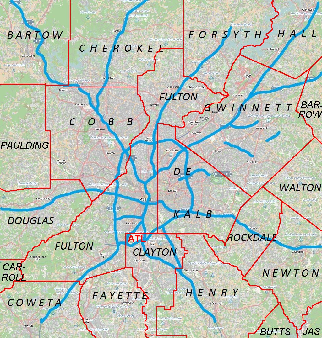
 Location of Cartersville in Metro Atlanta
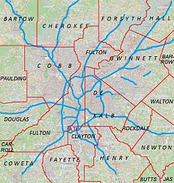
 Cartersville
Coordinates: 34°10′35″N 84°48′14″W / 34.17639°N 84.80389°WCoordinates: 34°10′35″N 84°48′14″W / 34.17639°N 84.80389°W Country United States of America State State of Georgia County Bartow Incorporated 1836 Government – Mayor Matt Santini Area – Total 23.5 sq mi (60.9 km2) – Land 23.4 sq mi (60.6 km2) – Water 0.1 sq mi (0.3 km2) Elevation 768 ft (234 m) Population (2010) – Total 19,731 – Density 807.0/sq mi (312.9/km2) Time zone Eastern Time (UTC-5) – Summer (DST) Eastern Daylight Time (UTC-4) ZIP code 30120, 30121 Area code(s) 770, 678 local: 381-387, 490, 607, 797, 382 FIPS code 13-13688[1] GNIS feature ID 0355017[2] Website http://www.cityofcartersville.org/ Cartersville is a town in Bartow County, in the U.S. state of Georgia. As of the 2010 census, the city had a population of 19,7314[3]. The city is the county seat of Bartow County[4].
Contents
Geography
Cartersville was named for Colonel Farish Carter.[5]
According to the U.S. Census Bureau, the city has a total area of 23.5 square miles (60.9 km²), of which, 23.4 square miles (60.6 km²) of it is land and 0.1 square miles (0.3 km²) of it (0.51%) is water.
Cartersville area communities
The following communities border the city:
- Cassville (north)
- Emerson (south)
- Euharlee (west)
- Kingston (northwest)
- Sugar Valley (west)
- Stilesboro (southwest)
- Taylorsville (southwest)
- White (northern)
- Landens Cat
Economy
Manufacturing, tourism, and services play a part in the economy of the city.[citation needed]
The city has medical establishments including The Cartersville Medical Center, and The Hope Center.[citation needed]
Education
The Cartersville City School District holds grades pre-school to grade twelve. It consists of two elementary schools, a middle school, and a high school.[6] The district has 226 full-time teachers and over 3,940 students.[7]
- Cartersville Elementary School
- Cartersville Primary School
- Cartersville Middle School
- Cartersville High School
- Woodland High School is supported by the Bartow County School District
Demographics
As of the census[1] of 2010, there were 19,010 people, 5,870 households, and 4,132 families residing in the city. The population density was 680.7 people per square mile (262.9/km²). There were 6,130 housing units at an average density of 262.0 per square mile (101.2/km²). The racial makeup of the city was 63.93% White, 29.64% African American, 0.28% Native American, 0.82% Asian, 0.04% Pacific Islander, 3.76% from other races, and 1.53% from two or more races. Hispanic or Latino of any race were 7.28% of the population.
There were 5,870 households out of which 33.3% had children under the age of 18 living with them, 52.6% were married couples living together, 13.6% had a female householder with no husband present, and 29.6% were non-families. 25.9% of all households were made up of individuals and 11.7% had someone living alone who was 65 years of age or older. The average household size was 2.59 and the average family size was 3.10.
In the city, the population was spread out with 25.9% under the age of 18, 8.7% from 18 to 24, 30.2% from 25 to 44, 20.8% from 45 to 64, and 14.4% who were 65 years of age or older. The median age was 36 years. For every 100 females there were 95.4 males. For every 100 females age 18 and over, there were 92.1 males.
The median income for a household in the city was $41,162, and the median income for a family was $48,219. Males had a median income of $35,092 versus $25,761 for females. The per capita income for the city was $19,977. About 8.9% of families and 11.4% of the population were below the poverty line, including 13.7% of those under age 18 and 15.4% of those age 65 or over.
Places of interest
- Booth Western Art Museum on North Museum Drive in Cartersville.[8] The Booth is the second largest art museum in Georgia.[citation needed] It houses the largest permanent exhibition space for Western art in the country. It is also a Smithsonian Institution Affiliate.
- Etowah Indian Mounds is an archaeological Native American site in Bartow County, Georgia, south of Cartersville.
- Tellus Science Museum, formerly the Weinman Mineral Museum, is a Smithsonian Institute Affiliate and features the first digital planetarium in North Georgia. NASA has installed a camera that tracks meteors at the museum.[9]
- The world's first outdoor Coca-Cola sign, painted in 1894, is located in downtown Cartersville on Young Brothers Pharmacy's wall.[10]
- Rose Lawn, a house museum, is the former home of noted evangelist Samuel Porter Jones,[11] for whom the Union Gospel Tabernacle (Ryman Auditorium) in Nashville was built, later to become the Grand Ol' Opry.
- The Bartow History Museum located in the Old Cartersville Courthouse, c. 1870, in downtown Cartersville on East Church St.[12]
Infrastructure
Roads
There are several major highways. Interstate 75 is the major north-south route through the area, leading to Adairsville to the north and Acworth to the south. U.S. Highway 41, which is concurrent with State Route 3, parallels Interstate 75. U.S. Highway 411 leads west to Rome and north to White. State Route 20 runs west to Rome concurrent with U.S. Highway 411 and runs east to Canton. State Route 61 runs north to White concurrent with U.S. Highway 411 and runs south to Dallas. State Route 113 runs southwesterly to Rockmart. State Route 293 runs west-northwest to Kingston.
Notable residents
- First African-American Georgia Supreme Court Justice, the Honorable Robert Benham (1946–present) was born and resided in Cartersville.
- Georgia Governor Joe Frank Harris (1936–present) resides in Cartersville.
- Evangelist Samuel Porter Jones (1847–1906). The Union Gospel Tabernacle (Ryman Auditorium), later the Grand Ol' Opry in Nashville, was built for him. He was a major force in spreading the Gospel across the U.S. in the late 19th century.
- Rebecca Latimer Felton (1835–1930) was the first female United States Senator.
- Singer/Songwriter/Producer Butch Walker (1969–present) grew up in Cartersville and references it in the songs "Get Down," "Suburbia," and "Don't You Think Someone Should Take You Home."
- Actor Wayne Knight (1955–present), Newman from Seinfeld grew up in Cartersville.
- Lottie Moon was a Baptist missionary to China. She taught at Cartersville Female High School from 1871 to 1873 before moving to China. She was a member of Cartersville First Baptist Church.
- The baseball player Rudy York (1913–70) holds the major league record for the most home runs hit in the month of August.
- Author Corra Harris, the first woman to be a war correspondent who covered World War I for The New York Post, and author of novels including Circuit Riders's Wife.
- Bill Arp (Charles Henry Smith, 1826–1903, nationally syndicated columnist. A book about his life was written by another Cartersville citizen, David B. Parker entitled "Alias Bill Arp: Charles Henry Smith and the South's "Goodly Heritage" (Athens: University of Georgia Press, 1991).
- Country music singer Cledus T. Judd (1964–present) resides in Cartersville and is a graduate of Cass High School.
- Miami Dolphins Pro Bowl running back and the highest player ever drafted to the NFL from the state of Georgia, Ronnie Brown, attended Cartersville High School.
- Detroit Lions defensive tackle Andre Fluellen attended Cartersville High School.
- Former NFL Super Bowl champion running back and Georgia Bulldog Keith Henderson resides in Cartersville and attended Cartersville High School.
- 2009 3rd Overall MLB draft pick chosen by the San Diego Padres Donavan Tate, attended Cartersville High School.
- Robert Lavette who played with the Dallas Cowboys, attended Cartersville High School. He is the Georgia Tech all time leading rusher.
- Bob Burns, founding member and original drummer of southern rock band Lynyrd Skynyrd.
- W. J. Gordy, who was an award-winning American potter.
References
- ^ a b "American FactFinder". United States Census Bureau. http://factfinder.census.gov. Retrieved 2008-01-31.
- ^ "US Board on Geographic Names". United States Geological Survey. 2007-10-25. http://geonames.usgs.gov. Retrieved 2008-01-31.
- ^ http://quickfacts.census.gov/qfd/states/13/1313688.html
- ^ "Find a County". National Association of Counties. http://www.naco.org/Counties/Pages/FindACounty.aspx. Retrieved 2011-06-07.
- ^ "City of Cartersville". The State of Georgia. http://cartersville.georgia.gov/05/home/0,2230,9023877,00.html;jsessionid=7B4038E9C0AAE755BD9D8AB906B87938. Retrieved 2011-11-12.
- ^ Georgia Board of Education. Retrieved June 2, 2010.
- ^ School Stats. Retrieved June 2, 2010.
- ^ Lee Walburn (June 2005). "Best Western — The Booth Western Art Museum n Cartersville brings the old west to northwestern Georgia triggering celluloid-tinted memories of cowboys, standoffs, and frogs". Atlanta Magazine. http://books.google.com/books?id=hQ8AAAAAMBAJ&pg=PA60&dq=Booth+Western+Art+Museum+cartersville&hl=en&ei=LtG-TrLHCqGQiAK65fD7Ag&sa=X&oi=book_result&ct=result&resnum=2&ved=0CDkQ6AEwAQ#v=onepage&q=Booth%20Western%20Art%20Museum%20cartersville&f=false. Retrieved 2011-11-12.
- ^ Marie Nesmith. "NASA installs 'fireball' camera at Tellus Science Museum". The Daily Tribune. http://www.daily-tribune.com/view/full_story/12430463/article-NASA-installs--fireball--camera-at-Tellus-Science-Museum. Retrieved 2011-11-12.
- ^ Amy Gillis Lowry; Abbie Tucker Parks (May 1997). North Georgia's Dixie Highway. Arcadia Publishing. pp. 99. ISBN 978-0738544311. http://books.google.com/books?id=itA8NkoBsZkC&pg=PA99&dq=world%27s+first+outdoor+Coca-Cola+sign+cartersville&hl=en&ei=uNy-TsWqMMLViAKv9LGuBQ&sa=X&oi=book_result&ct=result&resnum=4&ved=0CFgQ6AEwAw#v=onepage&q=world%27s%20first%20outdoor%20Coca-Cola%20sign%20cartersville&f=false.
- ^ William Pencak (October 2009). Encyclopedia of the Veteran in America, Volume 1. Greenwood Publishing Group. pp. 615. ISBN 978-0313340093. http://books.google.com/books?id=XtxJ_zF_ydUC&pg=PA615&dq=roselawn+museum+cartersville+sam+jones&hl=en&ei=F9m-TuPiEMrmiALEyPT4Ag&sa=X&oi=book_result&ct=result&resnum=6&ved=0CFIQ6AEwBQ#v=onepage&q=roselawn%20museum%20cartersville%20sam%20jones&f=false.
- ^ Matt Shinall. "Bartow History Museum reflects on past as transition into new home begins". The Daily Tribune. http://www.daily-tribune.com/view/full_story/8067736/article-Bartow-History-Museum-reflects-on-past-as-transition-into-new-home-begins. Retrieved 2011-11-12.
External links
- Official City of Cartersville site
- Cartersville Visitors Bureau
- Cartersville Chamber of Commerce
- City Data site
- The Daily Tribune, newspaper based in Cartersville
- News Talk AM 1270, radio station based in Cartersville
Metro Atlanta Counties 
Major city Municipalities & communities 100k-250k 25k-100k Alpharetta • Brookhaven • Candler-McAfee • Duluth • Dunwoody • East Point • Gainesville • Johns Creek • Lawrenceville • Mableton • Marietta • Milton • Newnan • Peachtree City • Peachtree Corners • Redan • Smyrna • Tucker10k-25k Acworth • Belvedere Park • Buford • Carrollton • Cartersville • Chamblee • College Park • Conyers • Covington • Decatur • Doraville • Druid Hills • Douglasville • Fayetteville • Forest Park • Griffin • Kennesaw • Suwanee • Lilburn • Monroe • Mountain Park • North Decatur • North Druid Hills • Panthersville • Powder Springs • Riverdale • Snellville • Stockbridge • Sugar Hill • Union City • Vinings • Winder • WoodstockTopics Architecture • Culture • History • Media • Neighborhoods • People • Tourism • Transportation Municipalities and communities of Bartow County, Georgia County seat: CartersvilleCities Adairsville | Cartersville | Emerson | Euharlee | Kingston | White

Town Unincorporated
communitiesAtco | Cassville | Rowland Springs | Rydal | Stilesboro
Footnotes ‡This populated place also has portions in an adjacent county or counties
Categories:- Atlanta metropolitan area
- Cities in Georgia (U.S. state)
- Populated places in Bartow County, Georgia
- County seats in Georgia (U.S. state)


Wikimedia Foundation. 2010.