- Enigma, Georgia
Infobox Settlement
official_name = Enigma, Georgia
other_name =
native_name =
nickname =
settlement_type =Town
motto =
imagesize =
image_caption =
flag_size =
image_
seal_size =
image_shield =
shield_size =
image_blank_emblem =
blank_emblem_type =
blank_emblem_size =
imagesize =
image_caption =
flag_size =
image_
seal_size =
image_shield =
shield_size =
image_blank_emblem =
blank_emblem_type =
blank_emblem_size =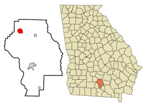
mapsize = 250px
map_caption = Location in Berrien County and the state of Georgia
mapsize1 =
map_caption1 =
image_dot_
dot_mapsize =
dot_map_caption =
dot_x =
dot_y =
pushpin_
pushpin_label_position =
pushpin_map_caption =
pushpin_mapsize =
subdivision_type = Country
subdivision_name =United States
subdivision_type1 = State
subdivision_name1 = Georgia
subdivision_type2 = County
subdivision_name2 = Berrien
subdivision_type3 =
subdivision_name3 =
subdivision_type4 =
subdivision_name4 =
government_footnotes =
government_type =
leader_title =
leader_name =
leader_title1 =
leader_name1 =
leader_title2 =
leader_name2 =
leader_title3 =
leader_name3 =
leader_title4 =
leader_name4 =
established_title =
established_date =
established_title2 =
established_date2 =
established_title3 =
established_date3 =
area_magnitude =
unit_pref = Imperial
area_footnotes =
area_total_km2 = 8.5
area_land_km2 = 8.4
area_water_km2 = 0.1
area_total_sq_mi = 3.3
area_land_sq_mi = 3.3
area_water_sq_mi = 0
area_water_percent =
area_urban_km2 =
area_urban_sq_mi =
area_metro_km2 =
area_metro_sq_mi =
area_blank1_title =
area_blank1_km2 =
area_blank1_sq_mi =
population_as_of = 2000
population_footnotes =
population_note =
population_total = 869
population_density_km2 = 102.2
population_density_sq_mi = 263.3
population_metro =
population_density_metro_km2 =
population_density_metro_sq_mi =
population_urban =
population_density_urban_km2 =
population_density_urban_sq_mi =
population_blank1_title =
population_blank1 =
population_density_blank1_km2 =
population_density_blank1_sq_mi =
timezone = Eastern (EST)
utc_offset = -5
timezone_DST = EDT
utc_offset_DST = -4
latd = 31 |latm = 24 |lats = 41 |latNS = N
longd = 83 |longm = 19 |longs = 52 |longEW = W
elevation_footnotes =
elevation_m = 93
elevation_ft = 305
postal_code_type =ZIP code
postal_code = 31749
area_code = 229
blank_name = FIPS code
blank_info = 13-27596GR|2
blank1_name = GNIS feature ID
blank1_info = 0313955GR|3
website =
footnotes =Enigma is a town in Berrien County, Georgia,
United States . The population was 869 at the 2000 census.History
Enigma, Georgia, is a small town in South Georgia located in the northwest tip of Berrien County, nine miles east of Tifton, on Highway 82. The town was founded between 1876-1880 by John A. Ball. It did not start out named "Enigma." Originally a settlement, it was commonly referred to as "Gunn and Weston" until Ball decided he wanted a real name for this town. Two names, "Lax" and "Enigma," were proposed to state officials for review. Lax was already taken by another nearby settlement and so "Enigma" became the official name. [ Cauthen, Edna Dean, Elon Dean Murphy and Estelle Dean McMillan. "The History of Berrien County: Enigma, Berrien County, Georgia" 1975.] Enigma is an odd name for a town; by definition it means a puzzle or mystery. Ball said, “It was a puzzle what to name it anyway." The town was incorporated on August 21, 1906. [ Cauthen, Edna Dean, Elon Dean Murphy and Estelle Dean McMillan. "The History of Berrien County: Enigma, Berrien County, Georgia" 1975.]
Ball along with his family originated in Raleigh, N.C., traveling to South Georgia on the
Brunswick and Western Railroad . He became the town’s first postmaster, and not long afterward, Capt J.B. Gunn fromTerrell County, Georgia came as an assistant. Ball and his son Jim started a turpentine business around 1878. Ball returned to Raleigh to bring back a man named Tubb Daughtry and his family to help run the business. He gave them land to live on and permission to worship as they pleased. The turpentine business soon dwindled and lumber became the main focus. Capt. J. B. Gunn and Capt. S. R. Weston built a sawmill two miles east of Enigma. H. F. Stewart came to work in the sawmill. [ Cauthen, Edna Dean, Elon Dean Murphy and Estelle Dean McMillan. "The History of Berrien County: Enigma, Berrien County, Georgia" 1975.]Other businesses opened in Enigma throughout the years, including a grocery, merchandise, and hardware stores. E.F. Bussey set up a merchandise store in a building owned at one time by Gunn. This building also housed the U.S. Post Office and sold coffins on its second story. [Cauthen, Edna Dean, Elon Dean Murphy and Estelle Dean McMillan. "The History of Berrien County: Enigma, Berrien County, Georgia" 1975.] It was located on the south side of the railroad. The railroad’s closest depot was in Brookfield, Ga., four miles away. Enigma had a doctor’s office run by G.R. Parker. There have been three banks in Enigma throughout the years. Two banks were started around 1915 to 1917 and the other one was started in 1973. The People's Bank opened in 1915 and closed in 1916, and the Ambrose-Enigma Banking Company opened on June 5, 1917 and closed around 1920. [Owens, O.Dee. Personal Interview. 16 Nov 2007.] The Bank of Alapaha opened a branch in Enigma on March 1, 1973 and is still in business today.
Economy
Most citizens of Enigma commute to neighboring towns to work and shop. The town's economy is based primarily on agriculture. The Corner Café is its only restaurant, and it has two gas stations - the Quick Stop #2 (#1 is in Brookfield) and the Danfair Express, and all three are located on Highway 82. The Post Office, Glass Unlimited, Volunteer Fire Department, City Hall, the salon (Freida’s Beauty Barn), and the Bank of Alapaha are all located on Main Street. Just off of Main Street is the factory Geo Tex, LLC Plant #2 where screening is made. There is also Berrien Peanut Company two and a half miles outside of Enigma and there used to be a skating rink about a mile from Berrien Peanut Company. There are other buildings on Main Street and Highway 82 but they are currently vacant.
chools
The Enigma school was located on the north side of town. It started as a one-room school house then moved to a three-room school house. A large brick building was built in 1926 to serve as a new school, also on the north side, just across from Highway 82. In the 1950s all county high schools were consolidated into Berrien High in Nashville, the county seat. The original Enigma school building was still in use as part of the elementary school when it burned in October 1973. The gymnasium and cafeteria were still standing and portable classrooms were brought in so the school could continue until it was rebuilt [ Cauthen, Edna Dean, Elon Dean Murphy and Estelle Dean McMillan. "The History of Berrien County: Enigma, Berrien County, Georgia" 1975.] . The school merged with the other schools in the county in the 1980’s to form Berrien high, middle, elementary, and primary schools [ Owens, O.Dee. Personal Interview.] The school grounds now serve as the Enigma City Park.
Functions
The Park holds the town’s annual
Fourth of July celebration, consisting of vendors, exhibits and the Miss Enigma Firecracker Pageant, each year. The only other functions the town has each year are the Halloween Trick or Treat and the Christmas Parade.Enigma is also home to Southern States Championship Wrestling. They run monthly shows and only charge $2 a seat. This has helped add a little southern tradition and entertainment for all ages
Churches
There are several churches in the Enigma community. Most have some affiliation with the Baptist Denomination. On the north side of town from highway 82 west is the St. Stephen’s Missionary Baptist Church. On the same road across highway 82, there is the Mount. Zion Holiness Baptist Church, which was organized in 1921. The Christian Church opened in June 1908 and was torn down and rebuilt in 1946, it added an education annex in 1960. It is located on Main Street, one block west of Mount. Zion. Also on Main Street are Enigma Baptist Church and Enigma Methodist Church next door to one another. The Enigma Baptist is one of the oldest churches in town, it began in 1889. It started as the Enigma Missionary Baptist Church. It joined the Mell Baptist Association shortly after both began and is still part of the association. In the 1910’s the church was destroyed by a tornado leaving only the pulpit and a chair on the podium. The Methodist Church also has been around for several years opening its doors in 1886. An architect from Canada named John C. Gubesm designed and built it [ Cauthen, Edna Dean, Elon Dean Murphy and Estelle Dean McMillan. "The History of Berrien County: Enigma, Berrien County, Georgia" 1975.] . Harvest Time Christian Outreach is across highway 82 from the Quick Stop #2. The church was opened by Becky King approxiamately three years ago, she leads the community in clothing drives, community bon fires, and the church has opened a sawmill on a vacant lot in the start of building a church. They are located in a small trailer until the new church is built. Pine Ridge Missionary Church is a relatively new church, just established in April 1962. It is part of the Smyrna Missionary Baptist Association [ Cauthen, Edna Dean, Elon Dean Murphy and Estelle Dean McMillan. "The History of Berrien County: Enigma, Berrien County, Georgia" 1975.] . It is just outside of town across the road from Berrien Peanut Company.
Interesting information
Enigma really is not known for any mystery, and does not have anyone famous from it except for Bobby Rowan, former senator in the Georgia Senate and Naomi Sego, a gospel singer. A 1971 novel by Harry Crews, "The Gospel Singer", is set partly in Enigma, but Crews grew up in nearby Fitzgerald.
Enigma’s first fire department was established in 1893 with a cistern to hold ten thousand gallons of water and have a pump and hose ready in case of fire. The first car in Enigma was a Rio owned by Dr. J.H. Hammond in 1893. The telephones were in operation earlier around the beginning of the 1900’s. The first airplane to fly over Enigma was in 1918. Enigma’s first electric lights were set up in approximately 1936, and the city water system was put into place about 1955. [Cauthen, Edna Dean, Elon Dean Murphy and Estelle Dean McMillan. "The History of Berrien County: Enigma, Berrien County, Georgia" 1975.] The oddest thing about Enigma is that there was once a well in the middle of Main Street. Pictures of this are hard to find and many of those who lived to see it are not around anymore. [ Hall, Rita, Melinda Griner, and Jeane Nugent. Personal Interview. 7 Nov 2007.]
Geography
Enigma is located at coor dms|31|24|41|N|83|19|52|W|city (31.411466, -83.331056)GR|1.
According to the
United States Census Bureau , the town has a total area of 3.3square mile s (8.5km² ), of which, 3.2 square miles (8.4 km²) of it is land and 0.04 square miles (0.1 km²) of it (0.91%) is water.Demographics
As of the
census GR|2 of 2000, there were 869 people, 313 households, and 231 families residing in the town. Thepopulation density was 267.2 people per square mile (103.2/km²). There were 348 housing units at an average density of 107.0/sq mi (41.3/km²). The racial makeup of the town was 77.79% White, 10.36% African American, 0.12% Asian, 0.92% Pacific Islander, 9.32% from other races, and 1.50% from two or more races. Hispanic or Latino of any race were 11.85% of the population.There were 313 households out of which 43.5% had children under the age of 18 living with them, 55.6% were married couples living together, 13.7% had a female householder with no husband present, and 25.9% were non-families. 23.0% of all households were made up of individuals and 10.2% had someone living alone who was 65 years of age or older. The average household size was 2.78 and the average family size was 3.24.
In the town the population was spread out with 35.4% under the age of 18, 7.5% from 18 to 24, 30.0% from 25 to 44, 18.4% from 45 to 64, and 8.6% who were 65 years of age or older. The median age was 29 years. For every 100 females there were 97.5 males. For every 100 females age 18 and over, there were 85.1 males.
The median income for a household in the town was $25,268, and the median income for a family was $27,375. Males had a median income of $22,202 versus $16,964 for females. The
per capita income for the town was $14,498. About 20.9% of families and 24.2% of the population were below thepoverty line , including 30.4% of those under age 18 and 19.5% of those age 65 or over.References
*Cauthen, Edna Dean, Elon Dean Murphy and Estelle Dean McMillan. "The History of Berrien County: Enigma, Berrien County, Georgia" 1975.
*Hall, Rita, Melinda Griner, and Jeane Nugent. Personal Interview. 7 November 2007.
*Owens, O.Dee. Personal Interview. 16 November 2007.
External links
* http://www.berriencountyga.com
* http://www.berrien.k12.ga.us/
Wikimedia Foundation. 2010.