- North Atlanta, Georgia
Infobox Settlement
official_name = North Atlanta, Georgia
other_name =
native_name =
nickname =
settlement_type = CDP
motto =
imagesize =
image_caption =
flag_size =
image_
seal_size =
image_shield =
shield_size =
image_blank_emblem =
blank_emblem_type =
blank_emblem_size =
imagesize =
image_caption =
flag_size =
image_
seal_size =
image_shield =
shield_size =
image_blank_emblem =
blank_emblem_type =
blank_emblem_size =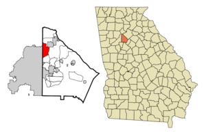
mapsize = 250px
map_caption = Location in DeKalb County and the state of Georgia
mapsize1 =
map_caption1 =
image_dot_
dot_mapsize =
dot_map_caption =
dot_x =
dot_y =
pushpin_
pushpin_label_position =
pushpin_map_caption =
pushpin_mapsize =
subdivision_type = Country
subdivision_name =United States
subdivision_type1 = State
subdivision_name1 = Georgia
subdivision_type2 = County
subdivision_name2 = DeKalb
subdivision_type3 =
subdivision_name3 =
subdivision_type4 =
subdivision_name4 =
government_footnotes =
government_type =
leader_title =
leader_name =
leader_title1 =
leader_name1 =
leader_title2 =
leader_name2 =
leader_title3 =
leader_name3 =
leader_title4 =
leader_name4 =
established_title =
established_date =
established_title2 =
established_date2 =
established_title3 =
established_date3 =
area_magnitude =
unit_pref = Imperial
area_footnotes =
area_total_km2 = 19.9
area_land_km2 = 19.8
area_water_km2 = 0.1
area_total_sq_mi = 7.8
area_land_sq_mi = 7.7
area_water_sq_mi = 0.1
area_water_percent =
area_urban_km2 =
area_urban_sq_mi =
area_metro_km2 =
area_metro_sq_mi =
area_blank1_title =
area_blank1_km2 =
area_blank1_sq_mi =
population_as_of = 2000
population_footnotes =
population_note =
population_total = 38579
population_density_km2 = 1938.6
population_density_sq_mi = 4946
population_metro =
population_density_metro_km2 =
population_density_metro_sq_mi =
population_urban =
population_density_urban_km2 =
population_density_urban_sq_mi =
population_blank1_title =
population_blank1 =
population_density_blank1_km2 =
population_density_blank1_sq_mi =
timezone = Eastern (EST)
utc_offset = -5
timezone_DST = EDT
utc_offset_DST = -4
latd = 33 |latm = 51 |lats = 46 |latNS = N
longd = 84 |longm = 20 |longs = 0 |longEW = W
elevation_footnotes =
elevation_m = 306
elevation_ft = 1004
postal_code_type =ZIP code
postal_code = 30319
area_code = 404
blank_name = FIPS code
blank_info = 13-56000GR|2
blank1_name = GNIS feature ID
blank1_info = 0332512GR|3
website =
footnotes =North Atlanta is a
census-designated place in DeKalb County, Georgia,United States . As of the 2000 census, the CDP had a totalpopulation of 38,579. North Atlanta is one of very few former incorporated places that exists in theUnited States , disincorporated during the 1960s.Description
North Atlanta's Census area contains separate communities of Brookhaven, North Atlanta, and Skyland.
Geography
North Atlanta is located at coor dms|33|51|46|N|84|20|0|W|city (33.862653, -84.333452)GR|1.
According to the
United States Census Bureau , the CDP has a total area of 7.7 square miles (20.0 km²), of which, 7.7 square miles (19.8 km²) of it is land and 0.1 square miles (0.2 km²) of it (0.78%) is water.Demographics
As of the
census GR|2 of 2000, there were 38,579 people, 15,886 households, and 7,402 families residing in the CDP. Thepopulation density was 5,040.6 people per square mile (1,947.1/km²). There were 16,636 housing units at an average density of 2,173.6/sq mi (839.6/km²). The racial makeup of the CDP was 61.52% White, 17.56% African American, 0.41% Native American, 4.88% Asian, 0.05% Pacific Islander, 12.64% from other races, and 2.94% from two or more races. Hispanic or Latino of any race were 27.41% of the population.There were 15,886 households out of which 18.5% had children under the age of 18 living with them, 33.3% were married couples living together, 7.4% had a female householder with no husband present, and 53.4% were non-families. 35.0% of all households were made up of individuals and 4.4% had someone living alone who was 65 years of age or older. The average household size was 2.35 and the average family size was 3.04.
In the CDP the population was spread out with 15.6% under the age of 18, 15.2% from 18 to 24, 47.2% from 25 to 44, 15.7% from 45 to 64, and 6.2% who were 65 years of age or older. The median age was 31 years. For every 100 females there were 121.9 males. For every 100 females age 18 and over, there were 124.2 males.
The median income for a household in the CDP was $52,333, and the median income for a family was $52,679. Males had a median income of $35,742 versus $37,043 for females. The
per capita income for the CDP was $32,087. About 7.6% of families and 11.8% of the population were below thepoverty line , including 16.1% of those under age 18 and 9.0% of those age 65 or over.References
External links
Wikimedia Foundation. 2010.