Gulf State Park

Gulf State Park

Infobox park
park=Gulf State Park
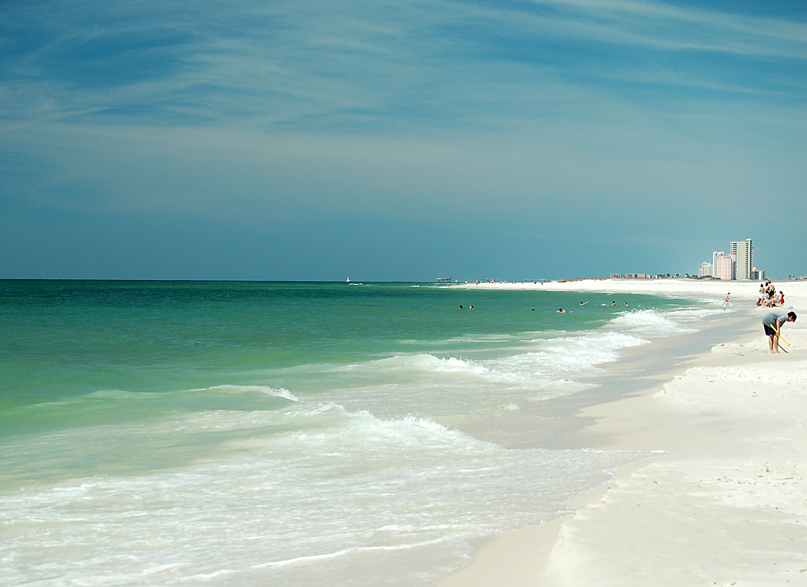


image size=240px
caption=Looking west along the beach at Gulf State Park
type=State Park
location=20115 Alabama Highway 135
Gulf Shores, Alabama, U.S.A.
coordinates=coord|30.26366|N|87.67761|W
size=convert|6150|acre|km2
opened=
operator=Alabama Department of Conservation and Natural Resources
visitors=
status=

Gulf State Park is a convert|6150|acre|km2|adj=onstate park in Gulf Shores, Alabama in southern Baldwin County. The park property fronts the Gulf of Mexico.cite web|title="Gulf State Park"|work="Alabama State Parks"|url=http://www.alapark.com/parks/park.cfm?parkid=22|accessdate=2008-01-10]

History

Gulf State Park has weathered several hurricanes but was largely devastated by Hurricane Ivan in 2004. Major renovations are underway due to damage and it is not back up to full capacity as of 2007.cite web|title="Gulf State Park"|work="StateParks.com"|url=http://stateparks.com/gulf.html/golfcourses/AL/8348.htm|accessdate=2008-01-10]

Amenities

The park features convert|2|mi|km of white sand beaches on the Gulf, modern and primitive campgrounds, rental cottages, nature trails, golf, and fishing. There are 154 campsites. The modern campsites features 50 amp electrical service, water, and the RV sites feature sewer hook-ups. The park also contains an 18 hole championship golf course that is open seven days a week and includes a proshop and snack bar.

References

External links

* [http://www.alapark.com/parks/park.cfm?parkid=22 Alabama State Parks - Gulf State Park]


Wikimedia Foundation. 2010.

Игры ⚽ Поможем написать реферат

Look at other dictionaries:

  • Grand Gulf State Park — im August 2007 Der Grand Gulf State Park besteht aus einer Schlucht mit teilweise eingestürztem Höhlensystem, einer Felsbrücke und einem Fluss mit Schlucklöchern. Der 134 ha große State Park liegt in 2100 m Höhe etwa 10 km westlich …   Deutsch Wikipedia

  • Grand Gulf State Park — near Thayer, Missouri, consists of 322 acres (130 hectares) encompassing a forked canyon that is the remnant of an ancient collapsed cave system. The Grand Gulf is nearly a mile long and up to 130 feet (40 m) deep with shear sides. An uncollapsed …   Wikipedia

  • Whetstone Gulf State Park — is a state park located in Lewis County, New York in the USA. The park is on the border of the Towns of Turin and Martinsburg. The park is on the edge of the Tug Hill Plateau, south of Lowville. The park is built in and around a three mile long… …   Wikipedia

  • Mammoth Spring State Park — Quelltopf der Mammoth Spring Der Mammoth Spring State Park liegt unmittelbar neben der Ortschaft Mammoth Spring im Fulton County des US Bundesstaates Arkansas auf 161 m Höhe. Der 25 ha große State Park enthält mit Mammoth Spring die… …   Deutsch Wikipedia

  • Itasca State Park — Geobox|Protected area name = Itasca State Park category = Minnesota State Park category iucn = IV image caption = The source of the Mississippi River at the north end of Lake Itasca country = United States country state = Minnesota state state… …   Wikipedia

  • Midway State Park — Location Maple Springs, New York, U.S. Coordinates 42°12′06″N 79°25′19″W /  …   Wikipedia

  • Mounds State Park — U.S. National Register of Historic Places …   Wikipedia

  • Riverbank State Park — From Gutenberg Riverbank State Park is a 28 acre (11 ha) park built on the top of a sewage treatment facility on the Hudson River, in the New York City borough of Manhattan. The park includes an Olympic size swimming pool (home to the… …   Wikipedia

  • Trace State Park — For the Tennessee state park, see Natchez Trace State Park. Trace State Park, also known as Old Natchez Trace Park, is a state park in the U.S. state of Mississippi. It is located off Mississippi Highway 6 near the hamlet of Furrs, about halfway… …   Wikipedia

  • Napeague State Park — Coordinates: 40°59′23″N 72°04′37″W / 40.989682°N 72.0769°W / 40.989682; 72.0769 …   Wikipedia

Share the article and excerpts

Direct link
Do a right-click on the link above
and select “Copy Link”