Coton Hill, Shropshire

Coton Hill, Shropshire

Coordinates: 52°42′58″N 2°45′14″W / 52.716°N 2.754°W / 52.716; -2.754

Coton Hill
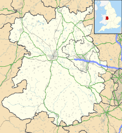
Coton Hill is located in Shropshire
Coton Hill

 Coton Hill shown within Shropshire
Population 1,500 (approx)
OS grid reference SJ492134
Unitary authority Shropshire
Ceremonial county Shropshire
Region West Midlands
Country England
Sovereign state United Kingdom
Post town Shrewsbury
Postcode district SY1
Dialling code 01743
Police West Mercia
Fire Shropshire
Ambulance West Midlands
EU Parliament West Midlands
UK Parliament Shrewsbury & Atcham
List of places: UK • England • Shropshire

Coton Hill was a village near to, but now a suburb of, the town of Shrewsbury, Shropshire in the West Midlands of England.

During the 19th Century the area became a centre for railway freight and two huge yards grew up in the area (Coton Hill North and Coton Hill South), on the Shrewsbury to Chester Line. Although the line is still running passenger and some freight services, only one of these yards still exists and it is disused. A serious rail crash occurred at Coton Hill South in January 1965.

Coton Hill has an unusual number of public houses in proximity to each other, thanks to being on the historic route from Ellesmere and Chester. Pubs include the Woody (Woodman Inn), the Bird in Hand, the Royal Oak and the Severn Apprentice.

The River Severn flows nearby. A strangely named passage exists in this old former village - "Pig Trough". The Shropshire Agricultural Showground is just outside Coton Hill, and this is used once a year, usually in May, to hold the Shropshire and West Midlands Show.

There has been, and continues to be, some residential development in this popular suburb of the county town. It is close to the town centre and yet also remains close to the countryside of Shropshire.

See also

Notes and references


Wikimedia Foundation. 2010.

Игры ⚽ Поможем написать реферат

Look at other dictionaries:

  • Coton Hill rail crash — Date and time 11 January 1965 Location Coton Hill, Shropshire Rail line Shrewsbury to Chester Line Cause Overspeed on incline Trains 2 Passengers …   Wikipedia

  • Coton Hill — may refer to: Coton Hill, Shropshire Coton Hill, Staffordshire This disambiguation page lists articles about distinct geographical locations with the same name. If an internal link led you here, you may wish …   Wikipedia

  • Coton — may refer to: Places Coton, Cambridgeshire Coton, Northamptonshire Coton, Shropshire Coton, Staffordshire Coton Clanford, Staffordshire Coton Hill, Shropshire Coton Hill, Staffordshire Coton in the Elms, Derbyshire Coton House, a late 18th… …   Wikipedia

  • Shropshire and West Midlands Show — The Shropshire and West Midlands Show, though usually called the West Mid Show, is an annual agriculture related show held on the outskirts of Shrewsbury (at Coton Hill), England.It has its own showground the Shropshire Agricultural Showground,… …   Wikipedia

  • Coton, Shropshire — Roadside pond in Coton near Hollinwood. Coton is the name of two hamlets in the English county of Shropshire: One Coton lies near the road from Whitchurch to Wem about one mile southeast of Hollinwood. Coton Hall, home of Viscount Hill, is an… …   Wikipedia

  • Wrexham & Shropshire — Infobox Rail companies bgcolor=696969 franchise=Not subject to franchising; Open access operator image filename=Wrexham and Shropshire 67012 Marylebone TT1.jpg widthpx=265px franchise=Not subject to franchising; Open access operator 28 April 2008 …   Wikipedia

  • List of places in Shropshire — This is a list of towns and villages in the ceremonial county of Shropshire, England. This list includes those places in Telford and Wrekin. See the list of places in England for places in other counties.The five major towns in the county… …   Wikipedia

  • Shrewsbury — ] A fault, the Hodnet Fault, starts approximately at the town, and runs as far as Market Drayton. Shrewsbury areauburbs and surrounding settlementsShrewsbury has a large number of suburbs and surrounding villages. As the town continues to expand …   Wikipedia

  • Bagley, Shrewsbury — infobox UK place country =England static static image caption = latitude =52.722 longitude = 2.754 official name =Bagley population =3000 (approx) shire district =Shrewsbury and Atcham shire county =Shropshire metropolitan borough = metropolitan… …   Wikipedia

  • John Benbow — in 1701, by Sir Godfrey Kneller. He holds a simple officer s hanger.[1] …   Wikipedia

Share the article and excerpts

Direct link
Do a right-click on the link above
and select “Copy Link”