- Hale'iwa, Hawai'i
Infobox Settlement
official_name = Haleiwa, Hawaii
other_name =
native_name =
nickname =
settlement_type = CDP
motto =
imagesize =
image_caption =
flag_size =
image_
seal_size =
image_shield =
shield_size =
image_blank_emblem =
blank_emblem_type =
blank_emblem_size =
imagesize =
image_caption =
flag_size =
image_
seal_size =
image_shield =
shield_size =
image_blank_emblem =
blank_emblem_type =
blank_emblem_size =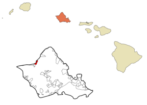
mapsize =
map_caption = Location in Honolulu County and the state ofHawaii
mapsize1 =
map_caption1 =
image_dot_
dot_mapsize =
dot_map_caption =
dot_x =
dot_y =
pushpin_
pushpin_label_position =
pushpin_map_caption =
pushpin_mapsize =
subdivision_type = Country
subdivision_name =United States
subdivision_type1 = State
subdivision_name1 =Hawaii
subdivision_type2 =
subdivision_name2 =
subdivision_type3 =
subdivision_name3 =
subdivision_type4 =
subdivision_name4 =
government_footnotes =
government_type =
leader_title =
leader_name =
leader_title1 =
leader_name1 =
leader_title2 =
leader_name2 =
leader_title3 =
leader_name3 =
leader_title4 =
leader_name4 =
established_title =
established_date =
established_title2 =
established_date2 =
established_title3 =
established_date3 =
area_magnitude =
unit_pref =
area_footnotes =
area_total_km2 = 6.6
area_land_km2 = 4.7
area_water_km2 = 1.8
area_total_sq_mi = 2.5
area_land_sq_mi = 1.8
area_water_sq_mi = 0.7
area_water_percent =
area_urban_km2 =
area_urban_sq_mi =
area_metro_km2 =
area_metro_sq_mi =
area_blank1_title =
area_blank1_km2 =
area_blank1_sq_mi =
population_as_of = 2000
population_footnotes =
population_note =
population_total = 2225
population_density_km2 = 470.3
population_density_sq_mi = 1218.1
population_metro =
population_density_metro_km2 =
population_density_metro_sq_mi =
population_urban =
population_density_urban_km2 =
population_density_urban_sq_mi =
population_blank1_title =
population_blank1 =
population_density_blank1_km2 =
population_density_blank1_sq_mi =
timezone = Hawaii-Aleutian
utc_offset = -10
timezone_DST =
utc_offset_DST =
latd = 21
latm = 35
lats = 24
latNS = N
longd = 158
longm = 6
longs = 50
longEW = W
elevation_footnotes =
elevation_m = 0
elevation_ft = 0
postal_code_type =ZIP code
postal_code = 96712
area_code = 808
blank_name = FIPS code
blank_info = 15-10750
blank1_name = GNIS feature ID
blank1_info = 0358941
website =
footnotes = Haleokinaiwa is a North Shore community andcensus-designated place (CDP) in the Waialua District of the Island of Ookinaahu, City & County of Honolulu. In 1898 a businessman named Benjamin Dillingham opened a hotel in the North Shore area and named it Haleiwa. In Hawaiian, "hale" means "house", and the "okinaiwa" is aFrigatebird . As of the 2000 Census, the CDP had a total population of 2,225, and is the largest commercial center on the North Shore of the Island. Its old plantation town character is preserved in many of the buildings, making this a popular destination for tourists and residents alike, visiting surfing and diving sites along the north shore.Haleokinaiwa is located on Waialua Bay, the mouth of Anahulu Stream (also known as Anahulu River). A small boat harbor is located here, and the shore of the bay is surrounded by Haleokinaiwa Beach Park (north side) and Haleokinaiwa Aliokinai Beach Park (south side). Further west from the center of town is Kaiaka State Recreation Area on Kiaka Point beside Kaiaka Bay.
On
December 7th ,1941 the only fighter aircraft who managed to scramble against the Japanese attackingPearl Harbor took off from the now abandoned Haleiwa Airfield.The U.S.
postal code for Haleokinaiwa, including Kawailoa, is 96712.Geography
Haleokinaiwa is located at 21°35'24" North, 158°6'50" West (21.590050, -158.113928)GR|1, southwest along Kamehameha Highway (State Rte. 83) from Pūpūkea. At Haleokinaiwa, Kamehameha Highway becomes State Rte. 99 (at the
traffic circle known as Weed Circle), which runs eastward up across the Ookinaahu central plateau to Wahiawā. A new bypass route (Joseph P. Leong Highway) avoids both the traffic circle and Haleokinaiwa, extending State Rte 83 to just north of Haleokinaiwa town. Haleokinaiwa Road and both Kaukonahua Road and Waialua Beach Road from Weed Circle go south and southwest into Waialua across Paukauila Stream.According to theUnited States Census Bureau , the CDP has a total area of 6.6 km² (2.5 mi²). 4.7 km² (1.8 mi²) of it is land and 1.8 km² (0.7 mi²) of it is water. The total area is 28.06% water.Demographics
As of the 2000 Census, there were 2,225 people, 770 households, and 525 families residing in the CDP. The
population density was then 469.4/km² (1,218.1/mi²). There were 867 housing units at an average density of 182.9/km² (474.6/mi²). The racial makeup of the CDP was 24.63% White, 0.49% Black or African American, 0.31% Native American, 28.85% Asian, 9.98% Pacific Islander, 0.81% from other races, and 34.92% from two or more races. 10.29% of the population were Hispanic or Latino of any race.There were 770 households out of which 28.8% had children under the age of 18 living with them, 45.7% were married couples living together, 14.4% had a female householder with no husband present, and 31.7% were non-families. 24.4% of all households were made up of individuals and 8.7% had someone living alone who was 65 years of age or older. The average household size was 2.88 and the average family size was 3.46.
In the CDP the population was spread out with 26.2% under the age of 18, 9.7% from 18 to 24, 27.2% from 25 to 44, 24.6% from 45 to 64, and 12.3% who were 65 years of age or older. The median age was 36 years. For every 100 females there were 103.6 males. For every 100 females age 18 and over, there were 101.1 males.
The median income for a household in the CDP was $39,643, and the median income for a family was $48,553. Males had a median income of $31,750 versus $25,163 for females. The
per capita income for the CDP was $16,504. 17.6% of the population and 15.0% of families were below thepoverty line . Out of the total population, 26.2% of those under the age of 18 and 6.7% of those 65 and older were living below the poverty line.References
External links
Wikimedia Foundation. 2010.