- Wai'anae, Hawai'i
Infobox Settlement
official_name = Waianae, Hawaii
other_name =
native_name =
nickname =
settlement_type = CDP
motto =
imagesize =
image_caption =
flag_size =
image_
seal_size =
image_shield =
shield_size =
image_blank_emblem =
blank_emblem_type =
blank_emblem_size =
imagesize =
image_caption =
flag_size =
image_
seal_size =
image_shield =
shield_size =
image_blank_emblem =
blank_emblem_type =
blank_emblem_size =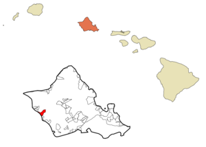
mapsize =
map_caption = Location in Honolulu County and the state ofHawaii
mapsize1 =
map_caption1 =
image_dot_
dot_mapsize =
dot_map_caption =
dot_x =
dot_y =
pushpin_
pushpin_label_position =
pushpin_map_caption =
pushpin_mapsize =
subdivision_type = Country
subdivision_name =United States
subdivision_type1 = State
subdivision_name1 =Hawaii
subdivision_type2 =
subdivision_name2 =
subdivision_type3 =
subdivision_name3 =
subdivision_type4 =
subdivision_name4 =
government_footnotes =
government_type =
leader_title =
leader_name =
leader_title1 =
leader_name1 =
leader_title2 =
leader_name2 =
leader_title3 =
leader_name3 =
leader_title4 =
leader_name4 =
established_title =
established_date =
established_title2 =
established_date2 =
established_title3 =
established_date3 =
area_magnitude =
unit_pref = Imperial
area_footnotes =
area_total_km2 = 13.2
area_land_km2 = 8.8
area_water_km2 = 4.4
area_total_sq_mi = 5.1
area_land_sq_mi = 3.4
area_water_sq_mi = 1.7
area_water_percent =
area_urban_km2 =
area_urban_sq_mi =
area_metro_km2 =
area_metro_sq_mi =
area_blank1_title =
area_blank1_km2 =
area_blank1_sq_mi =
population_as_of = 2000
population_footnotes =
population_note =
population_total = 10506
population_density_km2 = 1191.5
population_density_sq_mi = 3086.0
population_metro =
population_density_metro_km2 =
population_density_metro_sq_mi =
population_urban =
population_density_urban_km2 =
population_density_urban_sq_mi =
population_blank1_title =
population_blank1 =
population_density_blank1_km2 =
population_density_blank1_sq_mi =
timezone = Hawaii-Aleutian
utc_offset = -10
timezone_DST =
utc_offset_DST =
latd = 21
latm = 26
lats = 52
latNS = N
longd = 158
longm = 10
longs = 45
longEW = W
elevation_footnotes =
elevation_m = 0
elevation_ft = 0
postal_code_type =ZIP code
postal_code = 96792
area_code = 808
blank_name = FIPS code
blank_info = 15-74450
blank1_name = GNIS feature ID
blank1_info = 0364549
website =
footnotes = Waiokinaanae is a town andcensus-designated place (CDP) in Honolulu County,Hawaii ,United States . As of the 2000 Census, the CDP population was 10,506.Geography
Waiokinaanae is located at coor dms|21|26|52|N|158|10|45|W|city (21.447714, -158.179213)GR|1.
According to the
United States Census Bureau , the CDP has a total area of 5.1square mile s (13.2km² ), of which, 3.4 square miles (8.8 km²) of it is land and 1.7 square miles (4.4 km²) of it (33.14%) is water.The shoreline of Waiokinaanae includes a boat harbor. In 2006 the harbormastor of Waiokinaanae,
William Aila , announced his candidacy for theHawaii Democratic Party 's nomination forGovernor of Hawaii .Demographics
As of the
census GR|2 of 2000, there were 10,506 people, 2,595 households, and 2,221 families residing in the CDP. Thepopulation density was 3,086.0 people per square mile (1,193.1/km²). There were 2,925 housing units at an average density of 859.2/sq mi (332.2/km²). The racial makeup of the CDP was 9.35% White, 0.81% African American, 0.26% Native American, 19.44% Asian, 27.26% Pacific Islander, 0.97% from other races, and 41.92% from two or more races. Hispanic or Latino of any race were 14.00% of the population.There were 2,595 households out of which 43.9% had children under the age of 18 living with them, 58.0% were married couples living together, 19.6% had a female householder with no husband present, and 14.4% were non-families. 10.9% of all households were made up of individuals and 4.1% had someone living alone who was 65 years of age or older. The average household size was 4.04 and the average family size was 4.30.
In the CDP the population was spread out with 34.8% under the age of 18, 10.4% from 18 to 24, 26.8% from 25 to 44, 19.8% from 45 to 64, and 8.2% who were 65 years of age or older. The median age was 29 years. For every 100 females there were 98.9 males. For every 100 females age 18 and over, there were 94.5 males.
The median income for a household in the CDP was $46,717, and the median income for a family was $48,145. Males had a median income of $32,328 versus $22,451 for females. The
per capita income for the CDP was $13,348. About 17.2% of families and 19.8% of the population were below thepoverty line , including 28.6% of those under age 18 and 7.9% of those age 65 or over.Education
Waianae contains two high schools with some students attending
Waianae High School with others attendingNanakuli High School.fact|date=June 2008References
External links
Wikimedia Foundation. 2010.