- Kekaha, Hawaii
Infobox Settlement
official_name = Kekaha, Hawaii
other_name =
native_name =
nickname =
settlement_type = CDP
motto =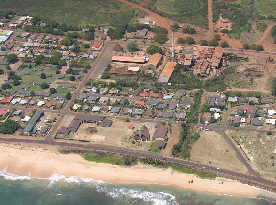
imagesize =250px
image_caption =aerial view of Kekaha
flag_size =
image_
seal_size =
image_shield =
shield_size =
image_blank_emblem =
blank_emblem_type =
blank_emblem_size =
flag_size =
image_
seal_size =
image_shield =
shield_size =
image_blank_emblem =
blank_emblem_type =
blank_emblem_size =
mapsize =
map_caption = Location in Kauai County and the state ofHawaii
mapsize1 =
map_caption1 =
image_dot_
dot_mapsize =
dot_map_caption =
dot_x =
dot_y =
pushpin_
pushpin_label_position =
pushpin_map_caption =
pushpin_mapsize =
subdivision_type = Country
subdivision_name =United States
subdivision_type1 = State
subdivision_name1 =Hawaii
subdivision_type2 = County
subdivision_name2 = Kauai
subdivision_type3 =
subdivision_name3 =
subdivision_type4 =
subdivision_name4 =
government_footnotes =
government_type =
leader_title =
leader_name =
leader_title1 =
leader_name1 =
leader_title2 =
leader_name2 =
leader_title3 =
leader_name3 =
leader_title4 =
leader_name4 =
established_title =
established_date =
established_title2 =
established_date2 =
established_title3 =
established_date3 =
area_magnitude =
unit_pref = Imperial
area_footnotes =
area_total_km2 = 3.2
area_land_km2 = 2.6
area_water_km2 = 0.6
area_total_sq_mi = 1.2
area_land_sq_mi = 1.0
area_water_sq_mi = 0.2
area_water_percent =
area_urban_km2 =
area_urban_sq_mi =
area_metro_km2 =
area_metro_sq_mi =
area_blank1_title =
area_blank1_km2 =
area_blank1_sq_mi =
population_as_of = 2000
population_footnotes =
population_note =
population_total = 3175
population_density_km2 = 1227.1
population_density_sq_mi = 3178.2
population_metro =
population_density_metro_km2 =
population_density_metro_sq_mi =
population_urban =
population_density_urban_km2 =
population_density_urban_sq_mi =
population_blank1_title =
population_blank1 =
population_density_blank1_km2 =
population_density_blank1_sq_mi =
timezone = Hawaii-Aleutian
utc_offset = -10
timezone_DST =
utc_offset_DST =
latd = 21
latm = 58
lats = 18
latNS = N
longd = 159
longm = 42
longs = 59
longEW = W
elevation_footnotes =
elevation_m = 3
elevation_ft = 10
postal_code_type =ZIP code
postal_code = 96752
area_code = 808
blank_name = FIPS code
blank_info = 15-35600
blank1_name = GNIS feature ID
blank1_info = 0361086
website =
footnotes = Kekaha (literally, "the place" in Hawaiian [Cite book | author=Pukui, Mary Kawena | authorlink= | coauthors= | title=Place Names of Hawaii | date= | publisher=University of Hawaii Press | location= | isbn=0-8248-0524-0 | pages=] ) is acensus-designated place (CDP) in Kauaokinai County, Hawaiokinai,United States . The population was 3,175 at the 2000 census.History
.
Hawaiokinai's first (and only) train robbery occurred here in February 1920, when a masked gunman stopped a slow-moving sugar train and escaped with the locomotive and $11,000 taken from the labor paymaster on board. Police recovered the money in a swamp near the home of a local fisherman, whose suspicious behavior soon resulted in his arrest and conviction. The fisherman was a big fan of Western movies, and was thought to have been inspired by some of the films he had seen.
Geography
Kekaha is located at coor dms|21|58|18|N|159|42|59|W|city (21.971690, -159.716290)GR|1.
According to the
United States Census Bureau , the CDP has a total area of 1.2square mile s (3.2km² ), of which, 1.0 square miles (2.6 km²) of it is land and 0.2 square miles (0.6 km²) of it (18.03%) is water.Demographics
As of the
census GR|2 of 2000, there were 3,175 people, 1,073 households, and 799 families residing in the CDP. Thepopulation density was 3,178.2 people per square mile (1,225.9/km²). There were 1,162 housing units at an average density of 1,163.2/sq mi (448.7/km²). The racial makeup of the CDP was 15.94% White, 0.19% African American, 0.50% Native American, 43.59% Asian, 12.38% Pacific Islander, 0.98% from other races, and 26.43% from two or more races. Hispanic or Latino of any race were 8.66% of the population.There were 1,073 households out of which 30.4% had children under the age of 18 living with them, 55.9% were married couples living together, 13.1% had a female householder with no husband present, and 25.5% were non-families. 21.4% of all households were made up of individuals and 9.4% had someone living alone who was 65 years of age or older. The average household size was 2.96 and the average family size was 3.44.
In the CDP the population was spread out with 25.1% under the age of 18, 7.5% from 18 to 24, 24.4% from 25 to 44, 27.4% from 45 to 64, and 15.6% who were 65 years of age or older. The median age was 40 years. For every 100 females there were 98.1 males. For every 100 females age 18 and over, there were 96.2 males.
The median income for a household in the CDP was $41,103, and the median income for a family was $48,629. Males had a median income of $32,969 versus $26,739 for females. The
per capita income for the CDP was $17,117. About 10.9% of families and 11.2% of the population were below thepoverty line , including 11.8% of those under age 18 and 11.1% of those age 65 or over.Items of interest
, Hawaiokinai's Forbidden Island.
Communications
Circa 1962, the Army Radio Station a few miles west of Kekaha provided ionospheric and tropospheric scatter communications as part of a line of stations from
California toVietnam , sending TTY traffic back and forth during theVietnam War .fact|date=December 2007References
External links
Wikimedia Foundation. 2010.