- Koloa, Hawaii
Infobox Settlement
official_name = Koloa, Hawaii
other_name =
native_name =
nickname =
settlement_type = CDP
motto =
imagesize =
image_caption =
flag_size =
image_
seal_size =
image_shield =
shield_size =
image_blank_emblem =
blank_emblem_type =
blank_emblem_size =
imagesize =
image_caption =
flag_size =
image_
seal_size =
image_shield =
shield_size =
image_blank_emblem =
blank_emblem_type =
blank_emblem_size =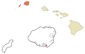
mapsize =
map_caption = Location in Kauai County and the state ofHawaii
mapsize1 =
map_caption1 =
image_dot_
dot_mapsize =
dot_map_caption =
dot_x =
dot_y =
pushpin_
pushpin_label_position =
pushpin_map_caption =
pushpin_mapsize =
subdivision_type = Country
subdivision_name =United States
subdivision_type1 = State
subdivision_name1 =Hawaii
subdivision_type2 = County
subdivision_name2 = Kauai
subdivision_type3 =
subdivision_name3 =
subdivision_type4 =
subdivision_name4 =
government_footnotes =
government_type =
leader_title =
leader_name =
leader_title1 =
leader_name1 =
leader_title2 =
leader_name2 =
leader_title3 =
leader_name3 =
leader_title4 =
leader_name4 =
established_title =
established_date =
established_title2 =
established_date2 =
established_title3 =
established_date3 =
area_magnitude =
unit_pref = Imperial
area_footnotes =
area_total_km2 = 3.1
area_land_km2 = 3.1
area_water_km2 = 0.0
area_total_sq_mi = 1.2
area_land_sq_mi = 1.2
area_water_sq_mi = 0.0
area_water_percent =
area_urban_km2 =
area_urban_sq_mi =
area_metro_km2 =
area_metro_sq_mi =
area_blank1_title =
area_blank1_km2 =
area_blank1_sq_mi =
population_as_of = 2000
population_footnotes =
population_note =
population_total = 1942
population_density_km2 = 629.1
population_density_sq_mi = 1629.5
population_metro =
population_density_metro_km2 =
population_density_metro_sq_mi =
population_urban =
population_density_urban_km2 =
population_density_urban_sq_mi =
population_blank1_title =
population_blank1 =
population_density_blank1_km2 =
population_density_blank1_sq_mi =
timezone = Hawaii-Aleutian
utc_offset = -10
timezone_DST =
utc_offset_DST =
latd = 21
latm = 54
lats = 26
latNS = N
longd = 159
longm = 27
longs = 57
longEW = W
elevation_footnotes =
elevation_m = 65
elevation_ft = 213
postal_code_type =ZIP code
postal_code = 96756
area_code = 808
blank_name = FIPS code
blank_info = 15-39200
blank1_name = GNIS feature ID
blank1_info = 0361395
website =
footnotes = :"For the mallard-like duck named Koloa, seeHawaiian Duck ".Kōloa is a
census-designated place (CDP) in Kauaokinai County, Hawaiokinai,United States . The population was 1,942 at the 2000 census. Kōloa is often incorrectly translated as "native duck", which is the correct translation for the similar-looking koloa (without the macron). Kōloa has no known translation [Cite book | author=Pukui, Mary Kawena | authorlink= | coauthors= | title=Place Names of Hawaii | date= | publisher=University of Hawaii Press | location= | isbn=0-8248-0524-0 | pages=] .Geography
Kōloa is located at coor dms|21|54|26|N|159|27|57|W|city (21.907137, -159.465877)GR|1.
According to the
United States Census Bureau , the CDP has a total area of 1.2square mile s (3.1km² ), all of it land.Demographics
As of the
census GR|2 of 2000, there were 1,942 people, 693 households, and 507 families residing in the CDP. Thepopulation density was 1,629.5 people per square mile (630.1/km²). There were 748 housing units at an average density of 627.6/sq mi (242.7/km²). The racial makeup of the CDP was 20.24% White, 0.36% African American, 0.26% Native American, 43.77% Asian, 7.78% Pacific Islander, 1.24% from other races, and 26.36% from two or more races. Hispanic or Latino of any race were 11.38% of the population.There were 693 households out of which 34.8% had children under the age of 18 living with them, 47.2% were married couples living together, 18.9% had a female householder with no husband present, and 26.8% were non-families. 22.5% of all households were made up of individuals and 8.7% had someone living alone who was 65 years of age or older. The average household size was 2.80 and the average family size was 3.25.
In the CDP the population was spread out with 26.0% under the age of 18, 9.9% from 18 to 24, 26.7% from 25 to 44, 21.6% from 45 to 64, and 15.8% who were 65 years of age or older. The median age was 36 years. For every 100 females there were 101.0 males. For every 100 females age 18 and over, there were 96.3 males.
, including 26.5% of those under age 18 and 6.0% of those age 65 or over.
Plantation
The town of Koloa is notable for the
Old Sugar Mill of Koloa which was the first such sugar plantation in Hawaii.Noted person
*
Ray Kane — Slack keyguitar ist.References
*Alexander, Arthur (1937). "Koloa Plantation 1835 - 1935". Honolulu, HI: [http://star-bulletin.com "Star-Bulletin"] .
*Hawaiian Sugar Planters' Association (1949). "Sugar in Hawaii". Honolulu, HI: Hawaiian Sugar Planters' Association.External links
Wikimedia Foundation. 2010.