- McCook, Illinois
-
McCook Village Country United States State Illinois County Cook Coordinates 41°47′55″N 87°49′57″W / 41.79861°N 87.8325°W Area 2.6 sq mi (7 km2) - land 2.6 sq mi (7 km2) Density 97.6 / sq mi (38 / km2) Timezone CST (UTC-6) - summer (DST) CDT (UTC-5) Postal code 60535 Area code 708 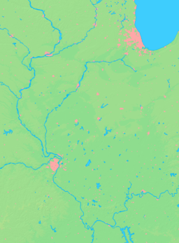

 Location of McCook within Illinois
Wikimedia Commons: McCook, Illinois McCook is a suburb of Chicago in Cook County, in the U.S. state of Illinois. As of the 2000 census, the village population was 254, which is the lowest population of all municipalities in the county. It was named for John J. McCook, a late 19th century director of the Santa Fe Railroad and a former American Civil War officer. The railway stopped at a small station in McCook.
Contents
Geography
McCook is located at 41°47′55″N 87°49′57″W / 41.79861°N 87.8325°W (41.798542, -87.832432)[1].
According to the United States Census Bureau, the village has a total area of 2.6 square miles (6.7 km2), of which, 2.6 square miles (6.7 km2) of it is land and 0.04 square miles (0.10 km2) of it (0.76%) is water.
McCook is home to a small population, but a large amount of heavy industry, resulting in a large tax base.
Demographics
As of the census[2] of 2000, there were 254 people, 119 households, and 69 families residing in the village. The population density was 97.6 people per square mile (37.7/km²). There were 125 housing units at an average density of 48.0 per square mile (18.6/km²). The racial makeup of the village was 95.28% White, 4.72% from other races. Hispanic or Latino of any race were 7.87% of the population.
The top three ancestries reported in McCook as of the 2000 census were Polish (18.9%), Irish (16.3%) and Italian (16.3%).[3]
There were 119 households out of which 19.3% had children under the age of 18 living with them, 39.5% were married couples living together, 11.8% had a female householder with no husband present, and 42.0% were non-families. 39.5% of all households were made up of individuals and 15.1% had someone living alone who was 65 years of age or older. The average household size was 2.13 and the average family size was 2.86.
In the village the population was spread out with 16.5% under the age of 18, 8.7% from 18 to 24, 28.3% from 25 to 44, 25.2% from 45 to 64, and 21.3% who were 65 years of age or older. The median age was 43 years. For every 100 females there were 91.0 males. For every 100 females age 18 and over, there were 91.0 males.
The median income for a household in the village was $43,125, and the median income for a family was $58,333. Males had a median income of $40,625 versus $26,429 for females. The per capita income for the village was $24,996. None of the families and 1.8% of the population were living below the poverty line, including no under eighteens and 4.1% of those over 64.
Government
McCook is in Illinois' 3rd congressional district.
Business
McCook is home to a large amount of heavy industry, including portions of Vulcan Materials Company McCook Quarry, UOP, and the Electro-Motive Diesel (EMD) railroad locomotive plant. Known as the LaGrange plant for its mailing address (McCook does not have its own post office), EMD produced most of their locomotives there from 1935 to 1991, when parent company General Motors moved all final-assembly operations to London, Ontario. The LaGrange plant now manufactures locomotive parts only, but EMD is considering resuming locomotive production there, so that they can reenter the passenger locomotive business, as federal funding cannot be used to purchase foreign-built locomotives.
Education
McCook is served by the Lyons School District 103 and J. Sterling Morton High School District 201's Morton West High School located in Berwyn.
References
- ^ "US Gazetteer files: 2010, 2000, and 1990". United States Census Bureau. 2011-02-12. http://www.census.gov/geo/www/gazetteer/gazette.html. Retrieved 2011-04-23.
- ^ "American FactFinder". United States Census Bureau. http://factfinder.census.gov. Retrieved 2008-01-31.
- ^ Profile of General Demographic Characteristics, McCook, IllinoisPDF (37.9 KiB). U.S. Census Bureau. Accessed 2007-04-03.
External links
Categories:- Communities on U.S. Route 66
- Villages in Illinois
- Populated places in Cook County, Illinois
- Chicago metropolitan area


Wikimedia Foundation. 2010.