- Darien, Illinois
-
Darien, Illinois 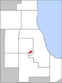
County: DuPage Township: Downers Grove Incorporated: City, 1969 Mayor: Kathleen Weaver ZIP code(s): 60561 Area code(s): 630 and 331 Population (2000): 22,860 Change from 1990: up 24.69% Density: 3,782.7/mi² (1,461.3/km²) Area: 6.1 mi² (15.9 km²) Per capita income: $39,795
(median: $89,836)Home value: $231,382
(median: $214,500 (2000))Website: www.darienil.gov Demographics (2000)[1] White Black Hispanic Asian 90.10% 0.97% 0.64% 9.53% Islander Native Other 0.03% 0.11% 0.97% Darien is a city in DuPage County, Illinois, USA. The population was 22,086 at the 2010 census.
A suburb of Chicago, Darien was named after a town in Connecticut.
Contents
Popular culture
The town motto is "A nice place to live" which happens to be the same town motto as Hill Valley from the Back to the Future movies.
Geography
Darien is located at 41°44′44″N 87°58′52″W / 41.74556°N 87.98111°WCoordinates: 41°44′44″N 87°58′52″W / 41.74556°N 87.98111°W (41.745623, -87.981087)[2].
According to the United States Census Bureau, the city has a total area of 6.1 square miles (16 km2), of which, 6.0 square miles (16 km2) is land and 0.1 square miles (0.26 km2) (1.14%) is water. Darien's City Hall used to be totally underground until 1994, when it was lifted up. Now only 75% is underground. Darien's City Hall is surrounded on three sides by the village of Downers Grove.
Darien is bordered by the cities of Downers Grove, Westmont, Woodridge, and Willowbrook,and it has easy access to the three major thoroughfares crossing Chicago's southwest suburbs: Interstate 55, Interstate 355, and Interstate 294.
History
The first people to settle here came from New England via the Erie Canal and Great Lakes. Among the first to arrive was the Thomas Andrus family. They settled along an old stagecoach line in 1835. Andrus served as Justice of the Peace, Town Clerk, Assessor, and County Commissioner. He also established the Andrus Inn, near what is currently the intersection of Lemont Road and I-55; the inn served the 15 stage coaches that traveled the stagecoach line, and included a tavern and a post office. Andrus named the area "Cass."
Andrus and Father Beggs built the First Cass Church, which was a log cabin design. The church's cemetery, located west of where the church stood (west of Baily Road and north of Frontage Road), can still be seen today. The church was also used as a school house.
Elisha and Eliza Smart settled here in 1838 with their 10 children. Elisha got gold fever and left for California, returning seven years later as a very rich man. He bought more land and the Smart family donated the land on which a new Cass Church was built in 1870.
John and Hannah Oldfield came to Cass in 1850. Mr. Oldfield raised cattle and increased his land holdings to 2,000 acres (8.1 km2).
Franklin Blanchard opened his cheese factory in 1881 — the location of the cheese factory being where McDonalds is today.
Martin Madden was an Irish immigrant who arrived at the Cass area during the late 19th century. He became a member of the Chicago City Council and later was elected to the House of Representatives and served in the United States Congress. In 1903, Mr. Madden built a home to look like the White House in Washington D.C. he called it Castle Eden. Today Castle Eden is part of the Aylesford Retreat Center of the Carmelite Fathers.
A group of German Lutherans from Europe came to the area near 67th and Clarendon Hills Road in 1859. They built the first St. John Lutheran Church and laid out the cemetery behind the church. Today the cemetery is still located at 67th and Clarendon Hills Road. In 1899, a new church was built on the northeast corner of Cass and 75th Street. The Church was located where the Taco Bell and Buona Beef Restaurant now stand. In 1969, the second church was torn down and the present St. John's Lutheran Church was built west of Cass and north of 75th Street.
A school was built on the northwest corner of Cass and 75th street in 1860. It was the first Lace School. It is now a museum which is open on the first Sunday of each month from 2:00pm to 4:00pm.
By 1890, the Village of Lace was established. The important location at that time was the triangle bordered by Cass Avenue, Plainfield Road and 75th Street. It was called "The Point". The Point included the Town Hall, General Store, Blacksmith Shop and the office of Dr. Roe. A Post Office had been established at The Point in 1884.
The future city of Darien was originally part of the Lace and Cass communities. Residents of the Marion Hills, Brookhaven, Farmingdale and Hinsbrook subdivisions wanted to incorporate as a single city; this finally happened in 1969. When the incorporation committee reached an impasse on an acceptable name for the new city, acting mayor Sam Kelly suggested the name "Darien". He had visited Darien, Connecticut, and found it to be a very pleasant and attractive community. Today, Darien is known as "A Nice Place to Live". Darien in Illinois is pronounced with the accent on the first syllable; Darien in Connecticut is pronounced with the accent on the last syllable.
 "A nice place to live"
Demographics
As of the census[3] of 2000, there were 22,860 people, 8,735 households, and 6,455 families residing in the city. The population density was 3,782.7 people per square mile (1,461.3/km²). There were 8,929 housing units at an average density of 1,477.5 per square mile (570.8/km²). The racial makeup of the city was 90.10% White, 0.97% African American, 0.11% Native American, 9.53% Asian, 0.03% Pacific Islander, 0.97% from other races, and 1.29% from two or more races. Hispanic or Latino of any race were 0.64% of the population.
There were 8,735 households out of which 31.4% had children under the age of 18 living with them, 64.1% were married couples living together, 7.3% had a female householder with no husband present, and 26.1% were non-families. 22.4% of all households were made up of individuals and 6.9% had someone living alone who was 65 years of age or older. The average household size was 2.61 and the average family size was 3.09.
In the city the population was spread out with 23.1% under the age of 18, 6.5% from 18 to 24, 28.1% from 25 to 44, 30.0% from 45 to 64, and 12.3% who were 65 years of age or older. The median age was 41 years. For every 100 females there were 96.3 males. For every 100 females age 18 and over, there were 92.1 males.
According to a 2007 estimate, the median income for a household in the city was $78,122, and the median income for a family was $95,332.[4] Males had a median income of $70,580 versus $46,352 for females. The per capita income for the city was $39,795. About 1.6% of families and 2.2% of the population were below the poverty line, including 2.1% of those under age 18 and 5.4% of those age 65 or over.
 Flag
FlagNotable people
- Rudy Fratto, Chicago Outfit
Other Dariens in the United States
- Darien, Connecticut
- Darien, Georgia
- Darien, New York
- Village of Darien, Wisconsin
- Town of Darien, Wisconsin
Notes
- ^ 2000 United States Census Data
- ^ "US Gazetteer files: 2010, 2000, and 1990". United States Census Bureau. 2011-02-12. http://www.census.gov/geo/www/gazetteer/gazette.html. Retrieved 2011-04-23.
- ^ "American FactFinder". United States Census Bureau. http://factfinder.census.gov. Retrieved 2008-01-31.
- ^ Darien at factfinder.census.gov
External links
Municipalities and communities of DuPage County, Illinois Cities Aurora‡ | Batavia‡ | Chicago‡ | Darien | Elmhurst‡ | Naperville‡ | Oakbrook Terrace | St. Charles‡ | Warrenville | West Chicago | Wheaton | Wood Dale

Villages Addison | Bartlett‡ | Bensenville‡ | Bloomingdale | Bolingbrook‡ | Burr Ridge‡ | Carol Stream | Clarendon Hills | Downers Grove | Elk Grove Village‡ | Glendale Heights | Glen Ellyn | Hanover Park‡ | Hinsdale‡ | Itasca | Lemont‡ | Lisle | Lombard | Oak Brook‡ | Roselle‡ | Schaumburg‡ | Villa Park | Wayne‡ | Westmont | Willowbrook | Willow Springs‡ | Winfield | Woodridge‡
Townships Addison | Bloomingdale | Downers Grove | Lisle | Milton | Naperville | Wayne | Winfield | York
Unincorporated
communitiesCloverdale | Eola | Flowerfield | Keeneyville | Lakewood | Medinah | Palisades | York Center
Footnotes ‡This populated place also has portions in an adjacent county or counties
 State of Illinois
Topics - Index
- Buildings and structures
- Communications
- Culture
- Delegations
- Economy
- Education
- Environment
- Geography
- Government
- Health
- History
- Music
- People
- Portal
- Society
- Sports
- Tourism
- Transportation
- Windmills
Regions - American Bottom
- Central Illinois
- Champaign–Urbana metropolitan area
- Chicago metropolitan area
- Driftless Area
- Forgottonia
- Fox Valley
- Illinois–Indiana–Kentucky Tri-State Area
- Metro East
- Mississippi Alluvial Plain
- North Shore
- Northern Illinois
- Northwestern Illinois
- Peoria metropolitan area
- Quad Cities
- River Bend
- Rockford metropolitan area
- Southern Illinois
- Streatorland
- Wabash Valley
Major cities,
towns and villages- Alton/Granite City/Edwardsville
- Arlington Heights/Palatine
- Aurora/Naperville/Oswego/Plainfield
- Bartlett/Hanover Park/Streamwood
- Belleville/East St. Louis/Collinsville/O'Fallon
- Berwyn/Cicero
- Bloomington/Normal
- Bolingbrook/Romeoville
- Buffalo Grove/Wheeling
- Calumet City
- Canton
- Carbondale
- Carol Stream/Glendale Heights
- Centralia
- Champaign/Urbana
- Charleston/Mattoon
- Chicago
- Chicago Heights
- Crystal Lake/Algonquin
- Danville
- Decatur
- DeKalb/Sycamore
- Des Plaines/Mount Prospect/Park Ridge
- Dixon
- Downers Grove/Woodridge
- Effingham
- Elgin/Carpentersville
- Elmhurst/Lombard/Addison
- Evanston/Skokie
- Freeport
- Galesburg
- Glenview/Northbrook
- Harrisburg
- Jacksonville
- Joliet
- Kankakee/Bradley/Bourbonnais
- Lincoln
- Macomb
- Marion/Herrin
- Moline/East Moline/Rock Island
- Mount Vernon
- Mundelein
- Oak Lawn
- Oak Park
- Orland Park/Tinley Park
- Ottawa/Streator/LaSalle/Peru
- Peoria/Pekin/East Peoria/Morton
- Pontiac
- Quincy
- Rochelle
- Rockford/Belvidere/Machesney Park/Loves Park
- St. Charles
- Schaumburg/Hoffman Estates/Elk Grove Village
- Springfield
- Sterling/Rock Falls
- Taylorville
- Waukegan/North Chicago/Gurnee
- Wheaton
Counties - Adams
- Alexander
- Bond
- Boone
- Brown
- Bureau
- Calhoun
- Carroll
- Cass
- Champaign
- Christian
- Clark
- Clay
- Clinton
- Coles
- Cook
- Crawford
- Cumberland
- DeKalb
- DeWitt
- Douglas
- DuPage
- Edgar
- Edwards
- Effingham
- Fayette
- Ford
- Franklin
- Fulton
- Gallatin
- Greene
- Grundy
- Hamilton
- Hancock
- Hardin
- Henderson
- Henry
- Iroquois
- Jackson
- Jasper
- Jefferson
- Jersey
- Jo Daviess
- Johnson
- Kane
- Kankakee
- Kendall
- Knox
- LaSalle
- Lake
- Lawrence
- Lee
- Livingston
- Logan
- Macon
- Macoupin
- Madison
- Marion
- Marshall
- Mason
- Massac
- McDonough
- McHenry
- McLean
- Menard
- Mercer
- Monroe
- Montgomery
- Morgan
- Moultrie
- Ogle
- Peoria
- Perry
- Piatt
- Pike
- Pope
- Pulaski
- Putnam
- Randolph
- Richland
- Rock Island
- Saline
- Sangamon
- Schuyler
- Scott
- Shelby
- St. Clair
- Stark
- Stephenson
- Tazewell
- Union
- Vermilion
- Wabash
- Warren
- Washington
- Wayne
- White
- Whiteside
- Will
- Williamson
- Winnebago
- Woodford

Downers Grove Westmont Willowbrook Naperville 
Burr Ridge  Darien

Woodridge Lemont Palos Park Categories:- Cities in Illinois
- Darien, Illinois
- Populated places in DuPage County, Illinois
- Chicago metropolitan area
- Populated places established in 1835


Wikimedia Foundation. 2010.