- West Frankfort, Illinois
Geobox|Settlement
name = West Frankfort
native_name =
other_name = Frank's Fort
category = City
etymology =
official_name =
motto = A Rich Past, A Bright Future
nickname =
image_caption =
symbol =
country = United States
state = Illinois
region_type = County
region = Franklin
district_type = Township
district =
municipality =
part =
landmark =
river =
location =
elevation_imperial = 400
elevation_imperial_note = cite web|url=Gnis3|420843|title=USGS detail on Newtown|accessdate=2007-10-21]
prominence_imperial =
lat_d = 37
lat_m = 53
lat_s = 55
lat_NS = N
long_d = 88
long_m = 55
long_s = 24
long_EW = W
highest =
highest_location =
highest_region =
highest_state =
highest_elevation_imperial =
highest_lat_d =
highest_lat_m =
highest_lat_s =
highest_lat_NS =
highest_long_d =
highest_long_m =
highest_long_s =
highest_long_EW =
lowest =
lowest_location =
lowest_region =
lowest_state =
lowest_elevation_imperial =
lowest_lat_d =
lowest_lat_m =
lowest_lat_s =
lowest_lat_NS =
lowest_long_d =
lowest_long_m =
lowest_long_s =
lowest_long_EW =
length_imperial =
length_orientation =
area_imperial = 4.8
area_land_imperial = 4.8
area_water_imperial = 0.0
area_urban_imperial =
area_metro_imperial =
population = 12949
population_date = 2000
population_urban =
population_metro =
population_density_imperial = 1726.8
population_density_urban_imperial =
population_density_metro_imperial =
established_type = Founded
established = 1810
established1_type =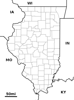
map_caption = Location of West Frankfort within Illinois
map_background = Illinois - background map.png
map1 =
map1_caption =
commons = West Frankfort, Illinois
statistics =
website = http://www.westfrankfort-il.com/
footnotes =West Frankfort is a city in Franklin County,
Illinois , USA. The population was 12,949 at the 2000 census.History
Although one might associate the name "
West Frankfort " with the cities named "Frankfurt " inGermany or Frankfort inKentucky , the truth is far more local. Around 1810, Francis Jordan, an early settler from Tennessee, with the help of his seven brothers, began construction of a fort atop a hill in present-day Franklin County. Completed in 1811, the fort was named "Frank's Fort", in Jordan's honor. [http://www.westfrankfort-il.com/default.asp?id=229 Official City Website] Retrieved on October 29, 2007]Michael Jordan also built a fort a few miles to the east, at Jordan's Settlement, near modern
Thompsonville, Illinois . This fort was called "Jordan's Fort". The construction of these forts was in response to the danger of attack duringTecumseh's War , which culminated in theBattle of Tippecanoe in 1811. Then-governor of theIllinois Territory ,Ninian Edwards , actively encouraged the construction of these forts and offered the services of the Saline Militia in their erection.Since the Shawnee Trail, an important trading route linking
Kaskaskia, Illinois andOld Shawneetown, Illinois ran along the high ground in the vicinity of the fort, this area became an attractive destination for settlers in search of cheap land made available by the recently passedBit Act of 1805. The resulting settlement took the name of the nearby fort, which was subsequently shortened to "Frankfort". Frankfort grew quickly during this period, its population rivaling that ofChicago at that time.After railroad tracks linking Chicago, Paducah, and Memphis were laid convert|4|mi|km|0 west of Frankfort, many businesses and residents migrated to the new commercial center which formed near the tracks. This new community came to be known as West Frankfort for its location west of Frankfort. The two cities eventually merged and retained the name of West Frankfort.
The area of West Frankfort formerly known as Frankfort is still sometimes referred to locally as Frankfort Heights or, more commonly, simply as "the Heights", due to its higher elevation relative to the rest of the city. A post office was maintained in Frankfort Heights until its destruction by fire in 2004, making West Frankfort one of the smallest cities in the United States to have two
ZIP codes .Geography
West Frankfort is located at coor dms|37|53|55|N|88|55|24|W|city (37.898545, -88.923315)GR|1.
According to the
United States Census Bureau , the city has a total area of 4.8square mile s (12.3km² ), of which, 4.8 square miles (12.3 km²) of it is land and 0.21% is water.Demographics
As of the
census GR|2 of 2000, there were 12,949 people, 6,005 households, and 5,486 families residing in the city. Thepopulation density was 1,726.8 people per square mile (666.2/km²). The racial makeup of the city was 98.40% White, 0.20% African American, 0.23% Native American, 0.31% Asian, 0.01% Pacific Islander, 0.12% from other races, and 0.80% from two or more races. Hispanic or Latino of any race were 0.77% of the population.In the city the population was spread out with 22.3% under the age of 18, 8.8% from 18 to 24, 26.0% from 25 to 44, 22.1% from 45 to 64, and 20.8% who were 65 years of age or older. The median age was 40 years. For every 100 females there were 86.8 males. For every 100 females age 18 and over, there were 83.4 males.
The median income for a household in the city was $25,358, and the median income for a family was $34,432. Males had a median income of $32,621 versus $18,765 for females. The
per capita income for the city was $14,671. About 13.9% of families and 18.6% of the population were below thepoverty line , including 27.0% of those under age 18 and 10.7% of those age 65 or over.Events
Each year West Frankfort hosts the Old King Coal Festival. This four-day event is held to pay tribute to coal miners with a parade, concerts, pagents, carnival rides and a wide variety of food. In 2008, OKC festivities will be begin Friday, September 19 and conclude on Sunday, September 22.
Notes
External links
* [http://www.westfrankfort-il.com/ Local government and community info]
* [http://www.wf168.frnkln.k12.il.us/ Frankfort Community Unit School District No. 168]
* [http://www.dailyamericannews.com/ West Frankfort "Daily American" newspaper]
* [http://www.3abn.org/ 3ABN Satellite Channel located in West Frankfort]

Wikimedia Foundation. 2010.