- Minooka, Illinois
-
Minooka Village 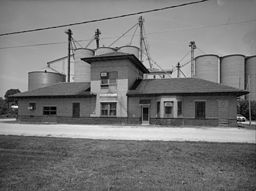 CO&P station at Minooka
Motto: "A Nice Place To Call Home." Country United States State Illinois Counties Grundy, Kendall, Will Elevation 609 ft (186 m) Coordinates 41°27′17″N 88°15′36″W / 41.45472°N 88.26°W Area 4.3 sq mi (11 km2) - land 4.3 sq mi (11 km2) Population 10,924 (2010) Density 931.5 / sq mi (360 / km2) Founded 1869 Mayor Pat Brennan Timezone CST (UTC-6) - summer (DST) CDT (UTC-5) Postal code 60447 Area code 815 & 779 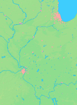

 Location of Minooka within Illinois
Wikimedia Commons: Minooka, Illinois Minooka is a village in Grundy, Kendall, and Will Counties, Illinois, United States.[1] The population was 10,924 at the 2010 census. Minooka currently has two high schools in its district, a campus for juniors and seniors and a newer campus for freshman and sophomores. Minooka School District 201 (elementary district) has a total of 5 schools and is scheduled to have 7 next year. Minooka has continuously been growing and has many new subdivisions. The Rock Island Line served the town at Minooka Station.
Contents
Geography
Minooka is located at 41°27′17″N 88°15′36″W / 41.45472°N 88.26°W (41.454849, -88.260084).[2]
According to the United States Census Bureau, the village has a total area of 4.3 square miles (11 km2), of which, 4.3 square miles (11 km2) of it is land and 0.1 square miles (0.26 km2) of it (1.62%) is water.
Demographics
As of the census[3] of 2000, there were 3,971 people, 1,315 households, and 1,088 families residing in the village. More recently, the estimated number of residents in 2010 is around 8,000. The population density was 931.5 people per square mile (359.9/km²). There were 1,338 housing units at an average density of 313.9 per square mile (121.3/km²). The racial makeup of the village was 98.04% White, 0.25% African American, 0.20% Native American, 0.30% Asian, 0.53% from other races, and 0.68% from two or more races. Hispanic or Latino of any race were 2.85% of the population.
There were 1,315 households out of which 49.3% had children under the age of 18 living with them, 70.3% were married couples living together, 8.1% had a female householder with no husband present, and 17.2% were non-families. 14.2% of all households were made up of individuals and 4.0% had someone living alone who was 65 years of age or older. The average household size was 3.02 and the average family size was 3.34.
In the village the population was spread out with 31.9% under the age of 18, 8.3% from 18 to 24, 30.4% from 25 to 44, 23.9% from 45 to 64, and 5.5% who were 65 years of age or older. The median age was 34 years. For every 100 females there were 98.6 males. For every 100 females age 18 and over, there were 99.8 males.
The median income for a household in the village was $75,249, and the median income for a family was $81,190. Males had a median income of $59,583 versus $33,347 for females. The per capita income for the village was $26,054. About 1.1% of families and 2.2% of the population were below the poverty line, including 0.5% of those under age 18 and 7.5% of those age 65 or over.
References
- ^ "2009 Zoning Map". Village of Minooka. 2009. http://www.minooka.com/Community/Maps/ZoningMapCurrent.pdf. Retrieved 22 February 2010.
- ^ "US Gazetteer files: 2010, 2000, and 1990". United States Census Bureau. 2011-02-12. http://www.census.gov/geo/www/gazetteer/gazette.html. Retrieved 2011-04-23.
- ^ "American FactFinder". United States Census Bureau. http://factfinder.census.gov. Retrieved 2008-01-31.
External links
Municipalities and communities of Grundy County, Illinois Cities 
Villages Braceville | Carbon Hill | Channahon‡ | Coal City‡ | Diamond‡ | Dwight‡ | East Brooklyn | Gardner | Godley‡ | Kinsman | Mazon | Minooka‡ | Seneca‡ | South Wilmington | Verona
Townships Aux Sable | Braceville | Erienna | Felix | Garfield | Goodfarm | Goose Lake | Greenfield | Highland | Maine | Mazon | Morris | Nettle Creek | Norman | Saratoga | Vienna | Wauponsee
Unincorporated
communitiesAux Sable | Central City | Clarke City‡ | Divine | Gorman | Harrisonville | Langham | Mazonia | Nettle Creek | Paytonville | Sand Ridge | Saratoga | Stockdale | Wauponsee |
Footnotes ‡This populated place also has portions in an adjacent county or counties
Municipalities and communities of Kendall County, Illinois Cities 
Villages Lisbon | Millbrook | Millington‡ | Minooka‡ | Montgomery‡ | Newark | Oswego | Plainfield‡ | Plattville
Townships Unincorporated
communitiesBoulder Hill | Bristol | Central | Fox | Helmar | Kentland | Knob Hill | Lisbon Center | Little Rock | Millhurst | Nettlecreek Pavilion |
Footnotes ‡This populated place also has portions in an adjacent county or counties
Municipalities and communities of Will County, Illinois Cities Aurora‡ | Braidwood | Crest Hill | Joliet‡ | Lockport | Naperville‡ | Wilmington

Villages Beecher | Bolingbrook‡ | Channahon‡ | Coal City‡ | Crete | Diamond‡ | Elwood | Frankfort‡ | Godley‡ | Homer Glen | Lemont‡ | Manhattan | Matteson‡ | Minooka‡ | Mokena | Monee | New Lenox | Orland Park‡ | Park Forest‡ | Peotone | Plainfield‡ | Rockdale | Romeoville | Sauk Village‡ | Shorewood | Steger‡ | Symerton | Tinley Park‡ | University Park‡ | Woodridge‡
CDPs Townships Unincorporated
communitiesGhost town Footnotes ‡This populated place also has portions in an adjacent county or counties
Categories:- Populated places in Grundy County, Illinois
- Populated places in Kendall County, Illinois
- Populated places in Will County, Illinois
- Villages in Illinois


Wikimedia Foundation. 2010.