- Neolithic Subpluvial
-
Part of a series on the History of Algeria 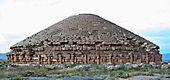
- Aterian Culture (80k BC)
- Iberomaurusian Culture (20k BC)
- Capsian culture (10k BC)
- Rock art in Oran, Djelfa,
- Tassili and Ahaggar
- Green Sahara
- Roknia
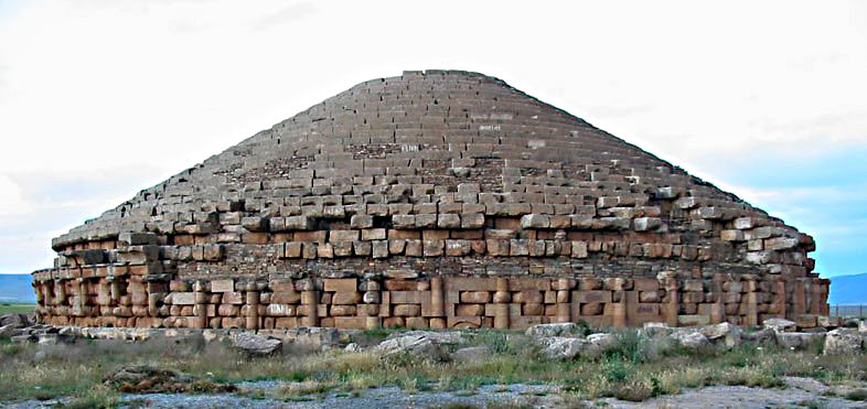
- Madghacen
- Jedars
- Related: Archeology of Algeria
- Getulia (~500 BC–40 AD)
- Numidia (202–46 BC)
- Punic Wars (264–146 BC)
- Jugurthine War (111–106 BC)
- Roman Mauretania and Africa (146 BC–585/590 AD)
- Vandalic War (533–534 AD)
- Praetorian Africa (534–590 AD)
- Exarchate of Africa (585–698 AD)
- Arab conquest (647–709 AD)
- Early African Church
- Partenia
- Fossatum Africae
- Gemellae
- Muhallabids (771–793 AD)
- Rustamid (776–909 AD)
- Ifranids (790–1066 AD)
- Aghlabids (800–909 AD)
- Fatimides (909–1171 AD)
- Maghrawas (970–1068 AD)
- Zirids (973–1152 AD)
- Hammadids (1014–1152 AD)
- Almoravids (1040–1147 AD)
- Almohads (1121–1269 AD)
- Marinids (1215–1465 AD)
- Hafsids (1229–1574 AD)
- Ziyyanids (1235–1556 AD)
Modern times- Ottoman Algeria (XVI–XIX century)
- Barbary corsairs
- Regency of Algiers
- Sack of Baltimore
- Turkish Abductions
- Barbary Slave Trade
- Barbary Wars
- French Algeria (XIX–XX century)
- French conquest
- Nationalism and resistance
- Algerian War
- GPRA
- Évian Accords
- Pied-Noir
- Harkis
- Oujda Group
The Neolithic Subpluvial — sometimes called the Holocene Wet Phase — was an extended period (from about 7500-7000 BC to about 3500-3000 BC) of wet and rainy conditions in the climate history of northern Africa. It was both preceded and followed by much drier periods.
The Neolithic Subpluvial was the most recent of a number of periods of "Wet Sahara" or "Green Sahara", during which the region was much more moist and supported a richer biota and human population than the present-day desert.
Contents
Date ranges
The Neolithic Subpluvial began during the 7th millennium BC and was strong for about 2000 years; it waned over time and ended after the 5.9 kiloyear event (3,900 BCE). Then the drier conditions that prevailed prior to the Neolithic Subpluvial returned; desertification advanced, and the Sahara desert formed (or re-formed). Arid conditions have continued through to the present day.[1]
Geography and hydrography
During the Neolithic Subpluvial, large areas of North, Central, and East Africa had hydrographic profiles significantly different from later norms. Existing lakes had surfaces tens of meters higher than today, sometimes with alternative drainages: Lake Turkana, in present-day Kenya, drained into the Nile River basin. Lake Chad reached a maximum extent of some 400,000 square kilometers in surface area, larger than the modern Caspian Sea, with a surface level about 30 meters (100 feet) higher than its twentieth-century average. Some shallower lakes and river systems existed in the subpluvial era that later disappeared entirely, and are detectable today only via radar and satellite imagery.
Ecology
North Africa enjoyed a fertile climate during the subpluvial era; what is now the Sahara supported a savanna type of ecosystem, with elephant, giraffe, and other grassland and woodland animals now typical of the Sahel region south of the desert, along with some now extinct megafauna such as Sivatherium and Pelorovis. Historian and Africanist Roland Oliver has described the scene as follows:
[In] the highlands of the central Sahara beyond the Libyan desert,... in the great massifs of the Tibesti and the Hoggar, the mountaintops, today bare rock, were covered at this period with forests of oak and walnut, lime, alder and elm. The lower slopes, together with those of the supporting bastions — the Tassili and the Acacus to the north, Ennedi and Air to the south — carried olive, juniper and Aleppo pine. In the valleys, perennially flowing rivers teemed with fish and were bordered by seed-bearing grasslands.[2]
Cultures
- Main article: Prehistoric Central North Africa
Clement and fertile conditions during the Neolithic Subpluvial supported increased human settlement of the Nile Valley in Egypt, as well as neolithic societies in Sudan and throughout the present-day Sahara. Cultures producing rock art (notably that at Tassili n'Ajjer in southeastern Algeria) flourished during this period.
The practical consequences of these changes took the form of increased abundance of fish, waterfowl, freshwater mollusks, rodents, hippos and crocodiles. The riches of this increased aquatic biomass were exploited by humans with rafts, boats, weirs, traps, harpoons, nets, hooks, lines and sinkers. This "riparian" (river) way of life supported much larger communities than could that of typical hunting bands.[3] These changes, along with the local development of pottery (whereby liquids could be both stored and heated) resulted in a "culinary revolution" consisting of soup, fish stew and porridge.[4] The last mentioned implies the cooking of gathered cereals.
The classic account of the riparian lifestyle of this period comes from investigations in Sudan during World War II by British archeologist Anthony Arkell.[5] Arkell's report described a Late Stone Age settlement on a sandbank of the Blue Nile which was then about 12 feet higher than its present flood stage. The countryside was clearly savanna, not the present-day desert, as evidenced by the bones of the most common species found in the middens — antelope, which require large expanses of seed-bearing grasses. These people probably lived mainly on fish, however, and Arkell concluded, based on the totality of the evidence, that rainfall at the time was at least three times that of today. The physical characteristics derived from skeletal remains suggested that these people were related to modern Nilotic peoples, such as the Nuer and Dinka. Subsequent radiocarbon dating firmly established Arkell's site to between 7000 and 5000 BC. Based on common patterns at his site and at French-excavated sites already reported from Chad, Mali and Niger (e.g., bone harpoons and a characteristic "wavy line" pottery), Arkell inferred "a common fishing and hunting culture spread by negroid people right across Africa at about the latitude of Khartoum at a time when the climate was so different that it was not desert. So far, the originators of the wavy line pottery are as yet unidentified.
In the 1960s, the archeologist Gabriel Camps investigated the remains of a hunting and fishing community dating from about 6700 BC in southern Algeria. These pottery-making people (the "wavy line" motif again) were definitely black African rather than Mediterranean in origin and (according to Camps) evidenced definite signs of deliberate cultivation of grain crops as opposed to simply the gathering of wild grains.[6] Later studies at the site have shown the culture to be hunter gatherers and not agriculturalists, as all the grains were morphologically wild, and the society was not sedentary.
Human remains were found by archaeologists in 2000 at a site known as Gobero in the Ténéré Desert of northeastern Niger.[7][8] The Gobero finds represent a uniquely preserved record of human habitation and burials from what is now called the Kiffian (7,700 to 6,200 B.C.) and the Tenerian (5,200 to 2,500 B.C.) cultures.
See also
References
- ^ Sources differ on specific date ranges, which necessarily varied over such a wide geographic expanse. One (Bard, Kathryn A. (1999), ed. Encyclopedia of the Archaeology of Ancient Egypt. London, Routledge, pg 863) gives "9000–5000 BP," or 7000–3000 BCE, for the duration of the subpluvial. Another (Wilkinson, Toby A. H. (1999), Early Dynastic Egypt. London, Routledge, pg 372) places the end of the subpluvial c. 3300 BCE.
- ^ Oliver, Roland (1999), The African Experience: From Olduvai Gorge to the 21st Century (Series: History of Civilization), London: Phoenix Press, revised edition, pg 39.
- ^ Oliver, pg 37.
- ^ Sutton, John E.G. (1974), "The Aquatic Civilization of Middle Africa", Journal of African History, Vol 15, pp 527-546.
- ^ Arkell, A.J. (1949), Early Khartoum, Oxford University Press.
- ^ Camps, Gabriel (1974), Les civilisation prehistoriques de l'Afrique du Nord et du Sahara, Paris, pp 22 and 225-226. The site is Amekni near Tamanrasset.
- ^ "Stone Age Graveyard Reveals Lifestyles Of A 'Green Sahara'". Science Daily. 15 August 2008. http://www.sciencedaily.com/releases/2008/08/080815101317.htm. Retrieved 2008-08-15.
- ^ Gwin P. (September 2008), Lost tribes of the green sahara, National Geographic Magazine
Further reading
- Burroughs, William J., ed. Climate: Into the 21st Century. Cambridge, Cambridge University Press, 2003
- Howell, Francis Clark, and François Bourlière. African Ecology and Human Evolution. London, Routledge, 2004 (reprint of the 1964 edition)
- Eamonn Gearon. "The Sahara: A Cultural History." Signal Books, UK, 2011. Oxford University Press, USA. 2011.
External links
Categories:- Climate
- Climatology
- Climate history
- History of the Sahara
- Prehistoric Africa
Wikimedia Foundation. 2010.