- Mettawa, Illinois
-
Mettawa Village Country United States State Illinois County Lake Coordinates 42°14′38″N 87°55′4″W / 42.24389°N 87.91778°W Area 5.5 sq mi (14 km2) - land 5.5 sq mi (14 km2) Population 367 (2000) Density 67.1 / sq mi (26 / km2) Mayor Jess Ray Timezone CST (UTC-6) - summer (DST) CDT (UTC-5) Postal code 60045, 60048, 60052 Area code 847 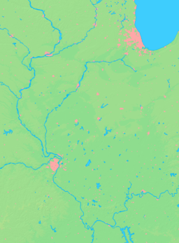

 Location of Mettawa within Illinois
Wikimedia Commons: Mettawa, Illinois Mettawa is a village in Lake County, Illinois, United States dedicated to preserving open lands and low-density residential development. The village maintains trails for pedestrian, bicycle and equestrian usage. Five forest preserves within the Lake County Forest Preserve District are located within village boundaries: including Old School Forest Preserve, Grainger Woods Conservation Preserve, MacArthur Woods, Captain Daniel Wright Woods and the former home (and grounds) of Adlai E. Stevenson II.
Mettawa's population was 367 at the 2000 census, although population is estimated to have increased to approximately 485 residents since that time.
Adjacent communities include Lake Forest, Lincolnshire, Vernon Hills, Libertyville, and Green Oaks.
Contents
History
Mettawa was founded by area residents in 1960 who worked together with a common goal of protecting their rural area from encroaching commercial development. The village was named for a nearby Potowatami settlement which is mentioned in an early history of Lake County.[1] Mettawa's first mayor was James Getz; subsequent mayors included Ed Fitzsimons, Julius Abler, and Barry McLean. Famous residents and property owners within the area now known as Mettawa have included two-time presidential nominee Adlai E. Stevenson, city planner Edward H. Bennett and more recently, news anchor and rancher Bill Kurtis. Stevenson's Mettawa estate on the Des Plaines River is a designated Illinois Historic Site and is listed on the National Register of Historic Places.
Government
Mettawa is governed by an elected President and six Board of Trustees.
Mayor:
- Jess Ray
Board of Trustees:
- Bill Armstrong
- Mary Brennan
- Lawrence Falbe
- John Maier
- Bill Nicholson
- Jack Tindall
Mettawa has been called a "paper village" because it lacks a dedicated Village Hall and has few paid administrative staff. Village meetings are held in a local hotel, and the Village contracts with an engineer, attorney, Mettawa Open Lands Association, and various consultants for operational services. In January 2009, the Village Board established its website which serves as a virtual Village Hall, providing official information including Village contacts, official documents and maps, meeting agendas and the Comprehensive Plan.
Conservation and Recreation
Mettawa was founded by conservationist landowners, and continues to be a center of land conservation and restoration activities. The village also supports a rural, equestrian-friendly lifestyle. Some residents maintain small farming operations, and the Village counts eight horse stables within its borders.
The Mettawa Open Lands Association (MOLA) is a non-profit organization which promotes quality open space within the Village and encourages the protection of public and private open lands. MOLA supports Mettawa-area residents and open lands (including unincorporated housing developments that are surrounded by Village land) with public workdays and educational programs, and provides quality open space management on Village properties. In celebration of Mettawa's 50th anniversary in 2010, MOLA distributed complimentary wildflower seed packets to all Village residents, and many residents in neighboring areas, and suggested that recipients plant the seeds along roadsides to help beautify the area.
MOLA also maintains the Whippoorwill Farm Preserve, an open lands area owned by the Village (just west of I-94 at the northwest corner of IL-60/Townline Road and Riverwoods Boulevard). Whippoorwill Farm is currently undergoing restoration to a native prairie/wetland habitat.
The Lake County Forest Preserve District maintains five forest preserves within Village Boundaries, including Old School, Grainger Woods, McArthur Woods, Captain Daniel Wright Woods and Adlai Stevenson Historic Home.
Mettawa also includes nine areas designated as Illinois Nature Preserves, one area within the Libertyville Township Open Space District, and the Covington Charitable Trust area (maintained by Lake Forest Open Lands Association).
The Des Plaines River Trail runs through the western edge of Mettawa, and connects with the Village's own Mettawa Trail system, which is used by pedestrians, cyclists and equestrians.
Commercial Development
Commercial development has occurred within and adjacent to Mettawa in recent years, despite resistance by residents and the Village Board. However, an unusually high percentage of the commercial structures are green buildings which have achieved high Leadership in Energy and Environmental Design (LEED) ratings. Tax revenues from businesses in Mettawa provide income to the Village which in turn provides eligible residents with a tax rebate.
HSBC completed construction of its North American Headquarters in Mettawa in 2008. Although no longer corporate headquarters, the building remains fully occupied by HSBC. This building achieved LEED Gold Certification and in March 2009 was named Green Development of the Year by The National Association of Industrial and Office Properties (NAIOP).[2]
The W. W. Grainger company's headquarters is located on unincorporated land enclosed within Mettawa's borders. In 2008 this building was updated to achieve its 2009 Gold LEED certification. Grainger purchased 535 acres (2.17 km2) of land in Mettawa (1993–1998), then disconnected from the Village to become part of unincorporated Lake County. In 1996, all of this land was annexed back into the village, with the exception of the 155 acres (0.63 km2) office campus. Grainger donated 257 acres (1.04 km2) to the Lake County Forest Preserve District. The resulting Grainger Forest Preserve hosts an equestrian center and includes open lands filled with rare ecosystems and species.[3] The remaining Grainger acreage is within the Village and zoned 5-acre (20,000 m2) residential.
Other major businesses also located near the busy intersection of highway I-94 and Route 60 in Mettawa include CDW, Residence Inn and Hilton Garden Inn, with construction of a Costco currently underway. Businesses located along Boulton Boulevard (east of I-94 in Mettawa's northeast corner) include Impact Networking, Metro Self-Storage and Stage Right, Inc.
Residential Development
The Village maintains a low-density five-acre zoning requirement for residential development. Most of Mettawa's Planned Unit Develoments (PUD) have included conservation easements and land restoration.
The Deerpath Farm conservation community, Mettawa's largest (200-acre (0.81 km2)) PUD, includes 140 acres (0.57 km2) of restored open lands managed by Lake Forest Open Lands Association, and also sponsors community workdays and nature education events. In 2006 it was named Development of the Year by the Lake County Stormwater Management Association for its innovative hydrology management based on wetland restoration.
Other PUDs within Mettawa include Sanctuary Estates and Mettawa Woods.
In the news
- "Neighborly gestures soothes Mettawa Costco foes" Daily Herald (22 Apr 2010)
- Mettawa woman turns dead oak tree into tables for her children" Daily Herald (25 Jun 2009
- "Hold the coin flip: Absentee votes decide Mettawa mayor's race" Daily Herald (21 Apr 2009)
- "Mettawa Ready for Change" Daily Herald (19 Mar 2009)
- "HSBC relocating North America staff to a 'green' building in a rural village" New York Times
- "Bank takes Environmental Step into Rural Town" New York Times (7 July 2008)]
Geography
Mettawa is located at 42°14′38″N 87°55′4″W / 42.24389°N 87.91778°W (42.243972, -87.917909).
According to the United States Census Bureau, the village has a total area of 5.5 square miles (14.2 km²), of which, 5.5 square miles (14.2 km²) of it is land and 0.04 square miles (0.1 km²) of it (0.55%) is water.
Demographics
As of the census of 2000, there were 367 people, 135 households, and 108 families residing in the village. The population density was 67.1 people per square mile (25.9/km²). There were 141 housing units at an average density of 25.8 per square mile (10.0/km²). The racial makeup of the village was 95.64% White, 2.45% Asian, 1.09% from other races, and 0.82% from two or more races. Hispanic or Latino of any race were 4.09% of the population.
There were 135 households out of which 33.3% had children under the age of 18 living with them, 75.6% were married couples living together, 1.5% had a female householder with no husband present, and 19.3% were non-families. 16.3% of all households were made up of individuals and 6.7% had someone living alone who was 65 years of age or older. The average household size was 2.68 and the average family size was 2.96.
In the village the population was spread out with 24.0% under the age of 18, 6.0% from 18 to 24, 20.4% from 25 to 44, 36.2% from 45 to 64, and 13.4% who were 65 years of age or older. The median age was 45 years. For every 100 females there were 103.9 males. For every 100 females age 18 and over, there were 103.6 males.
The median income for a household in the village was $127,388, and the median income for a family was $153,129. Males had a median income of $100,000 versus $51,250 for females. The per capita income for the village was $89,104. About 3.1% of families and 4.6% of the population were below the poverty line, including 7.1% of those under age 18 and 7.1% of those age 65 or over.
Notes
- ^ Haines, Part II: Vernon Hills, Page 95
- ^ http://www.e-architect.co.uk/america/hsbc_north_american_headquarters.htm
- ^ http://www.lcfpd.org/preserves/index.cfm?fuseaction=home.view&object_id=188&type=P
References
- Haines, Elijah M., "Historical and Statistical Sketches of Lake County, State of Illinois," (1852) Waukegan, Illinois: E.G. Howe, Part II: Town of Vernon, page 95
External links
- Village of Mettawa site
- Village of Mettawa Code of Ordinances at American Legal Publishing - Online Library
- Article at the Encyclopedia of Chicago
Categories:- Villages in Illinois
- Populated places in Lake County, Illinois


Wikimedia Foundation. 2010.