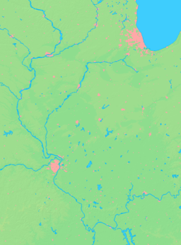
- Manito, Illinois
-
Manito Village Country United States State Illinois County Mason Elevation 488 ft (149 m) Coordinates 40°25′22″N 89°46′48″W / 40.42278°N 89.78°W Area 1.5 sq mi (4 km2) - land 1.5 sq mi (4 km2) Population 1,733 (2000) Density 1,126.0 / sq mi (435 / km2) Village president Timothy Sondag Timezone CST (UTC-6) - summer (DST) CDT (UTC-5) Postal code 61546 Area code 309 Wikimedia Commons: Manito, Illinois Manito is a village in Mason County, Illinois, United States. The population was 1,733 at the 2000 census, and 1,595 at a 2009 estimate.
The village is home to the Manito Popcorn Festival, which started in 1972.
Contents
Geography
Manito is located at 40°25′22″N 89°46′48″W / 40.42278°N 89.78°W (40.422723, -89.780056).[1]
According to the United States Census Bureau, the village has a total area of 1.5 square miles (3.9 km2), all of it land.
Demographics
As of the census[2] of 2000, there were 1,733 people, 686 households, and 506 families residing in the village. The population density was 1,126.0 people per square mile (434.5/km²). There were 723 housing units at an average density of 469.8 per square mile (181.3/km²). The racial makeup of the village was 99.08% White, 0.23% African American, 0.17% Native American, 0.17% Asian, and 0.35% from two or more races. Hispanic or Latino of any race were 0.29% of the population.
There were 686 households out of which 32.9% had children under the age of 18 living with them, 61.8% were married couples living together, 9.0% had a female householder with no husband present, and 26.1% were non-families. 22.0% of all households were made up of individuals and 10.8% had someone living alone who was 65 years of age or older. The average household size was 2.52 and the average family size was 2.93.
In the village the population was spread out with 25.0% under the age of 18, 8.1% from 18 to 24, 27.6% from 25 to 44, 25.6% from 45 to 64, and 13.8% who were 65 years of age or older. The median age was 37 years. For every 100 females there were 102.5 males. For every 100 females age 18 and over, there were 92.6 males.
The median income for a household in the village was $41,767, and the median income for a family was $48,438. Males had a median income of $36,927 versus $21,506 for females. The per capita income for the village was $18,345. About 5.4% of families and 8.2% of the population were below the poverty line, including 8.3% of those under age 18 and 6.3% of those age 65 or over.
Transportation
The Manito Mitchell Airport is a privately-owned public-use airport located in Tazewell County, three nautical miles (3.5 mi, 5.6 km) north of Manito's central business district.[3]
References
- ^ "US Gazetteer files: 2010, 2000, and 1990". United States Census Bureau. 2011-02-12. http://www.census.gov/geo/www/gazetteer/gazette.html. Retrieved 2011-04-23.
- ^ "American FactFinder". United States Census Bureau. http://factfinder.census.gov. Retrieved 2008-01-31.
- ^ FAA Airport Master Record for C45 (Form 5010 PDF). Federal Aviation Administration. Effective 30 June 2011.
External links
Municipalities and communities of Mason County, Illinois Cities Villages Townships Allens Grove | Bath | Crane Creek | Forest City | Havana | Kilbourne | Lynchburg | Manito | Mason City | Pennsylvania | Quiver | Salt Creek | Sherman
Unincorporated
communitiesBiggs | Bishop | Eckard | Goofy Ridge | Lakewood | Luther | Matanzas Beach | Parkland | Poplar City | Snicarte | Talbott | Teheran
Footnotes ‡This populated place also has portions in an adjacent county or counties
Categories:- Populated places in Mason County, Illinois
- Villages in Illinois
Wikimedia Foundation. 2010.


