- Maryland Route 22
-
Maryland Route 22

Route information Maintained by MDSHA Length: 12.91 mi[1] (20.78 km) Major junctions West end: 
 US 1 Bus. / MD 924 in Bel Air
 MD 543 in Fountain Green
 MD 136 in Churchville
 MD 155 in Churchville
 MD 156 near Churchville
 I-95 in Aberdeen
 MD 462 in Aberdeen
 US 40 in Aberdeen
East end: Aberdeen Proving Ground in Aberdeen Location Counties: Harford Highway system Maryland highway system
Interstate • US • State • Minor • Former • Turnpikes←  MD 21
MD 21MD 23  →
→Maryland Route 22 (MD 22) is a state highway in the U.S. state of Maryland. The state highway runs 12.91 miles (20.78 km) from U.S. Route 1 Business (US 1 Business) and MD 924 in Bel Air east to an entrance to Aberdeen Proving Ground in Aberdeen. MD 22 is the main connection between the county seat of Bel Air and Aberdeen, which is the largest city in Harford County. The state highway also provides the primary route between Interstate 95 (I-95) and Aberdeen Proving Ground; that section of MD 22 is a part of the National Highway System.[2]
MD 22 was one of the original state roads marked for improvement in 1909 and one of the original state-numbered highways in 1927. The highway was constructed between Bel Air and Aberdeen in the early 1910s. Another section of highway between Aberdeen and Havre de Grace, the Post Road, was also built in the early 1910s. The Post Road became part of US 40 in 1927 but was designated as an extension of MD 22 after US 40 was relocated in the early 1930s. MD 22 was reconstructed from Bel Air to Aberdeen in the 1950s. MD 22's present course east of I-95 was built in the late 1960s; the old section of MD 22 through Aberdeen became MD 132.
Contents
Route description
MD 22 begins in the Bel Air Courthouse Historic District in the town of Bel Air as a one-way pair, Fulford Avenue eastbound and Churchville Road westbound, at Main Street. Main Street carries northbound MD 924 and US 1 Business; the business route enters downtown Bel Air from the west on Fulford Avenue. Churchville Road continues west as unsigned MD 922E, which intersects Bond Street, which carries southbound MD 924 and US 1 Business; the business route leaves downtown Bel Air to the west on Churchville Road. The two directions of MD 22 unite at Shamrock Road as Churchville Road, a four-lane divided highway that passes Bel Air Park and The John Carroll School as it leaves the town of Bel Air. The state highway crosses over Bynum Run as it passes through the suburban area of Fountain Green, where the highway intersects MD 543 (Fountain Green Road).[1][3]
East of MD 543, MD 22 reduces to two lanes and passes through farmland with scattered residential subdivisions where the highway passes the historic homes Dibb House and Tudor Hall, the latter notable for being the boyhood home of John Wilkes Booth.[4] The state highway passes through the hamlet of Schucks Corner and encounters Thomas Run Road, which leads to Thomas Run Park, Harford Technical High School, Thomas Run Church, Medical Hall Historic District and the historic Hays-Heighe House on the campus of Harford Community College. In the village of Churchville, MD 22 intersects MD 136 (Calvary Road/Priestbridge Road) adjacent to the community's namesake, Churchville Presbyterian Church. After meeting the west end of MD 155 (Level Road) immediately to the east, the state highway curves to the south. After MD 156 (Aldino Road) splits to the east, MD 22 returns to an eastward heading to pass through the hamlet of Carsins. The state highway expands to a four-lane highway immediately before intersecting Long Drive, which serves as the entrance to Ripken Stadium, home of the Aberdeen IronBirds. Just east of the stadium complex, the state highway meets I-95 (John F. Kennedy Memorial Highway) at a partial cloverleaf interchange.[1][3]
MD 22 continues east as Aberdeen Thruway, a four-lane divided highway bypass of downtown Aberdeen that connects I-95 with Aberdeen Proving Ground. Immediately east of I-95, the state highway enters the city limits of Aberdeen and passes through a commercial area where the highway intersects Beards Hill Road. Beards Hill Road heads south as unsigned MD 132A, which leads to MD 132 (Bel Air Avenue), the old alignment of MD 22 that leads to downtown Aberdeen. MD 22 continues east through a two-block residential area where it intersects MD 462 (Paradise Road). The state highway continues east to grade-separated crossings of CSX's Philadelphia Subdivision and the Amtrak Northeast Corridor, which are separated by about 600 feet (180 m) northeast of downtown Aberdeen. Squeezed in between the two railroad lines is MD 22's partial cloverleaf interchange with US 40 (Philadelphia Boulevard); several movements between the two highways are provided via Rogers Avenue, which intersects MD 22 between the bridges across the Philadelphia Subdivision and US 40. East of the railroads, the state highway intersects Post Road, which heads north as another section of MD 132 (officially MD 132B), before reaching its eastern terminus at Bel Air Avenue just west of an entrance to Aberdeen Proving Ground.[1][3]
History
MD 22 was one of the original state roads marked for improvement by the Maryland State Roads Commission in 1909. The highway was part of the original main road from Baltimore to Aberdeen and Havre de Grace that passed through Bel Air. The Post Road, also known as the Philadelphia Road, did not become the main connection between Baltimore and Aberdeen until the 1920s. The highway from Bel Air to Churchville, part of the Bel Air Road extending west from Havre de Grace, was already improved beyond a rudimentary dirt road by 1910.[5] The highway from Churchville to Paradise Road in Aberdeen was constructed in 1911.[6][7] The portion of the state road between Bel Air and Churchville was reconstructed in 1913.[7] The Post Road between Aberdeen and Havre de Grace was constructed as a state aid road around 1911.[6][7] All three segments were constructed as a 14-foot (4.3 m) wide macadam road. The original construction did not include the portions of Bel Air Avenue and the Post Road within the limits of Aberdeen.[7] The portion of Bel Air Avenue from Paradise Road to the Post Road and the Post Road from there to approximately the modern intersection of MD 22 and MD 132B were rebuilt as a 17-foot (5.2 m) wide concrete road in 1917.[8]
MD 22 was widened to 17 feet (5.2 m) with the addition of 3-foot (0.91 m) wide concrete shoulders around 1926, just before the highway became one of the original state-numbered highways in 1927.[9][10] The Post Road became part of US 40 the same year.[10] Both MD 22 and US 40 from Aberdeen to Havre de Grace were widened to 20 feet (6.1 m) by 1930.[11] US 40 was relocated from the Post Road to its present alignment from Aberdeen to Havre de Grace between 1930 and 1933.[11][12] MD 22 was extended north along the Post Road to MD 132B's present northern terminus by 1939.[13] Work to further modernize MD 22 began in 1951 when Churchville Road from Bel Air to MD 156 near Churchville was straightened, widened, and resurfaced.[14] The Bel Air–Churchville work was completed in 1953; the following year, the MD 22–MD 155 intersection was reconstructed.[15] MD 22 from MD 156 to US 40 in Aberdeen was widened and resurfaced between 1954 and 1956.[15][16]
The Aberdeen Thruway was constructed to improve the east–west connection between I-95, US 40, and Aberdeen Proving Ground and to provide grade separated crossings of the Baltimore & Ohio Railroad (now CSX), Pennsylvania Railroad (now Amtrak), and US 40. The grade separations had been contemplated as early as 1942.[17] Construction on the relocation of MD 22 began in 1967 and was completed in 1969.[18][19] The old alignment of MD 22 from I-95 east and north through Aberdeen to US 40 near Havre de Grace was designated MD 132.[19] Beards Hill Road was reconstructed as a divided highway between MD 132 and MD 22 and the ramps from northbound I-95 to MD 132 and from eastbound MD 22 to MD 132 were constructed by 1972.[20] The western end of MD 22 was changed to a one-way pair when Fulford Avenue was added to the state highway system as eastbound MD 22 in Bel Air in 1979.[21] The state highway was expanded to a divided highway from the east end of the one-way pair to MD 543 between 1994 and 1999.[22][23] MD 22 was expanded to a four-lane divided highway from the I-95 overpass west to Long Drive in 2004 concurrent with the transformation of the original diamond interchange with I-95 to a partial cloverleaf with collector-distributor lanes.[20][24]
Junction list
The entire route is in Harford County.
Location Mile
[1]Destinations Notes Bel Air 0.00 US 1 Bus. / MD 924 north (Main Street) – Hickory, Forest HillWestern terminus Fountain Green 2.05 MD 543 (Fountain Green Road) – Hickory, RiversideChurchville 5.50 MD 136 (Priestford Road/Calvery Road) – Creswell, Dublin5.62 MD 155 east (Level Road) – Havre de Grace6.32 MD 156 east (Aldino Road) – AldinoAberdeen 9.82 I-95 (John F. Kennedy Memorial Highway) – Baltimore, New YorkI-95 Exit 85 10.30 Beards Hill Road to  MD 132
Beards Hill Road south is officially MD 132A 11.01 MD 462 (Paradise Road)11.84 US 40 (Philadelphia Boulevard) – Havre de Grace, EdgewoodPartial cloverleaf interchange 12.23 MD 132 north (Post Road) / Post Road southOfficially MD 132B 12.91 Entrance to Aberdeen Proving Ground / Bel Air Avenue west Eastern terminus 1.000 mi = 1.609 km; 1.000 km = 0.621 mi Auxiliary route
MD 22A is the designation for Old Section MD 22, a 0.13-mile (0.21 km) section of old alignment of MD 22 that serves several houses on the westbound side of MD 22 immediately to the west of the MD 22–I-95 interchange.[1] MD 22A was designated in 2004 when MD 22 was relocated slightly to the south as part of the construction of the divided highway to the west of I-95.[24]
References
- ^ a b c d e f "Highway Location Reference: Harford County" (PDF). Maryland State Highway Administration. 2009. http://www.marylandroads.com/Location/2009_HARFORD.pdf. Retrieved 2011-02-27.
- ^ Federal Highway Administration (August 2003) (PDF). National Highway System: Aberdeen-Havre de Grace-Bel Air MD (Map). http://www.fhwa.dot.gov/planning/nhs/maps/md/aberdeen_md.pdf. Retrieved 2011-02-27.
- ^ a b c Google, Inc. Google Maps – Maryland Route 22 (Map). Cartography by Google, Inc. http://maps.google.com/maps?f=d&source=s_d&saddr=Fulford+Ave&daddr=MD-22+E%2FAberdeen+Trwy&hl=en&geocode=Fak9WwIdDQpz-w%3BFfi-WgIdwAp2-w&mra=ls&sll=39.533414,-76.345732&sspn=0.00374,0.009645&ie=UTF8&t=h&z=12. Retrieved 2011-02-27.
- ^ "Harford expected to OK renovation of Booth home". The Baltimore Sun. 2008-09-08. p. 4.
- ^ Maryland Geological Survey. Map of Maryland (Map) (1910 ed.).
- ^ a b Maryland Geological Survey. Map of Maryland: Showing State Road System and State Aid Roads Completed or Under Construction December 31, 1911 (Map) (1911 ed.).
- ^ a b c d Report of the State Roads Commission of Maryland. 1912-1915. Baltimore: Maryland State Roads Commission. May 1915. pp. 52, 112, 124. http://www.archive.org/details/annualreportsofs1912mary. Retrieved 2011-02-28.
- ^ Report of the State Roads Commission of Maryland. 1916-1919. Baltimore: Maryland State Roads Commission. January 1920. p. 39. http://www.archive.org/details/annualreportsofs1916mary. Retrieved 2011-02-28.
- ^ Report of the State Roads Commission of Maryland. 1924-1926. Baltimore: Maryland State Roads Commission. January 1927. p. 45. http://www.archive.org/details/annualreportsofs1924mary. Retrieved 2011-02-28.
- ^ a b Maryland Geological Survey. Map of Maryland: Showing State Road System and State Aid Roads (Map) (1927 ed.).
- ^ a b Report of the State Roads Commission of Maryland. 1927-1930. Baltimore: Maryland State Roads Commission. 1930-10-01. pp. 68, 82. http://www.archive.org/details/reportofstateroa1927mary. Retrieved 2011-02-28.
- ^ Maryland Geological Survey. Map of Maryland Showing State Road System: State Aid Roads and Improved County Road Connections (Map) (1933 ed.).
- ^ Maryland State Roads Commission. General Highway Map: State of Maryland (Map) (1939 ed.).
- ^ Report of the State Roads Commission of Maryland. 1951-1952. Baltimore: Maryland State Roads Commission. 1952-12-15. p. 156. http://www.archive.org/details/reportofstateroa1951mary. Retrieved 2011-02-28.
- ^ a b Report of the State Roads Commission of Maryland. 1953-1954. Baltimore: Maryland State Roads Commission. 1954-11-12. pp. 175, 177, 179. http://www.archive.org/details/reportofstateroa1953mary. Retrieved 2011-02-28.
- ^ Report of the State Roads Commission of Maryland. 1955-1956. Baltimore: Maryland State Roads Commission. 1956-11-02. p. 163. http://www.archive.org/details/reportofstateroa1955mary. Retrieved 2011-02-28.
- ^ Report of the State Roads Commission of Maryland. 1941-1942. Baltimore: Maryland State Roads Commission. 1943-03-15. p. 47. http://www.archive.org/details/reportofstateroa1941mary. Retrieved 2011-02-28.
- ^ Maryland State Roads Commission. Maryland: Official Highway Map (Map) (1967 ed.).
- ^ a b Maryland State Roads Commission. Maryland: Official Highway Map (Map) (1969 ed.).
- ^ a b Maryland State Highway Administration. Maryland: Official Highway Map (Map) (1972 ed.).
- ^ Maryland State Highway Administration. Maryland: Official Highway Map (Map) (1979-80 ed.).
- ^ "NBI Structure Number: 100000120012020". National Bridge Inventory. http://nationalbridges.com/nbi_record.php?StateCode=24&struct=100000120012020. Retrieved 2011-02-28.
- ^ "Highway Location Reference: Harford County" (PDF). Maryland State Highway Administration. 1999. http://www.marylandroads.com/Location/1999_HARFORD.pdf. Retrieved 2011-02-28.
- ^ a b "Highway Location Reference: Harford County" (PDF). Maryland State Highway Administration. 2004. http://www.marylandroads.com/Location/2004_HARFORD.pdf. Retrieved 2011-02-28.
External links
Roads in Harford County, Maryland State highways 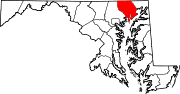
U.S. Highways Interstate Highways Categories:- State highways in Maryland
- Roads in Harford County, Maryland


Wikimedia Foundation. 2010.