- McLean, Illinois
-
McLean Village Country United States State Illinois County McLean Township Mount Hope Elevation 708 ft (216 m) Coordinates 40°18′54″N 89°10′14″W / 40.315°N 89.17056°W Area 0.4 sq mi (1 km2) - land 0.4 sq mi (1 km2) Population 830 (2010) Density 1,874.1 / sq mi (724 / km2) Timezone CST (UTC-6) - summer (DST) CDT (UTC-5) Postal code 61754 Area code 309 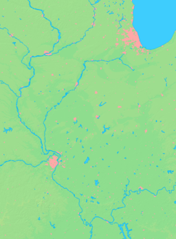

 Location of McLean within Illinois
Wikimedia Commons: McLean, Illinois McLean is a village in McLean County, Illinois, United States. The population was 830 at the 2010 census. It is part of the Bloomington–Normal Metropolitan Statistical Area.
Contents
Geography
McLean is located at 40°18′54″N 89°10′14″W / 40.315°N 89.17056°W (40.315032, -89.170645).[1]
According to the United States Census Bureau, the village has a total area of 0.4 square miles (1.0 km2), all of it land.
History
Mt. Hope and the Founding of the town of McLean
The town of McLean was laid out on 22 June 1855 by Franklin Price. Price (21 February 1821 - 25 July 1908)[2] Price was born in Chester Valley, Pennsylvania. He was the brother-in-law of Bloomington real estate developer Kersey Fell. Price came to Bloomington in 1849, worked as a clerk and newspaper writer and was elected mayor of Bloomington in 1855 and again in 1856, serving to 1858. Price never lived in the new town that he founded.
McLean was laid out when the Alton and Springfield Railroad, soon to become the Chicago and Alton, was first built. through McLean County; The nearby towns of Atlanta, Normal, and Towanda were laid out at the same time as McLean. There had been an earlier attempt at town founding nearby. Mt. Hope, two miles east of McLean, was established in 1836 by the Providence Farmers and Mechanics Emigrating Society of Rhode Island. The colony and its town were not a success, only three settlers actually arrived in McLean County. When the town of McLean was founded the church building from Mt. Hope was moved into McLean. The first residents of McLean were the brothers G. L. and F.A. Wheelock, railroad employees, who moved into the new station house to conduct business. A blacksmith shop was the first business and H.H. Dillon built the first warehouse.[3] McLean was incorporated as a village on 29 May 1866.and by 1900 it had grown to a population of a population of 532.[4]
Original Town Design of McLean
The design of the Original town of McLean remains today almost unaltered from the first plats. It’s design was similar to other places along the Alton and Springfield Railroad including Normal, Towanda, Odell and Dwight. The Original Town was a basically square with streets aligned north-south and east-west and split diagonally by the railroad with a line of lots paralleling either side of the tracks. As in other towns along the same railroad, there was a widened rectangular area paralleling the tracks labeled “Depot Grounds;” In the case of McLean, the Depot Grounds were laid out only on the southeast side of the railroad and the depot was located here. The triangle of land on the northwest side, between the lots paralleling the railroad and remainder of the town, was designated as a public property and is still used as a park. The comparable triangle on the opposite side of the tracks was unlabeled and its intended use is unclear. This same arrangement of public land was followed at the town of Towanda. Mclean was distinctive in that there were no streets between the diagonal line of lots along the tracks and, perhaps because of this, much of the business district developed along Morgan Street, which ran east-west just north or the park or along Hamilton Street, which ran north-south, just west of the park. The line of lots paralleling the tracks and southeast of the railroad became the location of the hotel and the town jail. Later additions on the east side of the town featured additional lots which paralled the railroad as well as more conventional blocks.[5]
Demographics
As of the census[6] of 2000, there were 808 people, 314 households, and 248 families residing in the village. The population density was 1,874.1 people per square mile (725.5/km²). There were 330 housing units at an average density of 765.4 per square mile (296.3/km²). The racial makeup of the village was 97.90% White, 0.74% African American, 0.12% Native American, 0.62% Asian, and 0.62% from two or more races.
There were 314 households out of which 36.0% had children under the age of 18 living with them, 65.0% were married couples living together, 9.6% had a female householder with no husband present, and 21.0% were non-families. 19.4% of all households were made up of individuals and 9.2% had someone living alone who was 65 years of age or older. The average household size was 2.57 and the average family size was 2.90.
In the village the population was spread out with 26.7% under the age of 18, 6.9% from 18 to 24, 30.3% from 25 to 44, 22.5% from 45 to 64, and 13.5% who were 65 years of age or older. The median age was 37 years. For every 100 females there were 93.8 males. For every 100 females age 18 and over, there were 92.2 males.
The median income for a household in the village was $47,337, and the median income for a family was $52,614. Males had a median income of $37,059 versus $27,589 for females. The per capita income for the village was $19,200. About 1.2% of families and 0.7% of the population were below the poverty line, including 0.9% of those under age 18 and none of those age 65 or over.
References
- ^ "US Gazetteer files: 2010, 2000, and 1990". United States Census Bureau. 2011-02-12. http://www.census.gov/geo/www/gazetteer/gazette.html. Retrieved 2011-04-23.
- ^ Historical Encyclopedia of Illinois and History of McLean County (Edited by Ezra M. Prince and John H. Burnham; 2 Vols. Chicago: Munsell, 1908) p. 902.
- ^ History of McLean County, Illinois (Chicago: LeBaron 1879) pp. 578 – 579, 589.
- ^ 'Historical Encyclopedia, 1908, P. 902.
- ^ Combined Indexed Atlas 1856 -1914, McLean County Illinois (Bloomington, Illinois: McLean County Historical Society and McLean County Genealogical society, 2006) pp. 113, 149.
- ^ "American FactFinder". United States Census Bureau. http://factfinder.census.gov. Retrieved 2008-01-31.
External links
Municipalities and communities of McLean County, Illinois Cities Bloomington | Chenoa | El Paso‡ | Le Roy | Lexington

Town Villages Anchor | Arrowsmith | Bellflower | Carlock | Colfax | Cooksville | Danvers | Downs | Ellsworth | Gridley | Heyworth | Hudson | McLean | Saybrook | Stanford | Towanda
Townships Allin | Anchor | Arrowsmith | Bellflower | Bloomington | Blue Mound | Cheney's Grove | Chenoa | Cropsey | Dale | Danvers | Dawson | Downs | Dry Grove | Empire | Funk's Grove | Gridley | Hudson | Lawndale | Lexington | Martin | Money Creek | Mount Hope | Normal | Old Town | Randolph | Towanda | West | White Oak | Yates
Unincorporated
communitiesBarnes | Bentown | Bloomington Heights | Cropsey | Covell | Fletcher | Funks Grove | Gillum | Glen Avon | Holder | Kerrick | Lyttleville | Meadows | Merna | Padua | Sabina | Shirley | Twin Grove | Watkins‡ | Weedman‡ | Weston | Yuton
Ghost town Footnotes ‡This populated place also has portions in an adjacent county or counties
Categories:- Populated places in McLean County, Illinois
- Villages in Illinois
- Communities on U.S. Route 66
- Populated places established in 1855


Wikimedia Foundation. 2010.