- Rondout-West Strand Historic District
Infobox nrhp
name = Rondout-West Strand Historic District
nrhp_type = hd
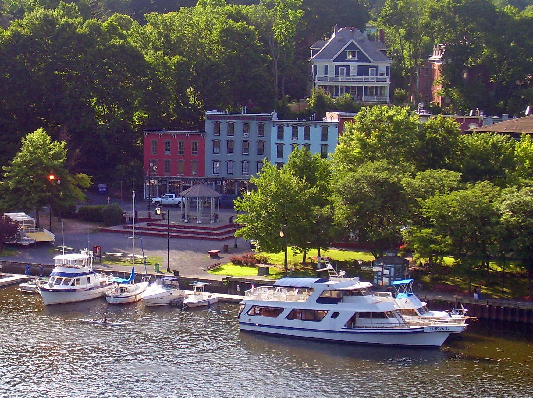
caption = Rondout-West Strand waterfront seen from US 9W
location = Kingston, NY
nearest_city =
lat_degrees = 41
lat_minutes = 55
lat_seconds = 07
lat_direction = N
long_degrees = 73
long_minutes = 59
long_seconds = 06
long_direction = W
area = 570 acres (2.3 km²)
built = 19th century
architect =
architecture =
added =August 24 ,1979
visitation_num =
visitation_year =
refnum = 79001641
mpsub =
governing_body = Private businesses and residences; city of KingstonSEE ALSORondout, New York The Rondout-West Strand
Historic District is located on the shore ofRondout Creek along the southern boundary of the city of Kingston,New York ,USA . FormerlyRondout, New York , it is bounded by the creek, Broadway, Hone, Ravine and McEntee streets, an area of 570 acres (2.3 km²) containing 259 buildings, most dating to the 19th century. US 9W and theJohn T. Loughran Bridge are immediately to the east; theKingston-Port Ewen Suspension Bridge crosses the creek to the west. The neighborhood is often referred to locally by either of the two names.The name of the
Rondout Creek comes from the fort, or redoubt, that was erected near its mouth The Dutch equivalent of the English word redoubt (meaning a fort or stronghold), is reduyt.In the Dutch records ofWildwyck , however, the spelling used to designate this same fort is invariably Ronduyt during the earliest period, with the present form rondout (often capitalized) appearing as early as November 22, 1666. Because the spelling of the word was unusual and implied a proper name, the translators, Oppenheim and Versteeg, preserved the original form in their translations instead of giving the English equivalent, as O´Callaghan and Fernow had done.The Dutch word ronduyt is an adjective meaning "frankly" or "positively." The word could also be broken down into its components and translated, literally, "round-out." However, it seems unlikely that the inhabitants ofEsopus had any special meaning in mind when they corrupted the Dutch word reduyt into ronduyt and rondout. Most likely, this corrupting process merely represented the simplification of a word (reduyt).The Strand(original pronunciation, in Dutch: "strunt"). Strand means, in Dutch, a shore or beach. The street running along the north shore of the Rondout Creek near its mouth has always been called "The Strand," or, more recently, "Strand Street" (East and West). [http://www.hrmm.org/rondout/names.htm]
A short, easily navigable distance up the creek from the
Hudson River , the area, originally known as Kingston Landing,cite web| url=http://www.hrmm.org/rondout/frame.html |title=Rondout Walking Tour| accessdate=2007-08-16] had always been an ideal location for a harbor. But it was not until the establishment of theDelaware and Hudson Canal in 1828 made it a key junction for coal being shipped from Northeast Pennsylvania andbluestone being quarried from the nearbyCatskill Mountains that it was able to fully take advantage of that situation. It grew so rapidly that it incorporated as the Village of Rondout in 1849. By 1872 it grew so much more it merged with the then-Town of Kingston to form today's city. By the time the canal closed in 1899, it had acquired buildings in all 19th-century architectural styles.cite web| url=http://www.nps.gov/history/nr/travel/kingston/sitelist1.htm| title=Rondout-West Strand Historic District| work=Kingston — List of Sites| page=16| accessdate=2007-08-16]The industrial base established was such that the neighborhood remained prosperous long after the closing of the canal. But by the 1960s it had, like similar areas in many other American cities, fallen into decay, and it was only when
urban renewal and the construction of the bridge led to the demolition of part of the neighborhood that efforts to preserve the remainder were seriously undertaken.It was added to the
National Register of Historic Places in 1979; the city has recognized it in its ordinances as well.PDFlink| [http://www.ci.kingston.ny.us/architecture/historicdistricts.pdf Kingston's Four Historic Districts] |1.84 MiB , retrieved August 16, 2007.] Today, the area is still an activewaterfront , although it primarily sees recreational traffic. Many smallboutique s andrestaurant s have opened in the old buildings along the streets; it has become a popular destination for visitors both by land and water.References
External links
Wikimedia Foundation. 2010.