- Davis Junction, Illinois
-
Davis Junction Village  Sign leading into the west side of the village.
Country United States State Illinois County Ogle Township Scott Elevation 791 ft (241 m) Coordinates 42°06′07″N 89°05′37″W / 42.10194°N 89.09361°W Area 9.8 sq mi (25 km2) - land 9.8 sq mi (25 km2) - water 0.0 sq mi (0 km2) Population 2,373 (2010) Density 50.0 / sq mi (19 / km2) Village President Sheryl Hawley (R) Postal code 61020 Area code 815 
 Location within Ogle County
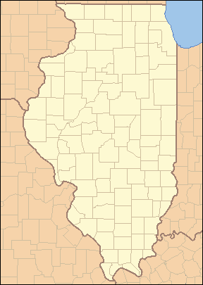
 Location within Illinois
Wikimedia Commons: Davis Junction, Illinois Website: http://www.davisjunction.com/ Davis Junction is a village in Ogle County, Illinois. The population was 2,373 at the 2010 census, up significantly from 491 at the 2000 census. It is located where the BNSF Railway and the Iowa, Chicago and Eastern Railroad intersect and along Illinois Route 72.
Contents
Geography
Davis Junction is located at 42°6′7″N 89°5′37″W / 42.10194°N 89.09361°W (42.101928, -89.093696)[1].
According to the United States Census Bureau, the village has a total area of 3.8 square miles (9.8 km2).
Demographics
As of the census[2] of 2000, there were 491 people, 165 households, and 132 families residing in Davis Junction. The population density was 129.6 people per square mile (50.0/km²). There were 172 housing units at an average density of 45.4 per square mile (17.5/km²). The racial makeup of the village was 98.37% White, 0.41% Asian, 0.41% from other races, and 0.81% from two or more races. Hispanic or Latino of any race were 1.02% of the population.
There were 165 households out of which 47.9% had children under the age of 18 living with them, 66.7% were married couples living together, 7.3% had a female householder with no husband present, and 20.0% were non-families. 15.8% of all households were made up of individuals and 6.7% had someone living alone who was 65 years of age or older. The average household size was 2.98 and the average family size was 3.37.
In the village the population was spread out with 34.0% under the age of 18, 6.5% from 18 to 24, 37.9% from 25 to 44, 13.8% from 45 to 64, and 7.7% who were 65 years of age or older. The median age was 31 years. For every 100 females there were 107.2 males. For every 100 females age 18 and over, there were 97.6 males.
The median income for a household in the village was $47,375, and the median income for a family was $51,250. Males had a median income of $36,875 versus $22,917 for females. The per capita income for the village was $16,915. About 2.5% of families and 2.6% of the population were below the poverty line, including none of those under age 18 and 23.1% of those age 65 or over.
References
- ^ "US Gazetteer files: 2010, 2000, and 1990". United States Census Bureau. 2011-02-12. http://www.census.gov/geo/www/gazetteer/gazette.html. Retrieved 2011-04-23.
- ^ "American FactFinder". United States Census Bureau. http://factfinder.census.gov. Retrieved 2008-01-31.
External links
Municipalities and communities of Ogle County, Illinois Cities 
Villages Adeline | Creston | Davis Junction | Forreston | Hillcrest | Leaf River | Monroe Center | Mount Morris | Stillman Valley
Townships Brookville | Buffalo | Byron | Dement | Eagle Point | Flagg | Forreston | Grand Detour | LaFayette | Leaf River | Lincoln | Lynnville | Marion | Maryland | Monroe | Mt. Morris | Oregon-Nashua | Pine Creek | Pine Rock | Rockvale | Scott | Taylor | White Rock | Woosung
Unincorporated
communitiesBaileyville | Brookville | Buffalo Grove | Chana | Daysville | Egan | Flagg | Flagg Center | Grand Detour | Haldane | Harper | Hazelhurst‡ | Holcomb | Kings | Lindenwood | Lost Nation | Paynes Point | Stratford | Woosung
Footnotes ‡This populated place also has portions in an adjacent county or counties
Categories:- Populated places in Ogle County, Illinois
- Villages in Illinois


Wikimedia Foundation. 2010.