- Smith River, California
-
For the river, see Smith River (California).
Smith River — census-designated place — Location in California
 Smith River
Coordinates: 41°55′41″N 124°08′49″W / 41.92806°N 124.14694°WCoordinates: 41°55′41″N 124°08′49″W / 41.92806°N 124.14694°W Country  United States
State  California
County Del Norte County Area[1] – Total 3.985 sq mi (10.321 km2) – Land 3.970 sq mi (10.283 km2) – Water 0.015 sq mi (0.038 km2) 0.37% Elevation[2] 52 ft (16 m) Population (2010) – Total 866 – Density 217.3/sq mi (83.9/km2) Time zone Pacific (PST) (UTC-8) – Summer (DST) PDT (UTC-7) ZIP Code 95567 Area code(s) 707 GNIS feature IDs 1659799; 2611450 U.S. Geological Survey Geographic Names Information System: Smith River, California; U.S. Geological Survey Geographic Names Information System: Smith River, California Smith River (formerly, Smith River Corners, Smith's River Valley, Smiths River,[3] and Smith's River[4]) is a census-designated place[5] in Del Norte County, California, United States. It is located 12 miles (19 km) north-northeast of Crescent City, 3 miles (4.8 km) east of the mouth of the Smith River,[4] at an elevation of 52 feet (16 m). As of 2010, the population was 866. The ZIP Code is 95567.[6] Its area code is 707. It is bordered by the Smith River National Recreation Area.
Contents
History
A post office was opened in 1863.[4]
One early settler of Smith River was William Dows Rexford who moved there with his sons in the early 1870s.[7]
Demographics
The 2010 United States Census[8] reported that Smith River had a population of 866. The population density was 217.3 people per square mile (83.9/km²). The racial makeup of Smith River was 528 (61.0%) White, 1 (0.1%) African American, 59 (6.8%) Native American, 5 (0.6%) Asian, 0 (0.0%) Pacific Islander, 234 (27.0%) from other races, and 39 (4.5%) from two or more races. Hispanic or Latino of any race were 293 persons (33.8%).
The Census reported that 866 people (100% of the population) lived in households, 0 (0%) lived in non-institutionalized group quarters, and 0 (0%) were institutionalized.
There were 315 households, out of which 127 (40.3%) had children under the age of 18 living in them, 160 (50.8%) were opposite-sex married couples living together, 44 (14.0%) had a female householder with no husband present, 18 (5.7%) had a male householder with no wife present. There were 22 (7.0%) unmarried opposite-sex partnerships, and 3 (1.0%) same-sex married couples or partnerships. 76 households (24.1%) were made up of individuals and 40 (12.7%) had someone living alone who was 65 years of age or older. The average household size was 2.75. There were 222 families (70.5% of all households); the average family size was 3.23.
The population was spread out with 267 people (30.8%) under the age of 18, 55 people (6.4%) aged 18 to 24, 220 people (25.4%) aged 25 to 44, 217 people (25.1%) aged 45 to 64, and 107 people (12.4%) who were 65 years of age or older. The median age was 34.8 years. For every 100 females there were 92.0 males. For every 100 females age 18 and over, there were 91.4 males.
There were 363 housing units at an average density of 91.1 per square mile (35.2/km²), of which 181 (57.5%) were owner-occupied, and 134 (42.5%) were occupied by renters. The homeowner vacancy rate was 3.2%; the rental vacancy rate was 3.6%. 473 people (54.6% of the population) lived in owner-occupied housing units and 393 people (45.4%) lived in rental housing units.
Politics
In the state legislature Smith River is located in the 4th Senate District, represented by Republican Doug LaMalfa, and in the 1st Assembly District, represented by Democrat Patty Berg. Federally, Smith River is located in California's 1st congressional district, which has a Cook PVI of D +10[9] and is represented by Democrat Mike Thompson.
References
- ^ U.S. Census
- ^ U.S. Geological Survey Geographic Names Information System: Smith River, California
- ^ All U.S. Geological Survey Geographic Names Information System: Smith River, California
- ^ a b c Durham, David L. (1998). California's Geographic Names: A Gazetteer of Historic and Modern Names of the State. Quill Driver Books. p. 145. ISBN 9781884995149.
- ^ U.S. Geological Survey Geographic Names Information System: Smith River, California
- ^ USPS ZIP Code lookup tool
- ^ http://genealogy.wikia.com/wiki/William_Dows_Rexford_%281800-1875%29 Rexford Family History
- ^ All data are derived from the United States Census Bureau reports from the 2010 United States Census, and are accessible on-line here. The data on unmarried partnerships and same-sex married couples are from the Census report DEC_10_SF1_PCT15. All other housing and population data are from Census report DEC_10_DP_DPDP1. Both reports are viewable online or downloadable in a zip file containing a comma-delimited data file. The area data, from which densities are calculated, are available on-line here. Percentage totals may not add to 100% due to rounding. The Census Bureau defines families as a household containing one or more people related to the householder by birth, opposite-sex marriage, or adoption. People living in group quarters are tabulated by the Census Bureau as neither owners nor renters. For further details, see the text files accompanying the data files containing the Census reports mentioned above.
- ^ "Will Gerrymandered Districts Stem the Wave of Voter Unrest?". Campaign Legal Center Blog. http://www.clcblog.org/blog_item-85.html. Retrieved 2007-10-19.
Municipalities and communities of Del Norte County, California City 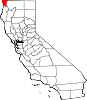
CDPs Bertsch-Oceanview | Gasquet | Hiouchi | Klamath | Smith River
Unincorporated
communitiesAdams Station | Camp Klamath | Crescent City North | Darlingtonia | Douglas Park | False Klamath | Fort Dick | French Hill | Hoppaw | Idlewild | Klamath Glen | Pacific Shores | Patrick Creek | Requa | Rockland | Scaath | Tryon Corner | Yontocket
Indian
reservationsGhost
townsBerteleda | Khoonkhwuttunne | Khwunrghunme | Lawyers Bar | Rekwoi | Sawuara | Shakesville | Shegoashkwu | Tatlatunne | Waukell Flat
Categories:- Populated places in Del Norte County, California
- Unincorporated communities in California
- Redwood Empire geography stubs


Wikimedia Foundation. 2010.