- De Land, Illinois
-
De Land Village  Water tower, Post Office and grain elevators in downtown De Land.
Country United States State Illinois County Piatt Elevation 700 ft (213.4 m) Coordinates 40°07′18″N 88°38′42″W / 40.12167°N 88.645°W Area 0.4 sq mi (1.04 km2) - land 0.4 sq mi (1 km2) - water 0 sq mi (0 km2), 0% Population 475 (2000) Density 1,198.1 / sq mi (462.6 / km2) Timezone CST (UTC-6) - summer (DST) CDT (UTC-5) ZIP code 61839 Area code 217 
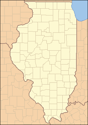
 Location of De Land within Illinois
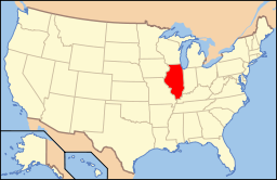 Location of Illinois in the United States
De Land is a village in Piatt County, Illinois, United States. The population was 475 at the 2000 census. The name of the village is spelled De Land by the census bureau, but it is alternately spelled as one word (DeLand).
Contents
Geography
De Land is located at 40°7′18″N 88°38′42″W / 40.12167°N 88.645°W (40.121624, -88.645064)[1].
According to the United States Census Bureau, the village has a total area of 0.4 square miles (1.0 km2), all of it land.
Demographics
As of the census[2] of 2000, there were 475 people, 190 households, and 148 families residing in the village. The population density was 1,198.1 people per square mile (458.5/km²). There were 206 housing units at an average density of 519.6 per square mile (198.8/km²). The racial makeup of the village was 99.79% White, 0.21% Pacific Islander.
There were 190 households out of which 32.1% had children under the age of 18 living with them, 62.6% were married couples living together, 10.0% had a female householder with no husband present, and 22.1% were non-families. 20.5% of all households were made up of individuals and 11.1% had someone living alone who was 65 years of age or older. The average household size was 2.50 and the average family size was 2.86.
In the village the population was spread out with 24.6% under the age of 18, 7.6% from 18 to 24, 26.9% from 25 to 44, 23.4% from 45 to 64, and 17.5% who were 65 years of age or older. The median age was 39 years. For every 100 females there were 95.5 males. For every 100 females age 18 and over, there were 94.6 males.
The median income for a household in the village was $40,982, and the median income for a family was $45,156. Males had a median income of $31,429 versus $20,893 for females. The per capita income for the village was $17,377. About 4.9% of families and 4.6% of the population were below the poverty line, including 2.8% of those under age 18 and 9.5% of those age 65 or over.
Local High School
De Land-Weldon is a school district that services both towns and the surrounding areas. It is the third smallest public high school in the state with a total enrollment of 54 students.[3]
References
- ^ "US Gazetteer files: 2010, 2000, and 1990". United States Census Bureau. 2011-02-12. http://www.census.gov/geo/www/gazetteer/gazette.html. Retrieved 2011-04-23.
- ^ "American FactFinder". United States Census Bureau. http://factfinder.census.gov. Retrieved 2008-01-31.
- ^ "IHSA". IHSA. http://www.ihsa.org/school/enrolln.htm. Retrieved 2010-01-30.
External links
Municipalities and communities of Piatt County, Illinois City 
Villages Townships Bement | Blue Ridge | Cerro Gordo | Goose Creek | Monticello | Sangamon | Unity | Willow Branch
Unincorporated
communitiesGalesville | La Place | Lodge | Milmine | Pierson | White Heath
Footnotes ‡This populated place also has portions in an adjacent county or counties
Categories:- Populated places in Piatt County, Illinois
- Villages in Illinois


Wikimedia Foundation. 2010.